Index of /cms/wp-content/uploads/2020/04
Name
Last modified
Size
Description
Parent Directory
-
ECT-Sudden-planar-re..>
2023-03-27 16:11
26M
Weak-layers.m4a
2021-05-09 13:13
21M
Loose_Wet.mp4
2020-04-25 13:44
21M
South-rockies-compre..>
2020-08-22 11:45
18M
Extended-column-test..>
2020-08-22 11:47
14M
Human-behaviours.m4a
2021-06-21 11:23
13M
Avalanche-Bulletin-U..>
2022-10-20 14:43
13M
Avalanche-problems.m4a
2021-06-18 14:32
12M
Weather-forecast.m4a
2021-06-21 10:58
11M
onX-backcountry-Slop..>
2024-11-09 15:01
9.7M
Safe-travel-habits-u..>
2021-10-25 19:51
9.2M
Types-of-avalanches-..>
2022-07-19 20:09
8.1M
Safe-travel-habits.m4a
2021-06-21 11:13
7.9M
Terrain-connectivity..>
2021-06-07 16:58
7.9M
whumfing.mp4
2020-04-24 18:14
7.5M
Safe-travel-habits-3..>
2023-04-05 12:15
6.9M
Types-of-avalanches.m4a
2021-05-23 13:44
6.9M
Weak-layers-2.0.m4a
2023-03-25 14:55
6.8M
Identifying-avalanch..>
2021-05-24 19:25
6.8M
Wind-exposure.m4a
2021-06-07 17:23
6.7M
Wind-loading-2022-up..>
2022-09-13 17:42
6.6M
Avaluator-3.0.m4a
2023-04-09 11:54
6.6M
types-of-avalanches-..>
2023-03-25 16:25
6.4M
Windy-2.png
2023-04-05 13:18
6.3M
Common-trigger-point..>
2021-06-08 12:16
6.0M
Avaluator.m4a
2021-06-21 11:06
6.0M
Solar-aspects.m4a
2021-06-07 17:12
5.9M
Signs-of-instability..>
2021-06-18 16:20
5.7M
Terrain-use.m4a
2021-06-14 11:30
5.7M
Avalanche-danger-sca..>
2021-06-14 11:45
5.7M
Wind-loaded.jpg
2023-03-27 16:41
5.6M
Avalanche-Canada.m4a
2021-06-14 11:55
5.5M
Spatial-variability.m4a
2021-06-08 12:39
5.5M
How-to-figure-out-sl..>
2021-06-07 17:05
5.5M
MIN.m4a
2021-06-18 14:50
5.4M
Skiing-Golden.mp4
2020-04-25 13:56
5.4M
How-layers-form.m4a
2021-05-09 12:47
5.3M
Welcome.m4a
2021-05-09 12:22
5.3M
Windy-1.png
2023-04-05 13:12
5.3M
BTL.jpg
2022-09-13 18:07
5.1M
Metamorphsis.m4a
2021-05-09 13:28
5.1M
Avalanche-Canada-tri..>
2021-06-18 16:06
5.0M
Avalanche-sizing.m4a
2021-05-23 13:50
4.9M
Weather-avalanche-da..>
2021-06-18 16:24
4.8M
Challenging-terrain.jpg
2023-04-04 16:26
4.8M
Triggers-Updated.m4a
2023-05-06 14:14
4.7M
spatial-variability-..>
2023-03-27 16:12
4.7M
Cornices.m4a
2021-06-07 17:32
4.6M
Avalanche-bulletin-t..>
2021-06-18 14:38
4.5M
Elevation.m4a
2021-06-08 11:55
4.5M
Confidence-uncertant..>
2021-06-21 11:42
4.1M
Complex-Terrain.jpg
2023-04-04 16:38
4.1M
Compaction.m4a
2021-05-23 13:35
4.0M
slope-angle.m4a
2021-05-24 19:32
4.0M
Recent-avalanches.jpg
2020-04-28 15:01
3.7M
Vegetation-clues.m4a
2021-06-08 12:44
3.7M
OUTMAP-Compass-unsmu..>
2024-11-09 22:06
3.7M
trim-line.jpg
2023-03-27 16:34
3.5M
Avalanche-formation.m4a
2021-05-23 13:55
3.5M
Cornice-1.jpg
2022-07-19 19:54
3.5M
sunshine.jpg
2023-04-05 12:49
3.3M
alpine-avalanche-pat..>
2022-07-25 19:27
3.2M
Risk.m4a
2021-06-21 11:35
3.1M
persistent-slab.jpg
2020-07-13 10:30
3.1M
fullsizeoutput_142b...>
2020-04-02 17:34
3.0M
Runout-zone.jpg
2022-07-25 18:26
3.0M
Runout-zone-1.jpg
2022-07-25 18:28
3.0M
Parts-of-an-avalanch..>
2021-05-24 19:09
3.0M
Ground-cover-and-anc..>
2021-06-08 12:08
2.9M
IMG_0412.jpg
2020-04-01 14:26
2.8M
Mountain-pic.jpg
2023-03-25 14:43
2.8M
IMG_6324.jpg
2021-05-09 12:38
2.8M
Cornice-collapse.jpg
2022-07-25 18:32
2.8M
wind-slab.jpeg
2020-06-27 14:32
2.8M
Appropriate-terrain-..>
2020-04-24 13:08
2.6M
Terrain-trap-.jpg
2022-09-13 19:45
2.6M
Scenario-1-Avaluator..>
2020-07-15 22:47
2.6M
Course-goals.m4a
2021-05-09 12:33
2.5M
Challenging-.jpg
2023-04-04 16:23
2.4M
ATES.m4a
2021-06-18 15:09
2.4M
DSC04144.jpg
2021-05-09 12:36
2.4M
IMG_1151.jpg
2023-04-09 12:34
2.4M
small-avalanche-terr..>
2020-04-04 14:18
2.3M
tim-line-2.jpg
2023-03-27 16:33
2.2M
Spatial-awarness-.m4a
2021-06-21 11:39
2.2M
Slope-shape.m4a
2021-06-08 12:02
2.1M
OUTMAP-3D-unsmushed.png
2024-11-09 22:04
2.1M
Kat-Snow-Science.jpg
2023-03-25 13:10
2.1M
Simple-terrain-2.0-1..>
2023-03-31 13:12
2.1M
Conflict.m4a
2021-06-21 11:32
2.1M
S.P.A.W.m4a
2021-06-18 14:42
2.0M
Complex-terrain-2.jpg
2023-04-04 16:41
2.0M
Terrain-traps.m4a
2021-06-08 12:48
2.0M
Smaller-terrain-high..>
2020-04-04 14:15
2.0M
Screenshot-2023-04-0..>
2023-04-05 13:03
2.0M
Wind-loading-1-unsmu..>
2020-04-10 12:44
2.0M
Snowing.jpg
2020-04-28 15:31
1.9M
Size-2-unsmushed.png
2020-04-03 12:37
1.9M
Wind-loaded-slope.jpg
2023-03-27 13:29
1.8M
Get-familiar.m4a
2021-06-18 14:54
1.7M
Complex-terrain.m4a
2021-06-18 15:44
1.6M
Remote-triggering-1-..>
2020-04-02 20:33
1.6M
Simple-terrain-2-uns..>
2020-04-12 13:54
1.6M
IMG_9480.jpg
2023-04-09 12:27
1.6M
Simple-terrain.m4a
2021-06-18 15:36
1.6M
Trim-lines-unsmushed..>
2020-04-09 16:53
1.5M
Cornice-2.jpg
2022-07-19 19:55
1.5M
stewart-sun.jpg
2023-04-05 12:56
1.5M
Size-1-unsmushed.png
2020-04-03 12:34
1.5M
safe-spots-unsmushed..>
2020-04-29 14:57
1.5M
Challening-2-unsmush..>
2020-04-12 14:09
1.5M
BTL-scaled.jpg
2025-12-22 16:26
1.5M
BTL-scaled-unsmushed..>
2025-12-22 16:26
1.5M
SH-Sun.jpg
2023-03-25 15:19
1.5M
terrain-exercise-ans..>
2020-04-24 13:46
1.5M
Simple-terrain-2.0.m4a
2023-03-31 13:16
1.5M
Challenging-unsmushe..>
2020-04-12 14:07
1.4M
High-hazard-take-2-u..>
2020-06-27 13:43
1.4M
Challening-2-1-unsmu..>
2020-06-27 14:30
1.4M
Mod-avalanche-danger..>
2020-06-27 13:47
1.4M
Avaluator-back-1-uns..>
2020-07-15 23:10
1.4M
Avaluator-back-unsmu..>
2020-04-24 17:53
1.4M
OUTMAP-Compass.png
2024-11-09 22:06
1.4M
Simple-terrain-unsmu..>
2020-04-12 13:52
1.4M
IMG_6816.jpg
2021-05-09 13:15
1.3M
Complex-Glaciated.jpg
2023-04-04 16:39
1.3M
Challenging-terrain.m4a
2021-06-18 15:39
1.3M
Avalanche-Danger-Rat..>
2020-04-15 20:10
1.3M
Avaluator-trip-plann..>
2021-06-18 15:49
1.3M
Windy-2-2048x1062.png
2023-04-05 13:18
1.3M
IMG_2464.jpg
2020-04-01 13:59
1.3M
escape-route-unsmush..>
2020-04-24 13:15
1.3M
Complex-2-unsmushed.png
2020-04-12 14:14
1.2M
Complex-2-1-unsmushe..>
2020-06-27 14:50
1.2M
Option-1-unsmushed.png
2020-04-24 14:03
1.2M
Option-3-unsmushed.png
2020-04-24 14:07
1.2M
Avaluator-front-unsm..>
2020-04-24 17:55
1.2M
Option-2-unsmushed.png
2020-04-24 14:05
1.2M
Avaluator-front-1-un..>
2020-07-15 23:15
1.2M
Montana-unsmushed.png
2020-04-04 15:42
1.1M
Wet-slab-avalanche-b..>
2023-03-30 12:52
1.1M
Terrain-photo-exerci..>
2020-04-24 13:59
1.1M
Avalanche-Canada-hom..>
2020-04-15 20:32
1.1M
Parks-Canada-winter-..>
2021-06-18 16:08
1.1M
Below-tree-line.jpg
2020-05-11 18:41
1.1M
Windy-1-2048x1054.png
2023-04-05 13:13
1.1M
wet-slab-1-unsmushed..>
2020-04-23 12:11
1.1M
Simple-Rudis-South.jpg
2023-03-31 12:57
1.0M
Cracking-on-skin-tra..>
2020-04-28 14:53
1.0M
loose-wet-hot-day.jpg
2020-04-28 15:37
1.0M
BTL-1536x2048.jpg
2022-09-13 18:08
1.0M
IMG_2446.jpg
2020-04-02 17:36
1.0M
Dog-tooth-weather-pl..>
2023-04-05 14:45
1.0M
best-230309-8238-uns..>
2023-03-25 14:39
1.0M
gully-terrain-trap-u..>
2020-04-10 11:46
1.0M
trim-line-scaled-uns..>
2023-03-27 16:34
1.0M
High-hazard-terrain-..>
2020-04-24 13:39
1.0M
Mod-hazard-terrain-p..>
2020-04-24 13:45
1.0M
Environment-canada-1..>
2023-04-05 13:07
1.0M
trim-line-scaled.jpg
2023-03-27 16:34
969K
Layers-onX-Backcount..>
2024-11-09 14:59
961K
persistent-slab-scal..>
2020-07-13 10:30
931K
OUTMAP-Compass-945x2..>
2024-11-09 22:06
928K
Slab-avalanche-1-uns..>
2020-04-02 18:59
911K
Slab-avalanche-unsmu..>
2020-04-02 18:50
908K
sunshine-scaled-unsm..>
2023-04-05 12:49
878K
persistent-slab-scal..>
2020-07-13 10:30
871K
Complex-Terrain-scal..>
2023-04-04 16:38
870K
parts-of-an-avalanch..>
2020-04-02 19:45
866K
Recent-avalanches-sc..>
2020-04-28 15:01
864K
best-230309-8238.jpg
2023-03-25 14:39
862K
Loose-avalanche-unsm..>
2020-04-02 18:46
859K
Scenario-1-Avaluator..>
2020-07-15 22:47
857K
Wind-loading-1.png
2020-04-10 12:44
856K
Wet-avalanche-unsmus..>
2020-04-02 19:10
856K
sunshine-scaled.jpg
2023-04-05 12:49
851K
Appropriate-terrain-..>
2020-04-24 13:08
845K
MIN-Weather-report-u..>
2023-03-30 13:36
837K
IMG_0412-scaled-unsm..>
2020-11-20 15:21
834K
Smaller-terrain-high..>
2020-04-04 14:15
831K
onX-backcountry-Slop..>
2024-11-09 15:01
828K
MIN-Snowpack-unsmush..>
2023-03-30 13:38
824K
Complex-Terrain-scal..>
2023-04-04 16:38
824K
MIN-Quick-Report-uns..>
2023-03-30 13:27
823K
wet-loose-size-2-uns..>
2020-04-03 12:41
821K
best-230309-6132-uns..>
2023-03-25 15:22
820K
MIN-avalanche-report..>
2023-03-30 13:31
819K
Complex-terrain-unsm..>
2020-04-12 14:13
819K
IMG_6324-scaled-unsm..>
2021-05-09 12:38
817K
Complex-terrain-1-un..>
2020-06-27 14:42
816K
Runout-zone-scaled.jpg
2022-07-25 18:26
815K
cross-loading-unsmus..>
2020-04-10 12:19
814K
dry-loose-avalanche-..>
2025-12-09 15:52
810K
dry-loose-avalanche.jpg
2025-12-09 15:52
810K
Details-Tab-1-unsmus..>
2023-03-30 12:18
804K
Recent-avalanches-sc..>
2020-04-28 15:01
801K
Wind-loaded-scaled-u..>
2025-12-16 00:06
800K
Wind-loaded-scaled.jpg
2025-12-16 00:06
800K
small-avalanche-terr..>
2020-04-04 14:18
796K
Runout-zone-1-scaled..>
2025-12-09 23:48
789K
Runout-zone-1-scaled..>
2025-12-09 23:48
789K
wind-loading-2.png
2025-12-15 17:06
787K
wind-loading-2-unsmu..>
2025-12-15 17:06
787K
tim-line-2-scaled-un..>
2023-03-27 16:33
787K
IMG_6324-scaled.jpg
2021-05-09 12:38
784K
Aspect-to-the-wind.png
2025-12-15 17:01
783K
Aspect-to-the-wind-u..>
2025-12-15 17:01
783K
IMG_0412-scaled.jpg
2020-11-20 15:21
776K
elevation.png
2025-12-22 16:17
776K
elevation-unsmushed.png
2025-12-22 16:17
776K
wind-loading-2-1536x..>
2020-04-05 12:40
776K
Windy-2-1536x796.png
2023-04-05 13:18
775K
tim-line-2-scaled.jpg
2023-03-27 16:33
765K
Below-tree-line-scal..>
2020-05-11 18:41
756K
thick-to-thin.png
2025-12-22 17:20
755K
thick-to-thin-unsmus..>
2025-12-22 17:20
755K
dry-loose-unsmushed.png
2020-04-23 12:26
747K
best-230309-6132.jpg
2023-03-25 15:22
739K
Simple-terrain-2.0-1..>
2023-03-31 13:12
736K
terrain-trap-depress..>
2020-04-12 12:53
736K
Problems-tab-1-unsmu..>
2023-03-30 12:12
734K
Size-2.png
2020-04-03 12:37
733K
Size-2-1.png
2025-12-22 16:45
733K
Size-2-1-unsmushed.png
2025-12-22 16:45
733K
Below-tree-line-scal..>
2020-05-11 18:41
719K
Not-well-defined-ava..>
2025-12-11 17:41
712K
Not-well-defined-ava..>
2025-12-11 17:41
712K
Wind-loading-1-1170x..>
2020-04-10 12:44
705K
thick-to-thin-1118x7..>
2020-04-09 14:33
699K
best-230309-6224-uns..>
2023-04-09 12:38
692K
Terrain-trap--scaled..>
2025-12-11 17:45
690K
Terrain-trap--scaled..>
2025-12-11 17:45
690K
best-230309-6117-uns..>
2023-04-09 11:26
685K
elevation-1536x808.png
2020-04-09 10:53
679K
Wind-loading.png
2025-12-15 17:05
676K
Wind-loading-unsmush..>
2025-12-15 17:05
676K
wind-loaded-unsmushe..>
2020-04-05 12:44
675K
small-avalanche-terr..>
2020-04-04 14:18
671K
Aspect-to-the-wind-1..>
2020-04-05 12:23
670K
Smaller-terrain-high..>
2020-04-04 14:15
660K
OUTMAP-Compass-768x1..>
2024-11-09 22:06
652K
trim-line-2048x1536.jpg
2023-03-27 16:34
648K
fullsizeoutput_142b-..>
2025-12-08 17:18
643K
fullsizeoutput_142b-..>
2025-12-08 17:18
643K
Trip-planning-tool-u..>
2020-04-12 14:25
640K
Size-2-1170x750.png
2020-04-03 12:38
638K
Size-2-1-1170x750.png
2020-04-09 11:19
638K
BTL-1152x1536.jpg
2022-09-13 18:07
638K
Avaluator-example-un..>
2020-07-15 22:43
637K
Windy-1-1536x790.png
2023-04-05 13:13
637K
OUTMAP-3D.png
2024-11-09 22:04
631K
Complex-terrain-2-sc..>
2023-04-04 16:41
628K
Cracking-below-unsmu..>
2020-04-28 14:54
626K
thick-to-thin-1024x7..>
2020-04-09 14:33
626K
Challenging-terrain-..>
2023-04-04 16:27
623K
uniform-slope.png
2025-12-14 23:56
620K
uniform-slope-unsmus..>
2025-12-14 23:56
620K
Wind-loading-1-1024x..>
2020-04-10 12:44
616K
best-230309-6224.jpg
2023-04-09 12:38
614K
alpine-avalanche-pat..>
2025-12-09 16:06
613K
alpine-avalanche-pat..>
2025-12-09 16:06
613K
Deep-persistent-slab..>
2023-03-30 12:40
613K
Remote-triggering-1.png
2020-04-02 20:33
608K
IMG_1151-scaled-unsm..>
2023-04-09 12:34
605K
Convex-versus-concav..>
2025-12-22 16:40
604K
Size-1.png
2020-04-03 12:34
604K
Convex-versus-concav..>
2025-12-22 16:40
604K
IMG_1151-scaled.jpg
2023-04-09 12:34
598K
trim-line-scaled.webp
2023-09-29 02:38
594K
Persistent-slab-unsm..>
2023-03-30 12:36
594K
best-230309-6117.jpg
2023-04-09 11:26
593K
Challenging-terrain-..>
2023-04-04 16:27
592K
Loose-wet-1-unsmushe..>
2023-03-30 12:27
592K
Spot-WX-Step-2-unsmu..>
2020-04-29 14:02
592K
crossloading.png
2025-12-15 17:10
591K
crossloading-unsmush..>
2025-12-15 17:10
591K
Complex-terrain-2-sc..>
2023-04-04 16:41
590K
Screenshot-2024-11-2..>
2024-11-25 17:00
589K
persistent-slab-1536..>
2020-07-13 10:30
586K
Size-1-985x750.png
2020-04-03 12:34
585K
Kat-Snow-Science-sca..>
2023-03-25 13:10
584K
Cornice-collapse-sca..>
2025-12-09 16:02
583K
Cornice-collapse-sca..>
2025-12-09 16:02
583K
Smaller-terrain-high..>
2020-04-04 14:15
583K
onX-backcountry-Slop..>
2024-11-09 15:01
582K
Windy-2-1170x750.png
2023-04-05 13:18
581K
Appropriate-terrain-..>
2020-04-24 13:08
578K
Simple-terrain-2.png
2020-04-12 13:54
578K
terrain-connectivity..>
2025-12-14 23:54
574K
terrain-connectivity..>
2025-12-14 23:54
574K
ground-cover.png
2025-12-22 16:52
572K
ground-cover-unsmush..>
2025-12-22 16:52
572K
Remote-triggering-1-..>
2020-04-02 20:33
572K
sunshine-2048x1536.jpg
2023-04-05 12:49
570K
Kat-Snow-Science-sca..>
2023-03-25 13:10
568K
OUTMAP-Compass-709x1..>
2024-11-09 22:06
564K
MIN-Incident-report-..>
2023-03-30 13:33
564K
trees-anchor-to-anch..>
2020-04-09 14:07
564K
fat-maps-overlay-uns..>
2020-04-05 11:44
563K
small-avalanche-terr..>
2020-04-04 14:18
561K
IMG_0412-2048x1536.jpg
2020-04-01 14:26
560K
Kat-Snow-Science-sca..>
2023-03-25 13:12
557K
Ridge-top-loading.png
2025-12-15 17:08
555K
Ridge-top-loading-un..>
2025-12-15 17:08
555K
Avalanche-Canada-hom..>
2022-09-16 14:50
552K
Weak-layer-ID-unsmus..>
2020-11-20 15:21
552K
Aspect-to-the-wind-1..>
2020-04-05 12:23
552K
Wind-slabs-unsmushed..>
2023-03-30 12:31
551K
Size-2-1024x777.png
2020-04-03 12:37
548K
Size-2-1-1024x777.png
2020-04-09 11:19
548K
Recent-avalanches-15..>
2020-04-28 15:01
548K
Complex-Terrain-2048..>
2023-04-04 16:38
547K
Challening-2.png
2020-04-12 14:09
546K
Wind-loaded-2048x136..>
2023-03-27 16:41
546K
Runout-zone-1536x204..>
2022-07-25 18:26
544K
Runout-zone-1-1536x2..>
2022-07-25 18:29
544K
Complex-Terrain-scal..>
2023-09-29 02:36
543K
IMG_6324-2048x1536.jpg
2021-05-09 12:38
540K
WSL-avalanche.jpeg
2025-12-15 17:08
538K
WSL-avalanche-unsmus..>
2025-12-15 17:08
538K
Av-formation.png
2025-12-09 23:26
538K
Av-formation-unsmush..>
2025-12-09 23:26
538K
Avaluator-home--unsm..>
2020-04-12 14:31
536K
uniform-slope-1170x7..>
2020-04-04 16:01
535K
tim-line-2-2048x1536..>
2023-03-27 16:33
534K
Simple-terrain.png
2020-04-12 13:52
534K
Av-formation-1536x85..>
2020-04-02 19:37
532K
crossloading-1170x74..>
2020-04-05 12:38
532K
Simple-Rudis-South-s..>
2023-03-31 12:57
528K
Simple-terrain-2-102..>
2020-04-12 13:54
522K
ground-cover-1114x75..>
2020-04-09 13:59
522K
Well-defined-avalanc..>
2020-04-04 13:48
519K
Well-defined-avalanc..>
2025-12-11 17:37
519K
Well-defined-avalanc..>
2025-12-11 17:37
519K
terrain-connectivity..>
2020-04-04 15:57
516K
Remote-triggering-1-..>
2020-04-02 20:33
516K
Trim-lines.png
2020-04-09 16:53
515K
windy-peak-unsmushed..>
2020-04-28 15:25
513K
Simple-terrain-999x7..>
2020-04-12 13:53
510K
Wind-loaded-slope-sc..>
2025-12-16 00:06
506K
Wind-loaded-slope-sc..>
2025-12-16 00:06
506K
onX-backcountry-Slop..>
2024-11-09 15:01
506K
Scenario-1-Avaluator..>
2020-07-15 22:47
505K
Simple-Rudis-South-s..>
2023-03-31 12:57
505K
Complex-Glaciated-sc..>
2023-04-04 16:39
505K
Appropriate-terrain-..>
2020-04-24 13:08
504K
Challening-2-1.png
2020-06-27 14:30
504K
Snowing-scaled-unsmu..>
2020-04-28 15:31
503K
Windy-1-1170x750.png
2023-04-05 13:13
501K
Below-tree-line-2048..>
2020-05-11 18:41
500K
safe-spots.png
2020-04-29 14:57
495K
Ridge-top-loading-11..>
2020-04-05 12:36
493K
Cornices-unsmushed.png
2023-03-30 12:44
492K
Challenging.png
2020-04-12 14:07
492K
Terrain-trap--2048x1..>
2022-09-13 19:45
492K
GEM-LAM-unsmushed.png
2020-04-29 14:07
486K
Complex-Glaciated-sc..>
2023-04-04 16:39
486K
elevation-1170x750.png
2020-04-09 10:53
484K
Trim-lines-874x750.png
2020-04-09 16:53
483K
Not-well-defined-ava..>
2020-04-04 13:55
481K
common-trigger-point..>
2025-12-22 17:19
478K
common-trigger-point..>
2025-12-22 17:19
477K
wind-loading-2-1170x..>
2020-04-05 12:40
475K
Convex-versus-concav..>
2020-04-09 11:14
475K
Screenshot-2023-04-0..>
2023-04-05 13:03
474K
IMG_0412-scaled-2048..>
2020-11-20 15:21
474K
Challenging--scaled-..>
2023-04-04 16:23
472K
OUTMAP-3D-945x2048.png
2024-11-09 22:04
471K
best-230309-8238-204..>
2023-03-25 14:40
468K
parts-of-an-avalanch..>
2020-04-02 19:45
466K
Spot-WX-step-1-unsmu..>
2020-04-29 14:01
465K
SPAW-unsmushed.png
2020-04-23 12:40
464K
Wet-slab.png
2025-12-09 15:58
463K
Wet-slab-unsmushed.png
2025-12-09 15:58
463K
terrain-connectivity..>
2020-04-04 15:57
461K
Wind-loading-1170x75..>
2020-04-05 12:34
460K
Snowing-scaled.jpg
2020-04-28 15:31
457K
Moderate-danger-rati..>
2023-03-30 12:00
454K
High-hazard-take-2.png
2020-06-27 13:43
454K
wet-slab-avalanche-u..>
2023-03-25 16:57
453K
Challenging--scaled.jpg
2023-04-04 16:23
450K
Terrain-with-slope-a..>
2020-04-04 14:41
450K
ground-cover-1024x76..>
2020-04-09 13:59
449K
onX-backcountry-Slop..>
2024-11-09 15:01
449K
Terrain-with-slope-a..>
2025-12-11 18:01
447K
Terrain-with-slope-a..>
2025-12-11 18:01
447K
Avaluator-back.png
2020-04-24 17:53
446K
Mod-avalanche-danger..>
2020-06-27 13:47
445K
parts-of-an-avalanch..>
2020-04-02 19:45
443K
terrain-exercise-ans..>
2020-04-24 13:46
442K
trees-anchor-to-anch..>
2020-04-09 14:07
442K
Dry-loose-1-unsmushe..>
2023-03-30 12:55
441K
OUTMAP-Compass-1170x..>
2024-11-09 22:06
439K
fullsizeoutput_142b-..>
2020-04-02 17:34
438K
Mod-avalanche-danger..>
2020-06-27 13:47
434K
Avaluator-back-1.png
2020-07-15 23:10
432K
alpine-avalanche-pat..>
2022-07-25 19:27
431K
wet-slab-1.png
2020-04-23 12:11
429K
wet-slab-avalanche.jpg
2023-03-25 16:57
428K
High-hazard-take-2-1..>
2020-06-27 13:43
427K
Wind-direction-unsmu..>
2020-04-29 14:29
425K
Simple-terrain-2.0-1..>
2023-03-31 13:12
424K
Common-trigger-point..>
2025-12-22 17:18
423K
Common-trigger-point..>
2025-12-22 17:18
423K
Avalanche-Danger-Rat..>
2020-04-15 20:10
421K
Montana.png
2020-04-04 15:42
420K
uniform-slope-1024x6..>
2020-04-04 16:01
419K
Complex-2.png
2020-04-12 14:14
417K
dry-loose-avalanche-..>
2023-03-25 16:53
416K
SH-Sun-scaled.jpg
2023-03-25 15:19
416K
SH-Sun-scaled-unsmus..>
2023-03-25 15:19
416K
Danger-rating-tab-un..>
2023-03-30 12:08
415K
Screenshot-2023-04-0..>
2023-04-05 13:03
414K
wind-slab-scaled-uns..>
2020-06-27 14:32
413K
Cornice-collapse-204..>
2022-07-25 18:32
411K
trees-anchor-to-anch..>
2020-04-09 14:07
411K
IMG_9480-scaled.jpg
2025-12-06 23:19
410K
IMG_9480-scaled-unsm..>
2025-12-06 23:19
410K
IMG_1151-2048x1536.jpg
2023-04-09 12:34
409K
Blue_Inverse-unsmush..>
2020-11-20 15:20
405K
wind-slab-scaled.jpeg
2020-06-27 14:32
405K
High-hazard-take-2-1..>
2020-06-27 13:43
405K
Scenario-1-Avaluator..>
2020-07-15 22:47
402K
Mod-avalanche-danger..>
2020-06-27 13:47
402K
Complex-terrain-2-20..>
2023-04-04 16:41
400K
fat-maps-overlay.jpg
2020-04-05 11:44
399K
Av-formation-1170x75..>
2020-04-02 19:37
398K
Complex-terrain-2-sc..>
2023-09-29 02:36
398K
Challenging-terrain-..>
2023-04-04 16:27
397K
Wet-avalanche.png
2020-04-02 19:10
397K
AST-Student-RELEASE-..>
2020-10-06 20:29
397K
Complex-2-1.png
2020-06-27 14:50
395K
Trim-lines-768x732.png
2020-04-09 16:53
394K
sunshine-scaled.webp
2023-09-29 02:36
393K
Wind-loaded-scaled.webp
2023-09-29 02:38
390K
Montana-835x750.png
2020-04-04 15:42
389K
crossloading-1024x58..>
2020-04-05 12:38
388K
Kat-Snow-Science-153..>
2023-03-25 13:10
388K
Option-1.png
2020-04-24 14:03
385K
escape-route.png
2020-04-24 13:15
384K
Option-3.png
2020-04-24 14:07
383K
terrain-exercise-ans..>
2020-04-24 13:46
381K
trim-line-1536x1152.jpg
2023-03-27 16:34
381K
Terrain-photo-exerci..>
2020-04-24 13:59
380K
persistent-slab-1152..>
2020-07-13 10:30
380K
wind-loading-2-1024x..>
2020-04-05 12:40
380K
Option-2.png
2020-04-24 14:05
379K
Windy-2-1024x531.png
2023-04-05 13:18
377K
Loose-avalanche.png
2020-04-02 18:46
377K
gully-terrain-trap.png
2020-04-10 11:46
377K
large-trees-flagging..>
2025-12-29 16:31
376K
large-trees-flagging..>
2025-12-29 16:31
376K
BTL-1170x750.jpg
2022-09-13 18:08
374K
Dry-avalanche.png
2025-12-09 16:08
371K
Dry-avalanche-unsmus..>
2025-12-09 16:08
371K
Buried-book-unsmushe..>
2020-04-29 15:54
370K
large-trees-flagging..>
2020-04-09 16:37
369K
terrain-exercise-ans..>
2020-04-24 13:47
369K
loose-wet-hot-day-sc..>
2020-04-28 15:37
364K
Aspect.png
2025-12-15 00:34
363K
Aspect-unsmushed.png
2025-12-15 00:34
363K
Size-1-768x614.png
2020-04-03 12:34
362K
Avalanche-Danger-Rat..>
2020-04-15 20:10
361K
Rogers-pass-skin-tra..>
2020-04-24 13:27
361K
DSC04144-scaled.jpg
2021-05-09 12:36
361K
DSC04144-scaled-unsm..>
2021-05-09 12:36
361K
Simple-terrain-2.0-1..>
2023-09-29 02:37
359K
Wind-loading-1-768x5..>
2020-04-10 12:44
358K
Rogers-pass-skin-tra..>
2020-04-24 13:27
358K
Blue_Inverse-unsmush..>
2020-04-01 13:38
358K
Simple-Rudis-South-2..>
2023-03-31 12:57
357K
best-230309-6132-204..>
2023-03-25 15:22
357K
thick-to-thin-768x57..>
2020-04-09 14:33
356K
Kat-Snow-Science-sca..>
2023-03-25 13:12
355K
cross-loading-1024x7..>
2020-04-10 12:19
354K
Convex-versus-concav..>
2020-04-09 11:14
352K
Wind-loading-1024x65..>
2020-04-05 12:34
352K
Avalanche-Canada-hom..>
2020-04-15 20:32
351K
Wind-loaded-slope-20..>
2023-03-27 13:29
351K
IMG_6324-1536x1152.jpg
2021-05-09 12:38
351K
Terrain-photo-exerci..>
2020-04-24 13:59
348K
Avalanche-Canada-hom..>
2020-04-15 20:32
348K
OUTMAP-3D-768x1665.png
2024-11-09 22:04
348K
Avalanche-Canada-hom..>
2022-09-16 14:50
347K
Challening-2-768x577..>
2020-04-12 14:09
347K
gully-terrain-trap-6..>
2020-04-10 11:46
345K
Challenging-terrain-..>
2023-09-29 02:37
343K
sunshine-1536x1152.jpg
2023-04-05 12:49
342K
Avaluator-front.png
2020-04-24 17:55
342K
Avaluator-front-972x..>
2020-04-24 17:55
342K
Slab-avalanche.png
2020-04-02 18:50
342K
Ridge-top-loading-10..>
2020-04-05 12:36
341K
Not-well-defined-ava..>
2020-04-04 13:55
341K
Slab-avalanche-1.png
2020-04-02 18:59
341K
wind-loaded-1024x767..>
2020-04-05 12:44
340K
stewart-sun-scaled-u..>
2023-04-05 12:56
339K
Complex-Glaciated-20..>
2023-04-04 16:39
338K
Smaller-terrain-high..>
2020-04-04 14:15
338K
Well-defined-avalanc..>
2020-04-04 13:48
337K
IMG_0412-1536x1152.jpg
2020-04-01 14:26
336K
loose-wet-hot-day-sc..>
2020-04-28 15:37
336K
best-230309-6224-204..>
2023-04-09 12:38
336K
Montana-768x766.png
2020-04-04 15:42
336K
stewart-sun-scaled.jpg
2023-04-05 12:56
335K
Avaluator-trip-plann..>
2021-06-18 15:49
334K
Avalanche-Canada-hom..>
2022-09-16 14:50
333K
tim-line-2-1536x1152..>
2023-03-27 16:33
333K
small-avalanche-terr..>
2020-04-04 14:18
332K
cross-loading.png
2020-04-10 12:19
332K
Wind-loaded-1536x102..>
2023-03-27 16:41
332K
Wet-slab-768x613.png
2020-04-05 12:16
332K
Avaluator-front-1-97..>
2020-07-15 23:15
332K
Avaluator-front-1.png
2020-07-15 23:15
331K
Screenshot-2023-04-0..>
2023-04-05 13:03
331K
trim-line-scaled-204..>
2023-09-29 02:38
330K
elevation-1024x539.png
2020-04-09 10:53
328K
Aspect-to-the-wind-1..>
2020-04-05 12:23
327K
Recent-avalanches-11..>
2020-04-28 15:01
327K
wet-loose-size-2.png
2020-04-03 12:41
326K
common-trigger-point..>
2020-04-09 14:32
325K
cornice.png
2025-12-21 23:31
325K
cornice-unsmushed.png
2025-12-21 23:31
325K
Runout-zone-1152x153..>
2022-07-25 18:26
323K
Avalanche-Canada-hom..>
2022-09-16 14:50
323K
Challening-2-1-768x5..>
2020-06-27 14:30
322K
Fat-maps-menu-unsmus..>
2020-04-05 11:43
321K
Challenging-768x576.png
2020-04-12 14:07
321K
Wet-avalanche-768x61..>
2020-04-02 19:10
320K
Size-2-768x583.png
2020-04-03 12:37
320K
Size-2-1-768x583.png
2020-04-09 11:19
320K
Simple-terrain-2-768..>
2020-04-12 13:54
319K
Simple-terrain-768x6..>
2020-04-12 13:53
318K
concavity-unsmushed.png
2020-04-09 11:18
318K
Complex-Terrain-1536..>
2023-04-04 16:38
317K
BTL-768x1024.jpg
2022-09-13 18:07
317K
Trip-planning-exampl..>
2020-07-15 22:34
316K
Loose-avalanche-768x..>
2020-04-02 18:46
315K
Terrain-trap--1536x1..>
2022-09-13 19:45
315K
Compass-unsmushed.jpg
2020-04-05 11:47
314K
safe-spots-768x575.png
2020-04-29 14:57
314K
Runout-zone-1-1152x1..>
2022-07-25 18:31
314K
Mountain-weather-for..>
2020-05-13 12:58
313K
Environment-canada-1..>
2023-04-05 13:07
312K
wind-loaded.png
2020-04-05 12:44
309K
Windy-1-1024x527.png
2023-04-05 13:12
309K
Dog-tooth-weather-pl..>
2023-04-05 14:46
308K
Below-tree-line-1536..>
2020-05-11 18:41
307K
Appropriate-terrain-..>
2020-04-24 13:08
307K
wet-slab-1-768x576.png
2020-04-23 12:12
306K
cross-loading-1068x7..>
2020-04-10 12:19
306K
best-230309-8238-153..>
2023-03-25 14:39
305K
Windy-2.webp
2023-09-29 02:36
305K
best-230309-6117-204..>
2023-04-09 11:26
305K
OUTMAP-3D-709x1536.png
2024-11-09 22:04
305K
Challenging--2048x12..>
2023-04-04 16:24
304K
Complex-terrain.png
2020-04-12 14:13
302K
Remote-triggering-1-..>
2020-04-02 20:33
301K
wind-loaded-1031x750..>
2020-04-05 12:44
301K
Cherry-bowl-far-away..>
2025-12-11 18:09
299K
Cherry-bowl-far-away..>
2025-12-11 18:09
299K
Complex-Terrain-scal..>
2023-09-29 02:37
298K
AST-Student-RELEASE-..>
2020-10-06 20:29
298K
cornice-1024x662.png
2020-04-05 13:04
297K
Snowing-1536x2048.jpg
2020-04-28 15:31
297K
wet-loose-size-2-552..>
2020-04-03 12:41
296K
Mod-hazard-terrain-p..>
2020-04-24 13:45
296K
Avalanche-Canada-hom..>
2022-09-16 14:50
295K
High-hazard-terrain-..>
2020-04-24 13:39
295K
Complex-terrain-1.png
2020-06-27 14:42
294K
IMG_2464-scaled-unsm..>
2020-11-20 15:21
293K
Cornice-2-scaled.jpg
2025-12-09 16:02
292K
Cornice-2-scaled-uns..>
2025-12-09 16:02
292K
Common-trigger-point..>
2020-04-09 14:30
291K
Windy-1.webp
2023-09-29 02:36
290K
SH-Sun-2048x1536.jpg
2023-03-25 15:19
290K
Dry-avalanche-768x58..>
2020-04-02 19:09
289K
IMG_0412-scaled-1536..>
2020-11-20 15:21
289K
Cracking-on-skin-tra..>
2020-04-28 14:53
288K
Avaluator-back-768x5..>
2020-04-24 17:53
287K
Complex-2-768x580.png
2020-04-12 14:14
283K
Avaluator-back-1-768..>
2020-07-15 23:10
277K
Complex-terrain-1024..>
2020-04-12 14:13
277K
Av-formation-1024x57..>
2020-04-02 19:37
277K
terrain-exercise-ans..>
2020-04-24 13:46
276K
IMG_6816-scaled.jpg
2025-12-08 14:37
276K
IMG_6816-scaled-unsm..>
2025-12-08 14:37
276K
Slab-avalanche-1-768..>
2020-04-02 18:59
275K
IMG_9480-1536x2048.jpg
2023-04-09 12:28
274K
OUTMAP-Compass-472x1..>
2024-11-09 22:06
274K
Cherry-bowl-far-away..>
2020-04-04 15:37
274K
Mountain-pic-scaled.jpg
2023-03-25 14:43
273K
Mountain-pic-scaled-..>
2023-03-25 14:43
273K
Slab-avalanche-768x6..>
2020-04-02 18:50
273K
Avalanche-Danger-Rat..>
2020-04-15 20:10
273K
Cracking-below.png
2020-04-28 14:54
272K
parts-of-an-avalanch..>
2020-04-02 19:45
272K
Avalanche-Fatalities..>
2020-04-15 20:20
271K
Danger-Scale-updated..>
2024-11-25 16:51
271K
Wet-slab-avalanche-b..>
2023-03-30 12:52
270K
Terrain-with-slope-a..>
2020-04-04 14:41
270K
terrain-connectivity..>
2020-04-04 15:57
268K
dry-loose.png
2020-04-23 12:26
267K
Simple-terrain-2.0-1..>
2023-03-31 13:12
267K
Loose-wet-unsmushed.png
2020-04-23 11:51
267K
ground-cover-768x577..>
2020-04-09 13:59
266K
Cracking-below-575x7..>
2020-04-28 14:55
266K
OUTMAP-3D-1170x750.png
2024-11-09 22:04
266K
Complex-terrain-1-10..>
2020-06-27 14:42
266K
fullsizeoutput_142b-..>
2020-04-02 17:34
266K
escape-route-768x576..>
2020-04-24 13:15
263K
IMG_2464-scaled.jpg
2020-11-20 15:21
262K
Aspect-768x614.png
2020-04-05 11:54
262K
alpine-avalanche-pat..>
2022-07-25 19:27
260K
wind-slab-2048x1536...>
2020-06-27 14:32
259K
Complex-2-1-768x580.png
2020-06-27 14:50
258K
Avalanche-Canada-hom..>
2020-04-15 20:32
258K
Avaluator-trip-plann..>
2021-06-18 15:49
255K
Cracking-on-skin-tra..>
2020-04-28 14:53
254K
dry-loose-avalanche-..>
2023-03-25 16:53
254K
IMG_1151-1536x1152.jpg
2023-04-09 12:34
253K
Simple-Rudis-South-s..>
2023-09-29 02:37
252K
Cherry-bowl-top.png
2025-12-11 18:09
250K
Cherry-bowl-top-unsm..>
2025-12-11 18:09
250K
Simple-terrain-2.0-1..>
2023-09-29 02:37
250K
onX-backcountry-Slop..>
2024-11-09 15:01
248K
uniform-slope-768x49..>
2020-04-04 16:01
248K
Avalanche-sizing-153..>
2020-04-02 19:22
244K
Layers-onX-Backcount..>
2024-11-09 14:59
244K
Avalanche-sizing-117..>
2020-04-02 19:22
244K
Cornice-collapse-153..>
2022-07-25 18:32
243K
Mod-hazard-terrain-p..>
2020-04-24 13:45
242K
Banner-SPAW-unsmushe..>
2020-04-23 12:41
242K
Wet-slab-avalanche-b..>
2023-03-30 12:52
241K
loose-wet-hot-day-15..>
2020-04-28 15:37
241K
Kat-Snow-Science-115..>
2023-03-25 13:10
240K
Avaluator-trip-plann..>
2021-06-18 15:49
240K
High-hazard-terrain-..>
2020-04-24 13:39
239K
Cherry-bowl-top-1024..>
2020-04-04 15:38
239K
trees-anchor-to-anch..>
2020-04-09 14:07
238K
Complex-terrain-2-15..>
2023-04-04 16:41
237K
Challenging-terrain-..>
2023-04-04 16:27
237K
DSC04144-2048x1121.jpg
2021-05-09 12:37
237K
IMG_1151-scaled.webp
2023-09-29 02:36
237K
High-hazard-take-2-7..>
2020-06-27 13:43
237K
Mod-avalanche-danger..>
2020-06-27 13:47
234K
Complex-Glaciated-sc..>
2023-09-29 02:36
232K
Problems-tab-1-932x1..>
2023-03-30 12:12
232K
Avaluator-front-768x..>
2020-04-24 17:55
232K
best-230309-6132-153..>
2023-03-25 15:22
231K
Dog-tooth-weather-pl..>
2023-04-05 14:45
230K
cornice-triggered-av..>
2020-05-10 17:59
230K
stewart-sun-2048x101..>
2023-04-05 12:56
229K
Complex-terrain-2-sc..>
2023-09-29 02:36
228K
Wind-loaded-scaled-2..>
2023-09-29 02:38
228K
wind-loading-2-768x5..>
2020-04-05 12:40
228K
fat-maps-overlay-108..>
2020-04-05 11:44
228K
Recent-avalanches-11..>
2020-04-28 15:01
227K
crossloading-768x439..>
2020-04-05 12:38
227K
Simple-Rudis-South-1..>
2023-03-31 12:57
227K
Simple-terrain-2.0-1..>
2023-03-31 13:12
226K
Windy-2-768x398.png
2023-04-05 13:18
226K
persistent-slab-1170..>
2020-07-13 10:30
225K
Level-app-unsmushed.jpg
2020-05-11 17:35
225K
Challenging--scaled...>
2023-09-29 02:37
224K
Cornice-1-scaled.jpg
2025-12-09 16:02
224K
Cornice-1-scaled-uns..>
2025-12-09 16:02
224K
best-230309-6224-153..>
2023-04-09 12:38
223K
Wind-loaded-slope-15..>
2023-03-27 13:29
222K
Fat-maps-menu.jpg
2020-04-05 11:43
222K
IMG_2446-scaled.jpg
2025-12-08 17:19
220K
IMG_2446-scaled-unsm..>
2025-12-08 17:19
220K
Scenario-1-Avaluator..>
2020-07-15 22:47
219K
cropped-Complex-Glac..>
2025-05-15 12:58
217K
AST-Student-RELEASE-..>
2020-10-06 20:29
217K
sunshine-scaled-2048..>
2023-09-29 02:36
216K
Option-3-768x510.png
2020-04-24 14:08
216K
IMG_6324-1170x750.jpg
2021-05-09 12:38
216K
Details-Tab-1-726x10..>
2023-03-30 12:18
216K
dry-loose-768x483.png
2020-04-23 12:26
215K
Option-1-768x512.png
2020-04-24 14:03
214K
Ridge-top-loading-76..>
2020-04-05 12:36
213K
Weak-layer-ID-1.png
2025-12-08 13:51
212K
Weak-layer-ID-1-unsm..>
2025-12-08 13:51
212K
Rogers-pass-skin-tra..>
2020-04-24 13:27
212K
Level-app.jpg
2020-05-11 17:35
212K
Option-2-768x508.png
2020-04-24 14:05
212K
Complex-Glaciated-15..>
2023-04-04 16:39
211K
Weak-layer-ID.png
2020-11-20 15:21
211K
cross-loading-768x57..>
2020-04-10 12:19
211K
trim-line-scaled-153..>
2023-09-29 02:38
210K
wet-slab-avalanche-1..>
2023-03-25 16:57
209K
Windy-2-scaled.webp
2023-09-29 02:36
209K
Details-tab-unsmushe..>
2020-04-23 11:27
208K
large-trees-flagging..>
2020-04-09 16:37
208K
Wind-slabs-1536x862.png
2023-03-30 12:31
207K
MIN-avalanche-report..>
2023-03-30 13:31
207K
Terrain-photo-exerci..>
2020-04-24 13:59
207K
terrain-trap-depress..>
2020-04-12 12:53
206K
windy-peak.png
2020-04-28 15:25
205K
best-230309-8238-117..>
2023-03-25 14:40
205K
Tree-anchors-1536x39..>
2020-04-09 14:03
205K
Layers-onX-Backcount..>
2024-11-09 14:59
204K
trim-line-1170x750.jpg
2023-03-27 16:34
203K
Details-Tab-1-768x10..>
2023-03-30 12:18
201K
best-230309-6117-153..>
2023-04-09 11:26
201K
sunshine-1170x750.jpg
2023-04-05 12:49
200K
Terrain-trap--1170x7..>
2022-09-13 19:45
200K
Not-well-defined-ava..>
2020-04-04 13:55
200K
wind-loaded-768x575.png
2020-04-05 12:44
200K
Trip-planning-tool-1..>
2020-04-12 14:25
199K
Cornice-2-2048x902.jpg
2022-07-19 19:56
199K
Aspect-to-the-wind-7..>
2020-04-05 12:23
199K
Problems-tab-unsmush..>
2020-04-23 11:22
198K
Wind-loaded-1170x750..>
2023-03-27 16:41
197K
WSL-avalanche-1536x1..>
2023-03-27 13:24
197K
Challenging-terrain-..>
2023-09-29 02:37
196K
Blue_Inverse.png
2020-11-20 15:20
196K
Moderate-danger-rati..>
2023-03-30 12:00
194K
thick-to-thin-570x40..>
2020-04-09 14:33
193K
Convex-versus-concav..>
2020-04-09 11:14
193K
Deep-persisten-bulle..>
2020-04-23 12:01
193K
Challening-2-570x400..>
2020-04-12 14:09
193K
Avaluator-front-1-76..>
2020-07-15 23:15
193K
cornice-triggered-av..>
2020-05-10 17:59
192K
cornice-triggered-av..>
2020-05-10 17:59
192K
Mountain-pic-2048x12..>
2023-03-25 14:43
192K
Loose-wet-1-1536x895..>
2023-03-30 12:27
191K
Wind-loading-1-570x4..>
2020-04-10 12:44
191K
Wind-loading-768x490..>
2020-04-05 12:34
191K
Dog-tooth-weather-pl..>
2023-04-05 14:46
190K
Kat-Snow-Science-sca..>
2023-03-25 13:12
190K
Tree-anchors-unsmush..>
2025-12-22 16:58
190K
Tree-anchors.png
2025-12-22 16:58
190K
Complex-Terrain-scal..>
2023-09-29 02:37
190K
tim-line-2-1170x750.jpg
2023-03-27 16:33
189K
elevation-768x404.png
2020-04-09 10:53
188K
IMG_2464-1536x2048.jpg
2020-04-01 13:59
188K
Problems-tab-1.png
2023-03-30 12:12
188K
SH-Sun-1536x1152.jpg
2023-03-25 15:19
187K
high-avalanche-hazar..>
2020-05-12 11:58
186K
small-avalanche-terr..>
2020-04-04 14:18
186K
IMG_6324-1024x768.jpg
2021-05-09 12:38
185K
small-tree-flagging-..>
2025-12-29 16:32
185K
small-tree-flagging.png
2025-12-29 16:32
185K
Trim-lines-570x400.png
2020-04-09 16:53
185K
Windy-1-scaled.webp
2023-09-29 02:36
184K
Challenging--1536x92..>
2023-04-04 16:24
184K
ATES-Chart-e15932814..>
2020-06-27 14:10
184K
cornice-768x496.png
2020-04-05 13:04
182K
Windy-1-768x395.png
2023-04-05 13:12
182K
Size-1-570x400.png
2020-04-03 12:35
181K
Trip-planning-tool.png
2020-04-12 14:25
181K
Smaller-terrain-high..>
2020-04-04 14:15
181K
Details-Tab-1.png
2023-03-30 12:18
181K
Avaluator-example.png
2020-07-15 22:43
181K
Kat-Snow-Science-sca..>
2023-03-25 13:12
181K
trim-line-1024x768.jpg
2023-03-27 16:34
180K
Size-2-570x400.png
2020-04-03 12:38
180K
Size-2-1-570x400.png
2020-04-09 11:19
180K
Avalanche-formation-..>
2020-04-02 19:35
178K
ATES-Chart-unsmushed..>
2020-04-12 13:36
178K
Deep-persistent-slab..>
2023-03-30 12:40
178K
Persistent-slabs-bul..>
2020-04-23 11:59
178K
Challening-2-1-570x4..>
2020-06-27 14:30
178K
ATES-Chart-e15932815..>
2020-06-27 14:11
178K
Kat-Snow-Science-117..>
2023-03-25 13:10
178K
dry-loose-avalanche-..>
2023-03-25 16:53
178K
Loose-wet-1-1170x750..>
2023-03-30 12:27
177K
IMG_6816-1536x2048.jpg
2021-05-09 13:15
177K
Complex-terrain-2-11..>
2023-04-04 16:41
177K
persistent-slab-768x..>
2020-07-13 10:30
177K
Challenging-570x400.png
2020-04-12 14:07
176K
common-trigger-point..>
2020-04-09 14:32
176K
Windy-2-570x400.png
2023-04-05 13:18
176K
personal-performace-..>
2020-04-29 16:11
176K
sunshine-1024x768.jpg
2023-04-05 12:49
175K
Avalanche-Fatalities..>
2020-04-15 20:20
175K
Well-defined-avalanc..>
2020-04-04 13:48
174K
MIN-Snowpack-1170x75..>
2023-03-30 13:38
174K
wet-loose-size-2-552..>
2020-04-03 12:41
174K
Wet-slab-570x400.png
2020-04-05 12:16
174K
MIN-Quick-Report.png
2023-03-30 13:27
174K
best-230309-8238-102..>
2023-03-25 14:39
174K
MIN-Weather-report.png
2023-03-30 13:36
174K
Loose-avalanche-570x..>
2020-04-02 18:46
173K
MIN-avalanche-report..>
2023-03-30 13:31
173K
MIN-Quick-Report-842..>
2023-03-30 13:28
173K
safe-spots-570x400.png
2020-04-29 14:57
173K
IMG_0412-1170x750.jpg
2020-04-01 14:26
172K
Below-tree-line-1170..>
2020-05-11 18:41
172K
parts-of-an-avalanch..>
2020-04-02 19:45
172K
Avalanche-Fatalities..>
2020-04-15 20:20
171K
wet-slab-1-570x400.png
2020-04-23 12:12
171K
Screenshot-2023-04-0..>
2023-04-05 13:03
171K
Dog-tooth-plot-unsmu..>
2020-04-29 14:21
170K
Snowing-1152x1536.jpg
2020-04-28 15:31
170K
MIN-Snowpack.png
2023-03-30 13:38
170K
Cornices-bulletin-un..>
2020-04-23 12:03
170K
tim-line-2-1024x768.jpg
2023-03-27 16:33
169K
IMG_9480-1152x1536.jpg
2023-04-09 12:27
169K
Appropriate-terrain-..>
2020-04-24 13:08
169K
Av-formation-768x429..>
2020-04-02 19:37
168K
MIN-Weather-report-8..>
2023-03-30 13:36
168K
Simple-terrain-570x4..>
2020-04-12 13:53
168K
OUTMAP-3D-472x1024.png
2024-11-09 22:04
167K
Complex-Terrain-1170..>
2023-04-04 16:38
167K
Aspect-to-the-wind-5..>
2020-04-05 12:23
166K
Complex-terrain-768x..>
2020-04-12 14:13
165K
Environment-canada-1..>
2023-04-05 13:07
165K
Spot-WX-step-1-1170x..>
2020-04-29 14:01
165K
Spot-WX-step-1.png
2020-04-29 14:01
164K
Simple-terrain-2.0-1..>
2023-09-29 02:37
164K
IMG_2464-scaled-1536..>
2020-11-20 15:21
164K
gully-terrain-trap-5..>
2020-04-10 11:46
163K
Environment-canada-1..>
2023-04-05 13:07
163K
Wet-avalanche-570x40..>
2020-04-02 19:11
163K
Terrain-trap--1024x6..>
2022-09-13 19:45
163K
Cherry-bowl-far-away..>
2020-04-04 15:37
163K
Screenshot-2023-04-0..>
2023-09-29 02:36
163K
Wind-slabs-1170x750.png
2023-03-30 12:31
163K
Wind-loaded-1024x683..>
2023-03-27 16:41
163K
Spot-WX-Step-2.png
2020-04-29 14:02
163K
NAM-unsmushed.png
2020-04-29 14:11
163K
Trip-planning-tool-1..>
2020-04-12 14:25
162K
Remote-triggering-1-..>
2020-04-02 20:33
162K
parts-of-an-avalanch..>
2025-12-09 23:34
162K
parts-of-an-avalanch..>
2025-12-09 23:34
162K
Simple-terrain-2-570..>
2020-04-12 13:54
162K
Cracking-below-570x4..>
2020-04-28 14:55
162K
crossloading-570x400..>
2020-04-05 12:38
161K
Common-trigger-point..>
2020-04-09 14:30
161K
Simple-Rudis-South-s..>
2023-09-29 02:37
161K
Simple-Rudis-South-1..>
2023-03-31 12:57
161K
Cracking-on-skin-tra..>
2020-04-28 14:54
161K
Runout-zone-1170x750..>
2022-07-25 18:26
160K
Runout-zone-1-1170x7..>
2022-07-25 18:29
160K
windy-peak-768x438.png
2020-04-28 15:25
160K
Spot-WX-step-1-1024x..>
2020-04-29 14:01
160K
Windy-2-2048x1062.webp
2023-09-29 02:36
160K
MIN-Incident-report-..>
2023-03-30 13:33
159K
Avalanche-Danger-Rat..>
2020-04-15 20:10
158K
Dry-avalanche-570x40..>
2020-04-02 19:09
158K
IMG_0412-scaled-1170..>
2020-11-20 15:21
157K
Complex-terrain-1-76..>
2020-06-27 14:42
156K
Avalanche-Canada-hom..>
2020-04-15 20:32
156K
Montana-570x400.png
2020-04-04 15:42
156K
Fat-maps-menu-999x20..>
2020-04-05 11:43
156K
IMG_1151-1170x750.jpg
2023-04-09 12:34
155K
best-230309-6132-117..>
2023-03-25 15:22
155K
Runout-zone-768x1024..>
2022-07-25 18:26
155K
Runout-zone-1-768x10..>
2022-07-25 18:29
155K
Cornice-1-2048x1365.jpg
2022-07-19 19:55
154K
uniform-slope-570x40..>
2020-04-04 16:02
153K
Avaluator-back-570x4..>
2020-04-24 17:53
153K
Complex-2-570x400.png
2020-04-12 14:14
153K
loose-wet-hot-day-11..>
2020-04-28 15:37
153K
best-230309-6224-117..>
2023-04-09 12:38
153K
IMG_0412-1024x768.jpg
2020-04-01 14:26
153K
Below-tree-line-1024..>
2020-05-11 18:41
153K
Ridge-top-loading-57..>
2020-04-05 12:36
153K
Avalanche-sizing.png
2025-12-09 16:25
153K
Avalanche-sizing-uns..>
2025-12-09 16:25
153K
IMG_2446-1536x2048.jpg
2020-04-02 17:36
152K
Recent-avalanches-76..>
2020-04-28 15:01
152K
SPAW-718x750.png
2020-04-23 12:41
152K
MIN-Snowpack-885x102..>
2023-03-30 13:38
152K
SPAW.png
2020-04-23 12:40
152K
Complex-Glaciated-sc..>
2023-09-29 02:36
151K
conflict-quote-unsmu..>
2020-04-29 16:19
151K
Terrain-with-slope-a..>
2020-04-04 14:41
151K
best-230309-6224.webp
2023-09-29 02:36
151K
fat-maps-overlay-815..>
2020-04-05 11:44
151K
Problems-tab-1-768x8..>
2023-03-30 12:12
150K
Slab-avalanche-1-570..>
2020-04-02 18:59
150K
Windy-1-570x400.png
2023-04-05 13:13
150K
Slab-avalanche-570x4..>
2020-04-02 18:50
150K
Layers-onX-Backcount..>
2024-11-09 14:59
149K
Slope-angle-pic-768x..>
2020-04-04 14:34
149K
convexity-unsmushed.png
2025-12-22 16:41
149K
convexity.png
2025-12-22 16:41
149K
fullsizeoutput_142b-..>
2020-04-02 17:34
149K
wind-slab-1536x1152...>
2020-06-27 14:32
149K
Deep-persistent-slab..>
2023-03-30 12:40
149K
terrain-connectivity..>
2020-04-04 15:57
149K
Screenshot-2024-11-2..>
2024-11-25 17:00
147K
Dog-tooth-weather-pl..>
2023-04-05 14:45
147K
Moderate-danger-rati..>
2023-03-30 12:00
147K
GEM-LAM-1024x598.png
2020-04-29 14:07
147K
Complex-Terrain-1024..>
2023-04-04 16:38
147K
terrain-trap-depress..>
2020-04-12 12:53
146K
ground-cover-570x400..>
2020-04-09 13:59
146K
concavity.png
2020-04-09 11:18
146K
stewart-sun-1536x763..>
2023-04-05 12:56
145K
trees-anchor-to-anch..>
2020-04-09 14:07
145K
escape-route-570x400..>
2020-04-24 13:15
145K
Cherry-bowl-far-away..>
2020-04-04 15:37
145K
Wind-loaded-scaled-1..>
2023-09-29 02:38
145K
Avaluator-home-.png
2020-04-12 14:31
144K
Complex-terrain-2-sc..>
2023-09-29 02:36
144K
Avaluator-trip-plann..>
2021-06-18 15:49
144K
Avaluator-back-1-570..>
2020-07-15 23:10
144K
Low-danger-rating-un..>
2023-03-30 12:02
143K
wind-loading-2-570x4..>
2020-04-05 12:40
143K
Persistent-slab.png
2023-03-30 12:36
143K
GEM-LAM.png
2020-04-29 14:07
143K
MIN-avalanche-report..>
2023-03-30 13:31
143K
Challenging-terrain-..>
2023-04-04 16:27
142K
Screenshot-2024-11-2..>
2024-11-25 17:00
142K
small-tree-flagging-..>
2020-04-09 16:46
142K
onX-backcountry-Slop..>
2024-11-09 15:01
142K
Step-3-select-foreca..>
2020-04-29 14:04
142K
GEM-LAM-1170x709.png
2020-04-29 14:07
142K
DSC04144-1536x841.jpg
2021-05-09 12:37
141K
OUTMAP-Compass-570x4..>
2024-11-09 22:06
141K
Loose-wet-bulletin-u..>
2020-04-23 11:55
141K
best-230309-6117.webp
2023-09-29 02:36
140K
alpine-avalanche-pat..>
2022-07-25 19:29
140K
Aspect-570x400.png
2020-04-05 11:54
140K
Dog-tooth-weather-pl..>
2023-09-29 02:36
140K
Problems-tab-1-1092x..>
2023-03-30 12:12
140K
cropped-Complex-Glac..>
2025-05-15 12:58
139K
IMG_0412-scaled-1024..>
2020-11-20 15:21
139K
dry-loose-570x400.png
2020-04-23 12:26
139K
sunshine-scaled-1536..>
2023-09-29 02:36
139K
fat-maps-overlay-768..>
2020-04-05 11:44
139K
best-230309-6117-117..>
2023-04-09 11:26
138K
elevation-570x400.png
2020-04-09 10:54
138K
Loose-wet-1.png
2023-03-30 12:27
137K
Not-well-defined-ava..>
2020-04-04 13:55
137K
Complex-2-1-570x400.png
2020-06-27 14:50
136K
Scenario-1-Avaluator..>
2020-07-15 22:47
136K
Rocks-trees-trigger-..>
2020-04-09 14:05
136K
IMG_9480-scaled.webp
2023-09-29 02:36
136K
parts-of-an-avalanch..>
2020-04-02 19:44
135K
Blue_Inverse.jpg
2020-04-01 13:38
135K
Wind-loaded-slope-11..>
2023-03-27 13:29
135K
MIN-Weather-report-7..>
2023-03-30 13:36
135K
Complex-Glaciated-11..>
2023-04-04 16:39
134K
Simple-terrain-2.0-1..>
2023-03-31 13:12
134K
Simple-terrain-2.0-1..>
2023-09-29 02:37
134K
Mod-hazard-terrain-p..>
2020-04-24 13:45
134K
IMG_1151-1024x768.jpg
2023-04-09 12:34
134K
best-230309-6132-102..>
2023-03-25 15:22
134K
Challenging--scaled-..>
2023-09-29 02:37
134K
Cherry-bowl-top-768x..>
2020-04-04 15:38
133K
IMG_1151-scaled-2048..>
2023-09-29 02:36
133K
High-hazard-terrain-..>
2020-04-24 13:39
133K
Layers-onX-Backcount..>
2024-11-09 14:59
133K
Windy-1-2048x1054.webp
2023-09-29 02:36
133K
Snowing-1170x750.jpg
2020-04-28 15:31
133K
ATES-Chart-1024x476.png
2020-04-12 13:36
132K
Compass.jpg
2020-04-05 11:47
132K
Persistent-slab-1170..>
2023-03-30 12:36
132K
Option-3-570x400.png
2020-04-24 14:08
131K
best-230309-6224-102..>
2023-04-09 12:38
131K
Terrain-photo-exerci..>
2020-04-24 13:59
131K
Slope-angle-pic-822x..>
2020-04-04 14:34
131K
Wet-slab-avalanche-b..>
2023-03-30 12:52
130K
Option-1-570x400.png
2020-04-24 14:03
130K
Cherry-bowl-top-570x..>
2020-04-04 15:38
130K
Option-2-570x400.png
2020-04-24 14:05
130K
Slope-angle-pic.png
2025-12-11 17:53
130K
Slope-angle-pic-unsm..>
2025-12-11 17:53
130K
fullsizeoutput_142b-..>
2020-04-02 17:34
130K
Mod-avalanche-danger..>
2020-06-27 13:47
130K
Kat-Snow-Science-768..>
2023-03-25 13:10
130K
Wind-loading-570x400..>
2020-04-05 12:34
130K
High-hazard-take-2-5..>
2020-06-27 13:43
129K
Weak-layer-ID-570x40..>
2020-11-20 15:21
129K
Av-formation-570x400..>
2020-04-02 19:37
129K
Screenshot-2024-11-2..>
2024-11-25 16:53
129K
BTL-570x400.jpg
2022-09-13 18:08
128K
Wind-slabs.png
2023-03-30 12:31
128K
Screen-Shot-2020-04-..>
2020-04-02 19:21
127K
MIN-Quick-Report-768..>
2023-03-30 13:28
127K
Convex-versus-concav..>
2020-04-09 11:14
127K
Screenshot-2023-04-0..>
2023-04-05 13:03
127K
Challenging-terrain-..>
2023-09-29 02:37
127K
Spot-WX-step-1-768x4..>
2020-04-29 14:01
127K
Cornice-collapse-117..>
2022-07-25 18:33
126K
Screen-Shot-2020-04-..>
2025-12-11 18:16
126K
Screen-Shot-2020-04-..>
2025-12-11 18:16
126K
Mountain-pic-1536x94..>
2023-03-25 14:43
126K
dry-loose-avalanche-..>
2023-03-25 16:53
126K
Buried-book.png
2020-04-29 15:54
126K
Challenging--1170x75..>
2023-04-04 16:24
125K
Buried-book-487x750.png
2020-04-29 15:54
125K
Kat-Snow-Science-sca..>
2023-03-25 13:12
124K
ATES-Chart-e15932814..>
2020-06-27 14:10
124K
Cornice-2-1536x677.jpg
2022-07-19 19:56
124K
alpine-avalanche-pat..>
2022-07-25 19:28
124K
MIN-Snowpack-768x889..>
2023-03-30 13:38
124K
Screen-Shot-2020-04-..>
2020-04-04 15:48
124K
Trip-planning-tool-7..>
2020-04-12 14:25
123K
Wind-slabs-bulletin-..>
2020-04-23 11:56
123K
Details-tab-768x474.png
2020-04-23 11:27
123K
Wind-direction-946x2..>
2020-04-29 14:29
123K
Tree-anchors-1170x48..>
2020-04-09 14:03
123K
cross-loading-570x40..>
2020-04-10 12:19
123K
terrain-exercise-ans..>
2020-04-24 13:47
123K
Weak-layer-ID-1-570x..>
2020-11-20 15:21
122K
Rogers-pass-skin-tra..>
2020-04-24 13:27
122K
Step-3-select-foreca..>
2020-04-29 14:04
122K
IMG_6324-768x576.jpg
2021-05-09 12:38
122K
Avaluator-example-57..>
2020-07-15 22:43
122K
Wind-loaded-slope-10..>
2023-03-27 13:29
121K
Avaluator-front-570x..>
2020-04-24 17:55
121K
wet-slab-avalanche-1..>
2025-12-09 16:09
121K
wet-slab-avalanche-1..>
2025-12-09 16:09
121K
best-230309-8238-768..>
2023-03-25 14:39
121K
Cornices.png
2023-03-30 12:44
121K
ATES-Chart-e15932815..>
2020-06-27 14:11
120K
wet-slab-avalanche-1..>
2023-03-25 16:57
120K
best-230309-6117-102..>
2023-04-09 11:26
119K
Wet-slab-avalanche-b..>
2023-03-30 12:52
119K
Dog-tooth-plot-1024x..>
2020-04-29 14:21
119K
stewart-sun-1170x750..>
2023-04-05 12:56
119K
cornice-triggered-av..>
2020-05-10 17:59
119K
personal-performace-..>
2020-04-29 16:11
118K
Simple-Rudis-South-1..>
2023-03-31 12:57
117K
MIN-avalanche-report..>
2023-03-30 13:31
117K
Screenshot-2024-11-2..>
2024-11-25 17:00
117K
SH-Sun-1170x750.jpg
2023-03-25 15:19
117K
Simple-Rudis-South-s..>
2023-09-29 02:37
117K
Short-ATES-unsmushed..>
2021-06-18 15:04
117K
Screenshot-2023-04-0..>
2023-09-29 02:36
117K
Challenging-terrain-..>
2023-04-04 16:27
116K
Avalanche-Canada-hom..>
2020-04-15 20:32
115K
Moderate-danger-rati..>
2023-03-30 12:00
115K
sunshine-768x576.jpg
2023-04-05 12:49
115K
Screen-Shot-2022-10-..>
2022-10-20 14:29
115K
Cornice-collapse-102..>
2022-07-25 18:32
114K
stewart-sun-scaled.webp
2023-09-29 02:36
114K
Details-Tab-1.webp
2023-09-29 02:38
114K
wind-loaded-570x400.png
2020-04-05 12:44
114K
windy-peak-570x400.png
2020-04-28 15:25
113K
Complex-terrain-570x..>
2020-04-12 14:13
113K
MIN-Quick-Report-116..>
2023-03-30 13:28
112K
cornice-triggered-av..>
2020-05-10 17:59
112K
ATES-Chart-e15932815..>
2020-06-27 14:11
112K
ATES-Chart-e15932814..>
2020-06-27 14:10
112K
Spot-WX-Step-2-570x4..>
2020-04-29 14:02
112K
Level-app-946x2048.jpg
2020-05-11 17:35
112K
trim-line-scaled-117..>
2023-09-29 02:38
112K
Complex-terrain-2-10..>
2023-04-04 16:41
111K
WSL-avalanche-1170x7..>
2023-03-27 13:24
111K
Deep-persistent-slab..>
2023-03-30 12:40
111K
Bulletin-page-one-un..>
2020-04-23 11:05
111K
Wind-direction.png
2020-04-29 14:29
110K
Dry-loose-1.png
2023-03-30 12:55
110K
fat-maps-overlay-112..>
2020-04-05 11:44
110K
Details-Tab-1-988x75..>
2023-03-30 12:18
109K
MIN-Weather-report-1..>
2023-03-30 13:36
109K
Complex-Glaciated-10..>
2023-04-04 16:39
109K
IMG_9480-1170x750.jpg
2023-04-09 12:28
109K
wet-slab-avalanche-1..>
2023-03-25 16:57
109K
Screen-Shot-2022-10-..>
2022-10-20 14:31
109K
anchors-rock.png
2025-12-22 17:01
108K
anchors-rock-unsmush..>
2025-12-22 17:01
108K
SH-Sun-1024x768.jpg
2023-03-25 15:19
108K
IMG_2464-1152x1536.jpg
2020-04-01 13:59
108K
Windy-2-1536x796.webp
2023-09-29 02:36
108K
cornice-570x400.png
2020-04-05 13:04
108K
trim-line-768x576.jpg
2023-03-27 16:34
108K
conflict-quote.png
2020-04-29 16:19
108K
Complex-terrain-2-sc..>
2023-09-29 02:36
107K
Complex-terrain-1-57..>
2020-06-27 14:42
107K
Trip-planning-tool-5..>
2020-04-12 14:25
107K
anchors-rock-1024x32..>
2020-04-09 14:09
107K
Avalanche-Danger-Rat..>
2020-04-15 20:10
106K
anchors-rock-1170x38..>
2020-04-09 14:09
106K
IMG_6816-1152x1536.jpg
2021-05-09 13:15
106K
Complex-Glaciated-sc..>
2023-09-29 02:36
105K
tim-line-2-768x576.jpg
2023-03-27 16:33
104K
Avalanche-sizing-102..>
2020-04-02 19:22
104K
Cornice-2-1170x750.jpg
2022-07-19 19:56
104K
Wind-loaded-768x512.jpg
2023-03-27 16:41
104K
MIN-Incident-report-..>
2023-03-30 13:33
104K
Environment-canada-u..>
2020-05-13 13:00
103K
SPAW-570x400.png
2020-04-23 12:41
103K
Wind-slabs-1024x575.png
2023-03-30 12:31
103K
Rogers-pass-skin-tra..>
2020-04-24 13:27
102K
Complex-Terrain-scal..>
2023-09-29 02:37
102K
Persistent-slab-1024..>
2023-03-30 12:36
102K
Avaluator-front-1-57..>
2020-07-15 23:15
101K
Terrain-trap--768x50..>
2022-09-13 19:45
101K
Dog-tooth-weather-pl..>
2023-09-29 02:36
100K
DSC04144-1170x750.jpg
2021-05-09 12:37
100K
Compass-1017x2048.jpg
2020-04-05 11:47
99K
Cornices-1024x472.png
2023-03-30 12:44
99K
Avaluator-home--570x..>
2020-04-12 14:31
99K
trim-line-scaled-102..>
2023-09-29 02:38
99K
Risk-meme-unsmushed.jpg
2020-05-13 13:55
99K
Loose-wet-1-1024x596..>
2023-03-30 12:27
98K
Danger-rating-tab-65..>
2023-03-30 12:08
98K
Cornices-1170x692.png
2023-03-30 12:44
98K
Dry-loose-1-1024x452..>
2023-03-30 12:55
98K
wet-slab-avalanche-1..>
2023-03-27 13:14
97K
IMG_2464-scaled-1152..>
2020-11-20 15:21
97K
Cornice-1-1536x1024.jpg
2022-07-19 19:54
97K
Screenshot-2023-04-0..>
2023-04-05 13:03
97K
Fat-maps-menu-768x15..>
2020-04-05 11:43
96K
OUTMAP-3D-570x400.png
2024-11-09 22:04
96K
best-230309-6132-768..>
2023-03-25 15:22
95K
Spot-WX-step-1-570x4..>
2020-04-29 14:02
95K
Blue_Inverse-2048x11..>
2020-11-20 15:20
95K
Tree-anchors-1024x26..>
2020-04-09 14:03
95K
WSL-avalanche-1024x7..>
2023-03-27 13:24
95K
IMG_2446-1152x1536.jpg
2020-04-02 17:36
95K
Challenging--1024x61..>
2023-04-04 16:23
94K
Environment-canada-1..>
2023-04-05 13:07
94K
best-230309-6224-768..>
2023-04-09 12:38
94K
convexity-570x400.png
2020-04-09 11:15
93K
Below-tree-line-768x..>
2020-05-11 18:41
93K
GEM-LAM-768x449.png
2020-04-29 14:07
93K
MIN-Incident-report.png
2023-03-30 13:33
93K
best-230309-6224-204..>
2023-09-29 02:36
93K
Cracking-on-skin-tra..>
2020-04-28 14:54
92K
conflict-quote-493x4..>
2020-04-29 16:19
92K
concavity-570x400.png
2020-04-09 11:18
92K
Problems-tab-768x515..>
2020-04-23 11:22
92K
Fat-maps-menu-749x15..>
2020-04-05 11:43
91K
IMG_0412-768x576.jpg
2020-04-01 14:26
91K
Storm-slabs-bulletin..>
2020-04-23 12:05
91K
IMG_9480-768x1024.jpg
2023-04-09 12:27
90K
Sun-exposed-slope-76..>
2020-04-05 12:03
90K
terrain-trap-depress..>
2020-04-12 12:53
90K
best-230309-8238-570..>
2023-03-25 14:40
90K
Complex-Terrain-scal..>
2023-09-29 02:36
90K
Mountain-pic-1170x75..>
2023-03-25 14:43
90K
IMG_1151-768x576.jpg
2023-04-09 12:34
89K
Blue_Inverse-e158576..>
2020-11-20 15:20
89K
IMG_1151-scaled-1536..>
2023-09-29 02:36
89K
Challenging--scaled-..>
2023-09-29 02:37
89K
Dry-loose-1-1170x652..>
2023-03-30 12:55
88K
Slope-angle-pic-570x..>
2020-04-04 14:34
88K
best-230309-6117-204..>
2023-09-29 02:36
88K
Wind-loaded-scaled-1..>
2023-09-29 02:38
88K
Environment-canada-1..>
2020-05-13 13:00
88K
Dog-tooth-plot-768x5..>
2020-04-29 14:21
87K
best-230309-6117-768..>
2023-04-09 11:26
86K
Wind-direction-768x1..>
2020-04-29 14:29
86K
Complex-Terrain-768x..>
2023-04-04 16:38
86K
Windy-1-1536x790.webp
2023-09-29 02:36
85K
Rocks-trees-trigger-..>
2020-04-09 14:05
85K
Level-app-768x1663.jpg
2020-05-11 17:35
85K
Simple-terrain-2.0-1..>
2023-09-29 02:37
85K
parts-of-an-avalanch..>
2020-04-02 19:44
84K
Screenshot-2023-04-0..>
2023-09-29 02:36
84K
fat-maps-overlay-543..>
2020-04-05 11:44
84K
Simple-Rudis-South-s..>
2023-09-29 02:37
84K
Details-tab-570x400.png
2020-04-23 11:27
83K
IMG_0412-scaled-768x..>
2020-11-20 15:21
83K
Simple-terrain-2.0-1..>
2023-03-31 13:12
83K
Wind-loaded-slope-76..>
2023-03-27 13:29
82K
sunshine-scaled-1170..>
2023-09-29 02:36
82K
personal-performace.png
2020-04-29 16:11
82K
ATES-Chart-768x357.png
2020-04-12 13:36
82K
cropped-Complex-Glac..>
2025-05-15 12:58
82K
stewart-sun-1024x508..>
2023-04-05 12:56
82K
IMG_6324-570x400.jpg
2021-05-09 12:38
80K
Loose-wet.png
2020-04-23 11:51
80K
Blue_Inverse-e158576..>
2020-11-20 15:20
80K
personal-performace-..>
2020-04-29 16:11
80K
large-trees-flagging..>
2025-12-29 16:31
79K
loose-wet-hot-day-11..>
2020-04-28 15:37
79K
Danger-Scale-updated..>
2024-11-25 16:51
79K
Dog-tooth-weather-pl..>
2023-04-05 14:46
79K
Deep-persistent-slab..>
2023-03-30 12:40
79K
fullsizeoutput_142b-..>
2020-04-02 17:34
79K
Windy-2-1170x750.webp
2023-09-29 02:36
78K
Challenging-terrain-..>
2023-09-29 02:37
78K
Mountain-weather-for..>
2020-05-13 12:58
77K
SH-Sun-768x576.jpg
2023-03-25 15:19
77K
Snowing-768x1024.jpg
2020-04-28 15:31
77K
Avaluator-trip-plann..>
2021-06-18 15:49
77K
Level-app-demo-unsmu..>
2020-05-11 17:35
76K
Deep-persisten-bulle..>
2020-04-23 12:01
76K
loose-wet-hot-day-76..>
2020-04-28 15:37
76K
sunshine-570x400.jpg
2023-04-05 12:49
76K
Level-app-709x1536.jpg
2020-05-11 17:35
76K
dry-loose-avalanche-..>
2023-03-25 16:53
76K
Step-3-select-foreca..>
2020-04-29 14:04
76K
Screenshot-2024-11-2..>
2024-11-25 17:00
76K
Avalanche-sizing-768..>
2020-04-02 19:22
76K
Wind-direction-709x1..>
2020-04-29 14:29
76K
alpine-avalanche-pat..>
2022-07-25 19:28
75K
Avalanche-sizing-570..>
2020-04-02 19:22
75K
Mountain-pic-1024x62..>
2023-03-25 14:43
75K
Environment-canada-1..>
2023-09-29 02:36
75K
cornice-triggered-av..>
2020-05-10 17:59
75K
Details-Tab-1-768x10..>
2023-09-29 02:38
74K
Danger-rating-tab.png
2023-03-30 12:08
74K
Trip-planning-exampl..>
2020-07-15 22:34
74K
Blue_Inverse-1170x75..>
2020-04-01 13:38
74K
best-230309-6132-570..>
2023-03-25 15:22
74K
Danger-Scale-updated..>
2024-11-25 16:51
74K
Avalanche-Fatalities..>
2020-04-15 20:20
73K
Simple-Rudis-South-7..>
2023-03-31 12:57
73K
Layers-onX-Backcount..>
2024-11-09 14:59
73K
Kat-Snow-Science-sca..>
2023-03-25 13:12
73K
Loose-wet-750x750.png
2020-04-23 11:51
73K
Dog-tooth-weather-pl..>
2023-09-29 02:36
73K
DSC04144-1024x560.jpg
2021-05-09 12:37
73K
Environment-canada-1..>
2023-04-05 13:07
73K
Moderate-danger-rati..>
2023-03-30 12:00
73K
Avaluator-back-1-396..>
2020-07-15 23:10
73K
Simple-terrain-2.0-1..>
2023-03-31 13:12
73K
Avalanche-Fatalities..>
2020-04-15 20:20
73K
Wind-loaded-scaled-1..>
2023-09-29 02:38
72K
IMG_9480-scaled-1536..>
2023-09-29 02:36
72K
BTL-scaled-300x300.jpg
2025-12-22 16:25
72K
Cornices-bulletin-10..>
2020-04-23 12:03
72K
Blue_Inverse-e158576..>
2020-11-20 15:20
72K
wind-slab-1170x750.jpeg
2020-06-27 14:32
72K
wind-slab-1024x768.jpeg
2020-06-27 14:32
72K
best-230309-6224-570..>
2023-04-09 12:38
72K
Complex-Glaciated-sc..>
2023-09-29 02:36
72K
Level-app-1125x750.jpg
2020-05-11 17:35
72K
Wind-loaded-570x400.jpg
2023-03-27 16:41
71K
Tree-anchors-570x400..>
2020-04-09 14:03
71K
Persistent-slabs-bul..>
2020-04-23 12:00
71K
Buried-book-487x400.png
2020-04-29 15:55
71K
Kat-Snow-Science-570..>
2023-03-25 13:10
70K
anchors-rock-768x245..>
2020-04-09 14:09
70K
Challenging-terrain-..>
2023-04-04 16:27
69K
Compass-768x1546.jpg
2020-04-05 11:47
69K
sunshine-scaled-1024..>
2023-09-29 02:36
69K
Blue_Inverse-1536x87..>
2020-11-20 15:20
69K
Avalanche-Canada-hom..>
2022-09-16 14:50
69K
Complex-terrain-2-sc..>
2023-09-29 02:36
69K
Problems-tab-1.webp
2023-09-29 02:38
69K
Complex-Glaciated-76..>
2023-04-04 16:39
68K
Details-Tab-1-726x10..>
2023-09-29 02:38
68K
stewart-sun-scaled-2..>
2023-09-29 02:36
68K
Problems-tab-1-570x4..>
2023-03-30 12:12
68K
Compass-763x1536.jpg
2020-04-05 11:47
68K
Simple-Rudis-South-s..>
2023-09-29 02:37
67K
Details-Tab-1-988x75..>
2023-09-29 02:38
67K
Cornice-collapse-768..>
2022-07-25 18:32
67K
Banner-SPAW.png
2020-04-23 12:41
67K
best-230309-6117-570..>
2023-04-09 11:26
67K
SPAW-unsmushed.jpeg
2023-03-30 13:16
67K
wet-slab-avalanche-7..>
2023-03-25 16:57
67K
Complex-terrain-2-76..>
2023-04-04 16:41
66K
ATES-Chart.png
2020-04-12 13:36
66K
Cornice-2-1024x451.jpg
2022-07-19 19:56
66K
GEM-LAM-570x400.png
2020-04-29 14:07
65K
Avaluator-example-40..>
2020-07-15 22:43
65K
Sun-exposed-slope.png
2025-12-15 16:30
65K
Sun-exposed-slope-un..>
2025-12-15 16:30
65K
Wet-slab-300x300.png
2025-12-09 15:58
65K
IMG_6816-1170x750.jpg
2021-05-09 13:15
65K
Mountain-weather-for..>
2020-05-13 12:58
64K
Terrain-trap--570x40..>
2022-09-13 19:45
64K
Avalanche-formation-..>
2020-04-02 19:35
64K
Trim-lines-300x286.png
2020-04-09 16:53
64K
MIN-Weather-report.webp
2023-09-29 02:37
64K
Persistent-slab-768x..>
2023-03-30 12:36
64K
Scenario-1-Avaluator..>
2020-07-15 22:47
64K
personal-performace-..>
2020-04-29 16:11
64K
Details-Tab-1-570x40..>
2023-03-30 12:18
64K
Challenging-terrain-..>
2023-09-29 02:37
64K
best-230309-6224-153..>
2023-09-29 02:36
63K
MIN-Quick-Report.webp
2023-09-29 02:38
63K
Dry-avalanche-300x30..>
2025-12-09 16:08
63K
Wind-slabs-768x431.png
2023-03-30 12:31
62K
Well-defined-avalanc..>
2025-12-11 17:37
62K
Challenging--scaled-..>
2023-09-29 02:37
62K
trim-line-570x400.jpg
2023-03-27 16:34
62K
ground-cover-300x300..>
2025-12-22 16:52
62K
MIN-avalanche-report..>
2023-09-29 02:38
62K
Cornice-1-1170x750.jpg
2022-07-19 19:55
61K
persistent-slab-570x..>
2020-07-13 10:30
61K
Recent-avalanches-57..>
2020-04-28 15:01
61K
best-230309-6117-153..>
2023-09-29 02:36
61K
Dog-tooth-weather-pl..>
2023-09-29 02:36
61K
Trip-planning-exampl..>
2020-07-15 22:34
61K
IMG_1151-570x400.jpg
2023-04-09 12:34
61K
tim-line-2-570x400.jpg
2023-03-27 16:33
61K
Rogers-pass-skin-tra..>
2020-04-24 13:27
60K
Danger-rating-tab-57..>
2023-03-30 12:08
60K
IMG_2446-1170x750.jpg
2020-04-02 17:36
60K
Screenshot-2023-04-0..>
2023-09-29 02:36
60K
Cornices-768x354.png
2023-03-30 12:44
60K
BTL-225x300.jpg
2022-09-13 18:07
60K
common-trigger-point..>
2025-12-22 17:19
60K
large-trees-flagging..>
2020-04-09 16:37
60K
Banner-SPAW-600x750.png
2020-04-23 12:41
59K
Rocks-trees-trigger-..>
2020-04-09 14:05
59K
Challenging--768x460..>
2023-04-04 16:24
59K
MIN-Incident-report-..>
2023-03-30 13:33
59K
MIN-Snowpack.webp
2023-09-29 02:37
59K
elevation-300x300.png
2025-12-22 16:17
59K
Moderate-danger-rati..>
2023-03-30 12:00
59K
Windy-2-1024x531.webp
2023-09-29 02:36
59K
Complex-Glaciated-sc..>
2023-09-29 02:36
59K
Wet-slab-300x240.png
2020-04-05 12:16
59K
Loose-wet-1-768x447.png
2023-03-30 12:27
59K
Challening-2-300x226..>
2020-04-12 14:09
59K
Blue_Inverse-1024x58..>
2020-04-01 13:38
58K
Dry-loose-1-768x339.png
2023-03-30 12:55
58K
Montana-300x300.png
2020-04-04 15:42
58K
Screenshot-2023-04-0..>
2023-04-05 13:03
58K
Persistent-slabs-bul..>
2020-04-23 12:00
58K
Low-danger-rating-15..>
2023-03-30 12:03
58K
IMG_6816-768x1024.jpg
2021-05-09 13:15
58K
trim-line-scaled-768..>
2023-09-29 02:38
58K
Tree-anchors-768x199..>
2020-04-09 14:03
58K
common-trigger-point..>
2020-04-09 14:32
58K
Well-defined-avalanc..>
2020-04-04 13:48
58K
Banner-SPAW-570x400.png
2020-04-23 12:41
58K
Windy-1-1170x750.webp
2023-09-29 02:36
58K
human-triggered-aval..>
2020-05-10 18:01
57K
thick-to-thin-300x22..>
2020-04-09 14:33
57K
Environment-canada-1..>
2023-09-29 02:36
57K
Layers-onX-Backcount..>
2024-11-09 14:59
57K
Screen-Shot-2020-04-..>
2020-04-02 19:21
57K
Loose-wet-bulletin-5..>
2020-04-23 11:55
57K
Size-1-300x240.png
2020-04-03 12:34
57K
Wind-loading-1-300x2..>
2020-04-10 12:44
57K
ATES-Chart-570x400.png
2020-04-12 13:36
57K
stewart-sun-768x381.jpg
2023-04-05 12:56
57K
Avalanche-Fatalities..>
2020-04-15 20:20
57K
Simple-terrain-2-300..>
2020-04-12 13:54
56K
Loose-avalanche-300x..>
2020-04-02 18:46
56K
Wind-loaded-slope-57..>
2023-03-27 13:29
56K
Blue_Inverse-e158576..>
2020-11-20 15:20
56K
WSL-avalanche-768x57..>
2023-03-27 13:24
56K
Terrain-with-slope-a..>
2025-12-11 18:01
56K
Loose-wet-570x400.png
2020-04-23 11:51
56K
Step-3-select-foreca..>
2020-04-29 14:04
56K
Deep-persisten-bulle..>
2020-04-23 12:01
56K
Common-trigger-point..>
2025-12-22 17:18
56K
Dry-loose-1-570x400.png
2023-03-30 12:55
55K
thick-to-thin-300x30..>
2025-12-22 17:20
55K
small-tree-flagging-..>
2025-12-29 16:32
55K
MIN-Incident-report-..>
2023-03-30 13:33
55K
Simple-terrain-300x2..>
2020-04-12 13:53
55K
Mountain-pic-768x471..>
2023-03-25 14:43
55K
Details-tab.png
2020-04-23 11:27
55K
SH-Sun-570x400.jpg
2023-03-25 15:19
55K
Fat-maps-menu-499x10..>
2020-04-05 11:43
55K
Aspect-to-the-wind-3..>
2025-12-15 17:01
55K
Blue_Inverse-1170x75..>
2020-11-20 15:20
55K
wet-slab-avalanche-1..>
2023-03-27 13:14
54K
human-triggered-aval..>
2020-05-10 18:01
54K
dry-loose-avalanche-..>
2023-03-25 16:53
54K
small-avalanche-terr..>
2020-04-04 14:18
54K
Challening-2-1-300x2..>
2020-06-27 14:30
54K
Wet-avalanche-300x23..>
2020-04-02 19:10
54K
Fat-maps-menu-1125x7..>
2020-04-05 11:43
54K
IMG_0412-570x400.jpg
2020-04-01 14:26
54K
IMG_1151-scaled-1170..>
2023-09-29 02:36
54K
Low-danger-rating-11..>
2023-03-30 12:03
53K
wet-slab-1-300x225.png
2020-04-23 12:11
53K
Challenging-300x225.png
2020-04-12 14:07
53K
Simple-Rudis-South-5..>
2023-03-31 12:57
53K
Smaller-terrain-high..>
2020-04-04 14:15
53K
Problems-tab.png
2020-04-23 11:22
53K
uniform-slope-300x30..>
2025-12-14 23:56
53K
Deep-persistent-slab..>
2023-03-30 12:40
53K
best-230309-8238-300..>
2023-03-25 14:39
53K
Wet-slab-avalanche-b..>
2023-03-30 12:52
53K
Below-tree-line-570x..>
2020-05-11 18:41
53K
safe-spots-300x225.png
2020-04-29 14:57
53K
Size-2-300x228.png
2020-04-03 12:37
53K
Size-2-1-300x228.png
2020-04-09 11:19
53K
ATES-Chart-1170x592.png
2020-04-12 13:36
53K
Deep-persisten-bulle..>
2020-04-23 12:01
53K
Complex-Terrain-scal..>
2023-09-29 02:37
53K
high-avalanche-hazar..>
2020-05-12 11:58
53K
ATES-Chart-e15932814..>
2020-06-27 14:10
52K
cropped-Complex-Glac..>
2025-05-15 12:58
52K
Cornice-1-1024x683.jpg
2022-07-19 19:54
52K
Avalanche-Fatalities..>
2020-04-15 20:20
52K
Simple-terrain-2.0-1..>
2023-09-29 02:37
52K
Danger-Scale-updated..>
2024-11-25 16:51
52K
Cornices-bulletin-76..>
2020-04-23 12:03
52K
Complex-terrain-2-57..>
2023-04-04 16:41
51K
anchors-rock-570x387..>
2020-04-09 14:09
51K
Persistent-slabs-bul..>
2020-04-23 11:59
51K
Dry-avalanche-300x22..>
2020-04-02 19:09
51K
terrain-connectivity..>
2025-12-14 23:54
51K
wind-loading-2-300x3..>
2025-12-15 17:06
51K
Remote-triggering-1-..>
2020-04-02 20:33
51K
Dog-tooth-weather-pl..>
2023-04-05 14:46
50K
Appropriate-terrain-..>
2020-04-24 13:08
50K
Runout-zone-570x400.jpg
2022-07-25 18:26
50K
Deep-persistent-slab..>
2023-09-29 02:38
50K
NAM-1024x217.png
2020-04-29 14:11
50K
high-avalanche-hazar..>
2020-05-12 11:58
50K
parts-of-an-avalanch..>
2020-04-02 19:45
50K
IMG_2446-768x1024.jpg
2020-04-02 17:36
50K
gully-terrain-trap-2..>
2020-04-10 11:46
50K
Common-trigger-point..>
2020-04-09 14:30
50K
DSC04144-768x420.jpg
2021-05-09 12:37
50K
Slab-avalanche-300x2..>
2020-04-02 18:50
50K
Rocks-trees-trigger-..>
2020-04-09 14:05
50K
Rocks-trees-trigger-..>
2020-04-09 14:05
49K
stewart-sun-570x400.jpg
2023-04-05 12:56
49K
Cracking-on-skin-tra..>
2020-04-28 14:54
49K
Dog-tooth-plot-570x4..>
2020-04-29 14:21
49K
Slab-avalanche-1-300..>
2020-04-02 18:59
49K
Cornices-bulletin.png
2020-04-23 12:03
49K
Screenshot-2023-04-0..>
2023-09-29 02:36
49K
Moderate-danger-rati..>
2023-09-29 02:38
49K
IMG_2464-1170x750.jpg
2020-04-01 13:59
49K
Runout-zone-1-570x40..>
2022-07-25 18:32
49K
IMG_2464-768x1024.jpg
2020-04-01 13:59
49K
Screen-Shot-2020-04-..>
2025-12-11 18:16
49K
Cracking-below-225x3..>
2020-04-28 14:55
49K
Avaluator-front-1-37..>
2020-07-15 23:15
48K
Blue_Inverse-768x438..>
2020-04-01 13:38
48K
IMG_9480-570x400.jpg
2023-04-09 12:28
48K
Problems-tab-1-932x1..>
2023-09-29 02:38
48K
best-230309-6132-300..>
2023-03-25 15:22
48K
Complex-Terrain-570x..>
2023-04-04 16:38
48K
Aspect-300x300.png
2025-12-15 00:34
48K
Screenshot-2024-11-2..>
2024-11-25 17:01
48K
Terrain-with-slope-a..>
2020-04-04 14:41
48K
IMG_2464-scaled-1170..>
2020-11-20 15:21
47K
Complex-2-300x226.png
2020-04-12 14:14
47K
ATES-Chart-e15932814..>
2020-06-27 14:10
47K
IMG_2464-scaled-768x..>
2020-11-20 15:21
47K
Persistent-slab.webp
2023-09-29 02:38
47K
Challenging--scaled-..>
2023-09-29 02:37
47K
high-avalanche-hazar..>
2020-05-12 11:58
47K
IMG_9480-scaled-1152..>
2023-09-29 02:36
47K
terrain-connectivity..>
2020-04-04 15:57
47K
Sun-exposed-slope-57..>
2020-04-05 12:03
47K
Danger-rating-tab-74..>
2023-03-30 12:08
46K
MIN-Weather-report-5..>
2023-03-30 13:36
46K
Size-2-1-300x300.png
2025-12-22 16:45
46K
NAM.png
2020-04-29 14:11
46K
IMG_0412-scaled-570x..>
2020-11-20 15:21
46K
conflict-quote-296x3..>
2020-04-29 16:19
46K
Cracking-on-skin-tra..>
2020-04-28 14:53
46K
stewart-sun-scaled-1..>
2023-09-29 02:36
46K
ATES-Chart-e15932815..>
2020-06-27 14:11
46K
best-230309-6224-300..>
2023-04-09 12:38
46K
Danger-rating-tab.webp
2023-09-29 02:38
45K
Deep-persisten-bulle..>
2020-04-23 12:01
45K
Aspect-300x240.png
2020-04-05 11:54
45K
Wind-direction-1125x..>
2020-04-29 14:29
45K
Avaluator-back-300x2..>
2020-04-24 17:53
45K
ground-cover-300x225..>
2020-04-09 13:59
45K
Weak-layer-ID-1-248x..>
2020-11-20 15:21
45K
IMG_1151-scaled-1024..>
2023-09-29 02:36
45K
Kat-Snow-Science-sca..>
2023-03-25 13:12
45K
Weak-layer-ID-248x30..>
2020-11-20 15:21
45K
NAM-1170x261.png
2020-04-29 14:11
45K
alpine-avalanche-pat..>
2022-07-25 19:27
45K
escape-route-300x225..>
2020-04-24 13:15
45K
fullsizeoutput_142b-..>
2020-04-02 17:34
45K
Problems-tab-1-1092x..>
2023-09-29 02:38
45K
crossloading-300x300..>
2025-12-15 17:10
45K
Step-3-select-foreca..>
2020-04-29 14:04
45K
MIN-Incident-report...>
2023-09-29 02:37
45K
Deep-survival-1170x6..>
2020-04-29 15:56
44K
Windy-1-1024x527.webp
2023-09-29 02:36
44K
Level-app-473x1024.jpg
2020-05-11 17:35
44K
ATES-Chart-e15932815..>
2020-06-27 14:11
44K
Complex-Glaciated-57..>
2023-04-04 16:39
44K
Screen-Shot-2020-04-..>
2020-04-02 19:21
44K
MIN-Quick-Report-570..>
2023-03-30 13:28
44K
wet-loose-size-2-189..>
2020-04-03 12:41
44K
Step-3-select-foreca..>
2020-04-29 14:04
44K
wind-slab-768x576.jpeg
2020-06-27 14:32
44K
shallow-rocky-spot-u..>
2020-04-09 14:12
44K
Blue_Inverse-1024x58..>
2020-11-20 15:20
44K
best-230309-6117-300..>
2023-04-09 11:26
44K
Simple-terrain-2.0-1..>
2023-09-29 02:37
44K
high-avalanche-hazar..>
2020-05-12 11:58
43K
Mod-hazard-terrain-p..>
2020-04-24 13:45
43K
crossloading-300x172..>
2020-04-05 12:38
43K
best-230309-6224-117..>
2023-09-29 02:36
43K
IMG_6324-300x225.jpg
2021-05-09 12:38
43K
Simple-Rudis-South-s..>
2023-09-29 02:37
43K
BTL-150x150.jpg
2022-09-13 18:07
43K
Environment-canada-1..>
2023-04-05 13:07
43K
High-hazard-terrain-..>
2020-04-24 13:39
43K
Mountain-pic-570x400..>
2023-03-25 14:43
43K
Challenging-terrain-..>
2023-04-04 16:27
43K
Screen-Shot-2022-10-..>
2022-10-20 14:31
43K
SPAW-259x300.png
2020-04-23 12:40
43K
sunshine-300x225.jpg
2023-04-05 12:49
43K
Cornice-2-768x338.jpg
2022-07-19 19:56
42K
best-230309-8238-150..>
2023-03-25 14:39
42K
Wind-loaded-scaled-7..>
2023-09-29 02:38
42K
Environment-canada-1..>
2023-09-29 02:36
42K
Wet-slab-avalanche-b..>
2023-09-29 02:38
42K
Mod-avalanche-danger..>
2020-06-27 13:47
42K
Wind-loaded-scaled-3..>
2025-12-16 00:06
42K
High-hazard-take-2-3..>
2020-06-27 13:43
42K
fat-maps-overlay-570..>
2020-04-05 11:44
42K
Cornices-bulletin-57..>
2020-04-23 12:03
42K
terrain-exercise-ans..>
2020-04-24 13:46
42K
Compass-509x1024.jpg
2020-04-05 11:47
42K
human-triggered-aval..>
2020-05-10 18:01
42K
sunshine-scaled-768x..>
2023-09-29 02:36
42K
Avaluator-back-1-300..>
2020-07-15 23:10
42K
Moderate-danger-rati..>
2023-09-29 02:38
42K
best-230309-6117-117..>
2023-09-29 02:36
42K
Dog-tooth-weather-pl..>
2023-09-29 02:36
42K
Challenging--570x400..>
2023-04-04 16:24
42K
Persistent-slabs-bul..>
2020-04-23 12:00
41K
Level-app-demo.jpg
2020-05-11 17:35
41K
Complex-2-1-300x226.png
2020-06-27 14:50
41K
Low-danger-rating.png
2023-03-30 12:02
41K
cross-loading-300x22..>
2020-04-10 12:19
41K
best-230309-6132-150..>
2023-03-25 15:22
41K
Dog-tooth-plot.png
2020-04-29 14:21
41K
Problems-tab-570x400..>
2020-04-23 11:22
41K
Loose-wet-1.webp
2023-09-29 02:38
41K
Moderate-danger-rati..>
2023-03-30 12:00
41K
Not-well-defined-ava..>
2025-12-11 17:41
41K
Windy-2-300x156.png
2023-04-05 13:18
41K
MIN-avalanche-report..>
2023-03-30 13:31
41K
Wind-direction-473x1..>
2020-04-29 14:29
40K
dry-loose-300x189.png
2020-04-23 12:26
40K
Deep-survival-e15881..>
2020-04-29 15:57
40K
Blue_Inverse-e158576..>
2020-11-20 15:20
40K
uniform-slope-300x19..>
2020-04-04 16:01
40K
Complex-terrain-2-sc..>
2023-09-29 02:36
40K
Risk-meme.jpg
2020-05-13 13:55
40K
Low-danger-rating.webp
2023-09-29 02:38
40K
wind-loading-2-300x1..>
2020-04-05 12:40
40K
Compass-1125x750.jpg
2020-04-05 11:47
40K
Deep-persistent-slab..>
2023-09-29 02:38
40K
SPAW.jpeg
2023-03-30 13:16
40K
Wind-loading-300x300..>
2025-12-15 17:05
40K
trees-anchor-to-anch..>
2020-04-09 14:07
40K
DSC04144-570x400.jpg
2021-05-09 12:37
39K
Avalanche-Canada-hom..>
2022-09-16 14:50
39K
Environment-canada-7..>
2020-05-13 13:00
39K
Wind-loaded-300x200.jpg
2023-03-27 16:41
39K
Option-1-300x200.png
2020-04-24 14:03
39K
Ridge-top-loading-30..>
2025-12-15 17:08
39K
Cornice.jpg
2025-12-21 23:19
39K
Cornice-unsmushed.jpg
2025-12-21 23:19
39K
Loose-wet-1-570x400.png
2023-03-30 12:27
39K
Moderate-danger-rati..>
2023-09-29 02:38
39K
Option-3-300x199.png
2020-04-24 14:08
39K
Cornices-570x400.png
2023-03-30 12:44
39K
Persistent-slab-570x..>
2023-03-30 12:36
38K
Ridge-top-loading-30..>
2020-04-05 12:36
38K
BTL-scaled-100x100.jpg
2025-12-22 16:26
38K
Challenging-terrain-..>
2023-09-29 02:37
38K
best-230309-6224-150..>
2023-04-09 12:38
38K
wet-slab-avalanche-5..>
2023-03-25 16:57
38K
Option-2-300x198.png
2020-04-24 14:05
38K
Wind-slabs-570x400.png
2023-03-30 12:31
38K
Kat-Snow-Science-225..>
2023-03-25 13:10
38K
Problems-tab-1-768x8..>
2023-09-29 02:38
38K
wind-loaded-300x225.png
2020-04-05 12:44
38K
Spot-WX-Step-2-300x2..>
2020-04-29 14:02
38K
Avaluator-example-30..>
2020-07-15 22:43
37K
stewart-sun-scaled-1..>
2023-09-29 02:36
37K
Terrain-photo-exerci..>
2020-04-24 13:59
37K
Scenario-1-Avaluator..>
2020-07-15 22:47
37K
Cornice-2-570x400.jpg
2022-07-19 19:56
37K
Persistent-slab-1170..>
2023-09-29 02:38
37K
Wind-loaded-slope-sc..>
2025-12-16 00:06
37K
Loose-wet-bulletin.png
2020-04-23 11:55
37K
Complex-Glaciated-sc..>
2023-09-29 02:36
37K
best-230309-6224-102..>
2023-09-29 02:36
37K
Environment-canada-5..>
2020-05-13 13:00
37K
best-230309-6117-150..>
2023-04-09 11:26
36K
IMG_1151-300x225.jpg
2023-04-09 12:34
36K
Avaluator-front-300x..>
2020-04-24 17:55
36K
Loose-wet-1-1536x895..>
2023-09-29 02:38
36K
Screen-Shot-2022-10-..>
2022-10-20 14:31
36K
Screen-Shot-2020-04-..>
2020-04-04 15:48
36K
Screen-Shot-2022-10-..>
2022-10-20 14:29
36K
Short-ATES-570x400.png
2021-06-18 15:04
36K
Cherry-bowl-top-300x..>
2025-12-11 18:09
36K
Windy-2-768x398.webp
2023-09-29 02:36
36K
small-tree-flagging-..>
2020-04-09 16:46
36K
Convex-versus-concav..>
2025-12-22 16:40
36K
convexity-293x300.png
2020-04-09 11:15
36K
cornice-triggered-av..>
2020-05-10 17:59
36K
Deep-survival.jpg
2020-04-29 15:56
36K
Deep-survival-unsmus..>
2020-04-29 15:56
36K
Cornice-collapse-570..>
2022-07-25 18:33
36K
Low-danger-rating-10..>
2023-03-30 12:02
35K
Cherry-bowl-far-away..>
2025-12-11 18:09
35K
Aspect-to-the-wind-3..>
2020-04-05 12:23
35K
best-230309-6117-102..>
2023-09-29 02:36
35K
MIN-Snowpack-570x400..>
2023-03-30 13:38
35K
Weak-layer-ID-1-300x..>
2025-12-08 13:51
35K
SH-Sun-300x225.jpg
2023-03-25 15:19
35K
MIN-Weather-report-8..>
2023-09-29 02:37
35K
Rogers-pass-skin-tra..>
2020-04-24 13:27
35K
Screen-Shot-2022-10-..>
2022-10-20 14:29
35K
Blue_Inverse-570x400..>
2020-04-01 13:38
35K
Trip-planning-exampl..>
2020-07-15 22:34
34K
MIN-Quick-Report-842..>
2023-09-29 02:38
34K
Screenshot-2024-11-2..>
2024-11-25 16:53
34K
concavity-297x300.png
2020-04-09 11:18
34K
Snowing-570x400.jpg
2020-04-28 15:31
34K
Wind-loaded-slope-30..>
2023-03-27 13:29
34K
Danger-rating-tab-65..>
2023-09-29 02:38
34K
Mountain-weather-for..>
2020-05-13 12:58
34K
Not-well-defined-ava..>
2020-04-04 13:55
34K
IMG_9480-scaled-1170..>
2023-09-29 02:36
34K
Deep-survival-1024x5..>
2020-04-29 15:56
34K
Wind-slabs-bulletin.png
2020-04-23 11:56
34K
Low-danger-rating-15..>
2023-09-29 02:38
34K
Windy-1-300x154.png
2023-04-05 13:12
34K
MIN-avalanche-report..>
2023-09-29 02:38
34K
MIN-Incident-report-..>
2023-09-29 02:37
34K
Cornice-1-768x512.jpg
2022-07-19 19:54
34K
cornice-300x300.png
2025-12-21 23:31
33K
Cornices.webp
2023-09-29 02:38
33K
Environment-canada.png
2020-05-13 13:00
33K
Wind-slabs.webp
2023-09-29 02:38
33K
windy-peak-300x171.png
2020-04-28 15:25
33K
Wind-slabs-bulletin-..>
2020-04-23 11:56
33K
Av-formation-300x168..>
2020-04-02 19:37
33K
Blue_Inverse-e158576..>
2020-11-20 15:20
33K
Avaluator-home--300x..>
2020-04-12 14:31
33K
Environment-canada-1..>
2023-09-29 02:36
33K
Short-ATES.png
2021-06-18 15:04
33K
MIN-Snowpack-885x102..>
2023-09-29 02:37
32K
Environment-canada-1..>
2020-05-13 13:00
32K
Storm-slabs-bulletin..>
2020-04-23 12:05
32K
Screenshot-2024-11-2..>
2024-11-25 16:53
32K
Wet-slab-avalanche-b..>
2023-09-29 02:38
32K
IMG_6324-150x150.jpg
2021-05-09 12:38
32K
Complex-terrain-300x..>
2020-04-12 14:13
32K
Treeline-570x400.jpg
2020-05-11 18:40
32K
IMG_9480-scaled-300x..>
2025-12-06 23:19
32K
MIN-Weather-report-1..>
2023-09-29 02:37
32K
trim-line-scaled-570..>
2023-09-29 02:38
32K
sunshine-150x150.jpg
2023-04-05 12:49
32K
WSL-avalanche-570x40..>
2023-03-27 13:24
32K
Treeline.jpg
2025-12-22 16:23
32K
Treeline-unsmushed.jpg
2025-12-22 16:23
32K
Low-danger-rating-11..>
2023-09-29 02:38
32K
Blue_Inverse-768x438..>
2020-11-20 15:20
32K
Terrain-trap--scaled..>
2025-12-11 17:45
32K
Avaluator-front-1-30..>
2020-07-15 23:15
31K
Screenshot-2023-04-0..>
2023-09-29 02:36
31K
elevation-300x158.png
2020-04-09 10:53
31K
Wind-loaded-150x150.jpg
2023-03-27 16:41
31K
Simple-Rudis-South-s..>
2023-09-29 02:37
31K
Kat-Snow-Science-sca..>
2023-03-25 13:12
31K
MIN-Quick-Report-768..>
2023-09-29 02:38
31K
Avalanche-formation-..>
2020-04-02 19:35
31K
Av-formation-300x300..>
2025-12-09 23:26
31K
Wind-loading-300x192..>
2020-04-05 12:34
31K
tim-line-2-scaled-30..>
2025-12-29 16:33
31K
Loose-wet-1-1170x750..>
2023-09-29 02:38
31K
Slope-angle-pic-300x..>
2020-04-04 14:34
31K
Kat-Snow-Science-150..>
2023-03-25 13:10
30K
MIN-Quick-Report-116..>
2023-09-29 02:38
30K
NAM-768x163.png
2020-04-29 14:11
30K
Avalanche-Canada-hom..>
2020-04-15 20:32
30K
OUTMAP-Compass-138x3..>
2024-11-09 22:06
30K
Dog-tooth-weather-pl..>
2023-09-29 02:36
30K
Convex-versus-concav..>
2020-04-09 11:14
30K
Level-app-demo-2048x..>
2020-05-11 17:36
30K
MIN-Weather-report-7..>
2023-09-29 02:37
30K
Screenshot-2024-11-2..>
2024-11-25 16:53
30K
MIN-symbols-unsmushe..>
2020-04-23 13:07
30K
Cornices-1170x692.webp
2023-09-29 02:38
30K
cornice-300x194.png
2020-04-05 13:04
30K
Complex-terrain-2-sc..>
2023-09-29 02:36
30K
Avalanche-Danger-Rat..>
2020-04-15 20:10
30K
Level-app-570x400.jpg
2020-05-11 17:35
30K
Complex-terrain-1-30..>
2020-06-27 14:42
30K
high-avalanche-hazar..>
2020-05-12 11:58
30K
Challenging--scaled-..>
2023-09-29 02:37
30K
Cherry-bowl-far-away..>
2020-04-04 15:37
30K
IMG_6816-570x400.jpg
2021-05-09 13:15
29K
Cracking-on-skin-tra..>
2020-04-28 14:53
29K
Wind-slabs-1536x862...>
2023-09-29 02:38
29K
onX-backcountry-Slop..>
2024-11-09 15:01
29K
Complex-Terrain-scal..>
2023-09-29 02:37
29K
Rocks-trees-trigger-..>
2020-04-09 14:05
29K
IMG_1151-150x150.jpg
2023-04-09 12:34
29K
Wet-slab-avalanche-b..>
2023-03-30 12:52
29K
Buried-book-193x300.png
2020-04-29 15:54
29K
Wet-slab-avalanche-b..>
2023-03-30 12:52
29K
Bulletin-page-one.png
2020-04-23 11:05
29K
Environment-canada-1..>
2023-04-05 13:07
29K
MIN-avalanche-report..>
2023-09-29 02:38
29K
IMG_9480-225x300.jpg
2023-04-09 12:27
29K
Tree-anchors-300x300..>
2025-12-22 16:58
29K
wind-slab-570x400.jpeg
2020-06-27 14:32
29K
Deep-survival-e15881..>
2020-04-29 15:57
28K
Avaluator-trip-plann..>
2021-06-18 15:49
28K
ATES-Chart-e15932814..>
2020-06-27 14:10
28K
Wind-loaded-scaled-1..>
2025-12-16 00:06
28K
Mountain-pic-300x184..>
2023-03-25 14:43
28K
loose-wet-hot-day-57..>
2020-04-28 15:37
28K
Deep-persistent-slab..>
2023-09-29 02:38
28K
MIN-avalanche-report..>
2023-09-29 02:38
28K
IMG_1151-scaled-768x..>
2023-09-29 02:36
28K
Persistent-slab-1024..>
2023-09-29 02:38
28K
Dry-loose-1.webp
2023-09-29 02:38
27K
Windy-1-768x395.webp
2023-09-29 02:36
27K
SH-Sun-150x150.jpg
2023-03-25 15:19
27K
terrain-trap-depress..>
2020-04-12 12:53
27K
ATES-Chart-e15932815..>
2020-06-27 14:11
27K
Layers-onX-Backcount..>
2024-11-09 14:59
27K
human-triggered-aval..>
2020-05-10 18:01
27K
Blue_Inverse-570x400..>
2020-11-20 15:20
26K
Runout-zone-1-scaled..>
2025-12-09 23:48
26K
Wind-loaded-slope-15..>
2023-03-27 13:29
26K
OUTMAP-3D-138x300.png
2024-11-09 22:04
26K
AST-Student-RELEASE-..>
2020-10-06 20:29
26K
Windy-2-570x400.webp
2023-09-29 02:36
26K
Details-Tab-1-570x40..>
2023-09-29 02:38
26K
stewart-sun-300x149.jpg
2023-04-05 12:56
26K
MIN-Snowpack-1170x75..>
2023-09-29 02:37
26K
trim-line-300x225.jpg
2023-03-27 16:34
26K
MIN-Snowpack-768x889..>
2023-09-29 02:37
26K
Trip-planning-tool-3..>
2020-04-12 14:25
26K
Wind-loaded-scaled-5..>
2023-09-29 02:38
25K
NAM-570x261.png
2020-04-29 14:11
25K
tim-line-2-300x225.jpg
2023-03-27 16:33
25K
Environment-canada-1..>
2023-09-29 02:36
25K
personal-performace-..>
2020-04-29 16:11
25K
Moderate-danger-rati..>
2023-09-29 02:38
25K
dry-loose-avalanche-..>
2025-12-09 15:51
25K
Storm-slabs-bulletin..>
2020-04-23 12:05
25K
Danger-rating-tab-74..>
2023-09-29 02:38
25K
stewart-sun-scaled-1..>
2023-09-29 02:36
25K
Dry-loose-1-1170x652..>
2023-09-29 02:38
24K
Wind-slabs-1170x750...>
2023-09-29 02:38
24K
best-230309-6224-768..>
2023-09-29 02:36
24K
sunshine-scaled-570x..>
2023-09-29 02:36
24K
IMG_9480-scaled-768x..>
2023-09-29 02:36
24K
MIN-Incident-report-..>
2023-09-29 02:37
24K
Wind-loaded-slope-sc..>
2025-12-16 00:06
24K
wet-slab-avalanche-1..>
2025-12-09 16:09
24K
Mountain-pic-150x150..>
2023-03-25 14:43
24K
IMG_9480-150x150.jpg
2023-04-09 12:27
24K
Wet-slab-avalanche-b..>
2023-09-29 02:38
24K
Cherry-bowl-top-300x..>
2020-04-04 15:38
24K
Spot-WX-step-1-300x1..>
2020-04-29 14:01
24K
Low-danger-rating-57..>
2023-03-30 12:03
24K
Low-danger-rating-76..>
2023-03-30 12:02
24K
Cornice-480x400.jpg
2020-06-21 13:09
23K
Loose-wet-1-1024x596..>
2023-09-29 02:38
23K
Complex-Glaciated-sc..>
2023-09-29 02:36
23K
DSC04144-300x164.jpg
2021-05-09 12:37
23K
best-230309-6117-768..>
2023-09-29 02:36
23K
Details-tab-300x185.png
2020-04-23 11:27
23K
Challenging-terrain-..>
2023-09-29 02:37
23K
Loose-wet-255x300.png
2020-04-23 11:51
23K
Screenshot-2023-04-0..>
2023-09-29 02:36
23K
Cornice-1-570x400.jpg
2022-07-19 19:55
22K
large-trees-flagging..>
2020-04-09 16:37
22K
low-avy-hazard-unsmu..>
2020-05-12 12:08
22K
stewart-sun-150x150.jpg
2023-04-05 12:56
22K
Terrain-trap--300x19..>
2022-09-13 19:45
22K
parts-of-an-avalanch..>
2020-04-02 19:44
22K
parts-of-an-avalanch..>
2025-12-09 23:34
22K
IMG_9480-scaled-100x..>
2025-12-06 23:19
22K
Runout-zone-225x300.jpg
2022-07-25 18:27
22K
Runout-zone-1-225x30..>
2022-07-25 18:29
22K
SPAW-150x150.jpeg
2023-03-30 13:16
22K
IMG_6816-scaled-300x..>
2025-12-08 14:37
22K
Deep-survival-768x40..>
2020-04-29 15:56
21K
MIN-Incident-report-..>
2023-09-29 02:37
21K
Bulletin-page-one-25..>
2020-04-23 11:05
21K
Screenshot-2024-11-2..>
2024-11-25 16:53
21K
considerable-avy-haz..>
2020-05-12 12:01
21K
Deep-survival-570x40..>
2020-04-29 15:56
21K
IMG_6816-225x300.jpg
2021-05-09 13:15
21K
Wind-direction-570x4..>
2020-04-29 14:29
21K
Trip-planning-exampl..>
2020-07-15 22:34
21K
Windy-2-150x150.png
2023-04-05 13:18
21K
Challenging--scaled-..>
2023-09-29 02:37
21K
common-trigger-point..>
2020-04-09 14:32
21K
alpine-avalanche-pat..>
2025-12-09 16:06
21K
Challening-2-150x150..>
2020-04-12 14:09
21K
IMG_2446-570x400.jpg
2020-04-02 17:36
21K
Level-app-demo-1536x..>
2020-05-11 17:36
20K
Wind-loading-1-150x1..>
2020-04-10 12:44
20K
wet-loose-size-2-150..>
2020-04-03 12:41
20K
trim-line-scaled-300..>
2025-12-29 16:34
20K
concavity-300x300.png
2025-12-22 16:44
20K
thick-to-thin-150x15..>
2020-04-09 14:33
20K
crossloading-150x150..>
2020-04-05 12:38
20K
small-avalanche-terr..>
2020-04-04 14:18
20K
Wet-slab-150x150.png
2020-04-05 12:16
20K
GEM-LAM-300x175.png
2020-04-29 14:07
20K
Details-Tab-1-213x30..>
2023-03-30 12:18
20K
Banner-SPAW-187x300.png
2020-04-23 12:41
20K
Deep-persistent-slab..>
2023-09-29 02:38
20K
parts-of-an-avalanch..>
2020-04-02 19:45
20K
Low-danger-rating-10..>
2023-09-29 02:38
20K
Smaller-terrain-high..>
2020-04-04 14:15
20K
ATES-Chart-e15932814..>
2020-06-27 14:10
20K
ATES-Chart-e15932815..>
2020-06-27 14:11
20K
Dog-tooth-plot-300x2..>
2020-04-29 14:21
20K
Simple-terrain-2.0-1..>
2023-03-31 13:12
20K
Problems-tab-1-273x3..>
2023-03-30 12:12
20K
DSC04144-150x150.jpg
2021-05-09 12:37
20K
Simple-terrain-2-150..>
2020-04-12 13:54
20K
Bulletin-page-one-55..>
2020-04-23 11:05
20K
wet-slab-1-150x150.png
2020-04-23 12:11
20K
convexity-300x300.png
2025-12-22 16:41
20K
Aspect-to-the-wind-1..>
2020-04-05 12:23
19K
Well-defined-avalanc..>
2020-04-04 13:48
19K
low-avy-hazard.jpg
2020-05-12 12:08
19K
Loose-avalanche-150x..>
2020-04-02 18:46
19K
Windy-1-150x150.png
2023-04-05 13:12
19K
Challening-2-1-150x1..>
2020-06-27 14:30
19K
Danger-Scale-updated..>
2024-11-25 16:51
19K
gully-terrain-trap-1..>
2020-04-10 11:46
19K
wet-slab-avalanche-1..>
2023-03-27 13:14
19K
Size-1-150x150.png
2020-04-03 12:34
19K
Appropriate-terrain-..>
2020-04-24 13:08
19K
Fat-maps-menu-570x40..>
2020-04-05 11:43
19K
Persistent-slab-768x..>
2023-09-29 02:38
19K
Dry-avalanche-150x15..>
2020-04-02 19:09
19K
Challenging-150x150.png
2020-04-12 14:07
19K
Sun-exposed-slope-30..>
2020-04-05 12:03
19K
shallow-rocky-spot.png
2020-04-09 14:12
19K
safe-spots-150x150.png
2020-04-29 14:57
19K
OUTMAP-Compass-150x1..>
2024-11-09 22:06
19K
onX-backcountry-Slop..>
2024-11-09 15:01
19K
Cornices-1024x472.webp
2023-09-29 02:38
19K
Size-2-150x150.png
2020-04-03 12:37
19K
Size-2-1-150x150.png
2020-04-09 11:19
19K
Screenshot-2024-11-2..>
2024-11-25 17:00
19K
Common-trigger-point..>
2020-04-09 14:30
18K
Wet-avalanche-150x15..>
2020-04-02 19:10
18K
Cornice-2-scaled-300..>
2025-12-09 16:02
18K
Remote-triggering-1-..>
2020-04-02 20:33
18K
anchors-rock-300x300..>
2025-12-22 17:02
18K
Screen-Shot-2022-10-..>
2022-10-20 14:31
18K
Ridge-top-loading-15..>
2020-04-05 12:36
18K
Below-tree-line-300x..>
2020-05-11 18:41
18K
fullsizeoutput_142b-..>
2025-12-08 17:18
18K
Terrain-with-slope-a..>
2020-04-04 14:41
18K
Cracking-below-150x1..>
2020-04-28 14:55
18K
dry-loose-150x150.png
2020-04-23 12:26
18K
Simple-Rudis-South-3..>
2023-03-31 12:57
18K
Wind-slabs-1024x575...>
2023-09-29 02:38
18K
considerable-avy-haz..>
2020-05-12 12:01
18K
Simple-terrain-150x1..>
2020-04-12 13:53
18K
terrain-connectivity..>
2020-04-04 15:57
18K
Trim-lines-150x150.png
2020-04-09 16:53
18K
Windy-1-570x400.webp
2023-09-29 02:36
18K
Problems-tab-1-570x4..>
2023-09-29 02:38
18K
persistent-slab-225x..>
2020-07-13 10:30
18K
Slab-avalanche-1-150..>
2020-04-02 18:59
18K
Slab-avalanche-150x1..>
2020-04-02 18:50
18K
IMG_6816-150x150.jpg
2021-05-09 13:15
18K
Montana-150x150.png
2020-04-04 15:42
18K
Dog-tooth-weather-pl..>
2023-04-05 14:45
18K
Moderate-danger-rati..>
2023-09-29 02:38
18K
Cherry-bowl-far-away..>
2020-04-04 15:37
18K
Cracking-on-skin-tra..>
2020-04-28 14:54
18K
Screen-Shot-2020-04-..>
2020-04-02 19:21
18K
Complex-Glaciated-30..>
2023-04-04 16:39
18K
Complex-Terrain-300x..>
2023-04-04 16:38
17K
Avalanche-sizing-300..>
2020-04-02 19:22
17K
wind-loading-2-150x1..>
2020-04-05 12:40
17K
Loose-wet-bulletin-3..>
2020-04-23 11:55
17K
Problems-tab-300x201..>
2020-04-23 11:22
17K
Deep-persistent-slab..>
2023-09-29 02:38
17K
fullsizeoutput_142b-..>
2020-04-02 17:34
17K
Slope-angle-pic-300x..>
2025-12-11 17:53
17K
OUTMAP-3D-150x150.png
2024-11-09 22:04
17K
small-tree-flagging-..>
2020-04-09 16:46
17K
Complex-2-150x150.png
2020-04-12 14:14
17K
uniform-slope-150x15..>
2020-04-04 16:01
17K
Wet-slab-avalanche-b..>
2023-09-29 02:38
17K
IMG_0412-300x225.jpg
2020-04-01 14:26
17K
Screenshot-2023-04-0..>
2023-04-05 13:03
17K
Not-well-defined-ava..>
2020-04-04 13:55
17K
Compass-570x400.jpg
2020-04-05 11:48
17K
IMG_6816-scaled-100x..>
2025-12-08 14:37
17K
Cornice-collapse-sca..>
2025-12-09 16:02
17K
Av-formation-150x150..>
2020-04-02 19:37
17K
Weak-layer-ID-150x15..>
2020-11-20 15:21
17K
escape-route-150x150..>
2020-04-24 13:15
17K
shallow-rocky-spot-3..>
2020-04-09 14:12
17K
best-230309-6224-570..>
2023-09-29 02:36
17K
ground-cover-150x150..>
2020-04-09 13:59
16K
Environment-canada-1..>
2023-09-29 02:36
16K
alpine-avalanche-pat..>
2022-07-25 19:28
16K
Scenario-1-Avaluator..>
2020-07-15 22:47
16K
Wind-slabs-bulletin-..>
2020-04-23 11:56
16K
Aspect-150x150.png
2020-04-05 11:54
16K
Loose-wet-1-768x447...>
2023-09-29 02:38
16K
Weak-layer-ID-1-150x..>
2020-11-20 15:21
16K
Option-2-150x150.png
2020-04-24 14:05
16K
Option-3-150x150.png
2020-04-24 14:08
16K
IMG_1151-scaled-570x..>
2023-09-29 02:36
16K
windy-peak-150x150.png
2020-04-28 15:25
16K
Terrain-photo-exerci..>
2020-04-24 13:59
16K
Moderate-danger-rati..>
2023-09-29 02:38
16K
IMG_2464-570x400.jpg
2020-04-01 13:59
16K
elevation-150x150.png
2020-04-09 10:53
16K
Mod-hazard-terrain-p..>
2020-04-24 13:45
16K
Option-1-150x150.png
2020-04-24 14:03
16K
Avalanche-Canada-hom..>
2020-04-15 20:32
16K
cross-loading-150x15..>
2020-04-10 12:19
16K
Complex-terrain-2-30..>
2023-04-04 16:41
16K
High-hazard-terrain-..>
2020-04-24 13:39
16K
trees-anchor-to-anch..>
2020-04-09 14:07
16K
Challenging-terrain-..>
2023-04-04 16:27
16K
Avaluator-back-150x1..>
2020-04-24 17:53
16K
Dry-loose-1-1024x452..>
2023-09-29 02:38
16K
Challenging--300x180..>
2023-04-04 16:23
16K
Mod-avalanche-danger..>
2020-06-27 13:47
16K
stewart-sun-scaled-7..>
2023-09-29 02:36
16K
Sun-exposed-slope-30..>
2025-12-15 16:30
16K
Risk-meme-300x208.jpg
2020-05-13 13:55
16K
ATES-Chart-300x140.png
2020-04-12 13:36
16K
Persistent-slab-570x..>
2023-09-29 02:38
16K
Screen-Shot-2020-04-..>
2020-04-04 15:48
16K
Avaluator-back-1-150..>
2020-07-15 23:10
15K
IMG_0412-scaled-300x..>
2020-11-20 15:21
15K
Complex-2-1-150x150.png
2020-06-27 14:50
15K
High-hazard-take-2-1..>
2020-06-27 13:43
15K
Screen-Shot-2022-10-..>
2022-10-20 14:29
15K
IMG_2464-scaled-570x..>
2020-11-20 15:21
15K
Cherry-bowl-top-150x..>
2020-04-04 15:38
15K
best-230309-6117-570..>
2023-09-29 02:36
15K
Storm-slabs-bulletin..>
2020-04-23 12:05
15K
Treeline-300x300.jpg
2025-12-22 16:23
15K
Wet-slab-avalanche-b..>
2023-09-29 02:38
15K
Wind-loading-150x150..>
2020-04-05 12:34
15K
SPAW-150x150.png
2020-04-23 12:40
15K
Avalanche-sizing-300..>
2025-12-09 16:25
15K
wind-loaded-150x150.png
2020-04-05 12:44
15K
Trip-planning-tool-1..>
2020-04-12 14:25
15K
Complex-terrain-150x..>
2020-04-12 14:13
15K
Avalanche-Danger-Rat..>
2020-04-15 20:10
15K
Avaluator-example-15..>
2020-07-15 22:43
15K
trim-line-150x150.jpg
2023-03-27 16:34
14K
Danger-rating-tab-19..>
2023-03-30 12:08
14K
Recent-avalanches-22..>
2020-04-28 15:01
14K
dry-loose-avalanche-..>
2023-03-25 16:53
14K
tim-line-2-150x150.jpg
2023-03-27 16:33
14K
terrain-exercise-ans..>
2020-04-24 13:46
14K
Low-danger-rating-57..>
2023-09-29 02:38
14K
Level-app-demo-1170x..>
2020-05-11 17:36
14K
conflict-quote-150x1..>
2020-04-29 16:19
14K
cornice-triggered-av..>
2020-05-10 17:59
14K
Short-ATES-300x205.png
2021-06-18 15:04
14K
MIN-Quick-Report-247..>
2023-03-30 13:27
14K
cornice-150x150.png
2020-04-05 13:04
14K
MIN-avalanche-report..>
2023-03-30 13:31
14K
MIN-Weather-report-2..>
2023-03-30 13:36
14K
wet-slab-avalanche-3..>
2023-03-25 16:57
14K
WSL-avalanche-300x30..>
2025-12-15 17:08
14K
Complex-terrain-1-15..>
2020-06-27 14:42
14K
Convex-versus-concav..>
2020-04-09 11:14
14K
Buried-book-150x150.png
2020-04-29 15:54
14K
Low-danger-rating-76..>
2023-09-29 02:38
14K
Trip-planning-exampl..>
2020-07-15 22:34
14K
Simple-terrain-2.0-1..>
2023-03-31 13:12
14K
Screenshot-2024-11-2..>
2024-11-25 16:53
14K
Cornice-collapse-300..>
2022-07-25 18:32
13K
Cornice-2-300x132.jpg
2022-07-19 19:56
13K
Avalanche-formation-..>
2020-04-02 19:35
13K
anchors-rock-300x96.png
2020-04-09 14:09
13K
MIN-Snowpack-259x300..>
2023-03-30 13:38
13K
Spot-WX-Step-2-150x1..>
2020-04-29 14:02
13K
Loose-wet-1-570x400...>
2023-09-29 02:38
13K
stewart-sun-scaled-5..>
2023-09-29 02:36
13K
Blue_Inverse-300x171..>
2020-04-01 13:38
13K
fat-maps-overlay-159..>
2020-04-05 11:44
13K
Runout-zone-150x150.jpg
2022-07-25 18:26
13K
Runout-zone-1-150x15..>
2022-07-25 18:28
13K
Cornices-768x354.webp
2023-09-29 02:38
13K
Cornice-300x300.jpg
2025-12-21 23:19
13K
Deep-survival-e15881..>
2020-04-29 15:57
13K
Terrain-trap--150x15..>
2022-09-13 19:45
13K
avalanche-canada-app..>
2020-05-12 12:40
13K
Wind-slabs-768x431.webp
2023-09-29 02:38
12K
Avaluator-home--150x..>
2020-04-12 14:31
12K
Avaluator-front-150x..>
2020-04-24 17:55
12K
Blue_Inverse-e158576..>
2020-11-20 15:20
12K
Layers-onX-Backcount..>
2024-11-09 14:59
12K
Deep-persistent-slab..>
2023-03-30 12:40
12K
Spot-WX-step-1-150x1..>
2020-04-29 14:01
12K
IMG_9480-scaled-570x..>
2023-09-29 02:36
12K
Rogers-pass-skin-tra..>
2020-04-24 13:27
12K
Level-app-demo-1024x..>
2020-05-11 17:36
12K
Cornices-570x400.webp
2023-09-29 02:38
12K
Environment-canada-1..>
2023-09-29 02:36
12K
terrain-trap-depress..>
2020-04-12 12:53
12K
Blue_Inverse-300x171..>
2020-11-20 15:20
12K
Loose-wet-1-300x175.png
2023-03-30 12:27
11K
Environment-canada-3..>
2020-05-13 13:00
11K
Persistent-slab-300x..>
2023-03-30 12:36
11K
Simple-Rudis-South-1..>
2023-03-31 12:57
11K
Dry-loose-1-768x339...>
2023-09-29 02:38
11K
Deep-persisten-bulle..>
2020-04-23 12:01
11K
Wind-slabs-570x400.webp
2023-09-29 02:38
11K
wind-slab-300x225.jpeg
2020-06-27 14:32
11K
tim-line-2-scaled-10..>
2025-12-29 16:33
11K
Cornice-1-scaled-300..>
2025-12-09 16:02
11K
cropped-Complex-Glac..>
2025-05-15 12:58
11K
Danger-rating-tab-57..>
2023-09-29 02:38
11K
convexity-150x150.png
2020-04-09 11:15
11K
WSL-avalanche-300x22..>
2023-03-27 13:24
11K
Details-tab-150x150.png
2020-04-23 11:27
11K
Treeline-300x182.jpg
2020-05-11 18:40
11K
Tree-anchors-300x78.png
2020-04-09 14:03
11K
parts-of-an-avalanch..>
2020-04-02 19:44
11K
Persistent-slabs-bul..>
2020-04-23 11:59
11K
Complex-Glaciated-15..>
2023-04-04 16:39
11K
Avaluator-trip-plann..>
2021-06-18 15:49
11K
Tree-anchors-150x150..>
2020-04-09 14:03
11K
Cornice-225x300.jpg
2020-06-21 13:09
11K
Avaluator-front-1-15..>
2020-07-15 23:15
11K
trim-line-scaled-300..>
2023-09-29 02:38
11K
concavity-150x150.png
2020-04-09 11:18
10K
Wind-slabs-300x168.png
2023-03-30 12:31
10K
GEM-LAM-150x150.png
2020-04-29 14:07
10K
Runout-zone-1-scaled..>
2025-12-09 23:48
10K
Challenging--150x150..>
2023-04-04 16:24
10K
Complex-terrain-2-15..>
2023-04-04 16:41
10K
Wet-slab-avalanche-b..>
2023-09-29 02:38
10K
MIN-avalanche-report..>
2023-09-29 02:38
10K
IMG_2446-scaled-300x..>
2025-12-08 17:19
10K
Moderate-danger-rati..>
2023-03-30 12:00
10K
Mountain-weather-for..>
2020-05-13 12:58
10K
MIN-Weather-report-5..>
2023-09-29 02:37
10K
ATES-Chart-150x150.png
2020-04-12 13:36
10K
Environment-canada-1..>
2023-04-05 13:07
10K
Cornice-1-300x200.jpg
2022-07-19 19:54
9.9K
Avalanche-Fatalities..>
2020-04-15 20:20
9.9K
Weather-station-unsm..>
2020-04-15 20:39
9.9K
Fat-maps-menu-146x30..>
2020-04-05 11:43
9.9K
Danger-Scale-updated..>
2024-11-25 16:51
9.8K
investegators-150x15..>
2020-04-02 18:10
9.8K
Complex-Terrain-scal..>
2023-09-29 02:36
9.7K
Cornice-2-150x150.jpg
2022-07-19 19:56
9.6K
Screenshot-2024-11-2..>
2024-11-25 17:00
9.6K
large-trees-flagging..>
2025-12-29 16:31
9.6K
anchors-rock-150x150..>
2020-04-09 14:09
9.6K
Simple-terrain-2.0-1..>
2023-09-29 02:37
9.6K
MIN-Quick-Report-570..>
2023-09-29 02:38
9.5K
Dry-loose-1-570x400...>
2023-09-29 02:38
9.5K
Rocks-trees-trigger-..>
2020-04-09 14:05
9.5K
Problems-tab-1-150x1..>
2023-03-30 12:12
9.4K
loose-wet-hot-day-22..>
2020-04-28 15:37
9.4K
MIN-Incident-report-..>
2023-03-30 13:33
9.4K
Deep-persisten-bulle..>
2020-04-23 12:01
9.3K
Avalanche-sizing-150..>
2020-04-02 19:22
9.3K
Simple-Rudis-South-s..>
2023-09-29 02:37
9.3K
Screenshot-2023-04-0..>
2023-04-05 13:03
9.2K
Slope-angle-pic-150x..>
2020-04-04 14:34
9.2K
Wind-slabs-bulletin-..>
2020-04-23 11:56
9.1K
Terrain-trap--scaled..>
2025-12-11 17:45
9.1K
MIN-Snowpack-570x400..>
2023-09-29 02:37
9.0K
AST-Student-RELEASE-..>
2020-10-06 20:29
9.0K
elevation-100x100.png
2025-12-22 16:17
8.9K
Cornices-300x138.png
2023-03-30 12:44
8.9K
human-triggered-aval..>
2020-05-10 18:01
8.8K
Dog-tooth-weather-pl..>
2023-09-29 02:36
8.8K
Well-defined-avalanc..>
2025-12-11 17:37
8.8K
MIN-Incident-report-..>
2023-09-29 02:37
8.8K
Challenging-terrain-..>
2023-04-04 16:27
8.8K
high-avalanche-hazar..>
2020-05-12 11:58
8.7K
Level-app-demo-768x3..>
2020-05-11 17:36
8.7K
Details-Tab-1-150x15..>
2023-03-30 12:18
8.7K
IMG_2446-225x300.jpg
2020-04-02 17:36
8.6K
MIN-symbols.png
2020-04-23 13:07
8.6K
Cornices-bulletin-15..>
2020-04-23 12:03
8.6K
shallow-rocky-spot-1..>
2020-04-09 14:12
8.5K
Dry-loose-1-300x132.png
2023-03-30 12:55
8.5K
Wet-slab-100x100.png
2025-12-09 15:58
8.5K
Loose-wet-bulletin-1..>
2020-04-23 11:55
8.5K
Details-Tab-1-213x30..>
2023-09-29 02:38
8.5K
Dog-tooth-weather-pl..>
2023-04-05 14:45
8.5K
fat-maps-overlay-150..>
2020-04-05 11:44
8.5K
sunshine-scaled-300x..>
2023-09-29 02:36
8.4K
Cornices-bulletin-30..>
2020-04-23 12:03
8.3K
Complex-Terrain-150x..>
2023-04-04 16:38
8.3K
moderate-avy-danger-..>
2020-05-12 12:03
8.3K
Storm-slabs-bulletin..>
2020-04-23 12:05
8.3K
Dry-avalanche-100x10..>
2025-12-09 16:08
8.2K
Wet-slab-avalanche-b..>
2023-09-29 02:38
8.2K
Persistent-slabs-bul..>
2020-04-23 12:00
8.2K
common-trigger-point..>
2025-12-22 17:19
8.2K
Dog-tooth-plot-150x1..>
2020-04-29 14:21
8.1K
NAM-150x150.png
2020-04-29 14:11
8.1K
Bulletin-page-one-15..>
2020-04-23 11:05
8.0K
Risk-meme-150x150.jpg
2020-05-13 13:55
8.0K
alpine-avalanche-pat..>
2022-07-25 19:28
7.9K
Level-app-139x300.jpg
2020-05-11 17:35
7.9K
Problems-tab-1-273x3..>
2023-09-29 02:38
7.9K
Aspect-to-the-wind-1..>
2025-12-15 17:01
7.9K
Screen-Shot-2022-10-..>
2022-10-20 14:31
7.8K
Short-ATES-150x150.png
2021-06-18 15:04
7.8K
MIN-symbols-300x116.png
2020-04-23 13:07
7.8K
Wind-loaded-scaled-3..>
2023-09-29 02:38
7.8K
Dry-loose-1-150x150.png
2023-03-30 12:55
7.8K
Common-trigger-point..>
2025-12-22 17:18
7.7K
Snowing-225x300.jpg
2020-04-28 15:31
7.7K
Terrain-with-slope-a..>
2025-12-11 18:01
7.7K
Step-3-select-foreca..>
2020-04-29 14:04
7.7K
Storm-slabs-bulletin..>
2020-04-23 12:05
7.7K
ground-cover-100x100..>
2025-12-22 16:52
7.7K
Cornice-2-scaled-100..>
2025-12-09 16:02
7.6K
Deep-persistent-slab..>
2023-03-30 12:40
7.6K
dry-loose-avalanche-..>
2023-03-25 16:53
7.6K
Blue_Inverse-150x150..>
2020-04-01 13:38
7.6K
Complex-Glaciated-sc..>
2023-09-29 02:36
7.6K
personal-performace-..>
2020-04-29 16:11
7.6K
thick-to-thin-100x10..>
2025-12-22 17:20
7.5K
crossloading-100x100..>
2025-12-15 17:11
7.5K
considerable-avy-haz..>
2020-05-12 12:01
7.5K
hmm-unsmushed.jpg
2020-04-02 19:33
7.5K
hmm.jpg
2020-04-02 19:33
7.5K
Loose-wet-1-150x150.png
2023-03-30 12:27
7.5K
Low-danger-rating-30..>
2023-03-30 12:02
7.4K
wind-loading-2-100x1..>
2025-12-15 17:06
7.4K
Banner-SPAW-150x150.png
2020-04-23 12:41
7.3K
Cornices-150x150.png
2023-03-30 12:44
7.3K
small-tree-flagging-..>
2025-12-29 16:32
7.3K
Cracking-on-skin-tra..>
2020-04-28 14:53
7.3K
terrain-connectivity..>
2025-12-14 23:54
7.3K
Blue_Inverse-150x150..>
2020-11-20 15:20
7.3K
pinwheeling.jpg
2025-12-09 16:06
7.3K
pinwheeling-unsmushe..>
2025-12-09 16:06
7.3K
uniform-slope-100x10..>
2025-12-14 23:56
7.2K
low-avy-hazard-300x8..>
2020-05-12 12:08
7.2K
wet-slab-avalanche-1..>
2023-03-27 13:14
7.2K
IMG_2464-225x300.jpg
2020-04-01 13:59
7.2K
Complex-terrain-2-sc..>
2023-09-29 02:36
7.2K
Aspect-100x100.png
2025-12-15 00:34
7.2K
Screen-Shot-2020-04-..>
2025-12-11 18:16
7.2K
Blue_Inverse-e158576..>
2020-11-20 15:20
7.2K
Screen-Shot-2022-10-..>
2022-10-20 14:29
7.1K
Challenging-terrain-..>
2023-09-29 02:37
7.1K
IMG_2464-scaled-225x..>
2020-11-20 15:21
7.0K
Below-tree-line-150x..>
2020-05-11 18:41
7.0K
Wet-slab-avalanche-b..>
2023-03-30 12:52
7.0K
persistent-slab-150x..>
2020-07-13 10:30
6.9K
NAM-300x64.png
2020-04-29 14:11
6.9K
Compass-149x300.jpg
2020-04-05 11:47
6.8K
Cornice-collapse-150..>
2022-07-25 18:32
6.8K
fullsizeoutput_142b-..>
2020-04-02 17:34
6.7K
high-avalanche-hazar..>
2020-05-12 11:58
6.7K
IMG_0412-150x150.jpg
2020-04-01 14:26
6.7K
Wind-slabs-150x150.png
2023-03-30 12:31
6.7K
Avalanche-Fatalities..>
2020-04-15 20:20
6.6K
Persistent-slab-150x..>
2023-03-30 12:36
6.6K
Wind-direction-139x3..>
2020-04-29 14:29
6.6K
Moderate-danger-rati..>
2023-03-30 12:00
6.6K
MIN-symbols-150x150.png
2020-04-23 13:08
6.5K
Windy-2-300x156.webp
2023-09-29 02:36
6.5K
SPAW.webp
2023-09-29 02:38
6.5K
Not-well-defined-ava..>
2025-12-11 17:41
6.5K
MIN-Weather-report-1..>
2023-03-30 13:36
6.5K
Screenshot-2023-04-0..>
2023-09-29 02:36
6.4K
MIN-avalanche-report..>
2023-03-30 13:31
6.4K
Loose-wet-150x150.png
2020-04-23 11:51
6.4K
Level-app-demo-570x4..>
2020-05-11 17:36
6.4K
Challenging--scaled-..>
2023-09-29 02:37
6.3K
MIN-Quick-Report-150..>
2023-03-30 13:28
6.3K
best-230309-6224-300..>
2023-09-29 02:36
6.2K
avalanche-canada-app..>
2020-05-12 12:40
6.1K
Recent-avalanches-15..>
2020-04-28 15:01
6.1K
Screenshot-2024-11-2..>
2024-11-25 16:53
6.1K
MIN-Snowpack-150x150..>
2023-03-30 13:38
6.1K
Trip-planning-exampl..>
2020-07-15 22:34
6.1K
low-avy-hazard-150x1..>
2020-05-12 12:08
6.1K
Ridge-top-loading-10..>
2025-12-15 17:08
6.0K
best-230309-6117-300..>
2023-09-29 02:36
6.0K
Environment-canada-1..>
2020-05-13 13:00
6.0K
Danger-rating-tab-15..>
2023-03-30 12:08
6.0K
Size-2-1-100x100.png
2025-12-22 16:45
5.9K
Level-app-150x150.jpg
2020-05-11 17:35
5.9K
Deep-survival-e15881..>
2020-04-29 15:57
5.8K
Cornice-1-150x150.jpg
2022-07-19 19:54
5.8K
IMG_0412-scaled-150x..>
2020-11-20 15:21
5.8K
Step-3-select-foreca..>
2020-04-29 14:04
5.7K
Sun-exposed-slope-15..>
2020-04-05 12:03
5.7K
Weak-layer-ID-1-100x..>
2025-12-08 13:51
5.6K
Cherry-bowl-far-away..>
2025-12-11 18:09
5.6K
Rocks-trees-trigger-..>
2020-04-09 14:05
5.6K
Danger-rating-tab-19..>
2023-09-29 02:38
5.6K
IMG_1151-scaled-300x..>
2023-09-29 02:36
5.6K
wet-slab-avalanche-1..>
2023-03-25 16:57
5.6K
avalanche-canada-app..>
2020-05-12 12:40
5.6K
Simple-terrain-2.0-1..>
2023-09-29 02:37
5.5K
Cherry-bowl-top-100x..>
2025-12-11 18:09
5.4K
Fat-maps-menu-150x15..>
2020-04-05 11:43
5.4K
Treeline-150x150.jpg
2020-05-11 18:40
5.3K
alpine-avalanche-pat..>
2025-12-09 16:06
5.3K
Windy-1-300x154.webp
2023-09-29 02:36
5.3K
Deep-survival-300x15..>
2020-04-29 15:56
5.2K
cropped-Complex-Glac..>
2025-05-15 12:58
5.2K
MIN-Incident-report-..>
2023-03-30 13:33
5.2K
Wet-slab-avalanche-b..>
2023-03-30 12:52
5.2K
Screen-Shot-2020-04-..>
2020-04-02 19:21
5.2K
Tree-anchors-100x100..>
2025-12-22 16:58
5.1K
Av-formation-100x100..>
2025-12-09 23:26
5.1K
considerable-avy-haz..>
2020-05-12 12:01
5.0K
Cornice-collapse-sca..>
2025-12-09 16:02
4.9K
cornice-100x100.png
2025-12-21 23:31
4.9K
Low-danger-rating-15..>
2023-03-30 12:02
4.9K
pinwheeling-150x150.jpg
2020-04-05 12:08
4.8K
Convex-versus-concav..>
2025-12-22 16:40
4.8K
Environment-canada-1..>
2023-04-05 13:07
4.8K
Deep-persistent-slab..>
2023-09-29 02:38
4.7K
Wind-loading-100x100..>
2025-12-15 17:05
4.7K
Problems-tab-150x150..>
2020-04-23 11:22
4.7K
Rogers-pass-skin-tra..>
2020-04-24 13:27
4.6K
Layers-onX-Backcount..>
2024-11-09 14:59
4.6K
Cornice-1-scaled-100..>
2025-12-09 16:02
4.6K
Persistent-slab-300x..>
2023-09-29 02:38
4.6K
Simple-Rudis-South-s..>
2023-09-29 02:37
4.5K
Wind-direction-150x1..>
2020-04-29 14:29
4.5K
cornice-triggered-av..>
2020-05-10 17:59
4.5K
human-triggered-aval..>
2020-05-10 18:01
4.4K
parts-of-an-avalanch..>
2025-12-09 23:34
4.3K
hmm-150x150.jpg
2020-04-02 19:33
4.3K
loose-wet-hot-day-15..>
2020-04-28 15:37
4.3K
Deep-survival-150x15..>
2020-04-29 15:56
4.2K
convexity-100x100.png
2025-12-22 16:41
4.2K
wind-slab-150x150.jpeg
2020-06-27 14:32
4.2K
IMG_2446-150x150.jpg
2020-04-02 17:36
4.1K
WSL-avalanche-150x15..>
2023-03-27 13:24
4.1K
Moderate-danger-rati..>
2023-09-29 02:38
4.1K
MIN-Quick-Report-247..>
2023-09-29 02:38
4.1K
Loose-wet-1-300x175...>
2023-09-29 02:38
4.0K
MIN-Snowpack-259x300..>
2023-09-29 02:37
4.0K
Cornice-150x150.jpg
2020-06-21 13:09
4.0K
trim-line-scaled-150..>
2023-09-29 02:38
4.0K
dry-loose-avalanche-..>
2025-12-09 15:52
3.9K
MIN-Weather-report-2..>
2023-09-29 02:37
3.9K
IMG_9480-scaled-225x..>
2023-09-29 02:36
3.8K
MIN-avalanche-report..>
2023-09-29 02:38
3.8K
Environment-canada-1..>
2023-09-29 02:36
3.8K
Screenshot-2023-04-0..>
2023-09-29 02:36
3.8K
wet-slab-avalanche-1..>
2025-12-09 16:09
3.7K
Compass-150x150.jpg
2020-04-05 11:47
3.7K
Dog-tooth-weather-pl..>
2023-09-29 02:36
3.7K
Complex-Terrain-scal..>
2023-09-29 02:36
3.7K
Slope-angle-pic-100x..>
2025-12-11 17:53
3.6K
stewart-sun-scaled-3..>
2023-09-29 02:36
3.6K
Low-danger-rating-30..>
2023-09-29 02:38
3.5K
Cracking-on-skin-tra..>
2020-04-28 14:53
3.5K
Complex-terrain-2-sc..>
2023-09-29 02:36
3.5K
Avalanche-sizing-100..>
2025-12-09 16:25
3.5K
fullsizeoutput_142b-..>
2025-12-08 17:18
3.4K
sunshine-scaled-150x..>
2023-09-29 02:36
3.4K
Snowing-150x150.jpg
2020-04-28 15:31
3.4K
anchors-rock-100x100..>
2025-12-22 17:02
3.4K
Screenshot-2024-11-2..>
2024-11-25 16:53
3.4K
Challenging--scaled-..>
2023-09-29 02:37
3.4K
Wind-slabs-300x168.webp
2023-09-29 02:38
3.3K
Cornices-300x138.webp
2023-09-29 02:38
3.3K
Complex-Glaciated-sc..>
2023-09-29 02:36
3.3K
IMG_2464-150x150.jpg
2020-04-01 13:59
3.2K
Details-Tab-1-150x15..>
2023-09-29 02:38
3.1K
Windy-2-150x150.webp
2023-09-29 02:36
3.1K
trim-line-scaled-100..>
2025-12-29 16:34
3.1K
SPAW-150x150.webp
2023-09-29 02:38
3.1K
Sun-exposed-slope-10..>
2025-12-15 16:30
3.1K
IMG_2464-scaled-150x..>
2020-11-20 15:21
3.1K
Dry-loose-1-300x132...>
2023-09-29 02:38
3.0K
Level-app-demo-300x1..>
2020-05-11 17:36
3.0K
Wind-loaded-scaled-1..>
2023-09-29 02:38
2.9K
best-230309-6117-150..>
2023-09-29 02:36
2.9K
best-230309-6224-150..>
2023-09-29 02:36
2.9K
Problems-tab-1-150x1..>
2023-09-29 02:38
2.9K
investegators.png
2020-04-02 18:10
2.8K
investegators-unsmus..>
2020-04-02 18:10
2.8K
moderate-avy-danger.png
2020-05-12 12:03
2.8K
Treeline-100x100.jpg
2025-12-22 16:23
2.8K
Challenging-terrain-..>
2023-09-29 02:37
2.8K
Moderate-danger-rati..>
2023-09-29 02:38
2.7K
cropped-Complex-Glac..>
2025-05-15 12:58
2.7K
Danger-rating-tab-15..>
2023-09-29 02:38
2.6K
Deep-persistent-slab..>
2023-09-29 02:38
2.6K
Wet-slab-avalanche-b..>
2023-09-29 02:38
2.5K
Weather-station.png
2020-04-15 20:39
2.4K
IMG_2446-scaled-100x..>
2025-12-08 17:19
2.4K
IMG_1151-scaled-150x..>
2023-09-29 02:36
2.4K
MIN-Incident-report-..>
2023-09-29 02:37
2.4K
Persistent-slab-150x..>
2023-09-29 02:38
2.3K
Low-danger-rating-15..>
2023-09-29 02:38
2.3K
moderate-avy-danger-..>
2020-05-12 12:03
2.2K
WSL-avalanche-100x10..>
2025-12-15 17:08
2.2K
Cornice-100x100.jpg
2025-12-21 23:19
2.2K
Cornices-150x150.webp
2023-09-29 02:38
2.2K
pinwheeling-100x100.jpg
2025-12-09 16:06
2.2K
Windy-1-150x150.webp
2023-09-29 02:36
2.1K
Dry-loose-1-150x150...>
2023-09-29 02:38
2.0K
IMG_9480-scaled-150x..>
2023-09-29 02:36
2.0K
Loose-wet-1-150x150...>
2023-09-29 02:38
2.0K
stewart-sun-scaled-1..>
2023-09-29 02:36
1.9K
Level-app-demo-150x1..>
2020-05-11 17:36
1.8K
Wind-slabs-150x150.webp
2023-09-29 02:38
1.8K
Wet-slab-avalanche-b..>
2023-09-29 02:38
1.7K
MIN-Weather-report-1..>
2023-09-29 02:37
1.5K
Environment-canada-1..>
2023-09-29 02:36
1.5K
MIN-Quick-Report-150..>
2023-09-29 02:38
1.4K
MIN-avalanche-report..>
2023-09-29 02:38
1.3K
MIN-Snowpack-150x150..>
2023-09-29 02:37
1.3K
MIN-Incident-report-..>
2023-09-29 02:37
1.1K
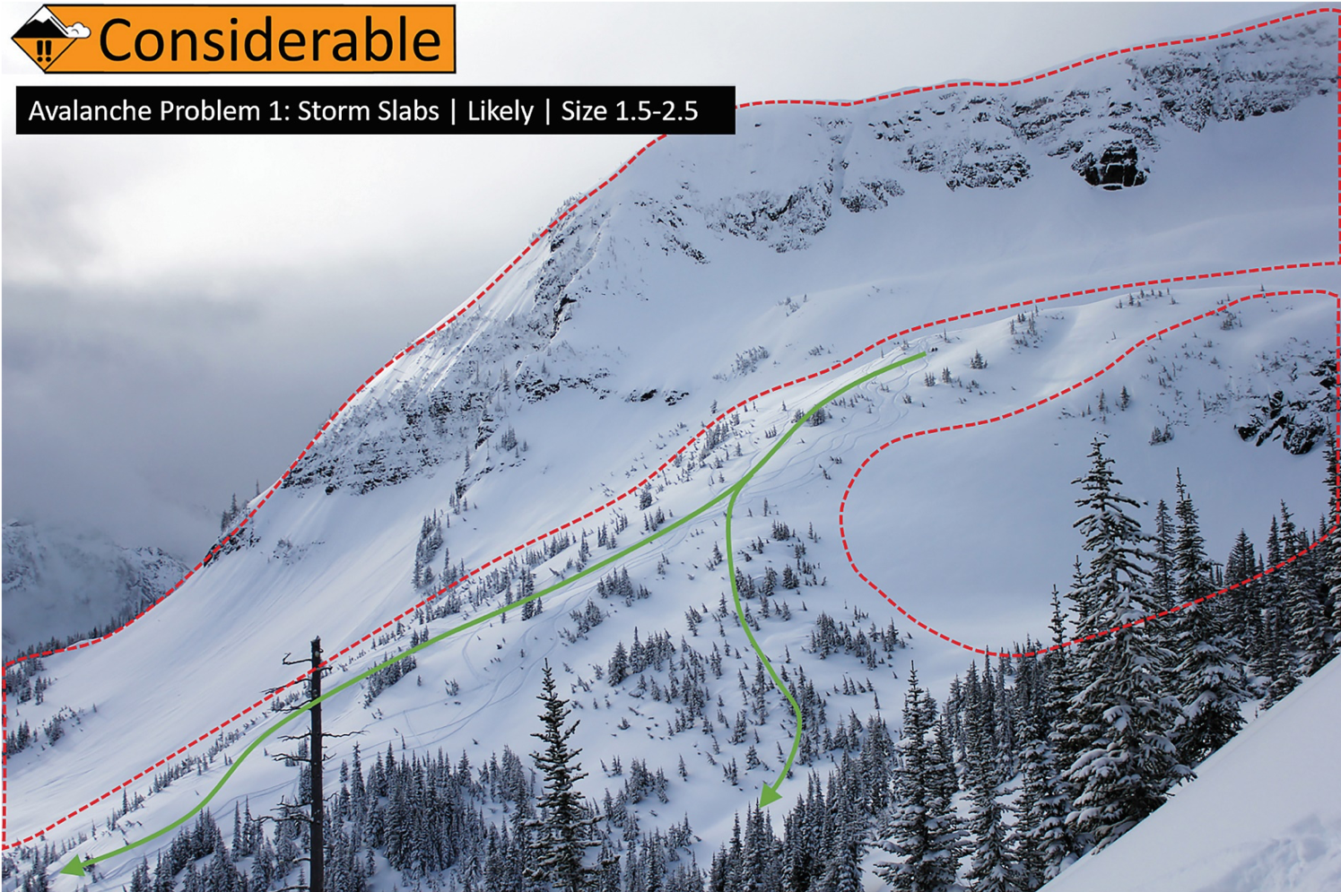
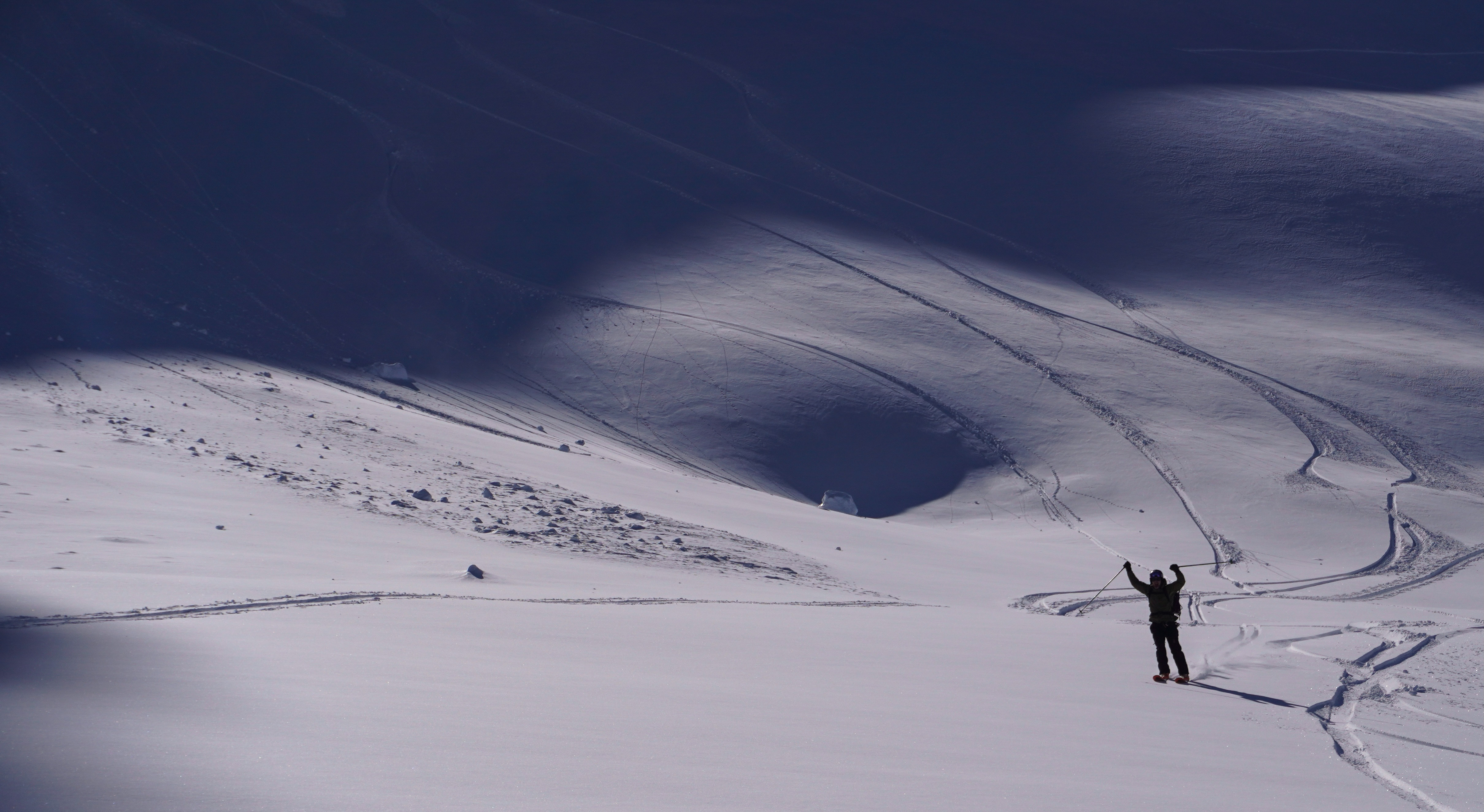
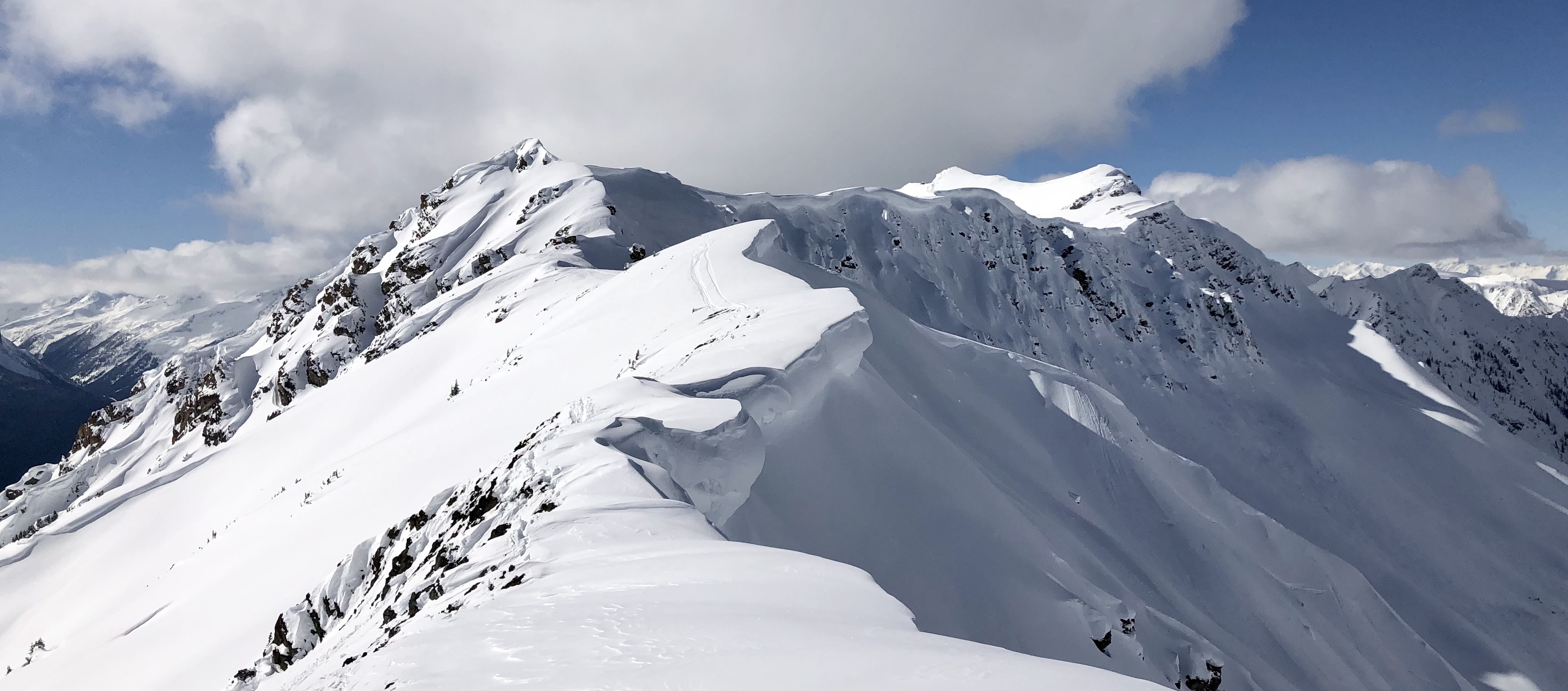
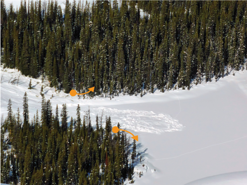
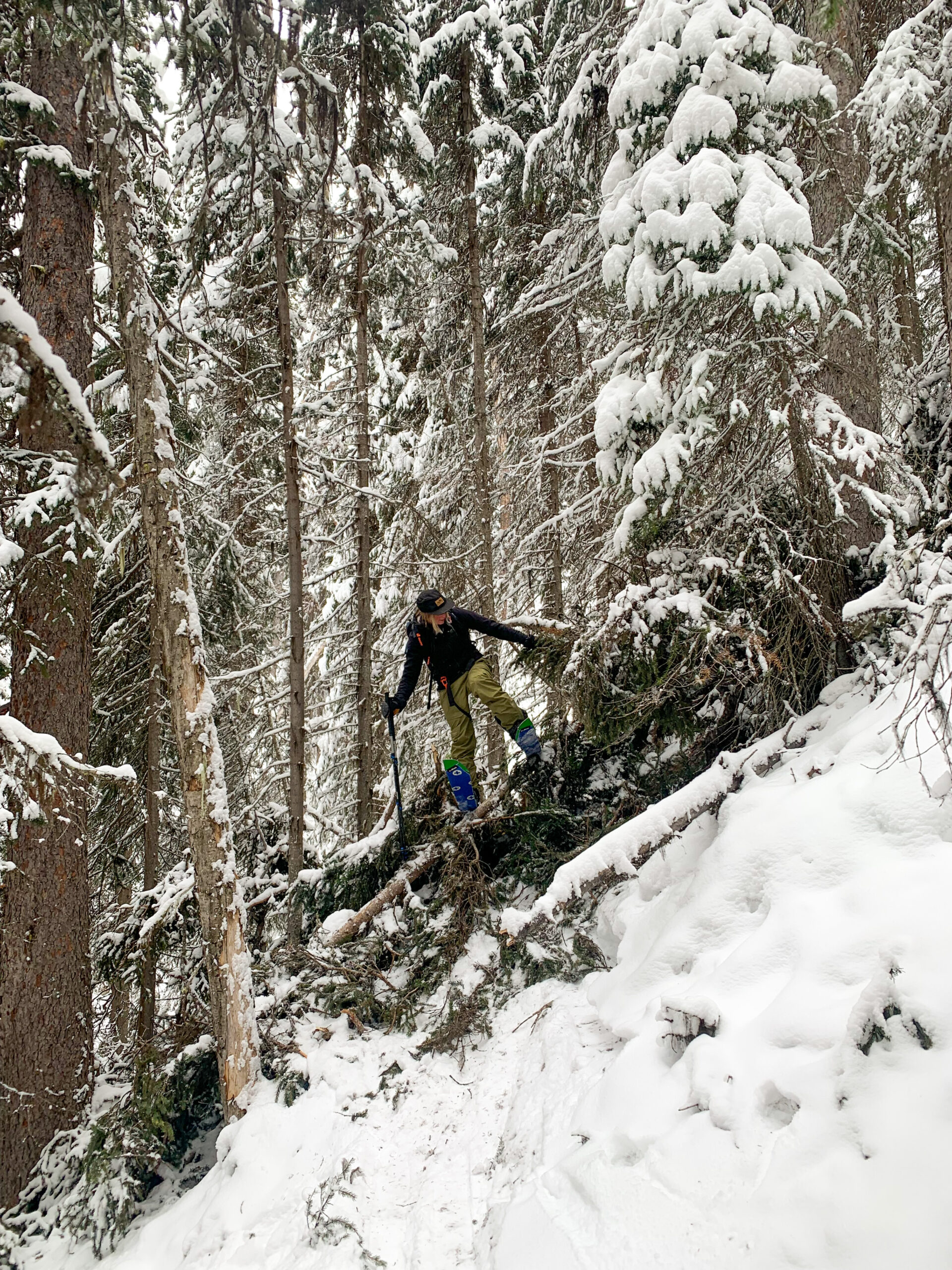
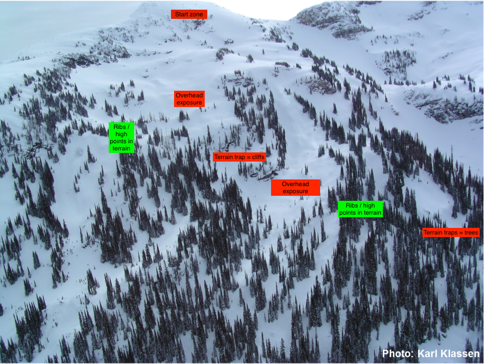
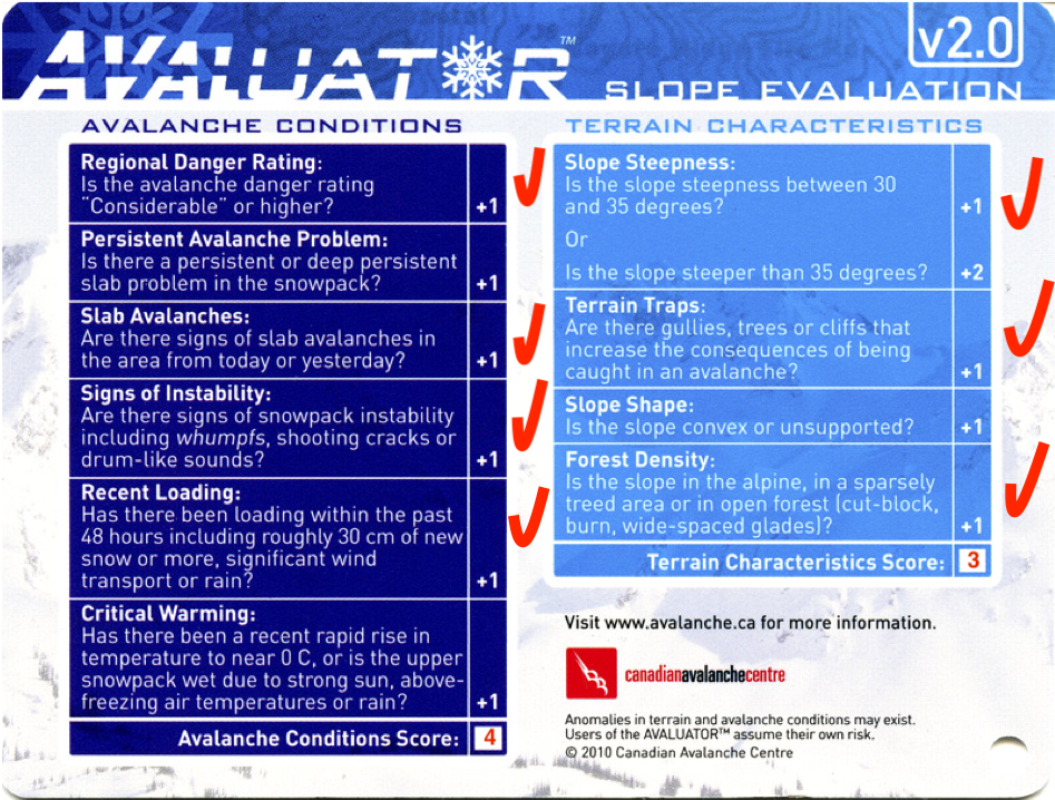
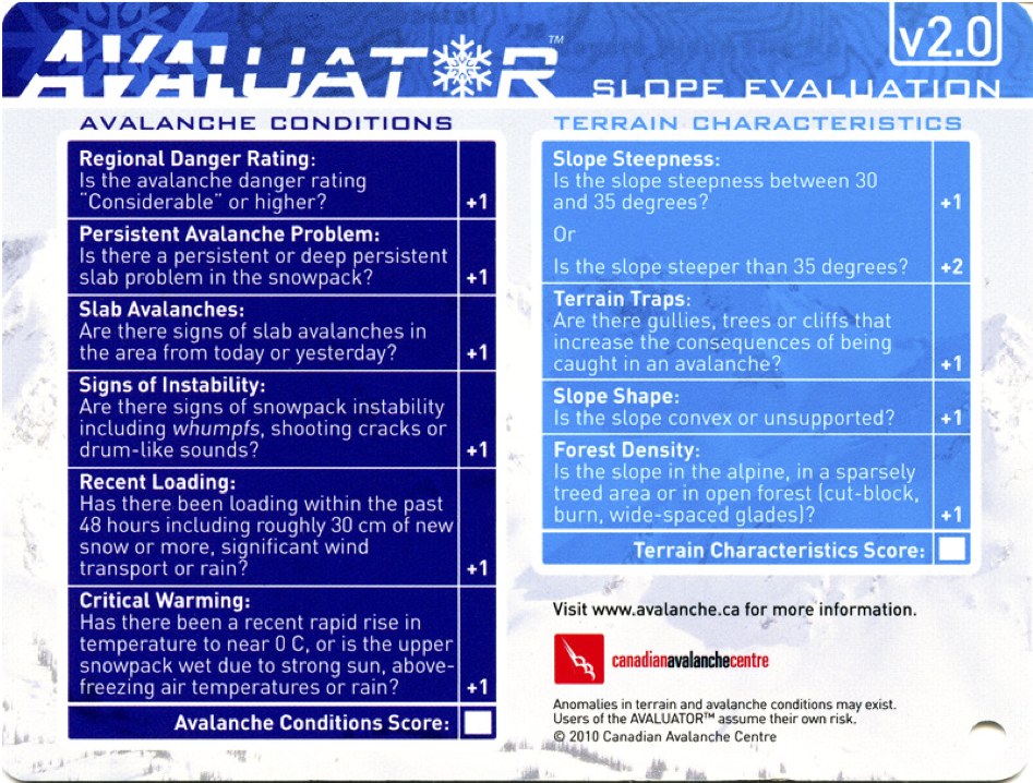
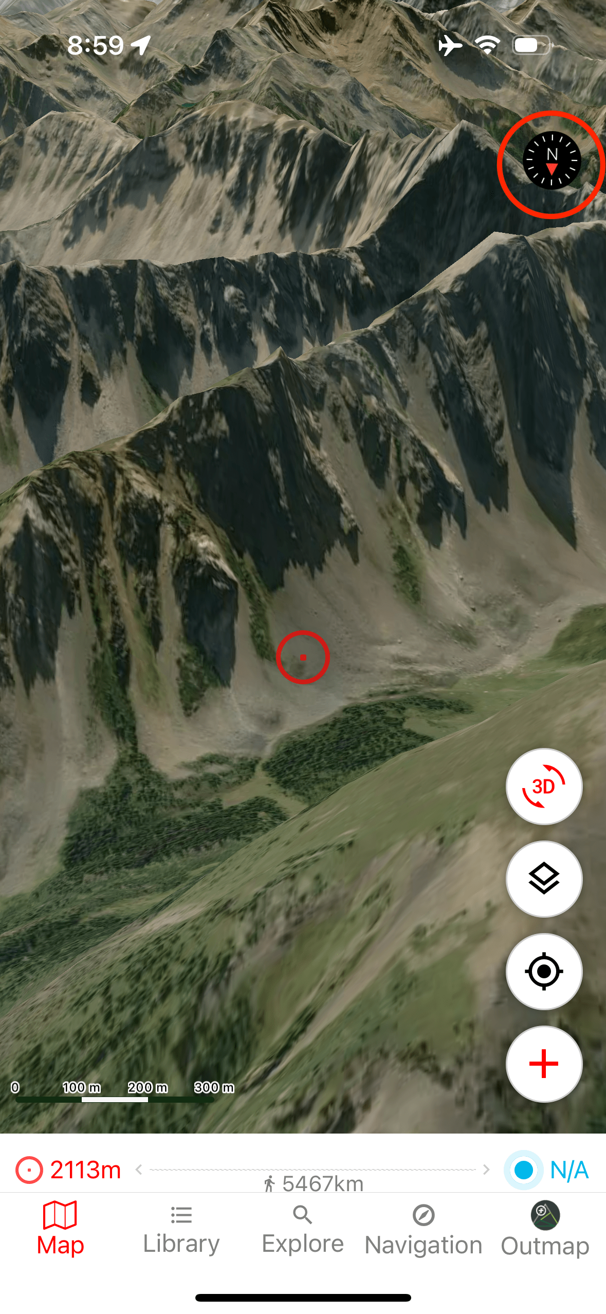
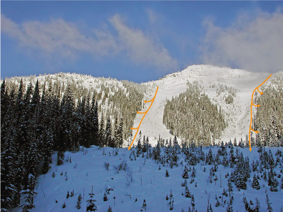
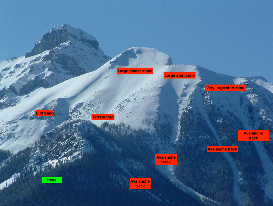
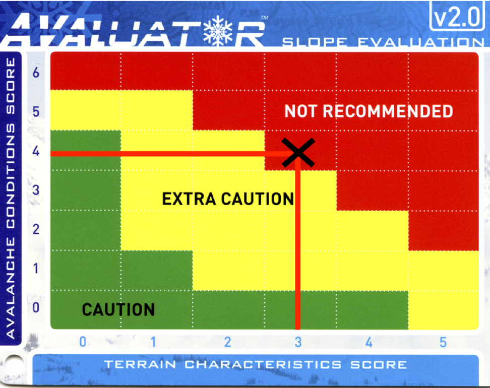
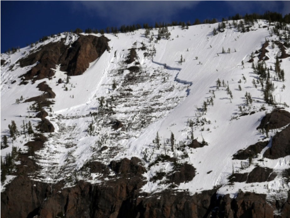
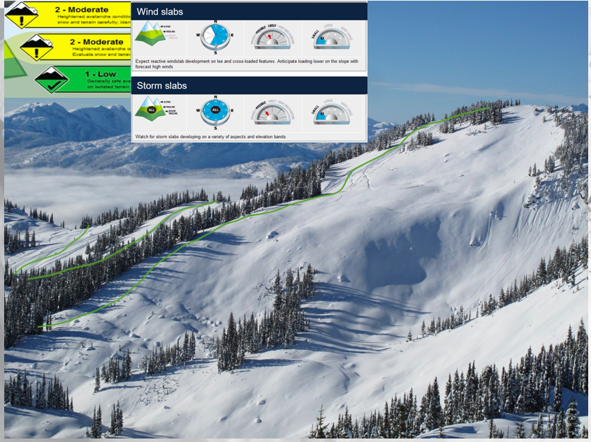
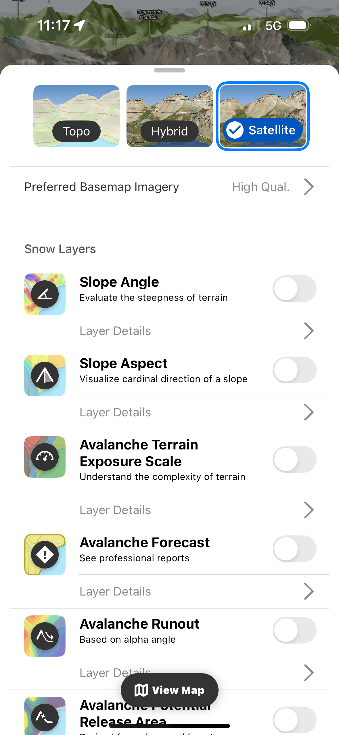
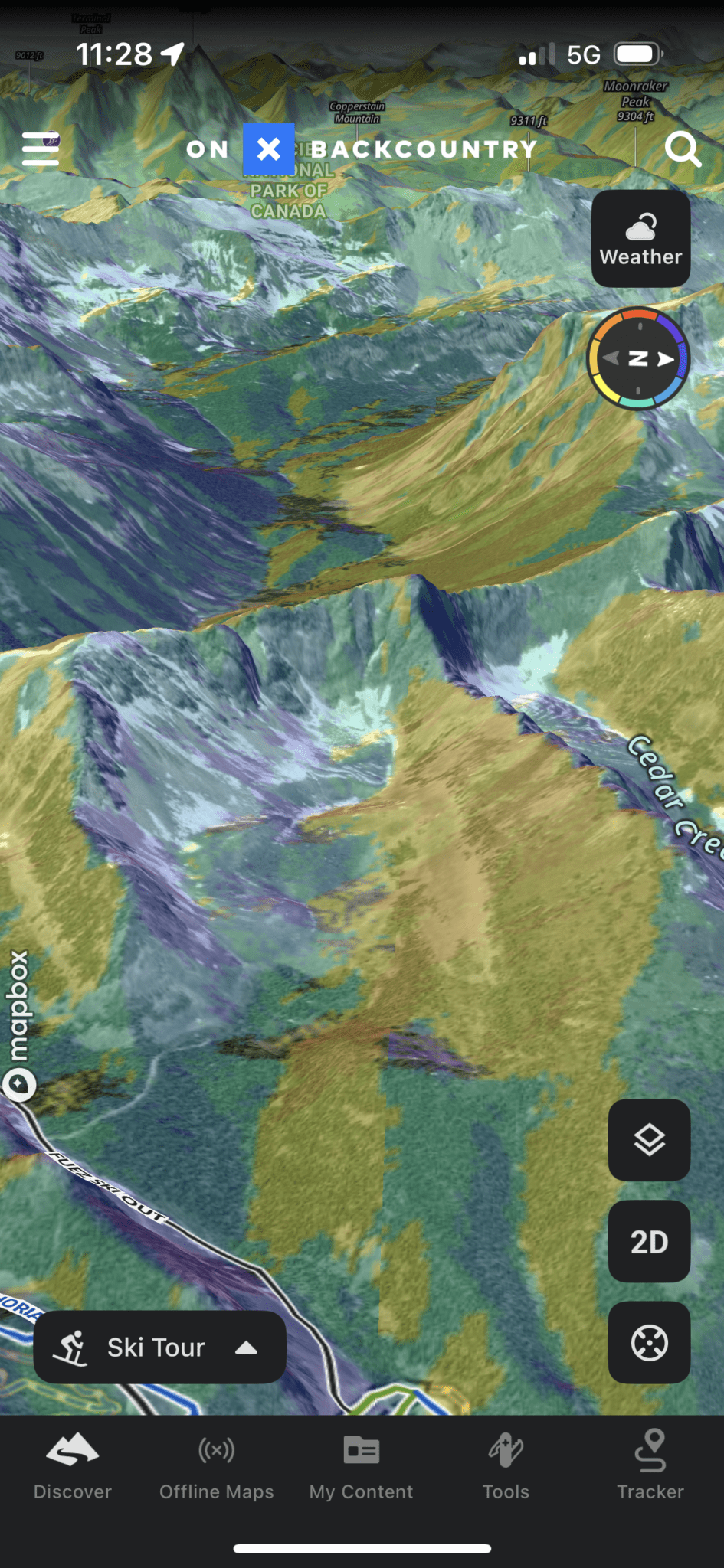
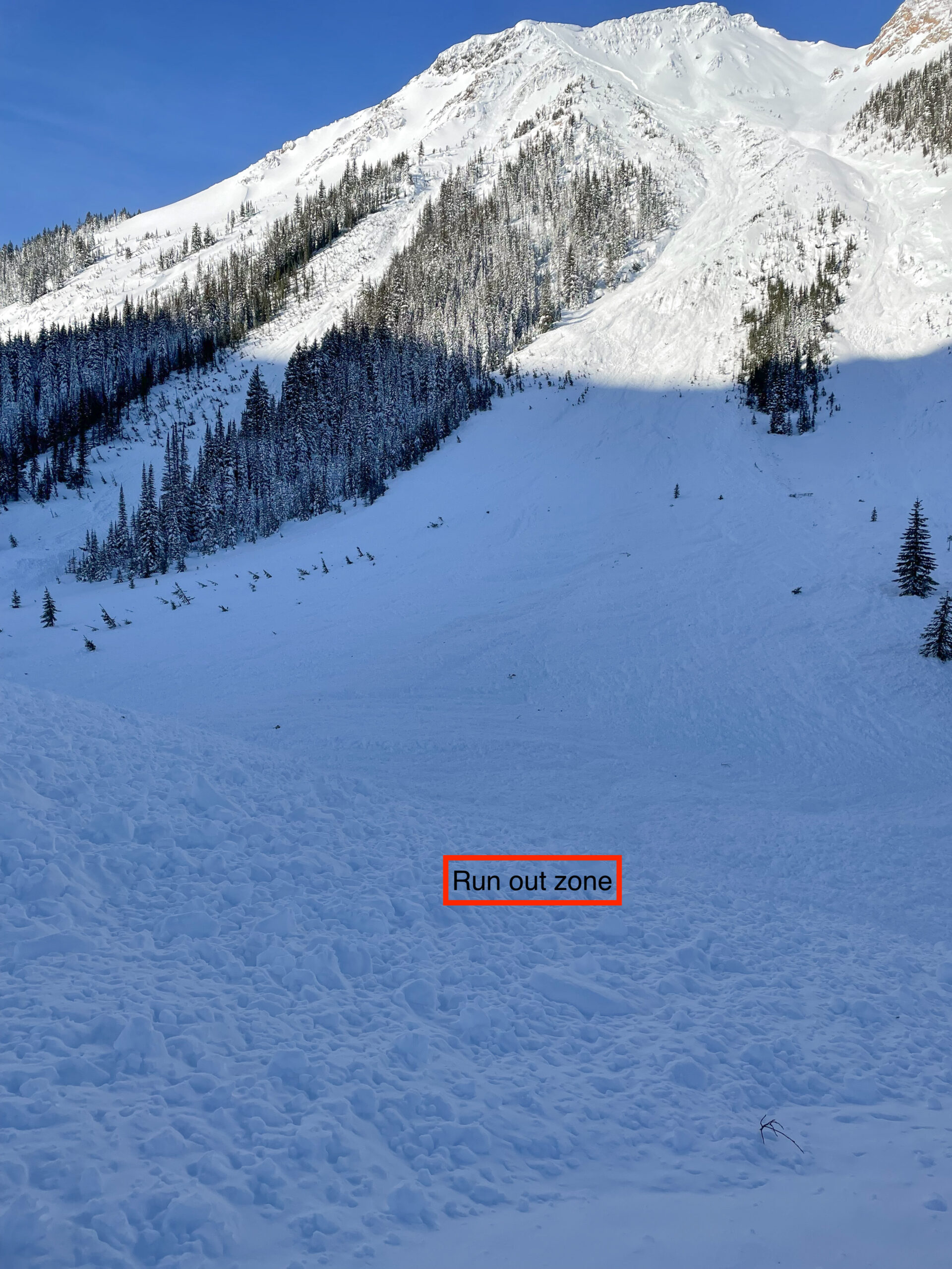
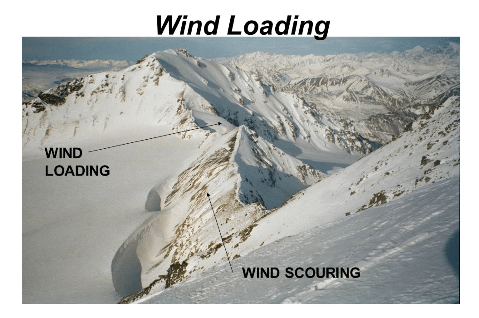
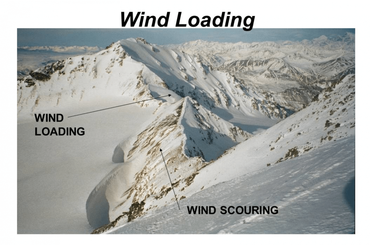
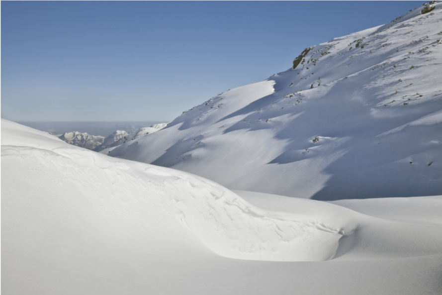
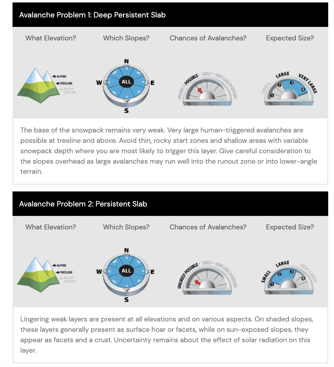
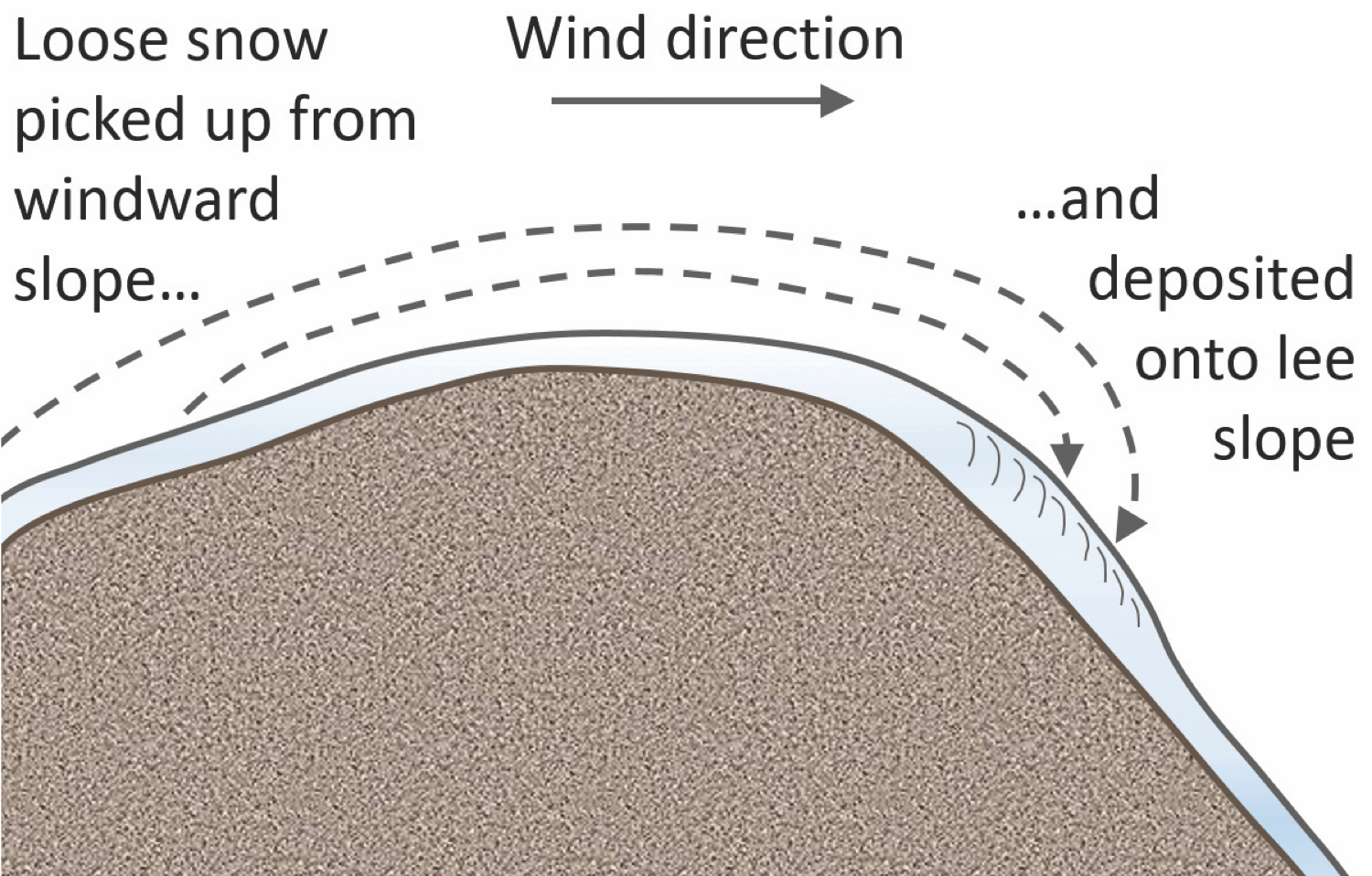
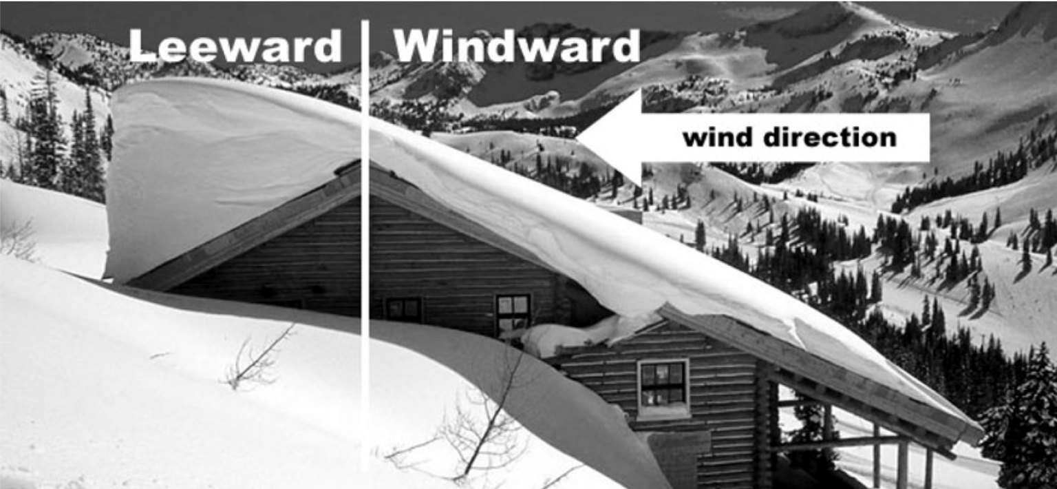
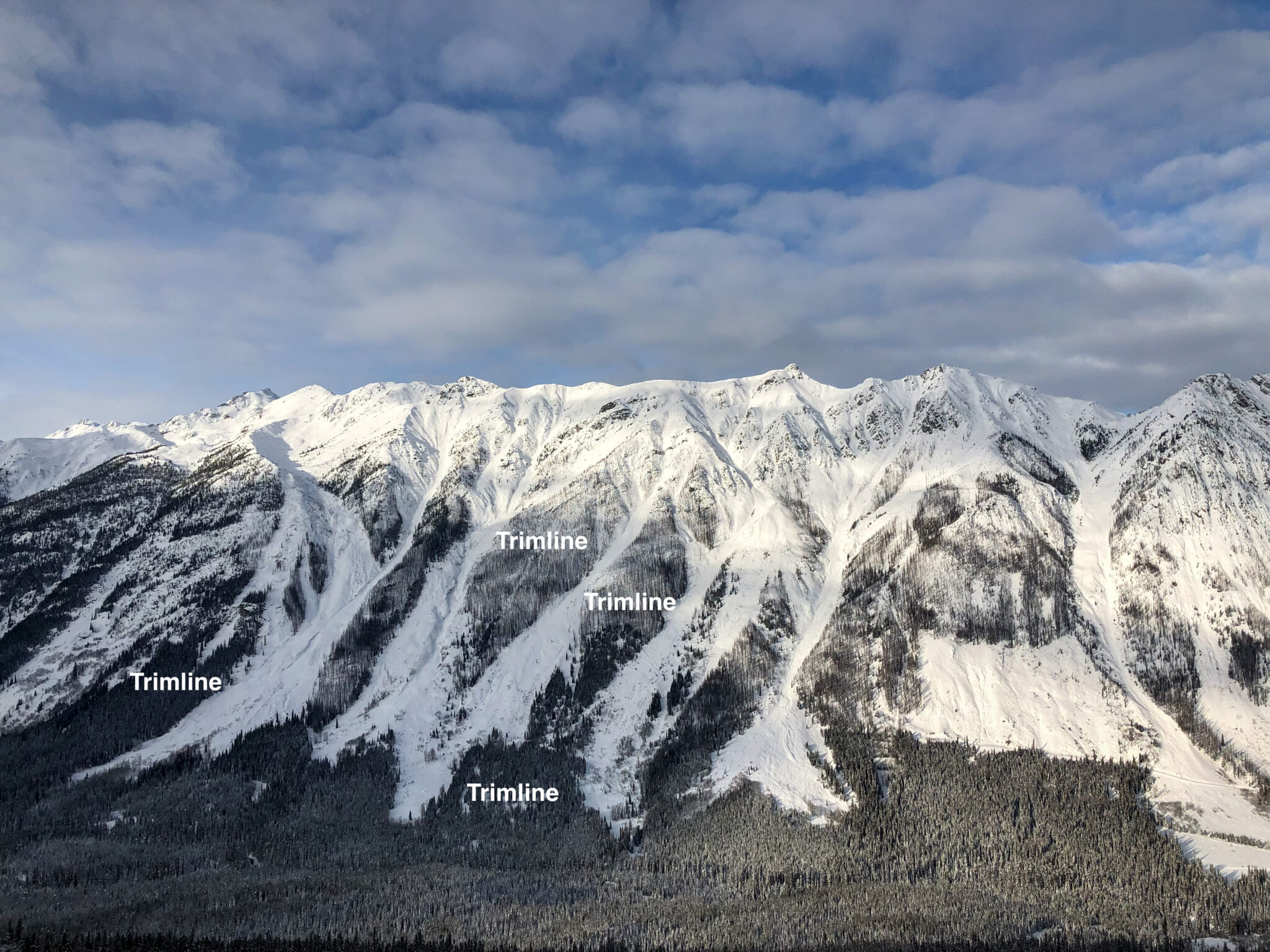
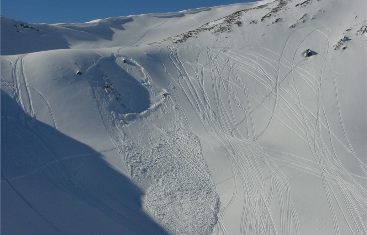
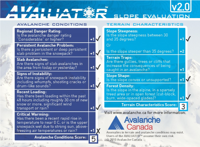
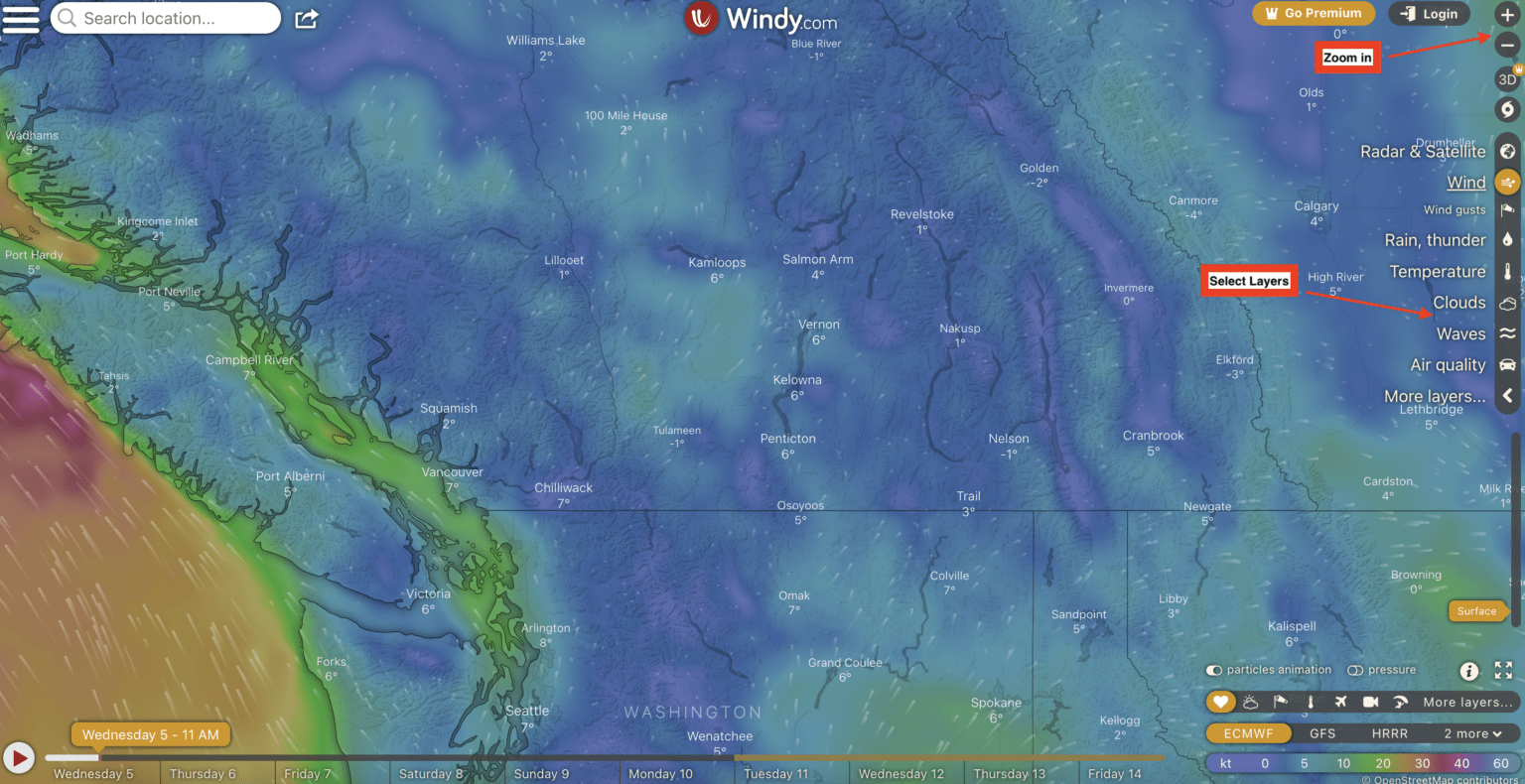
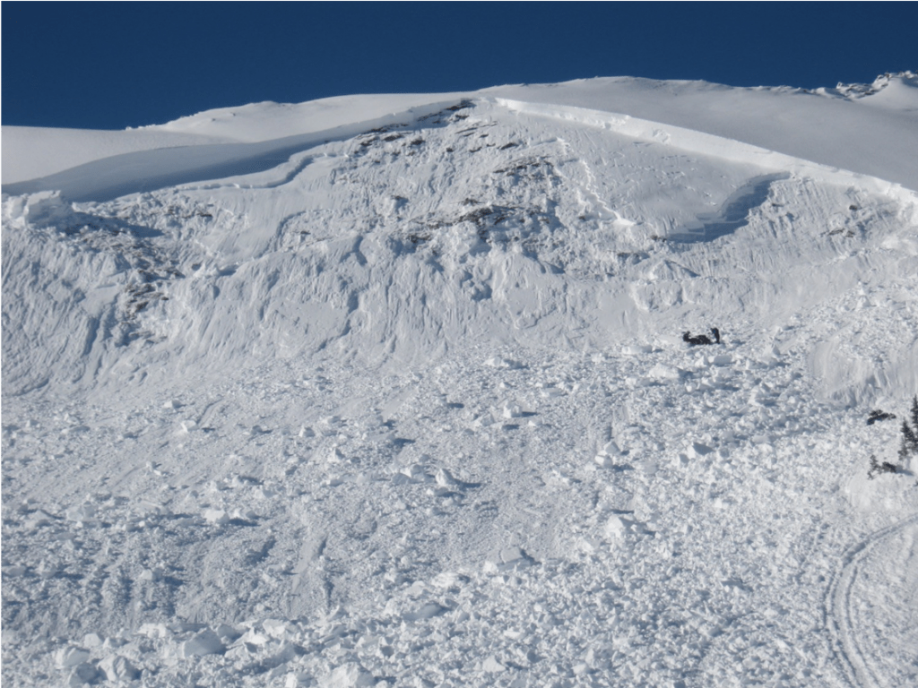
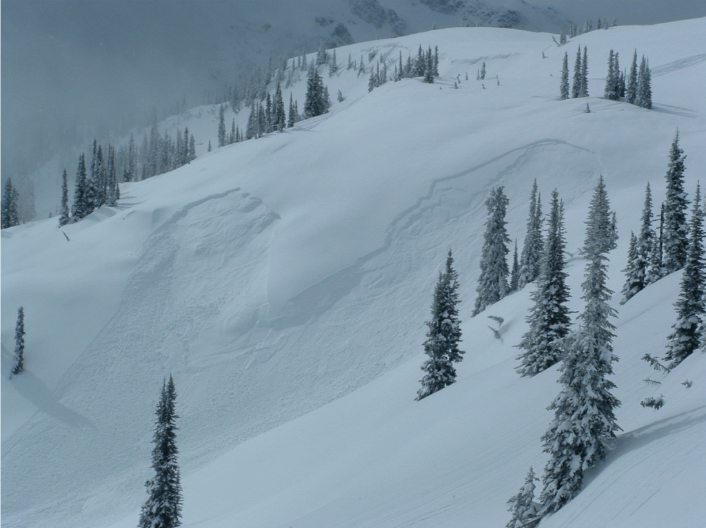
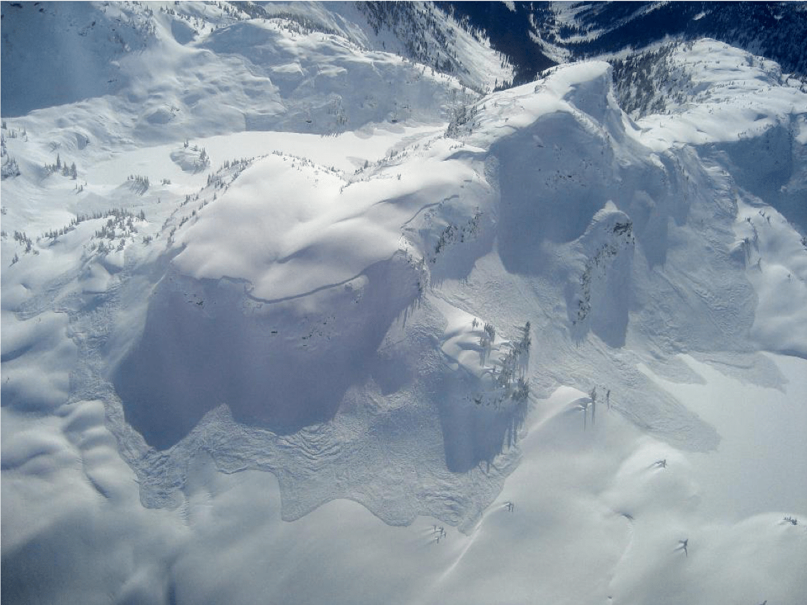
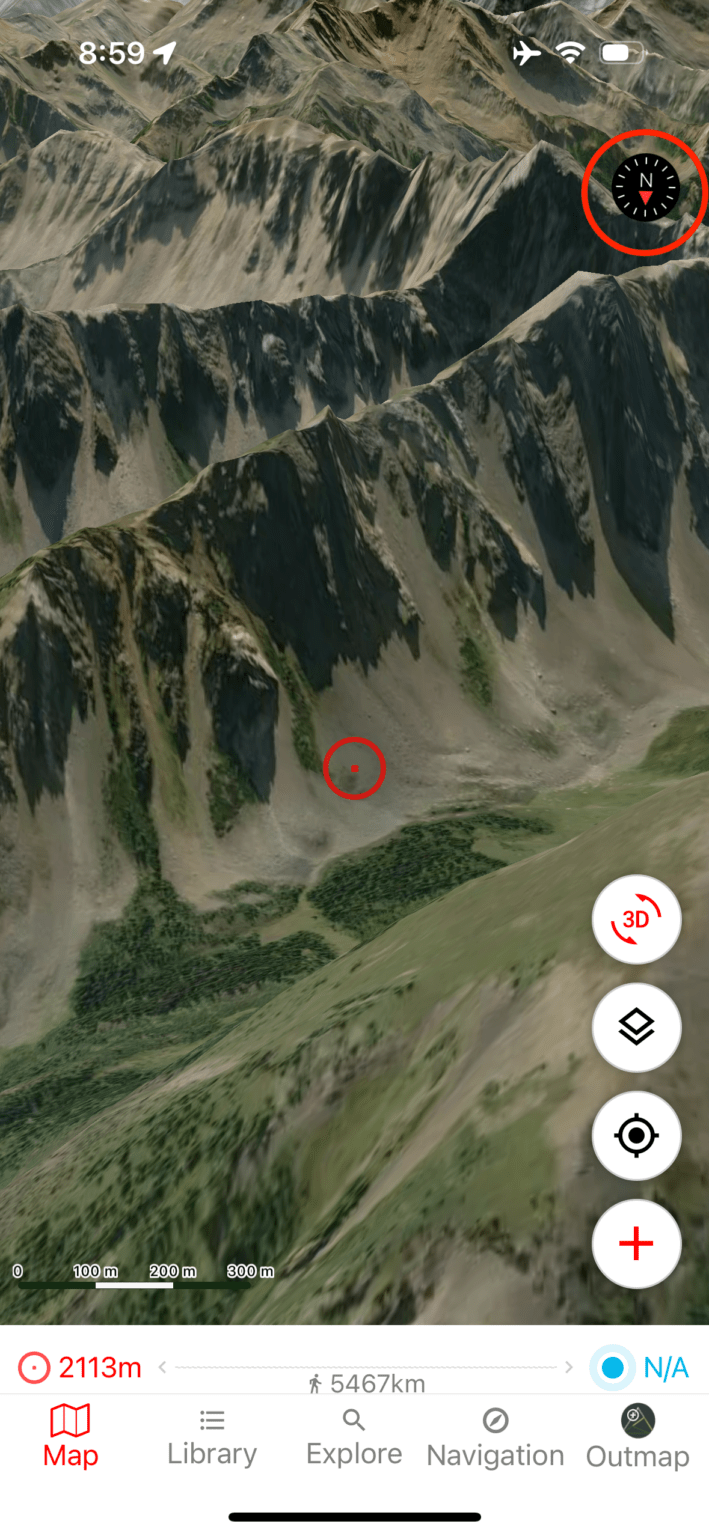
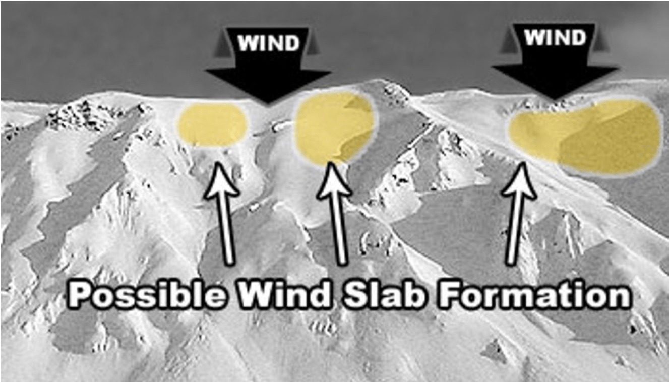
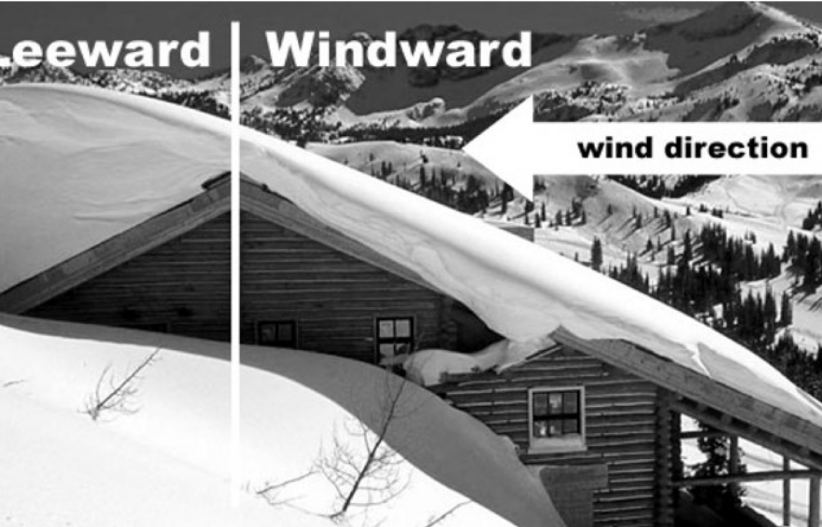
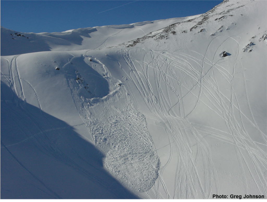
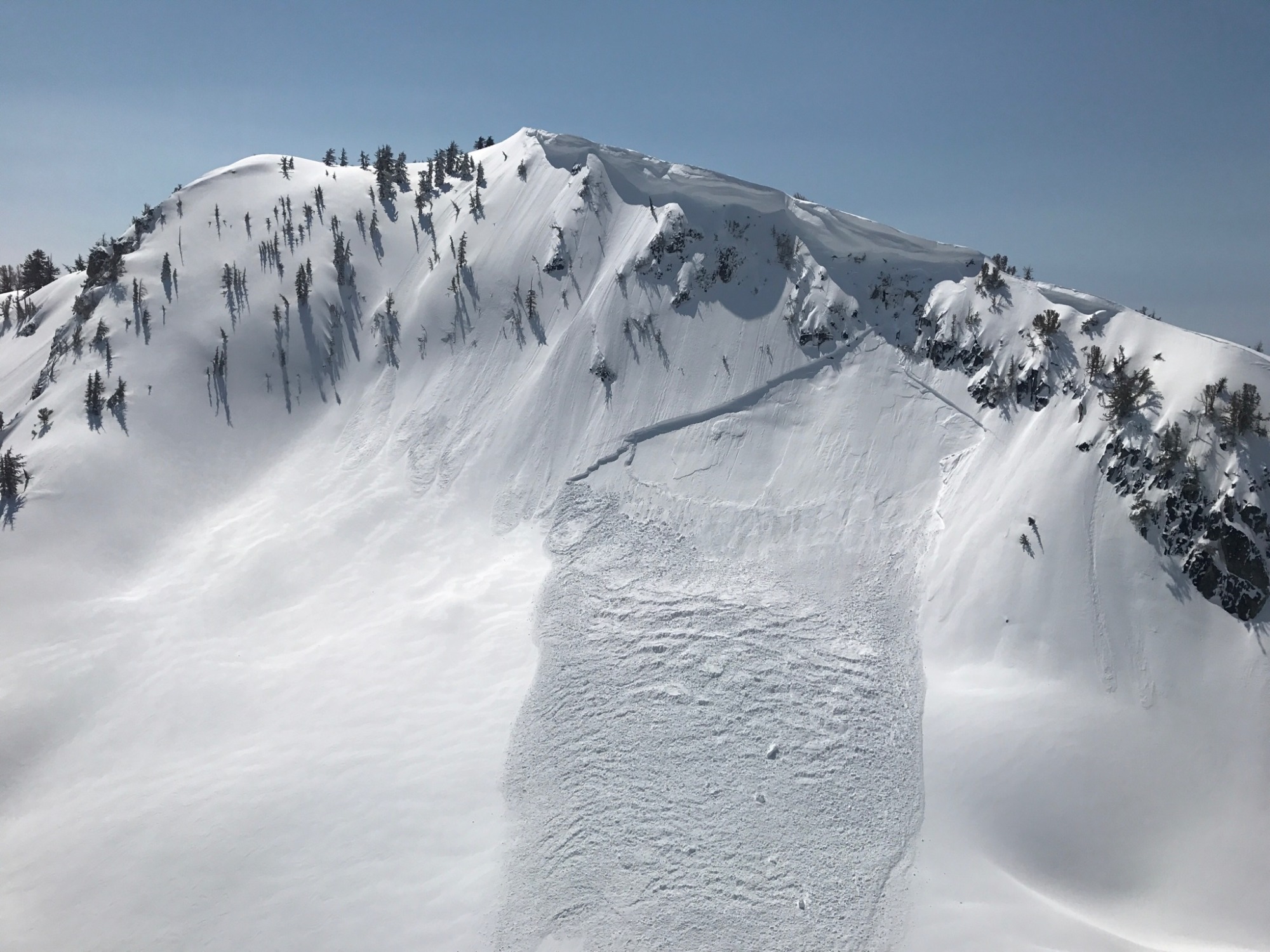
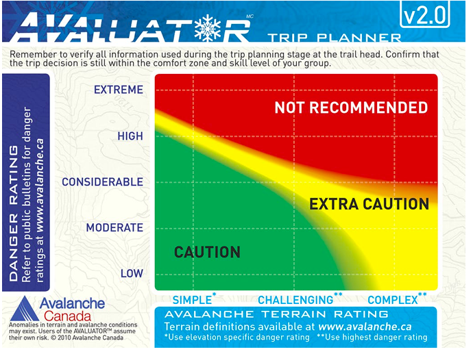
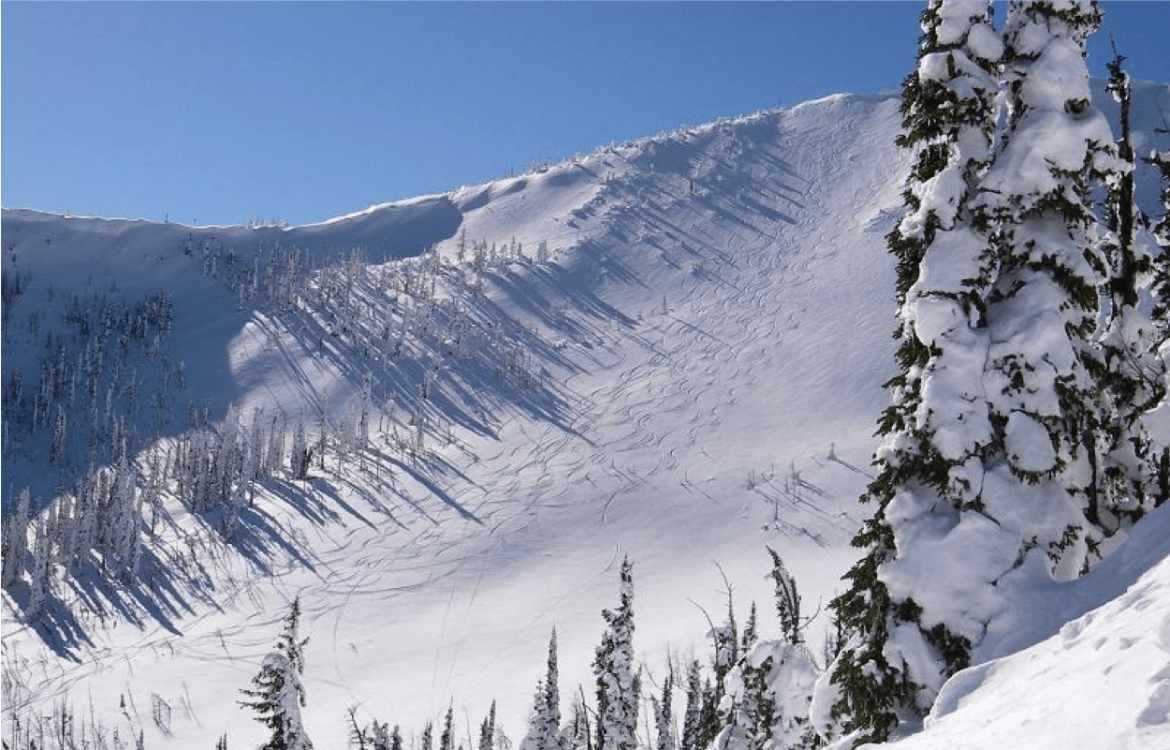
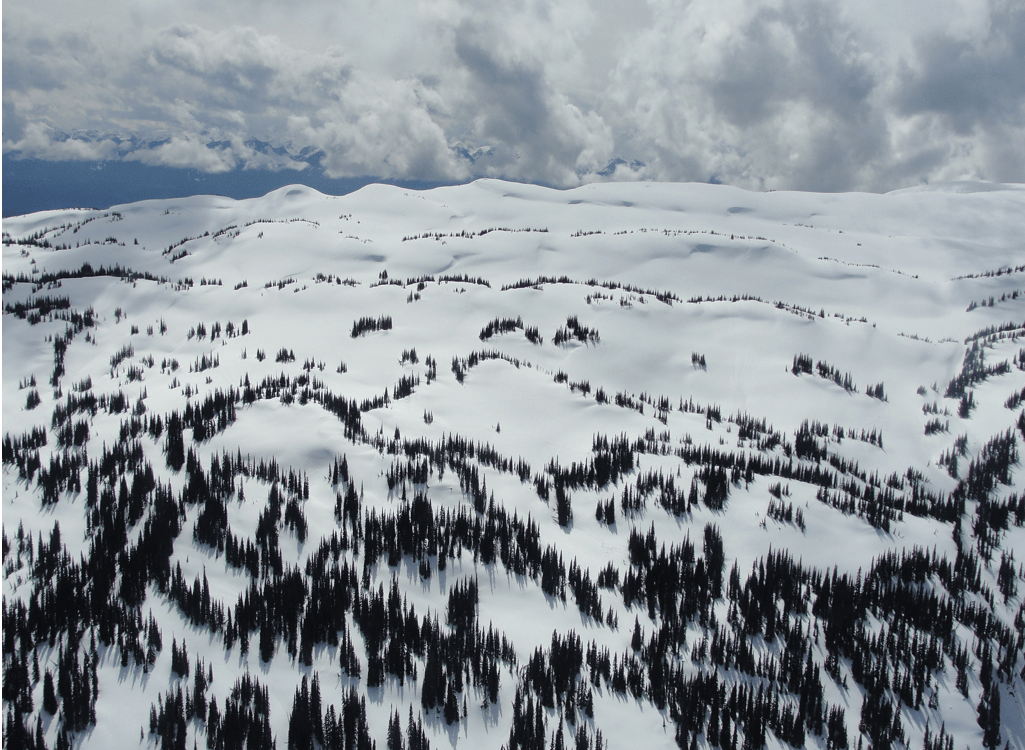
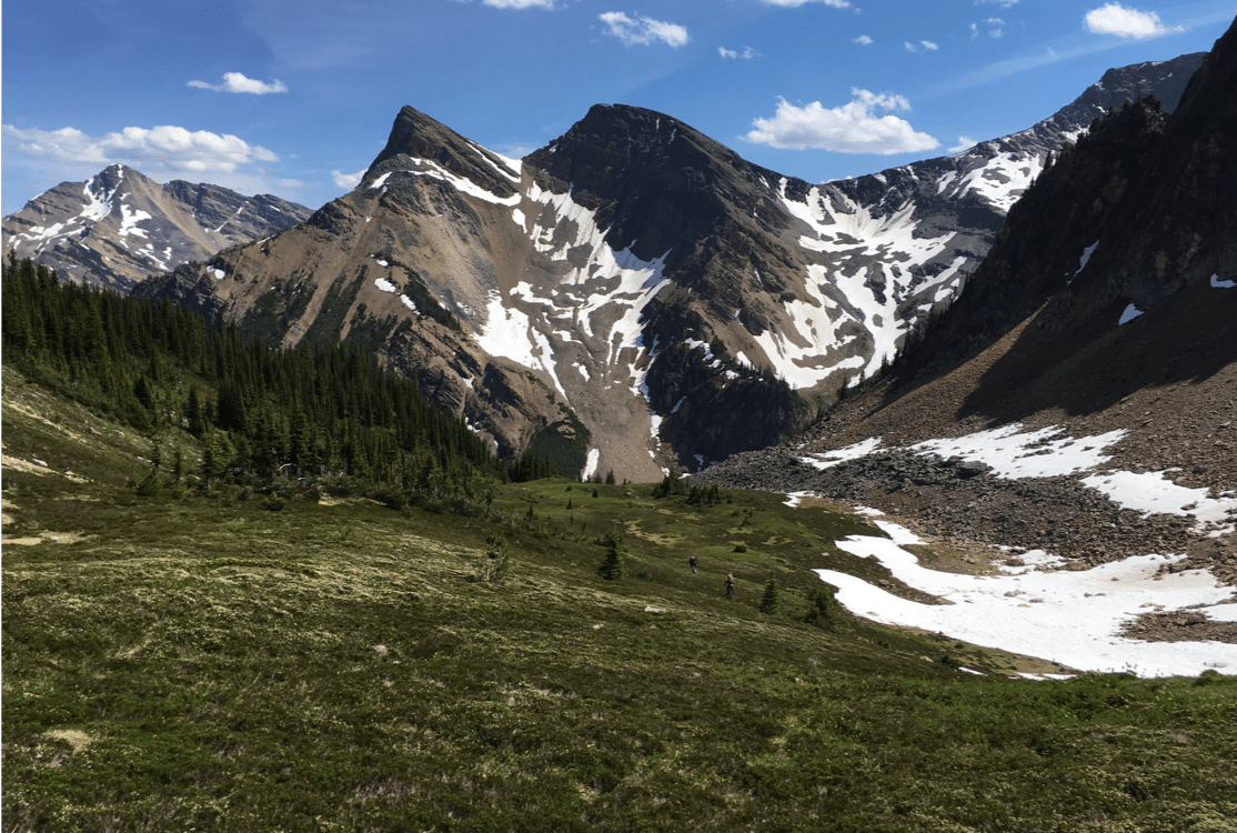
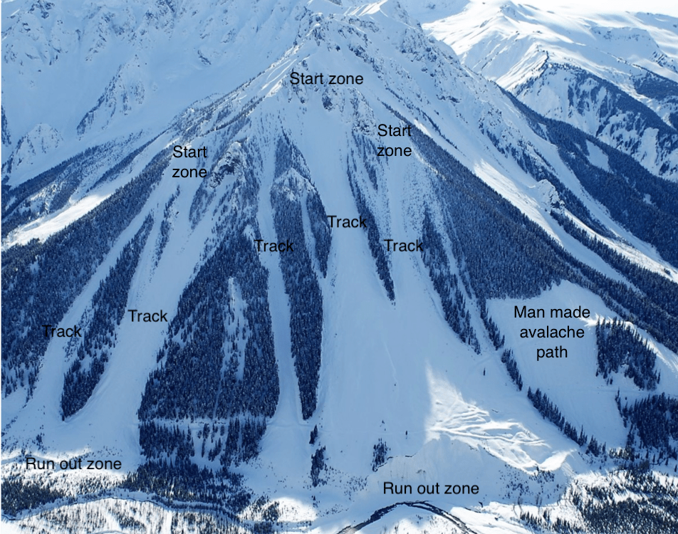
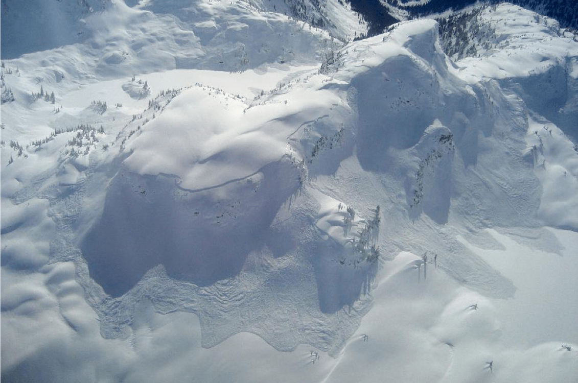
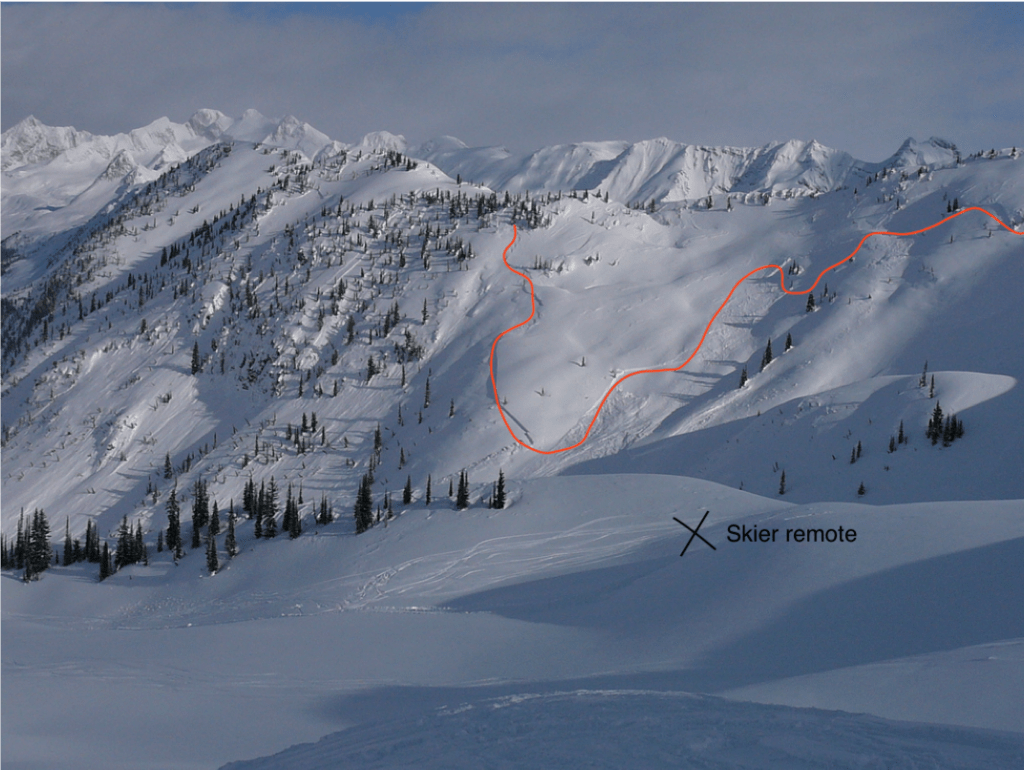
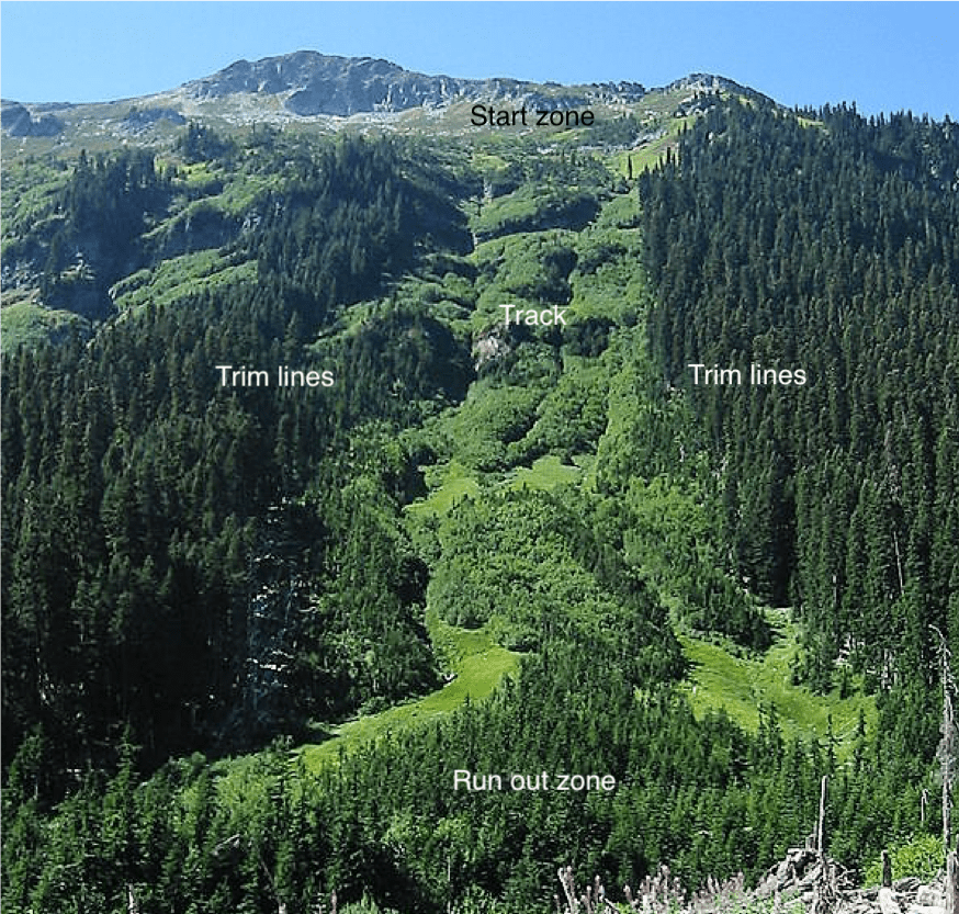
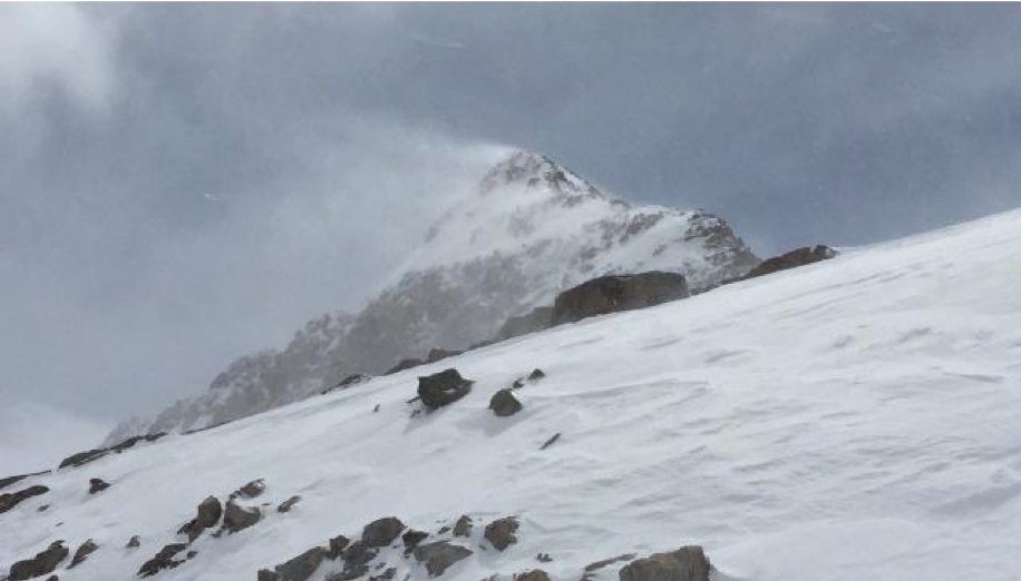
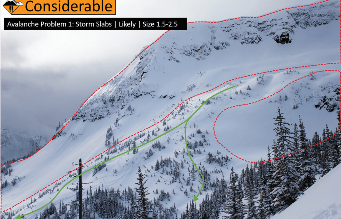
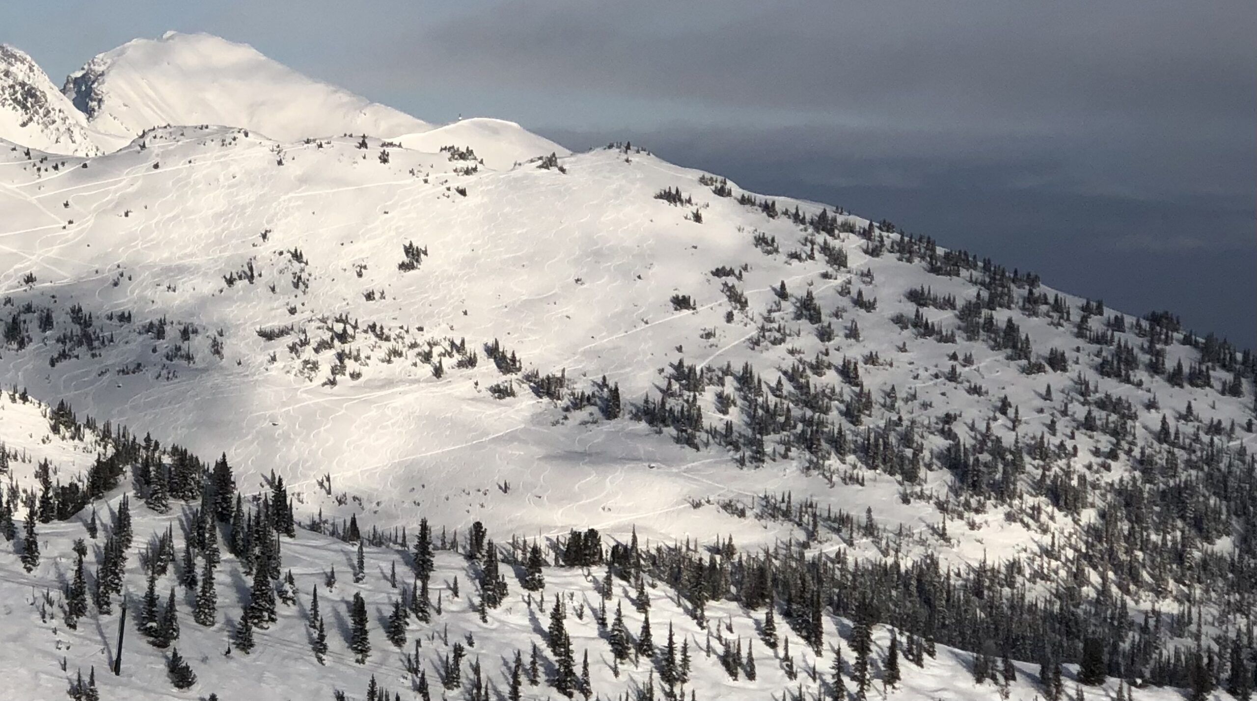
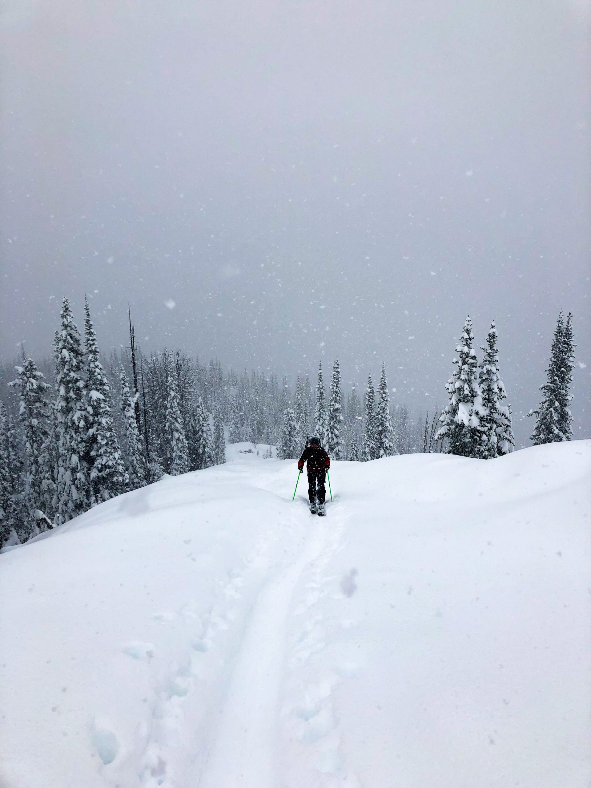
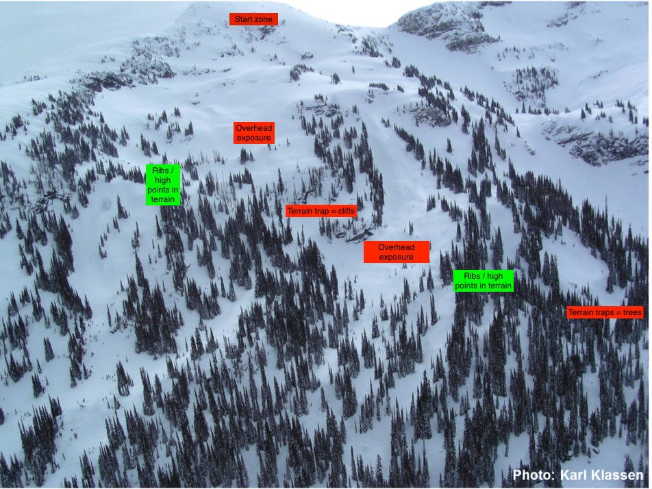
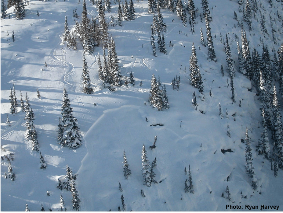
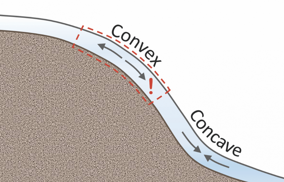
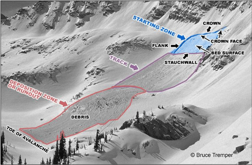
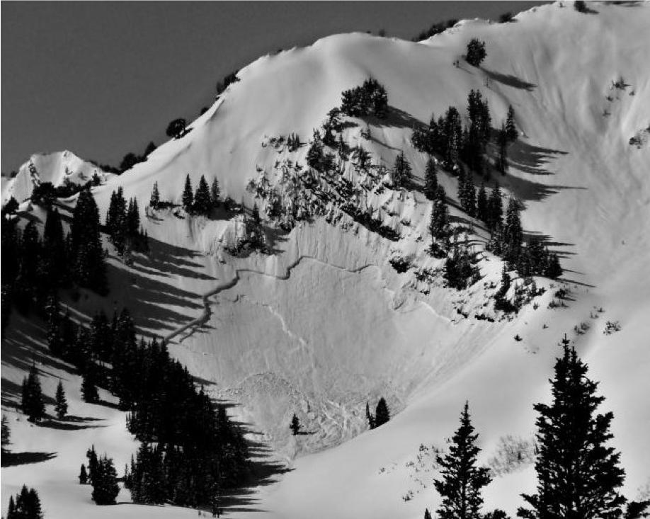
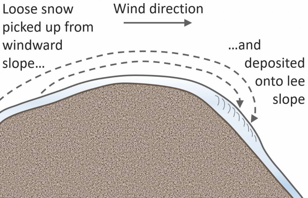
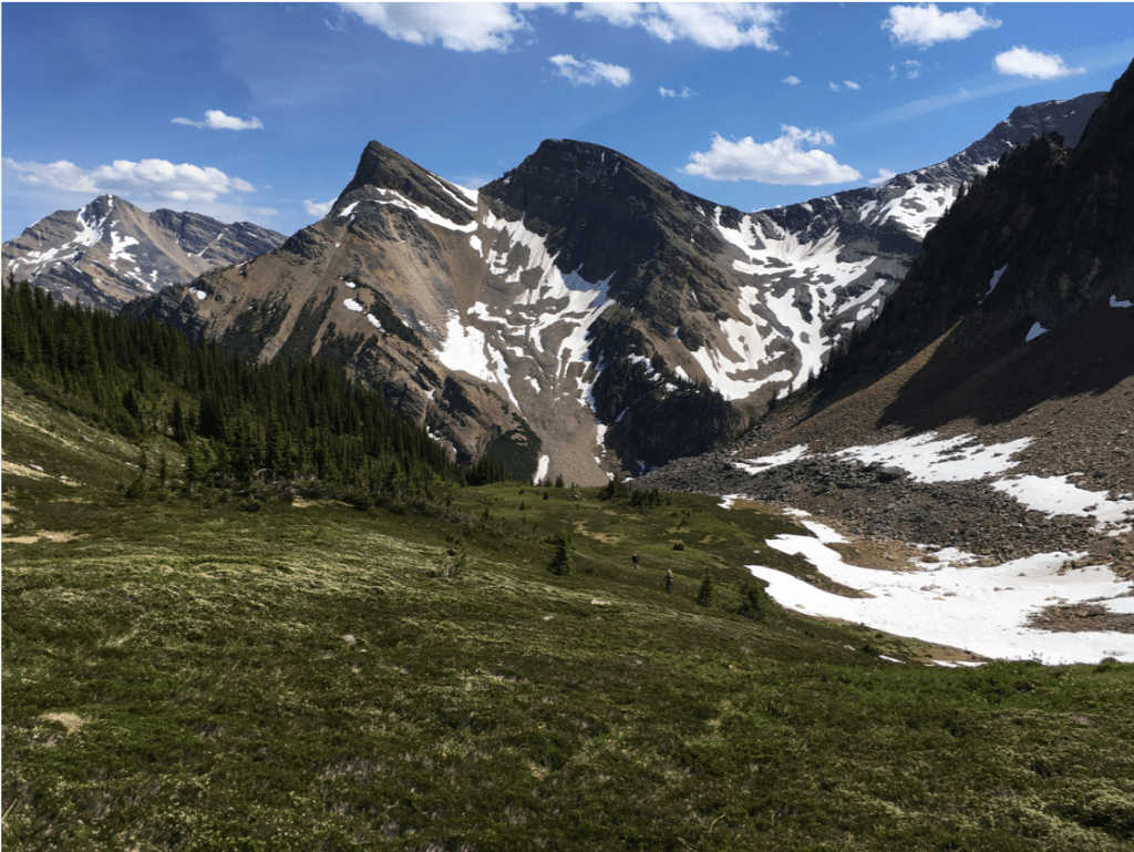
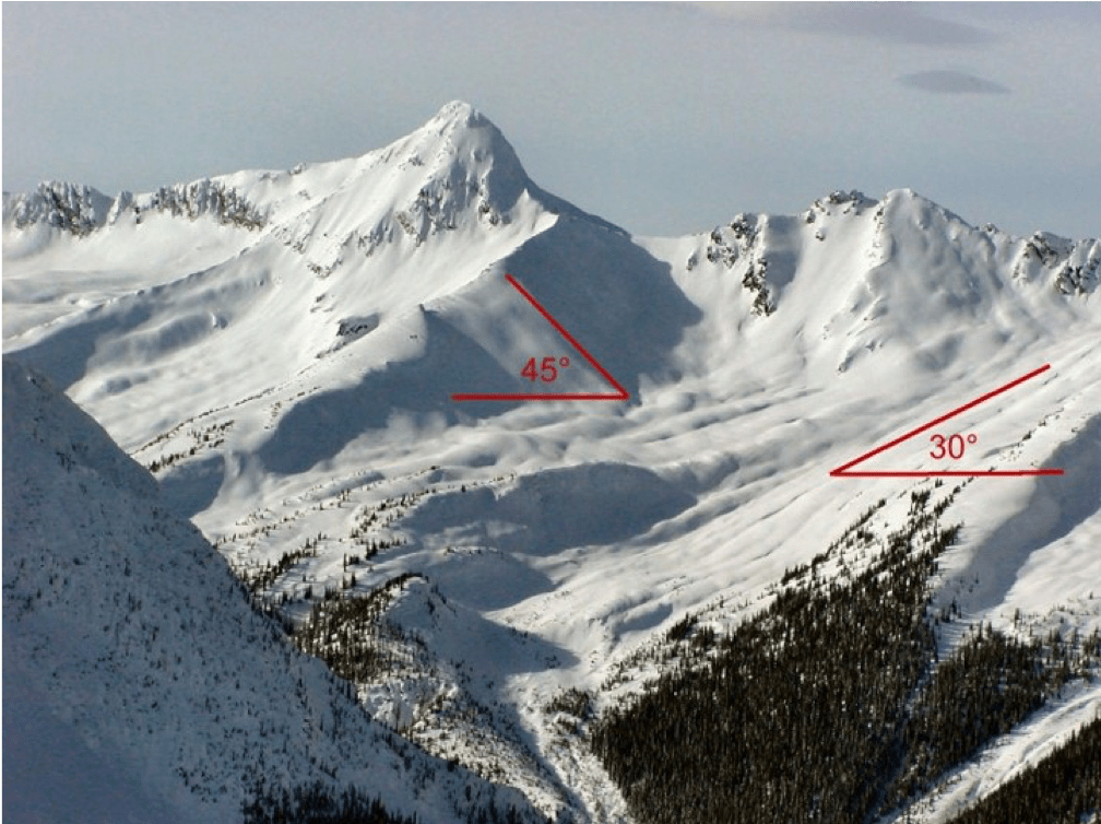
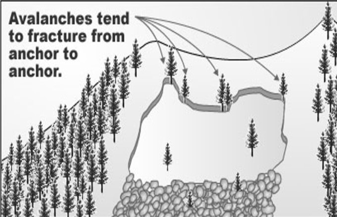
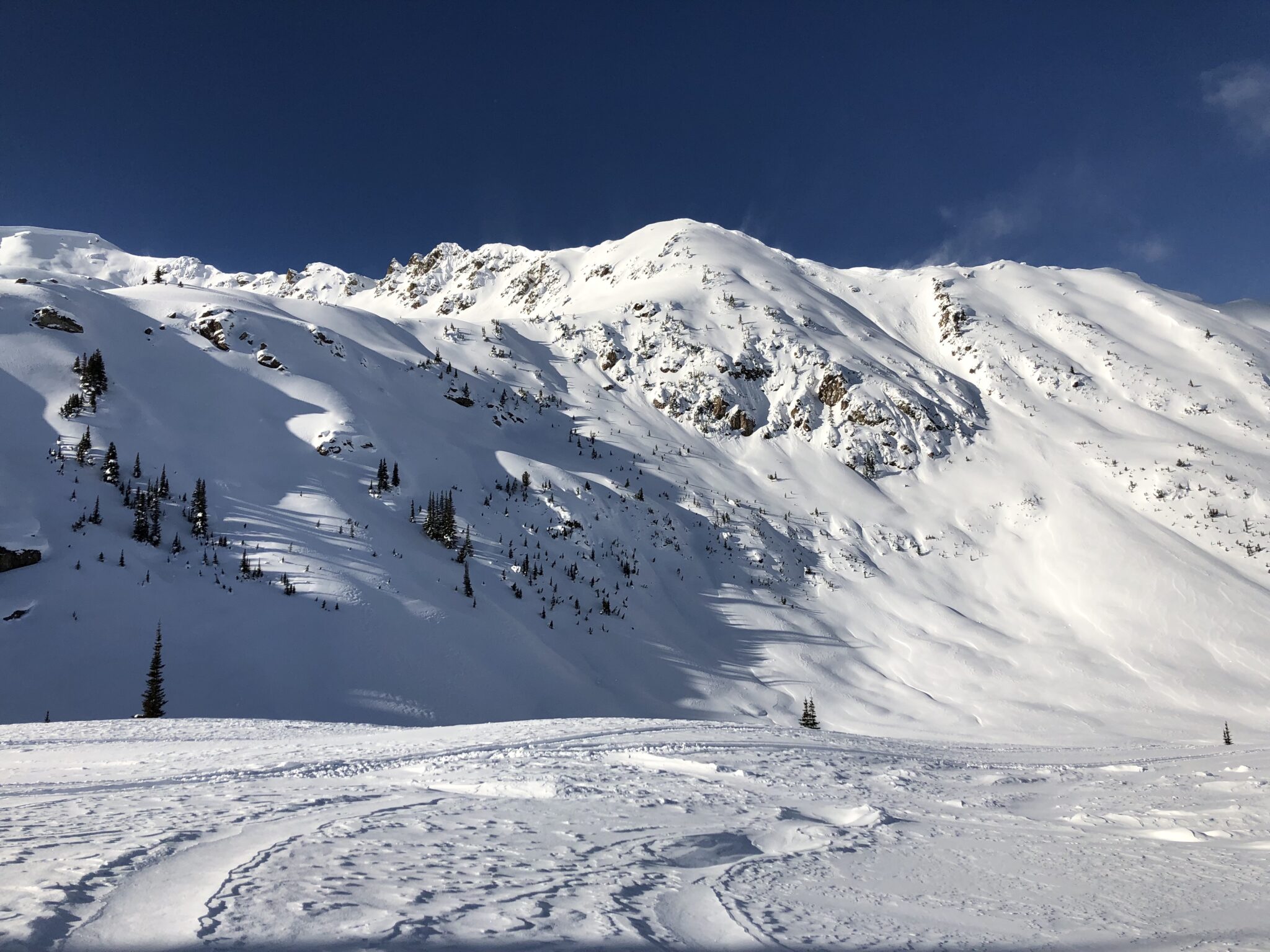
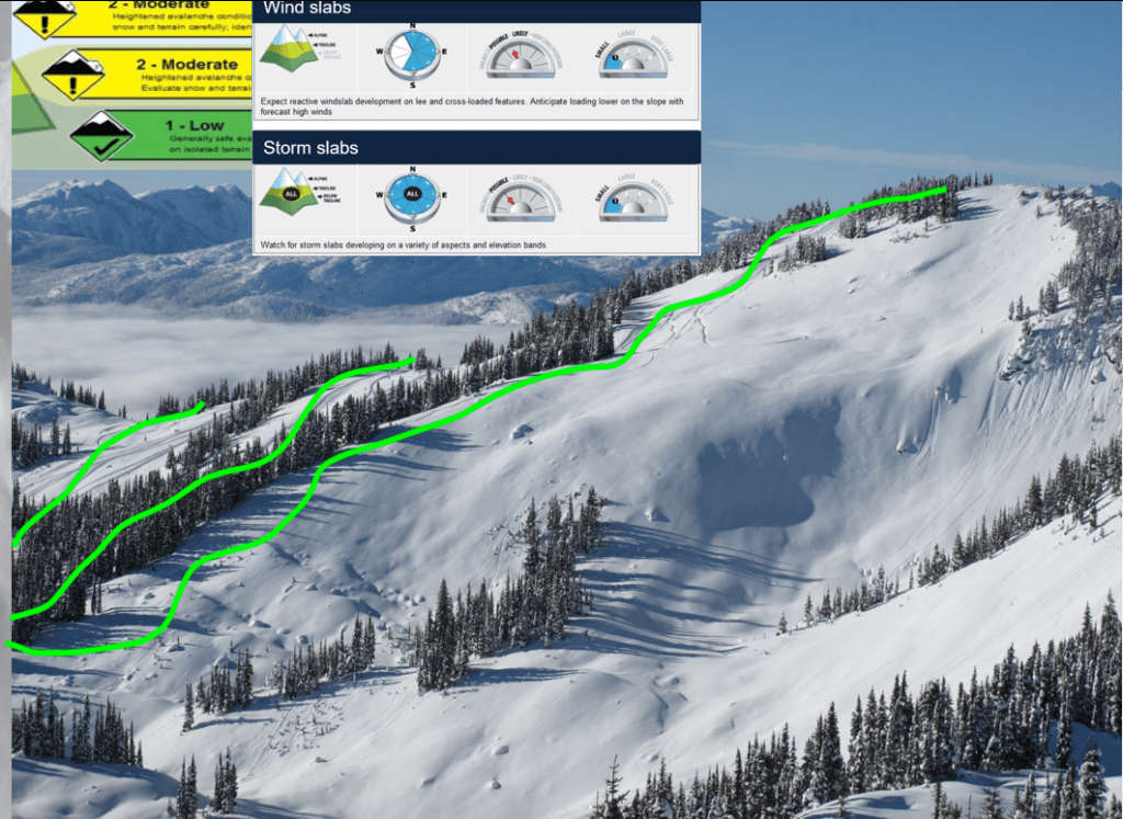
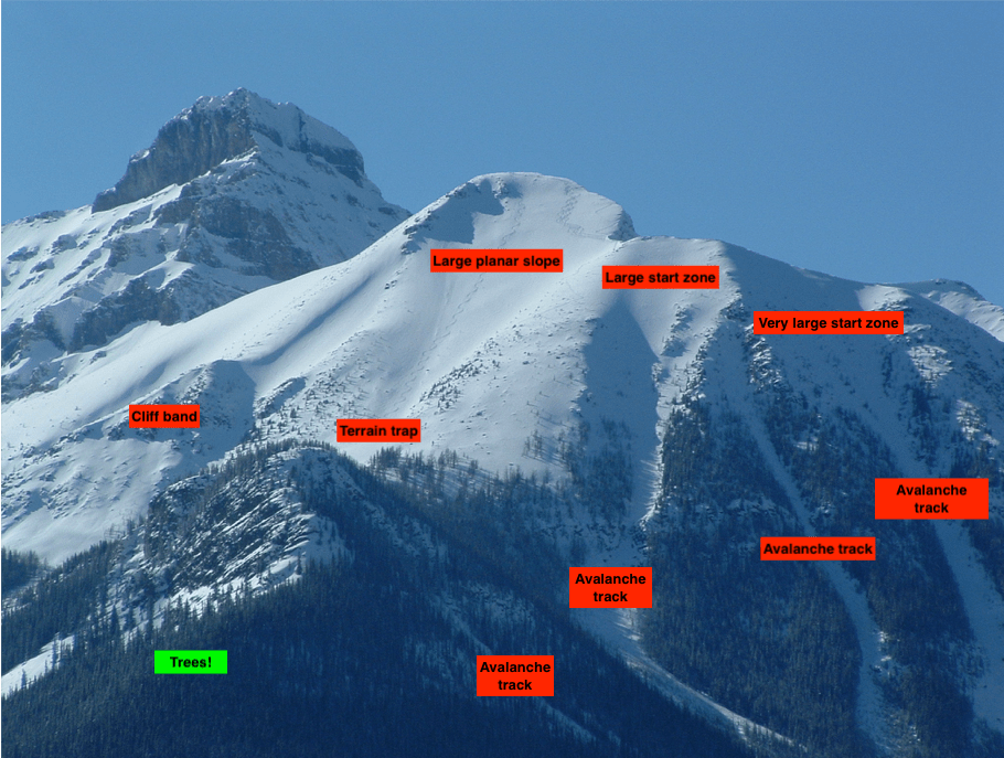
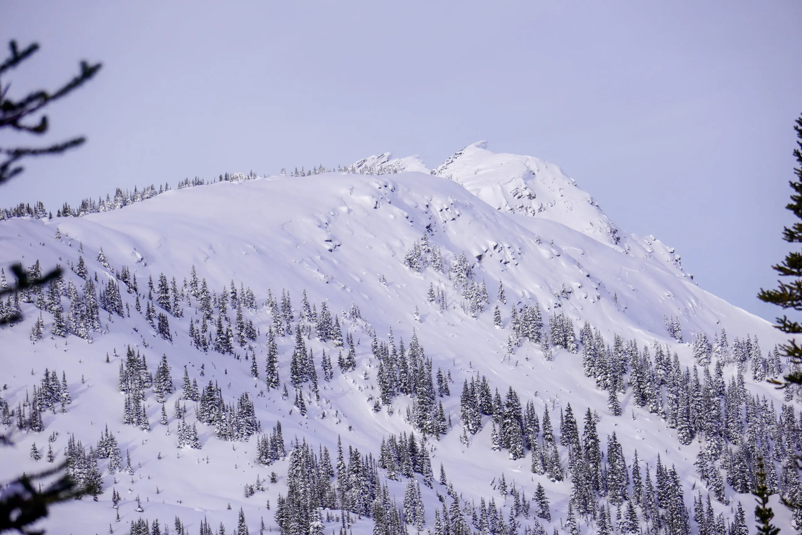
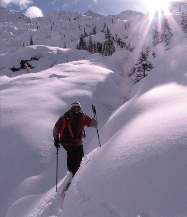
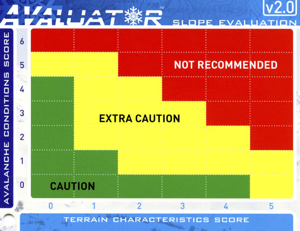
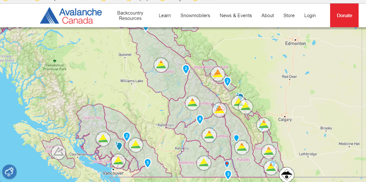
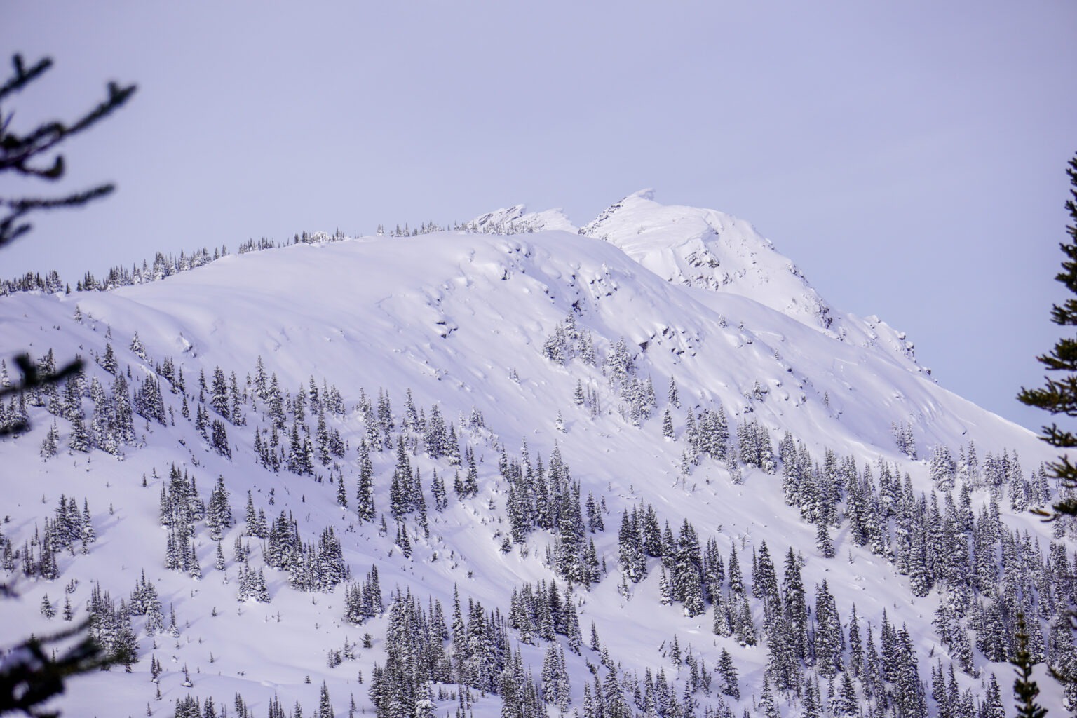
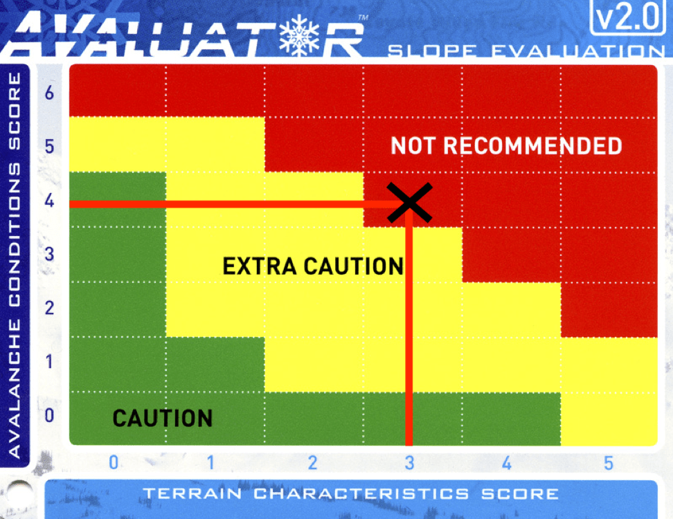
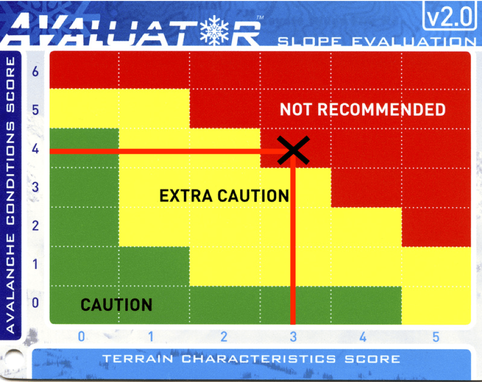
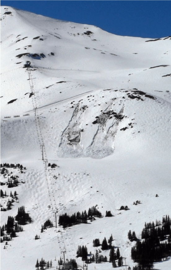
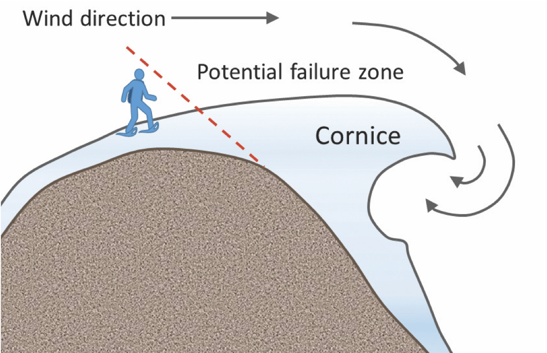
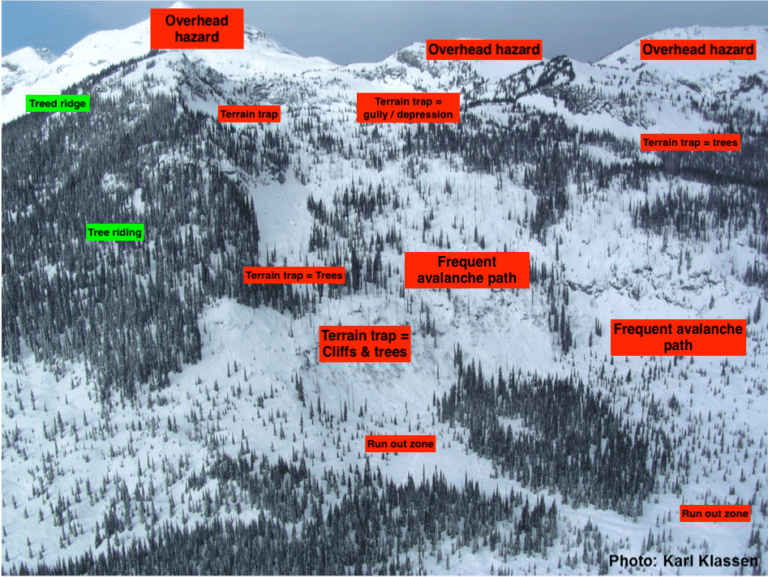
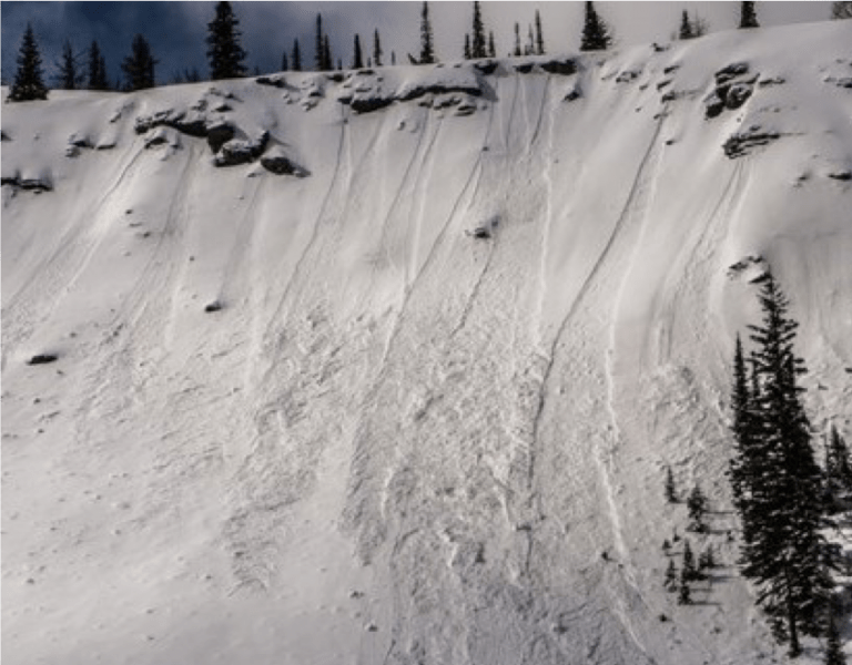
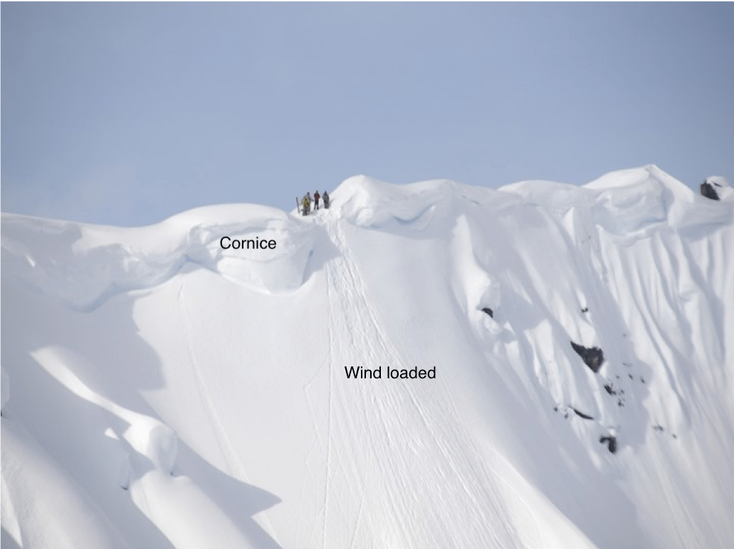
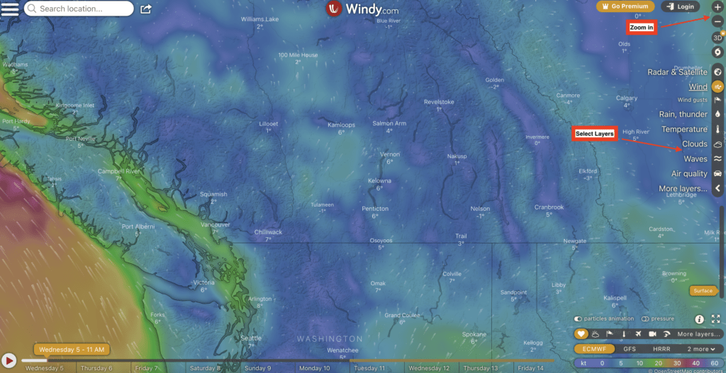
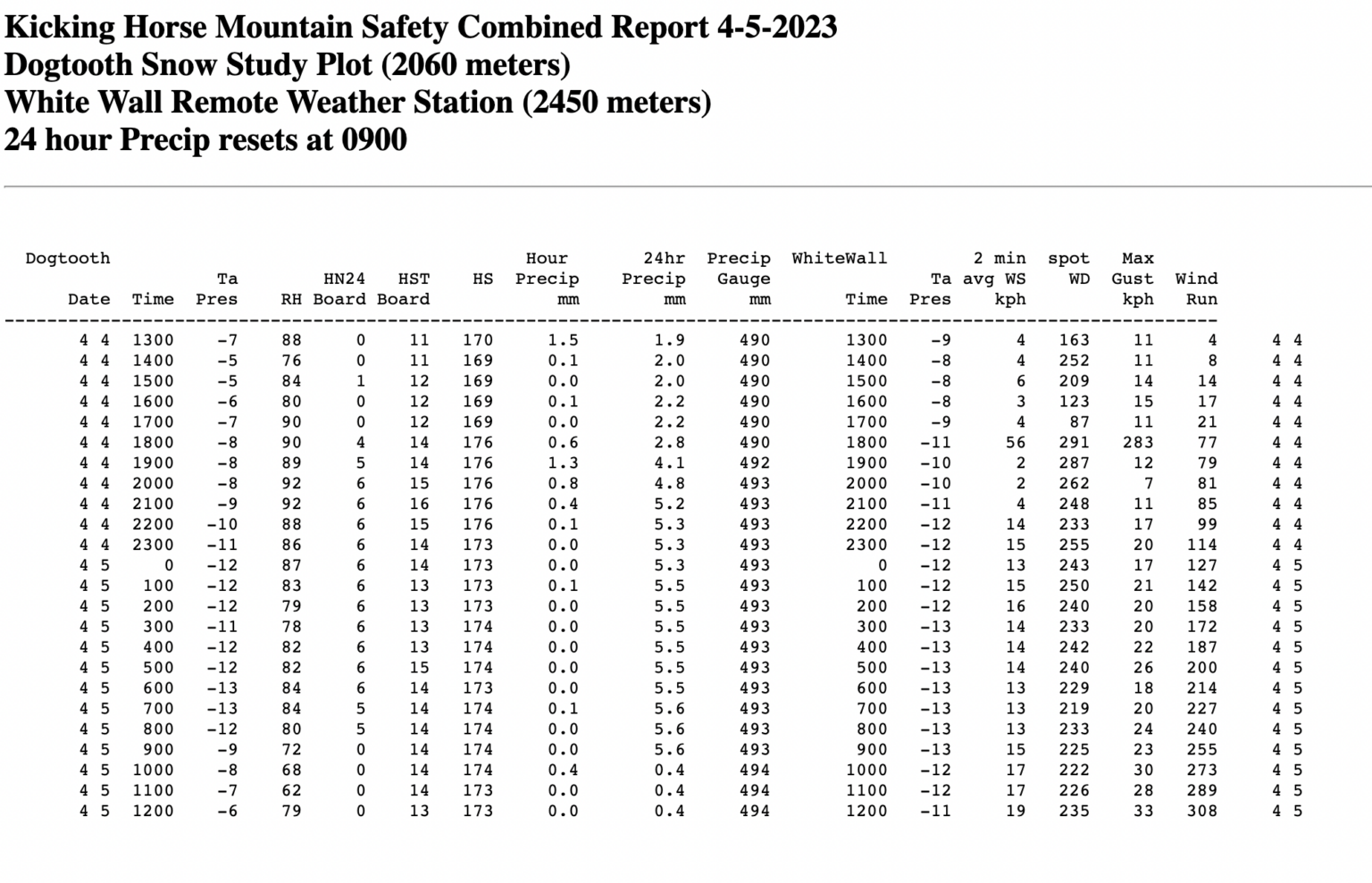
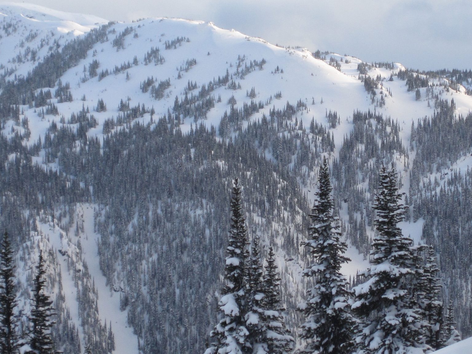
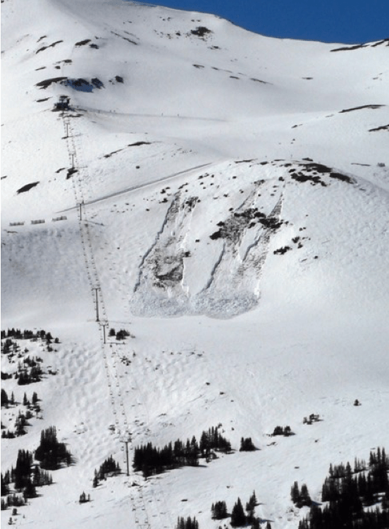
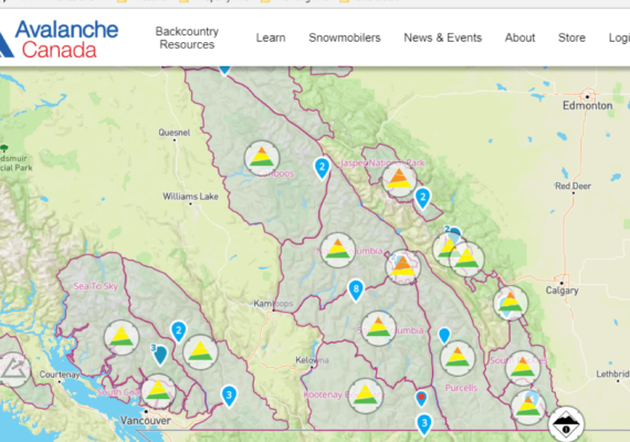
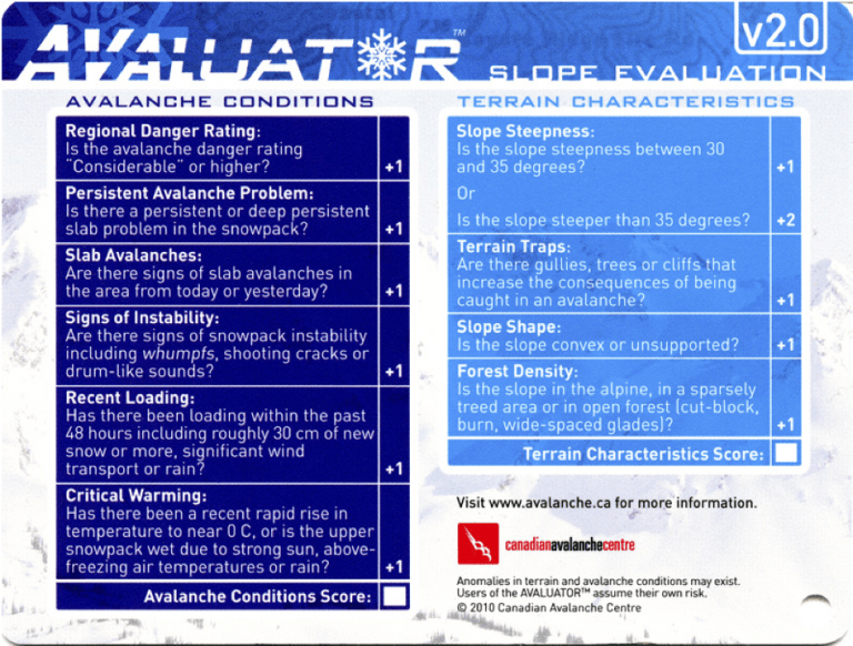
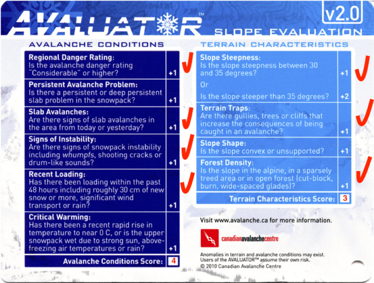
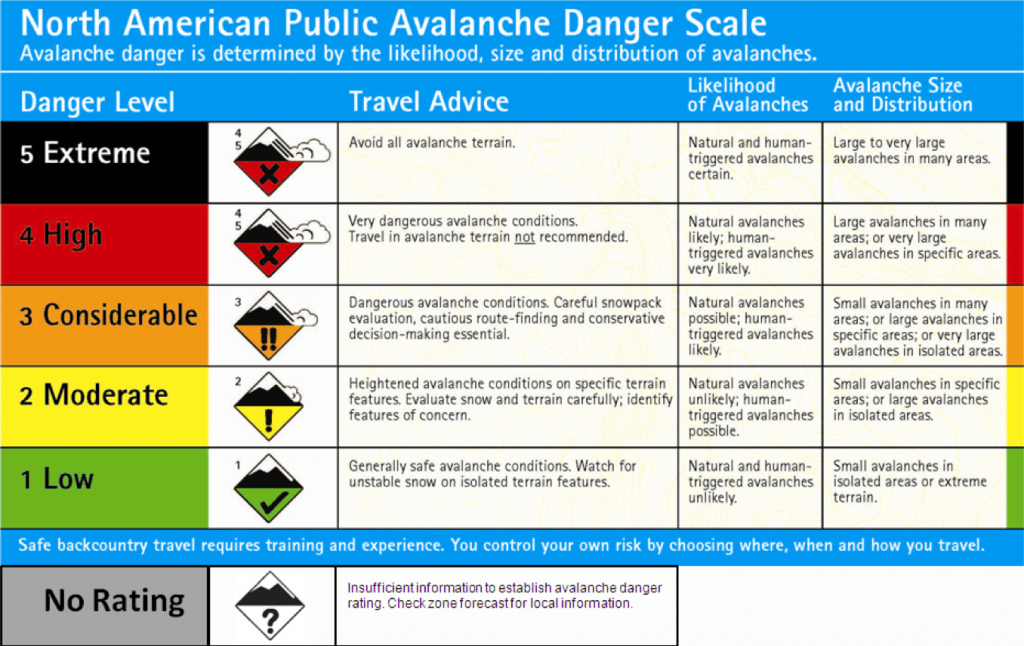
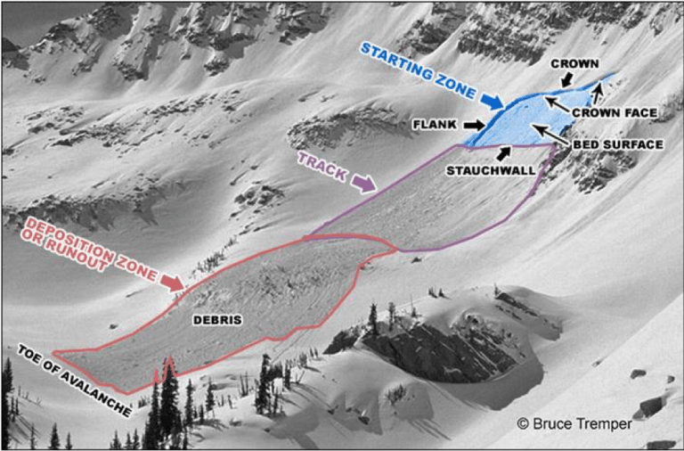
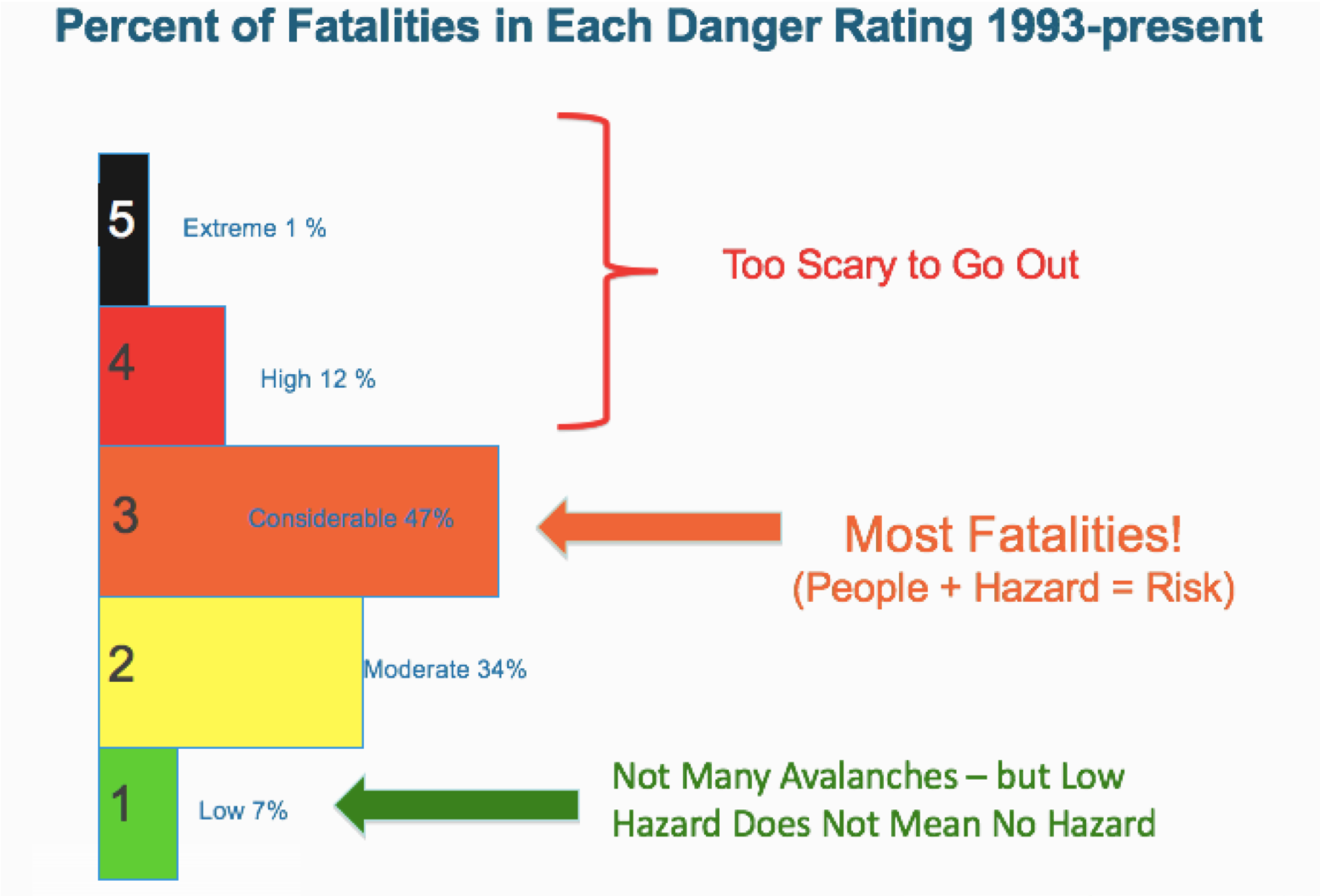
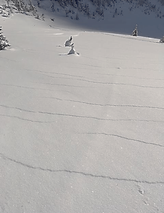
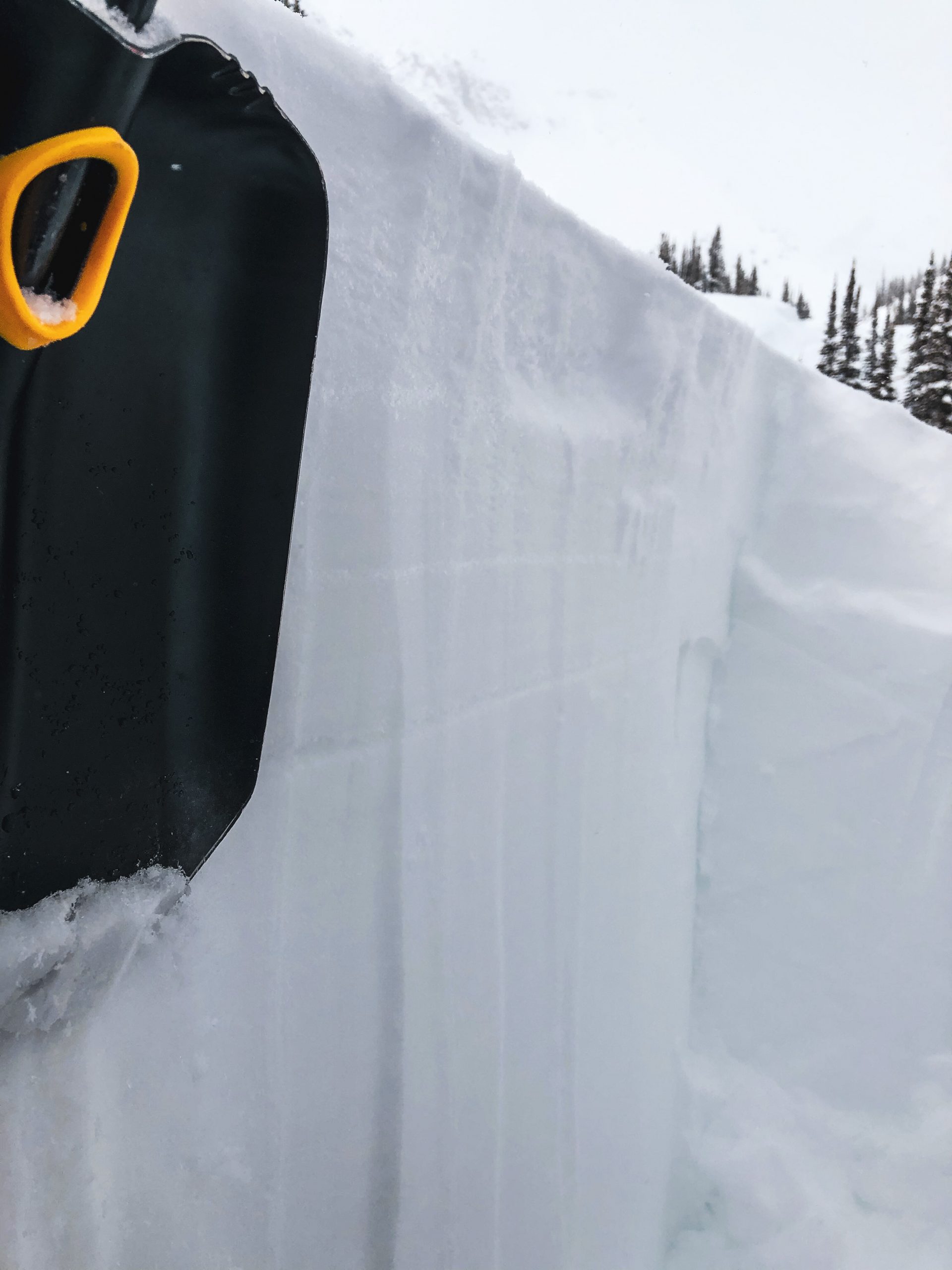
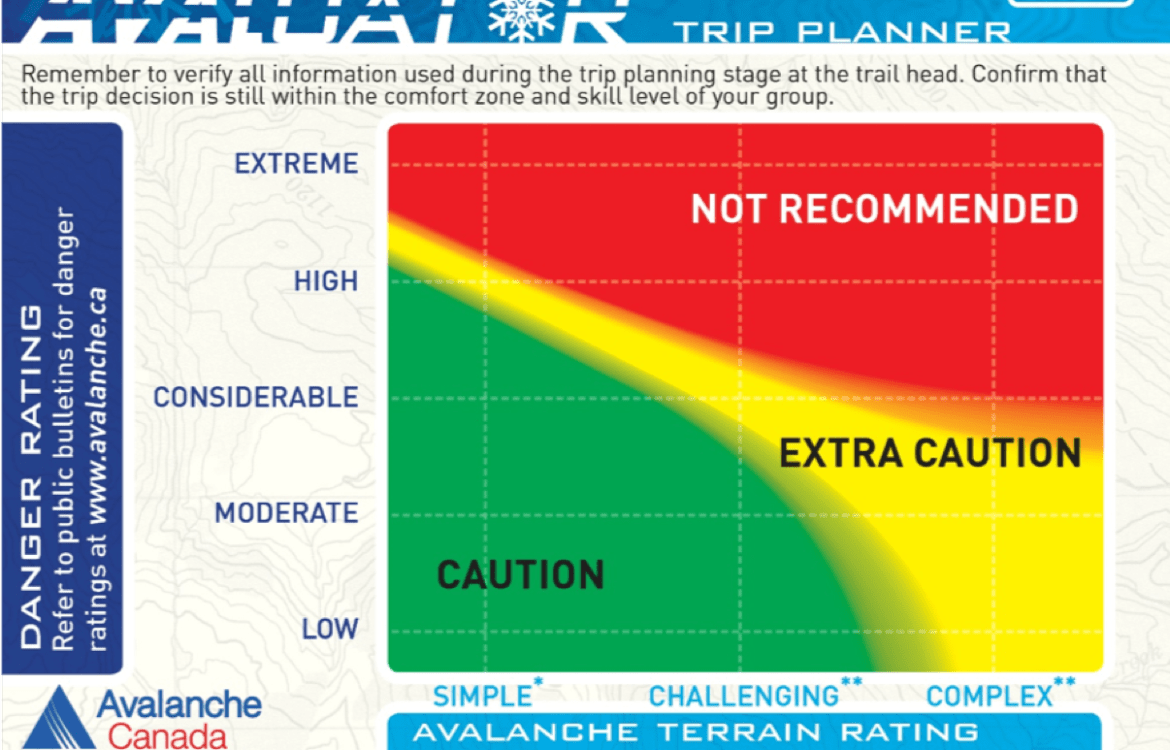
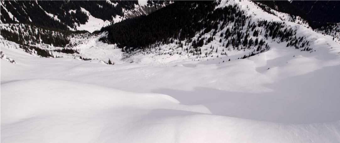
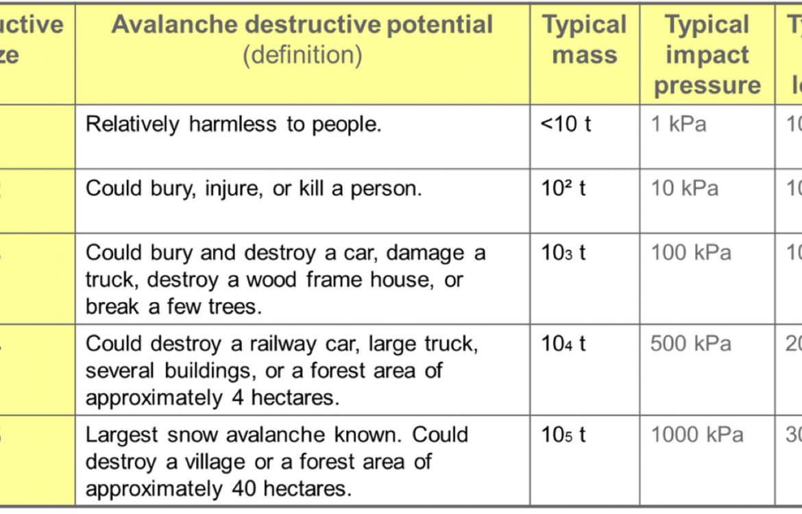
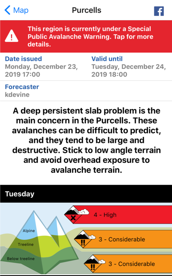
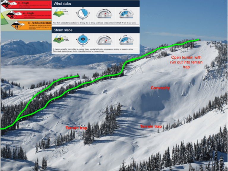
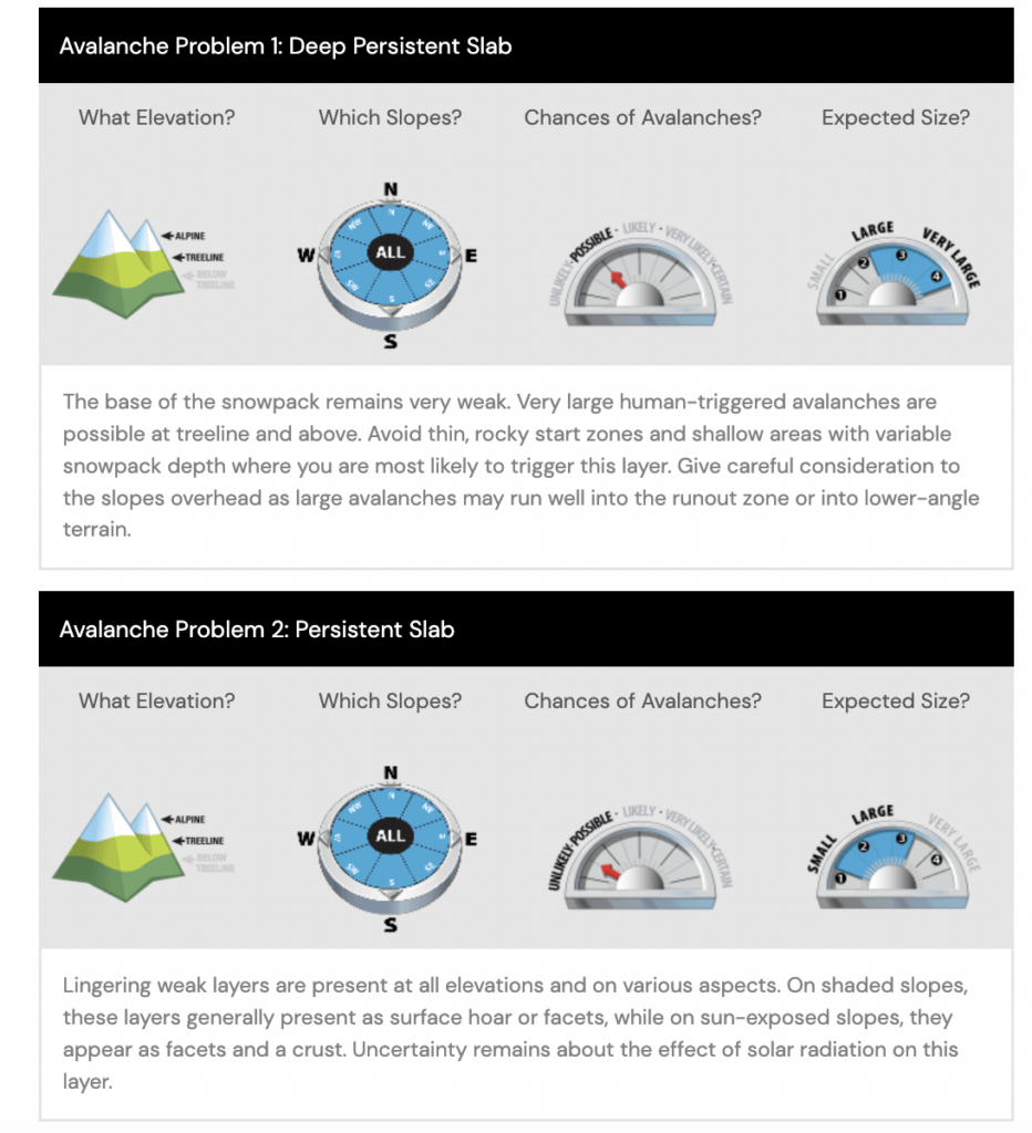
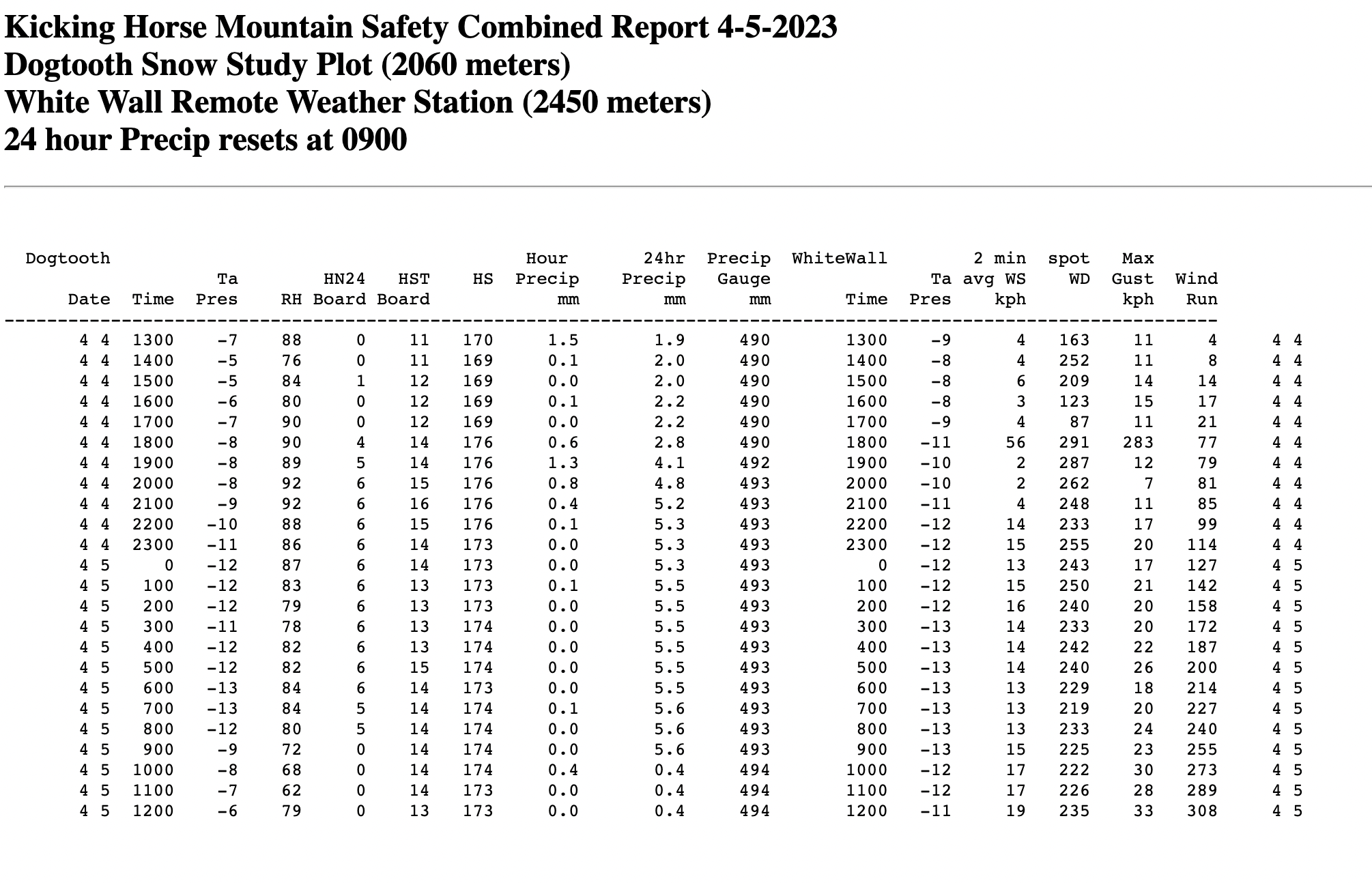
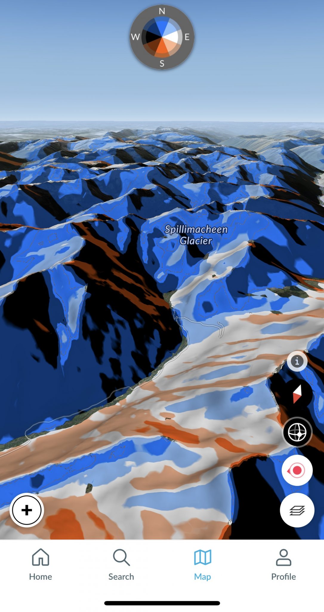
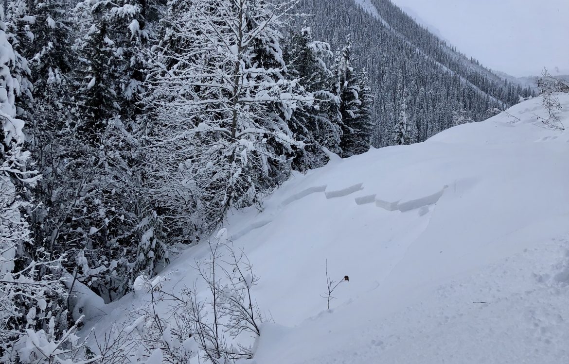
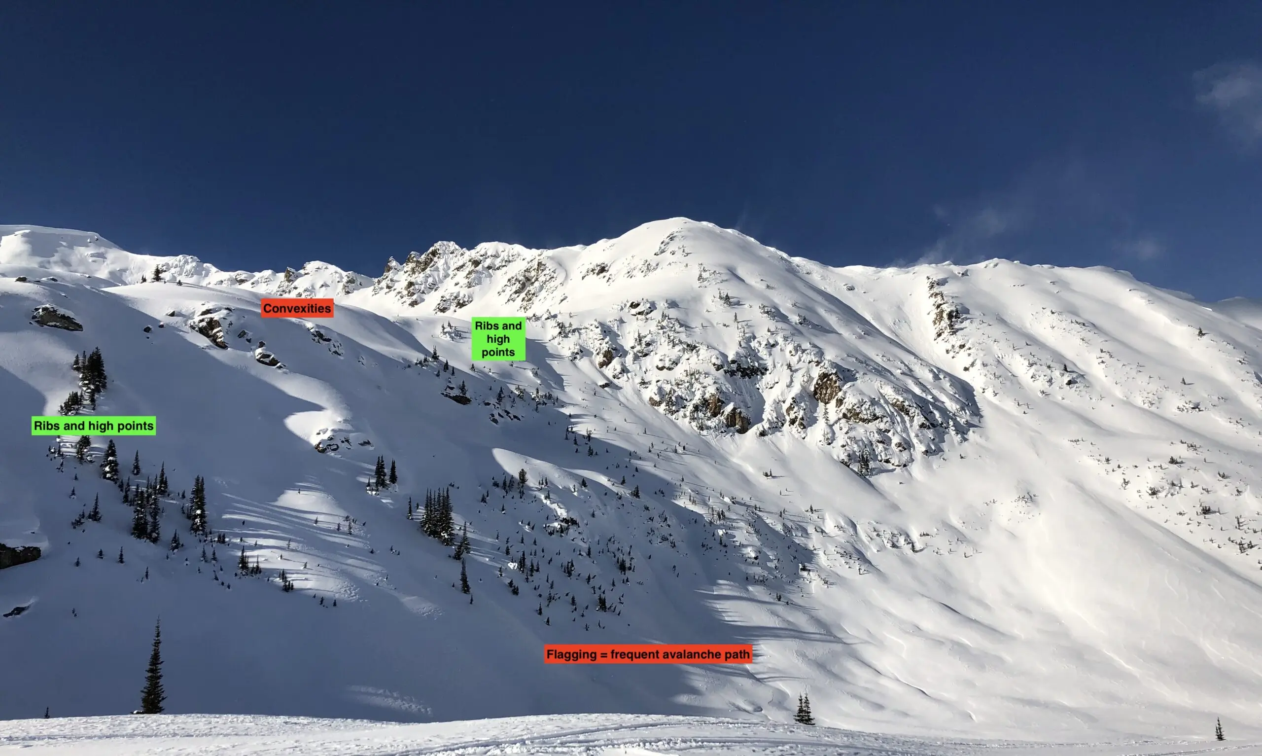
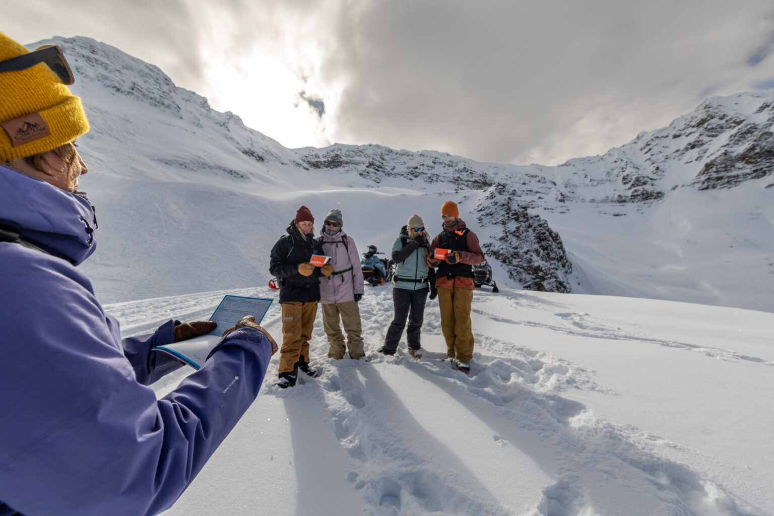
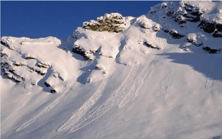
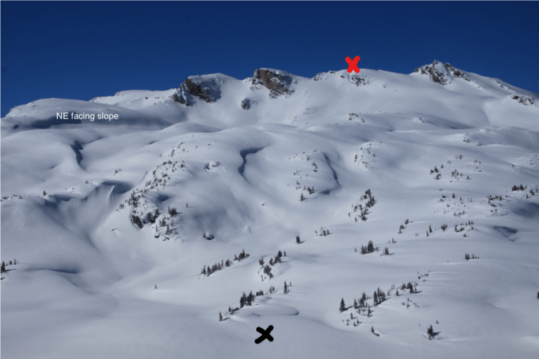
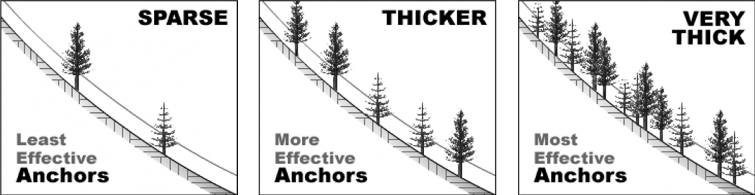
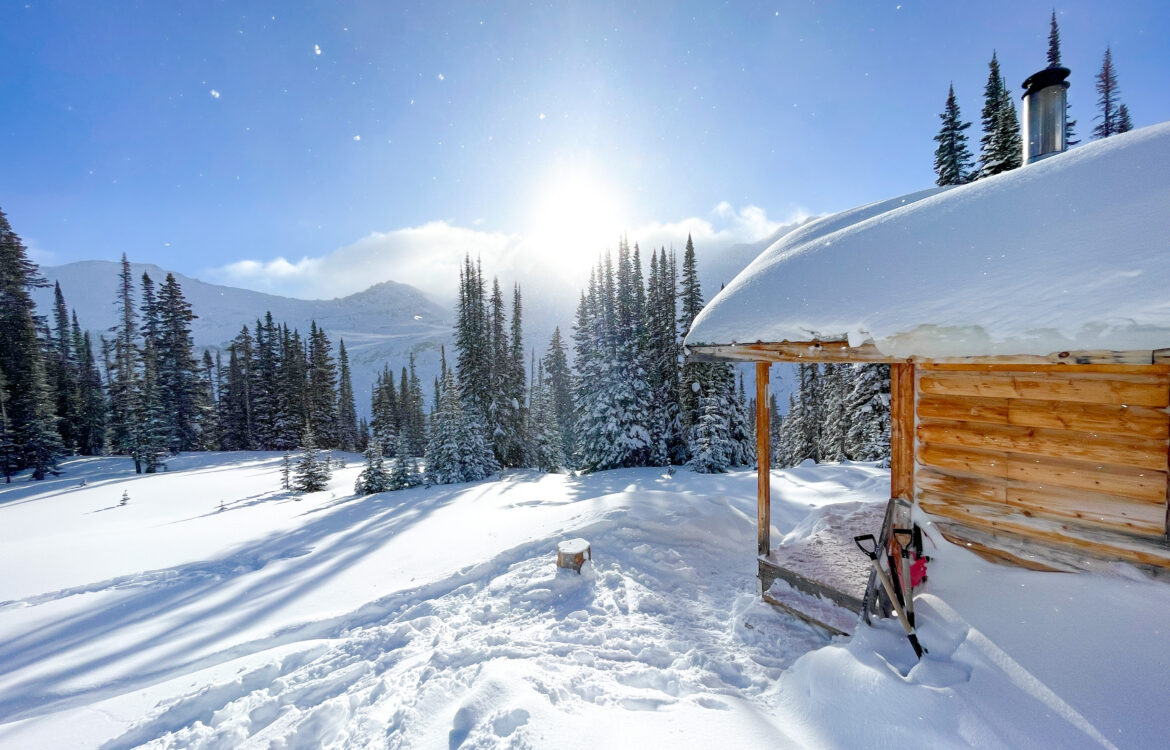
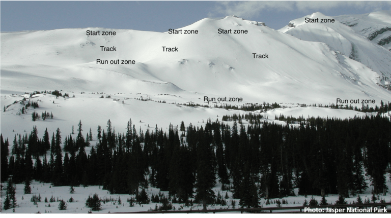
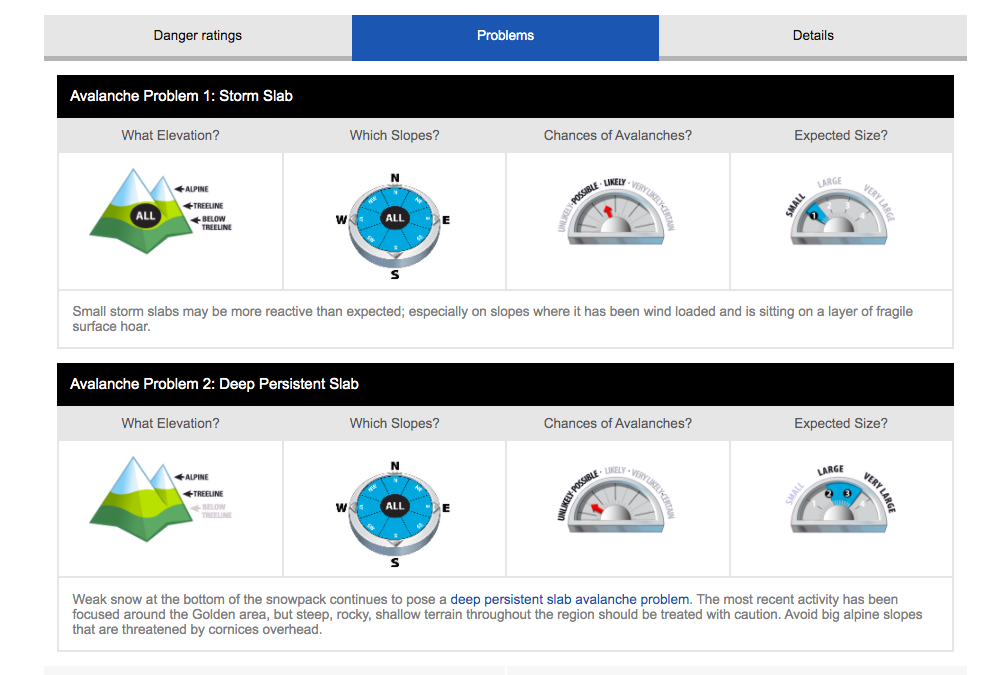
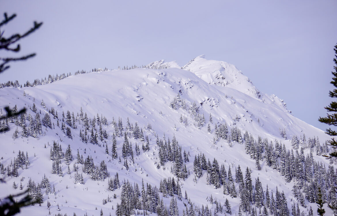
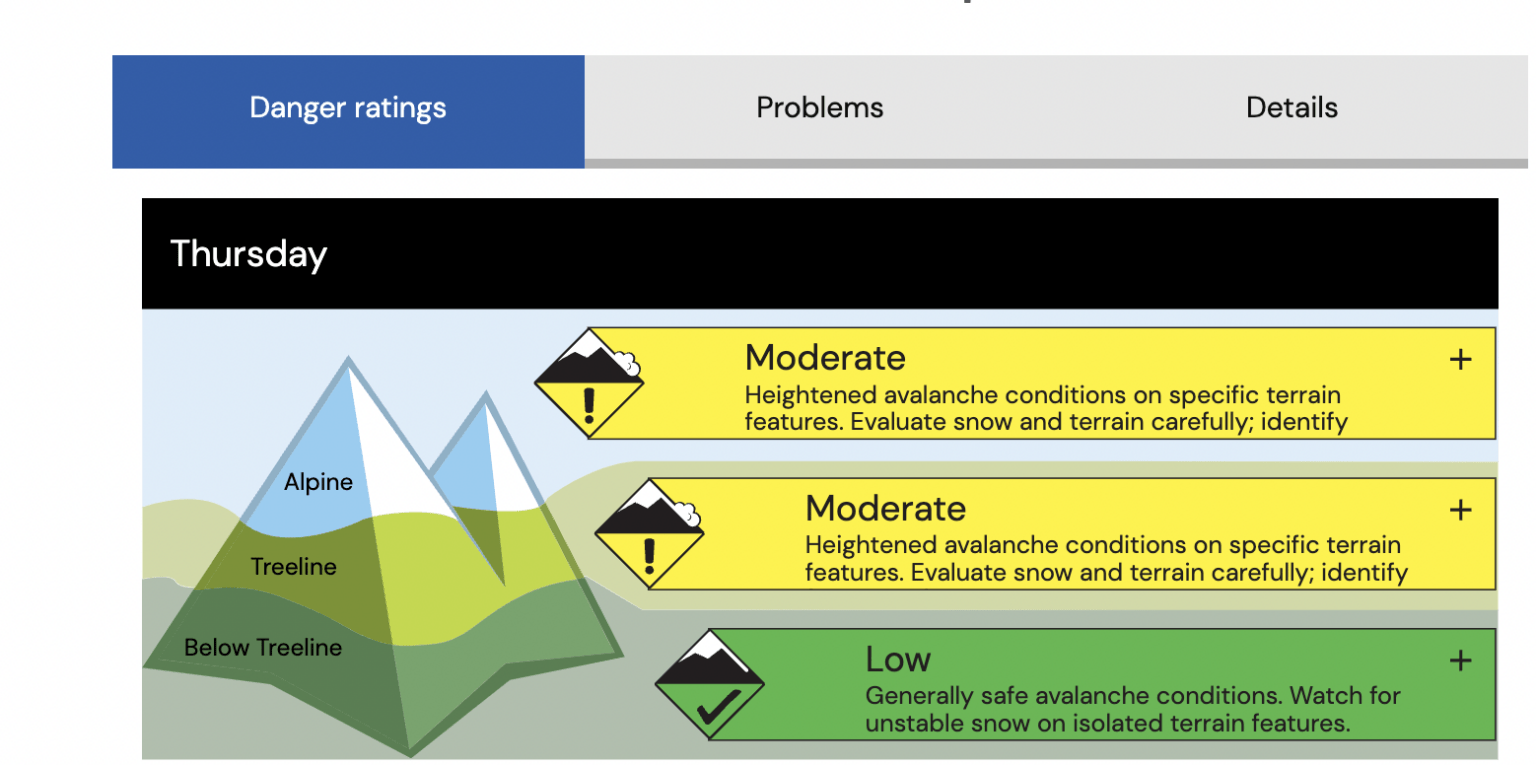
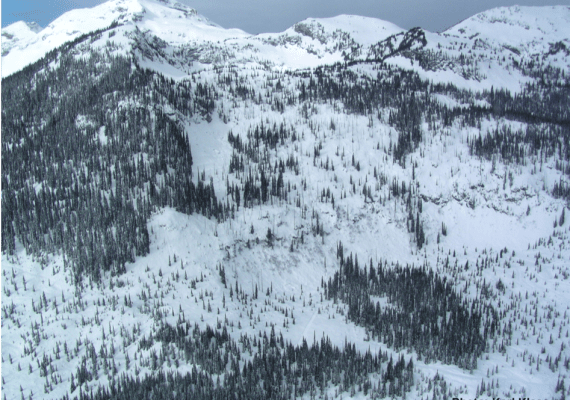
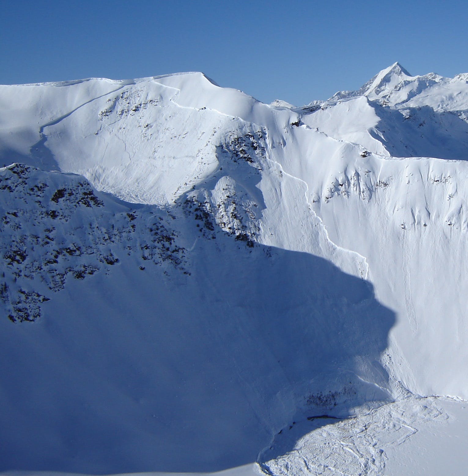
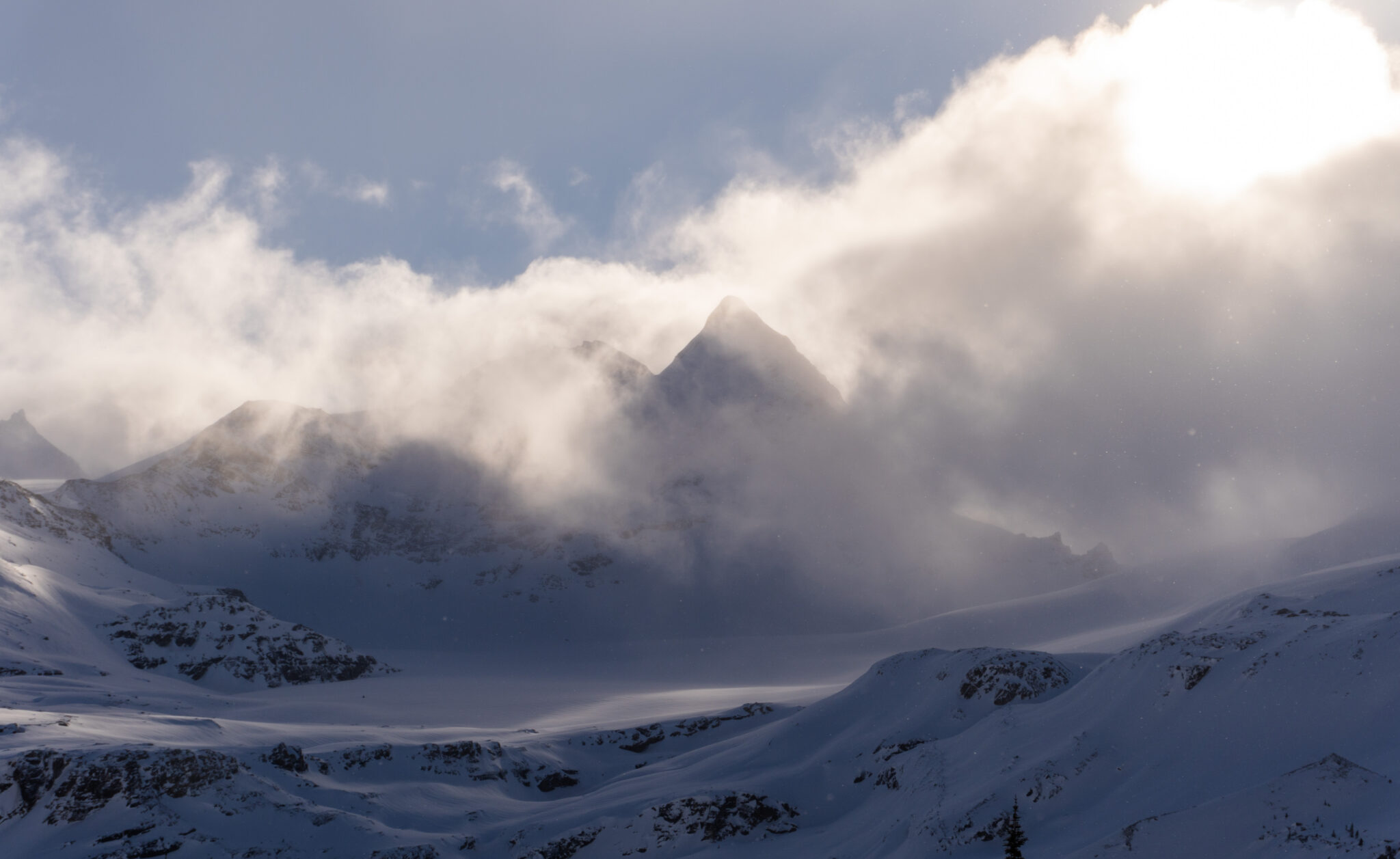
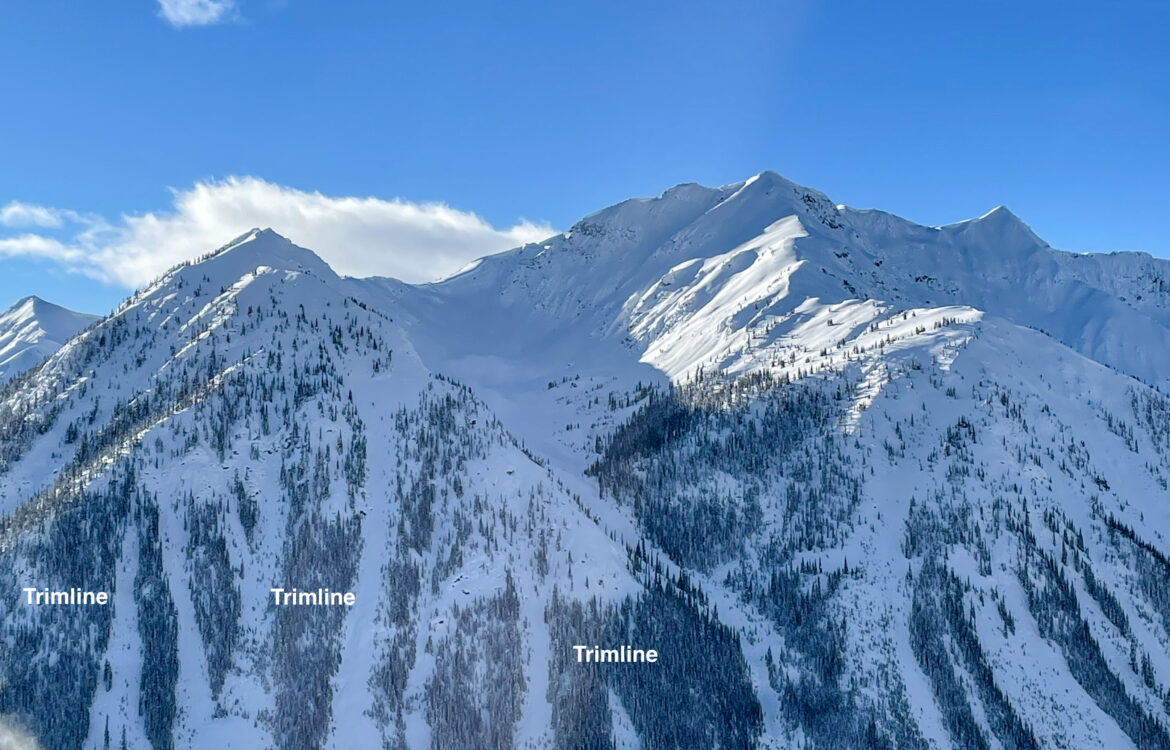
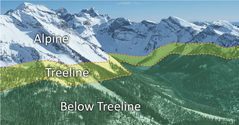
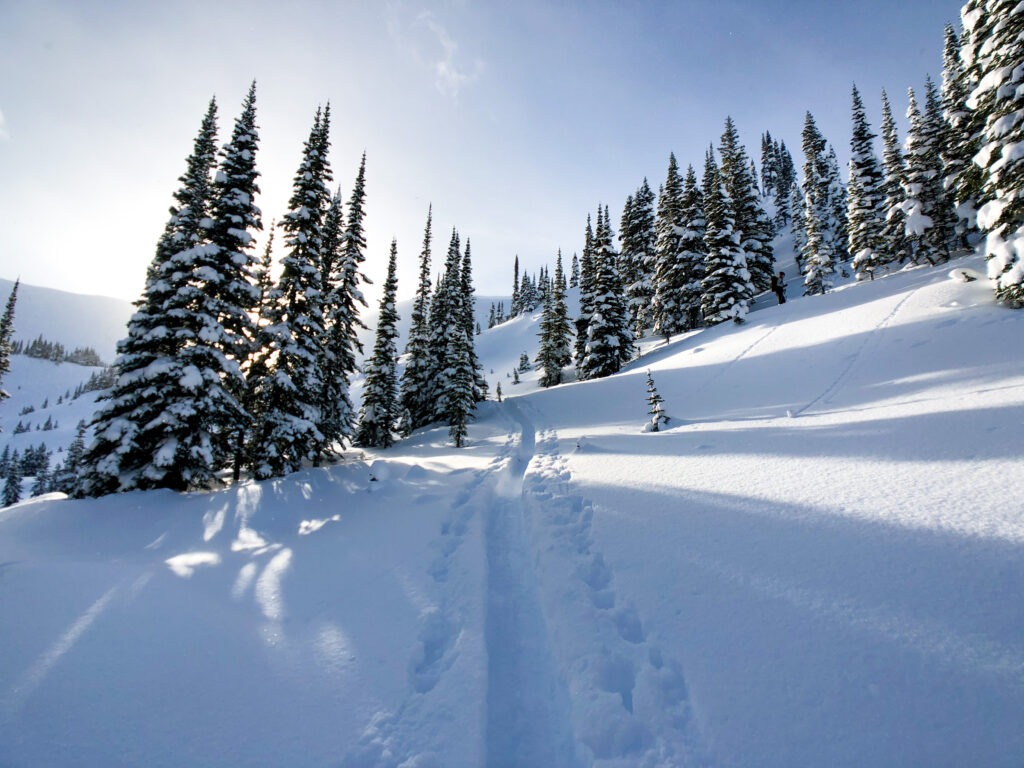
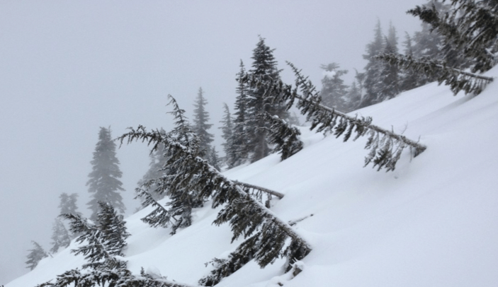
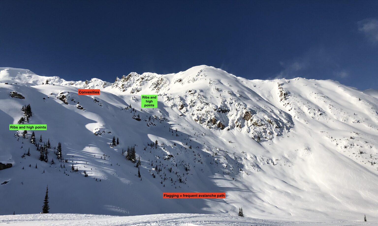
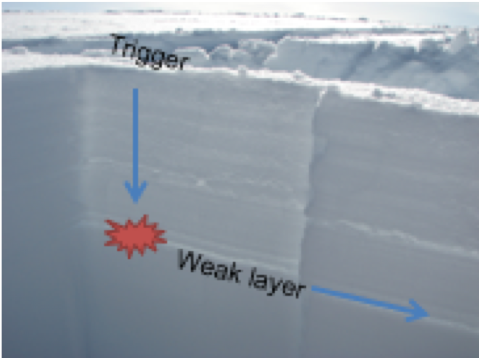
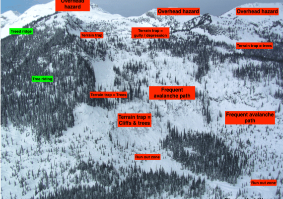
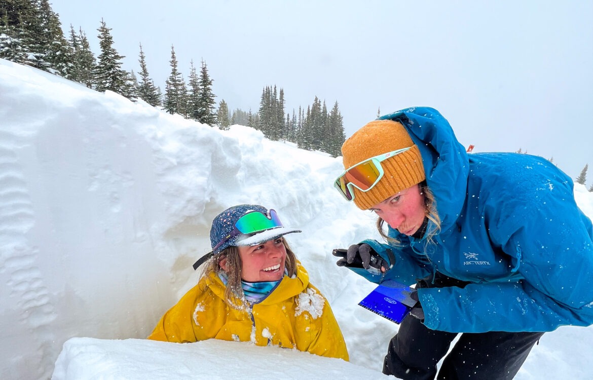
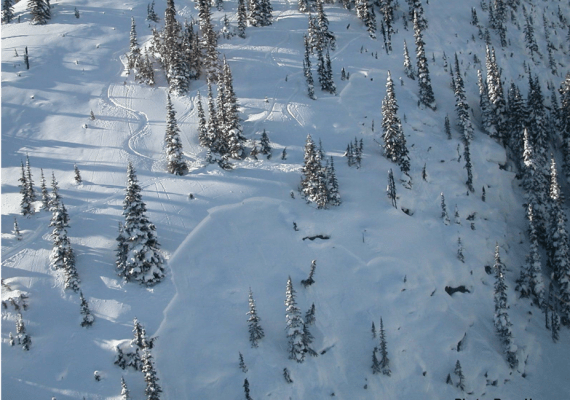
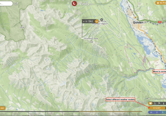
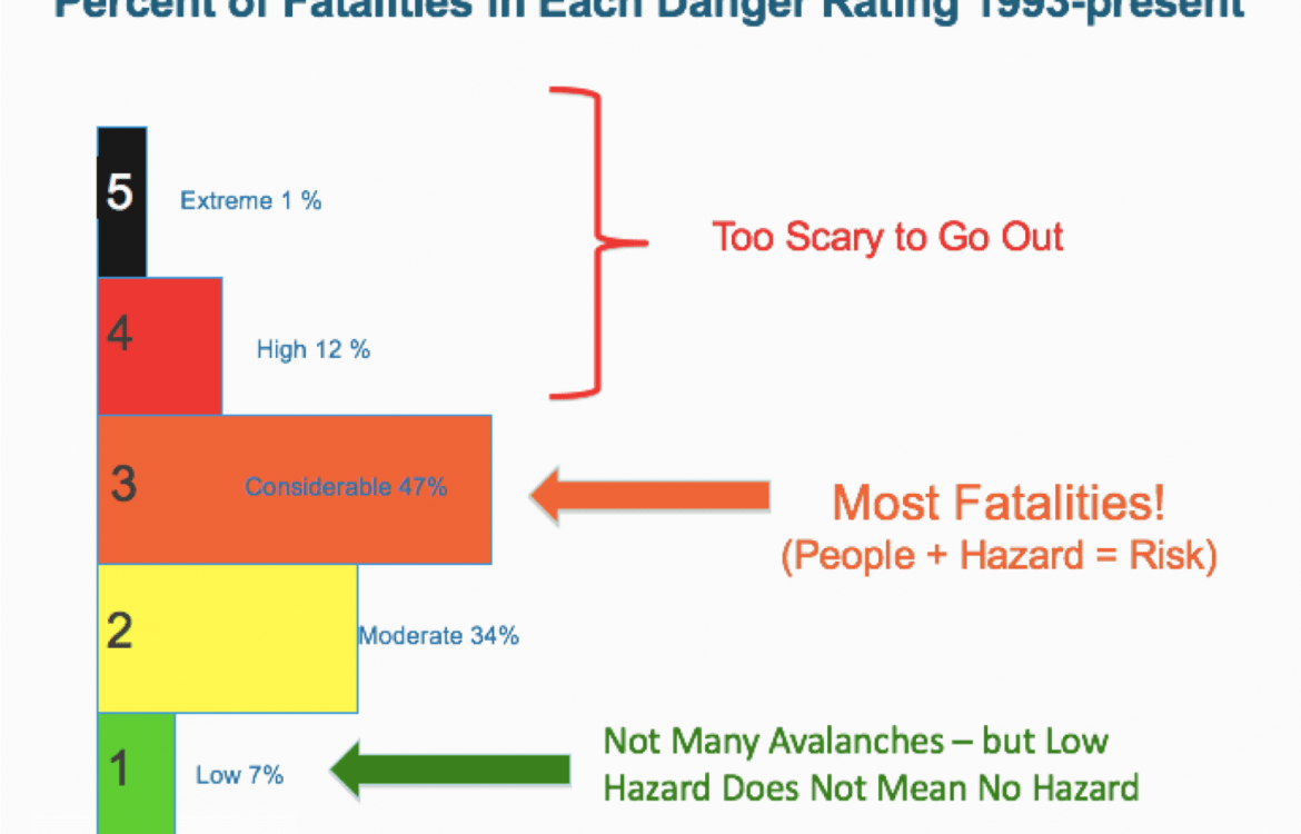
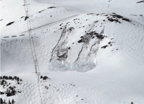
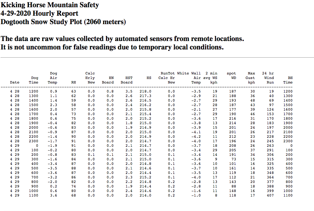
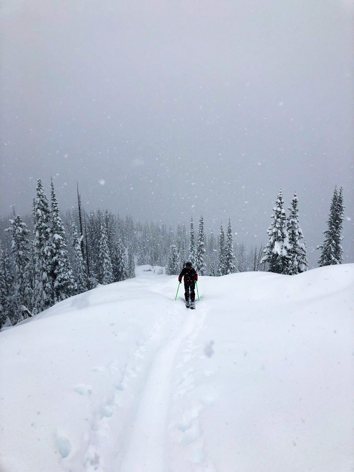
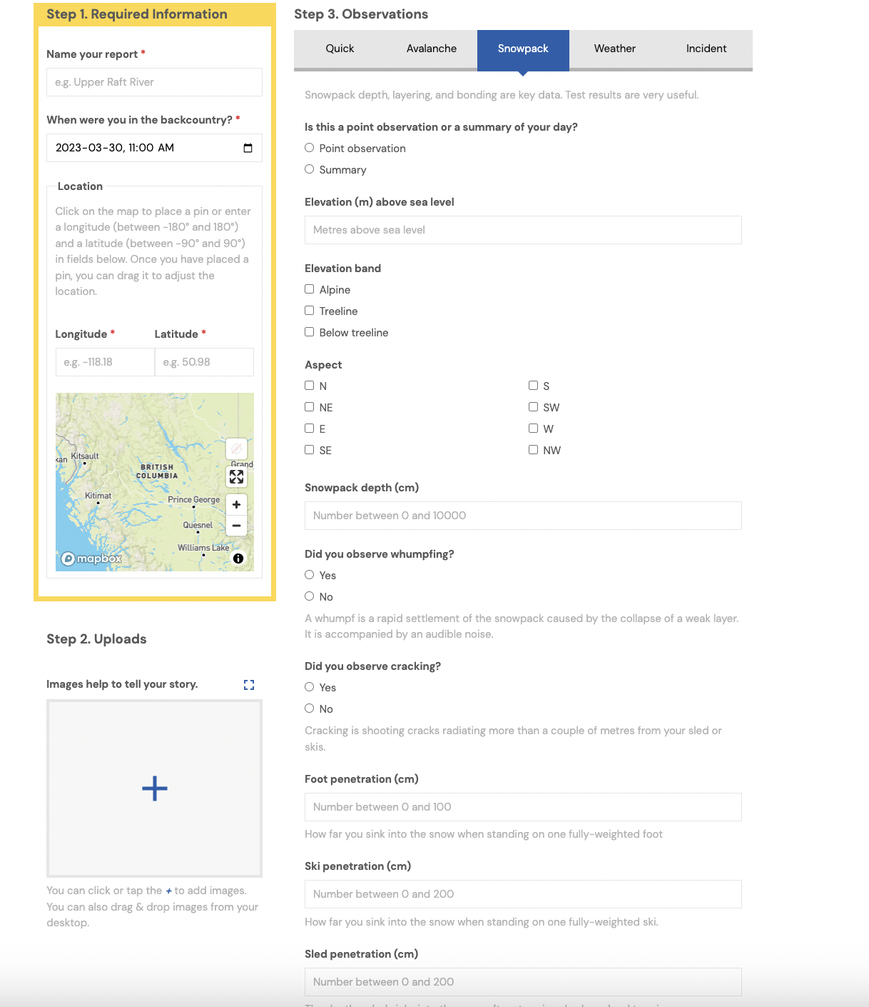
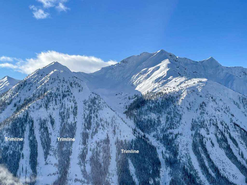
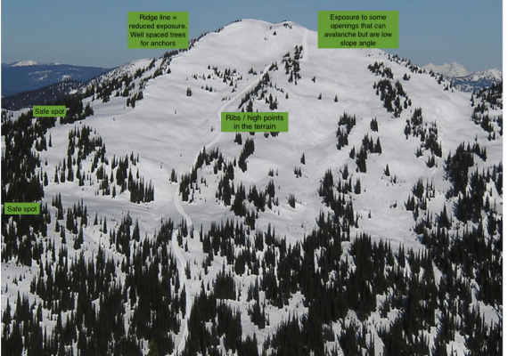
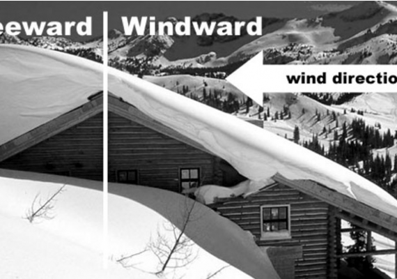
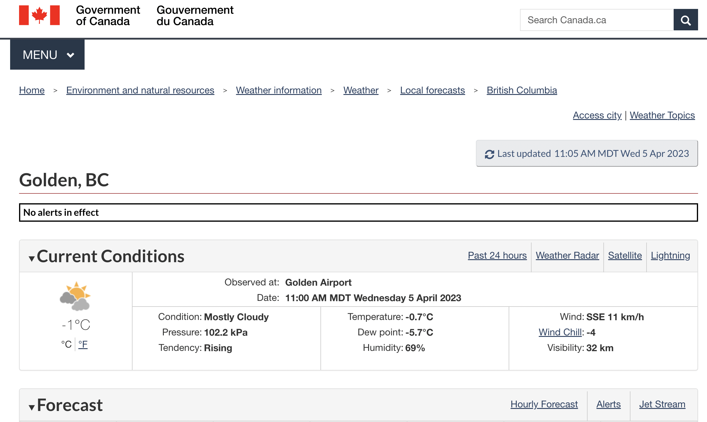
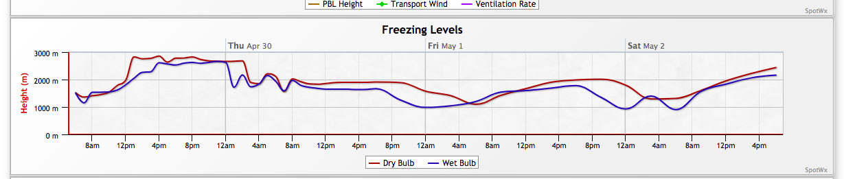
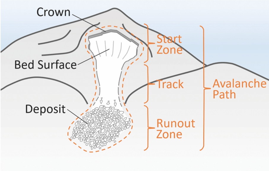
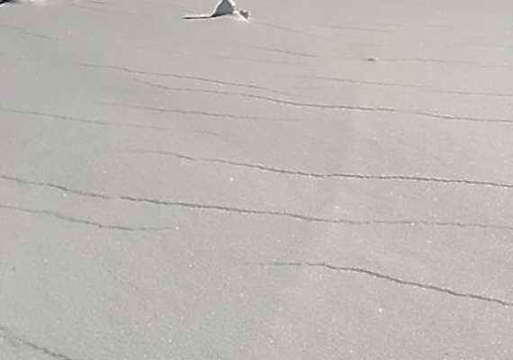
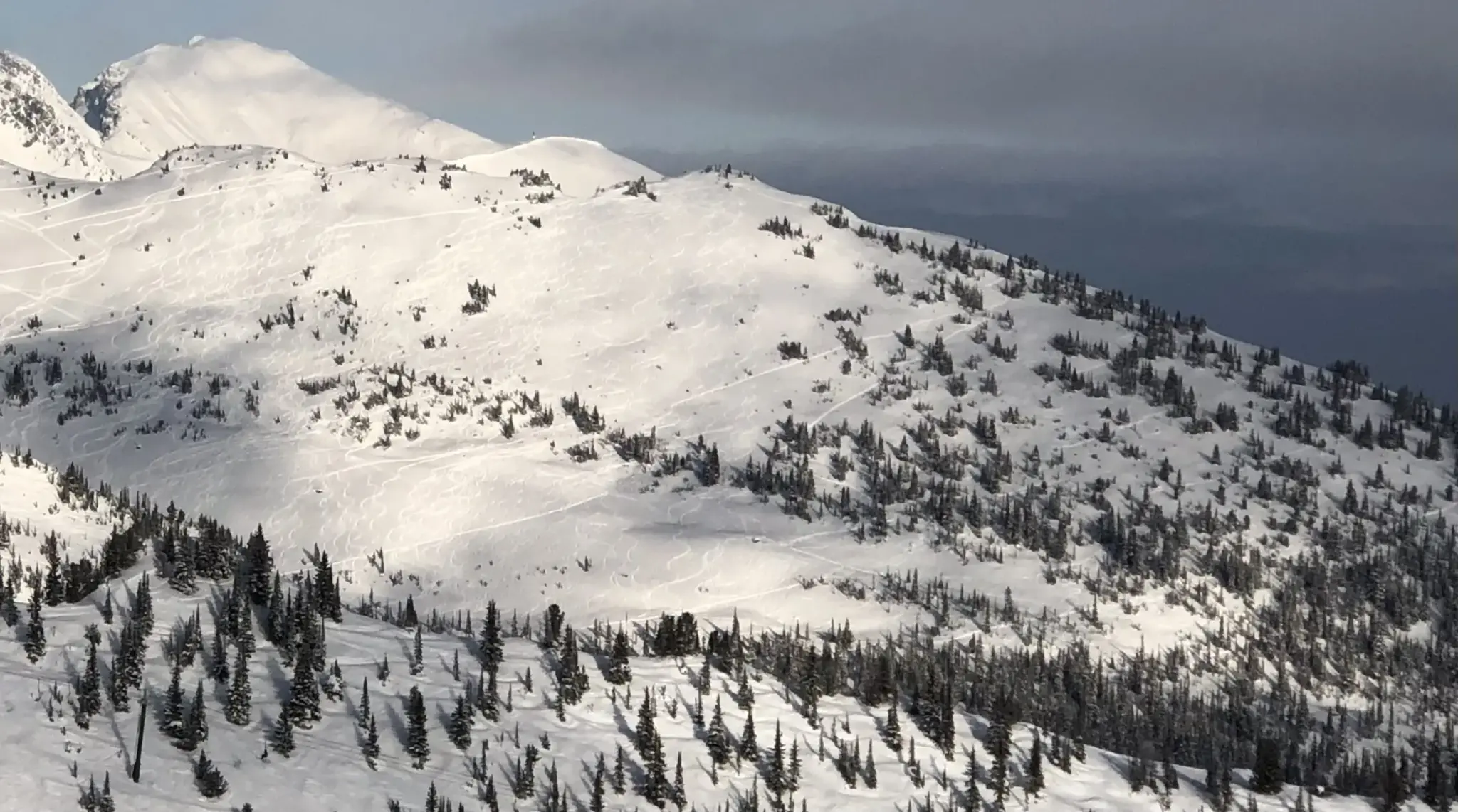
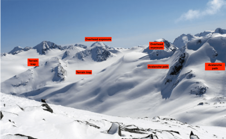
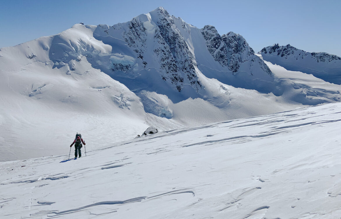
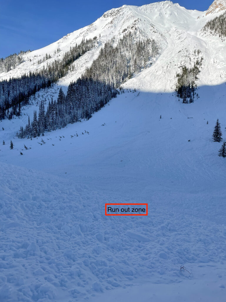
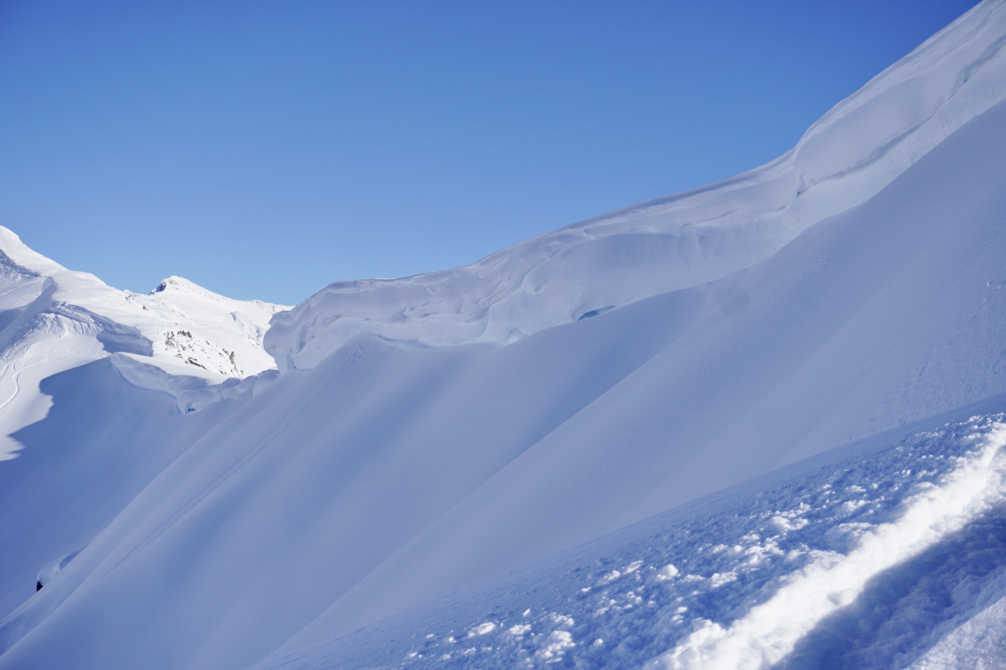
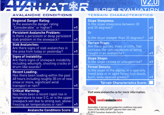
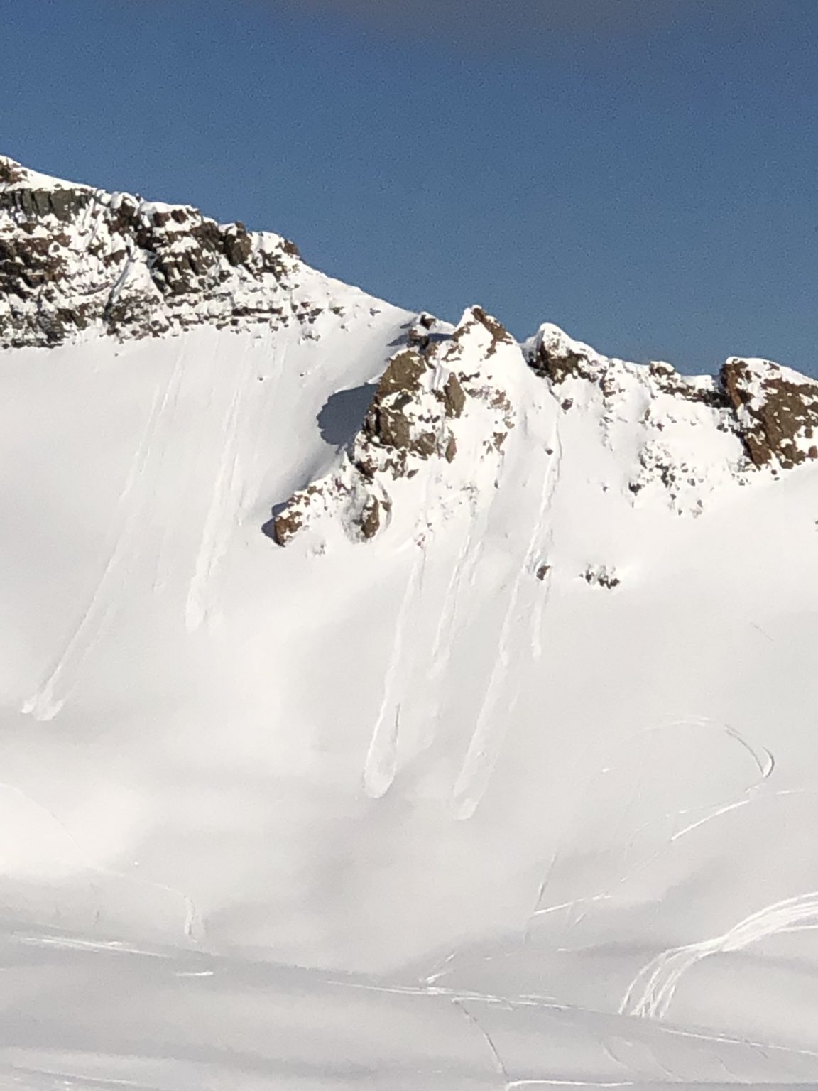
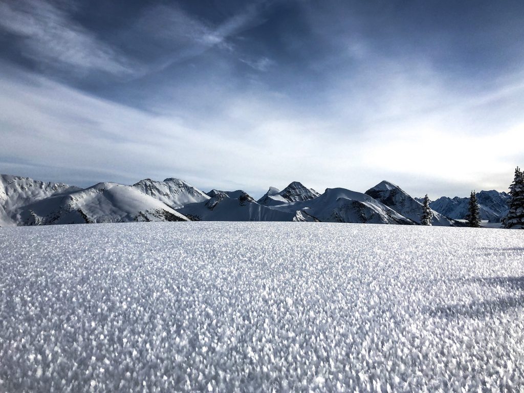
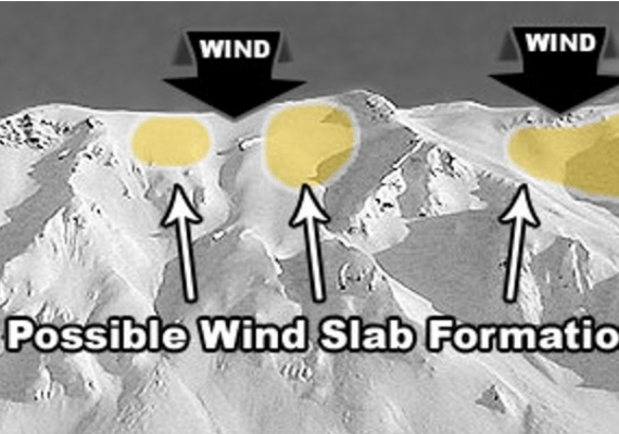
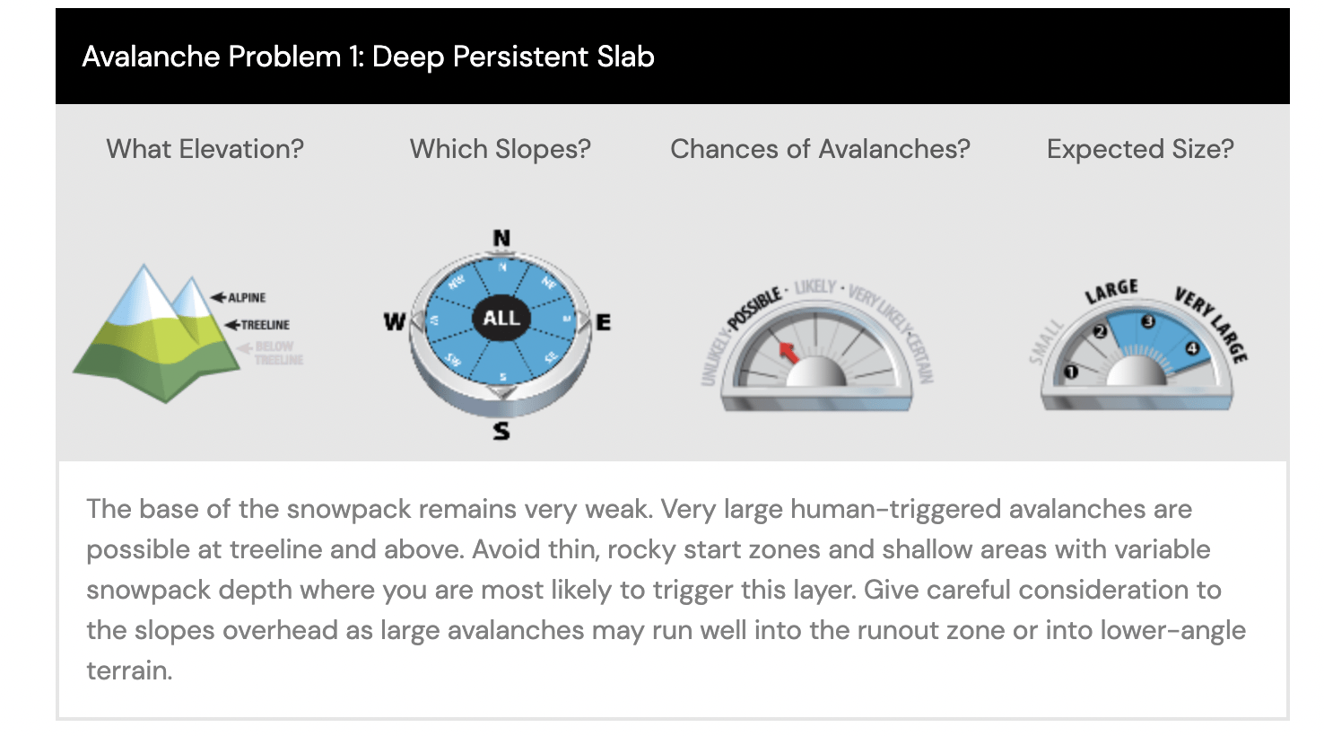
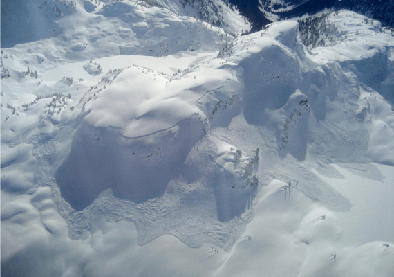
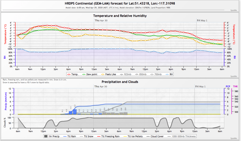
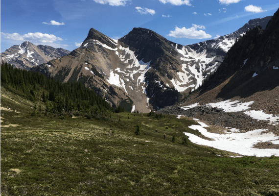
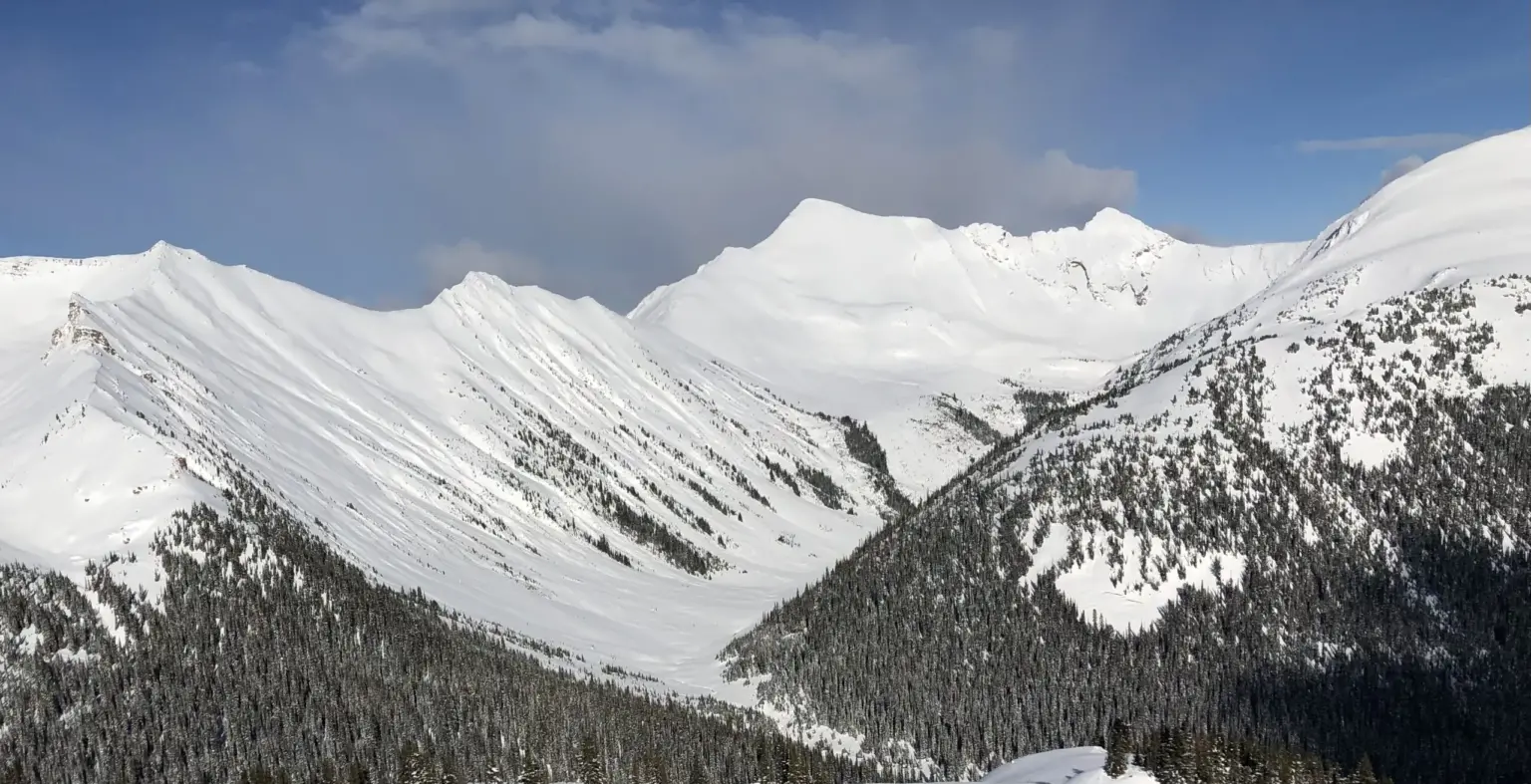
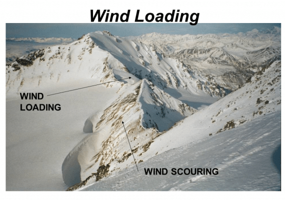
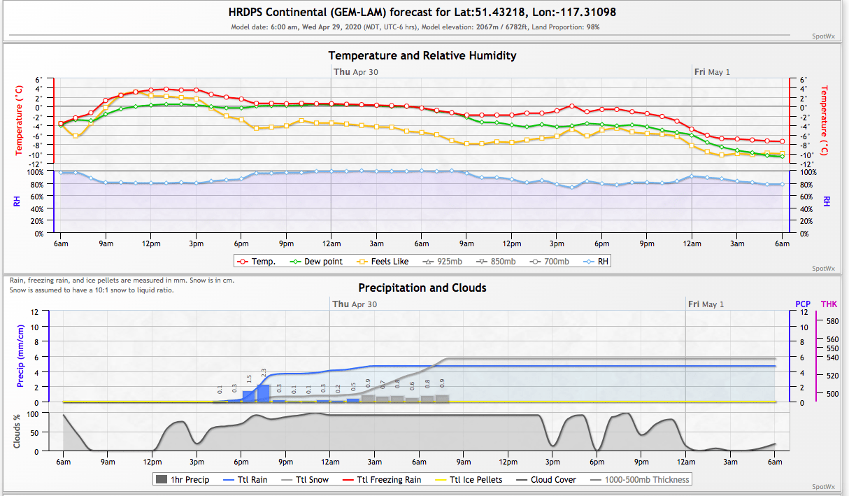
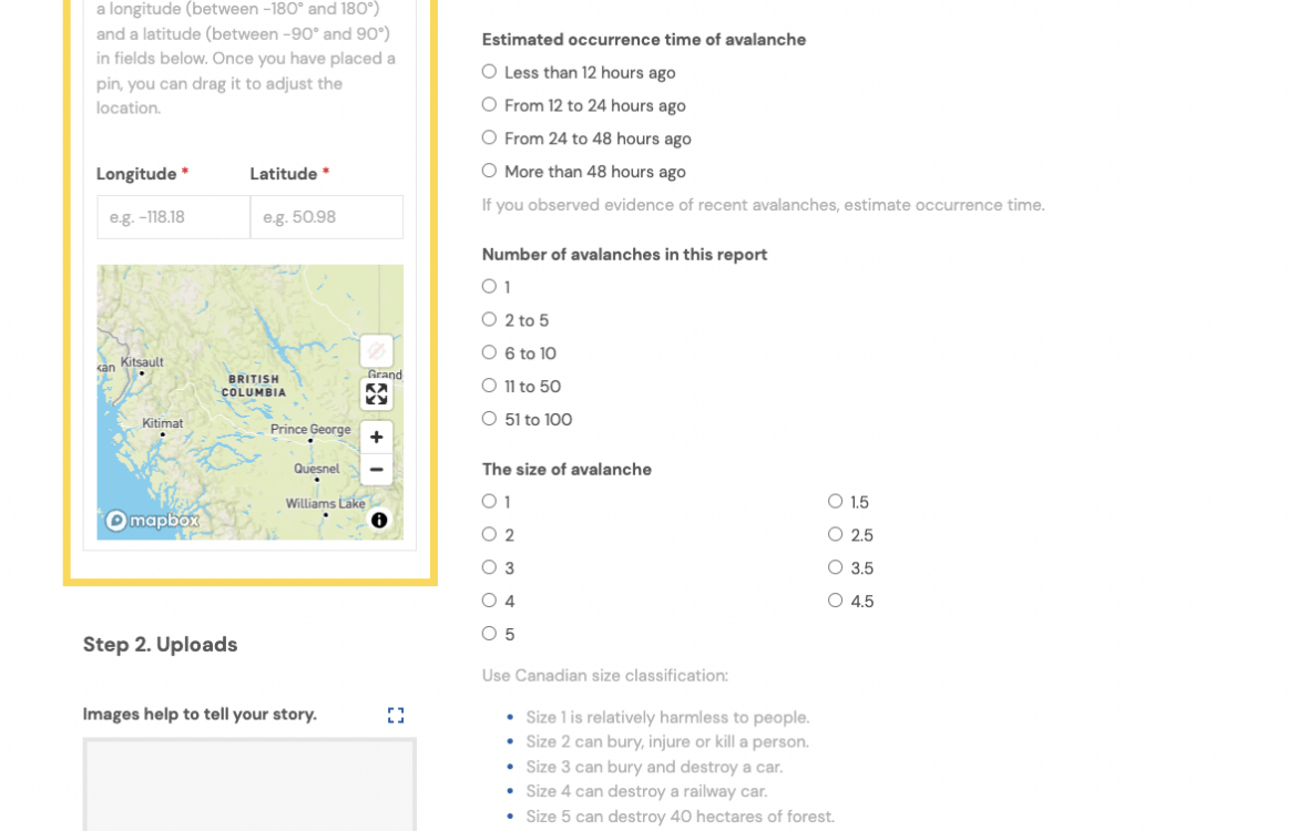
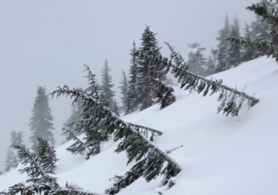
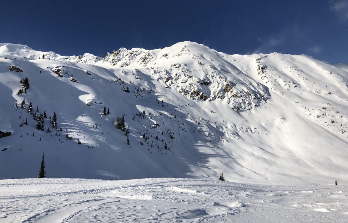
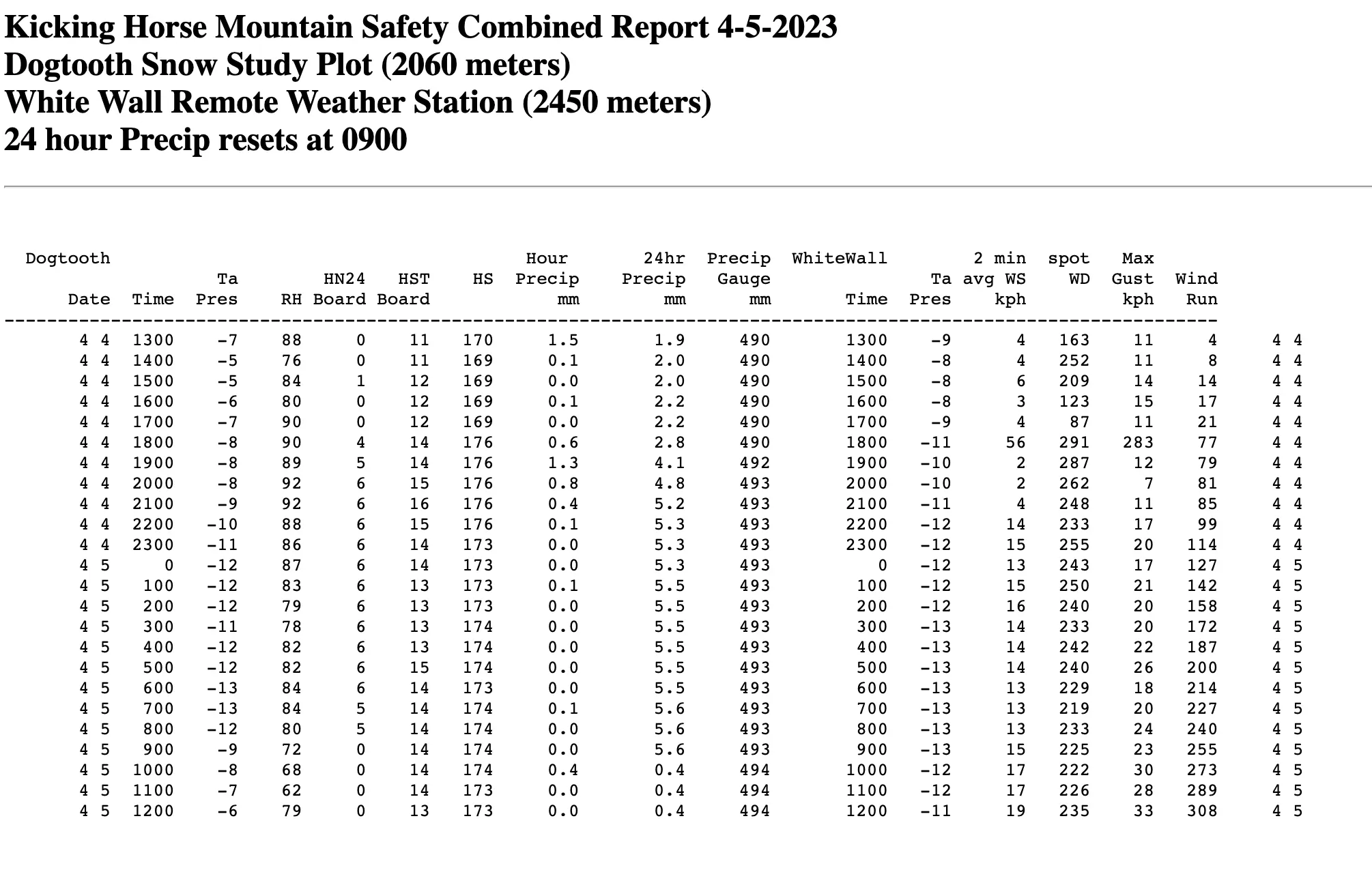
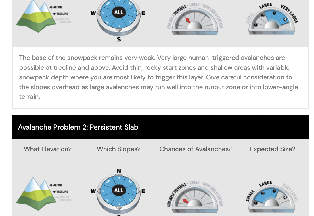
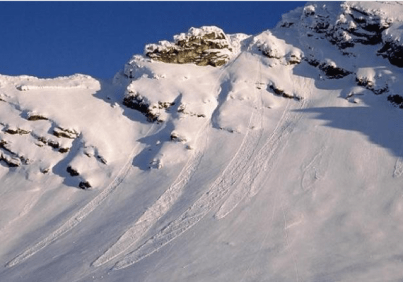
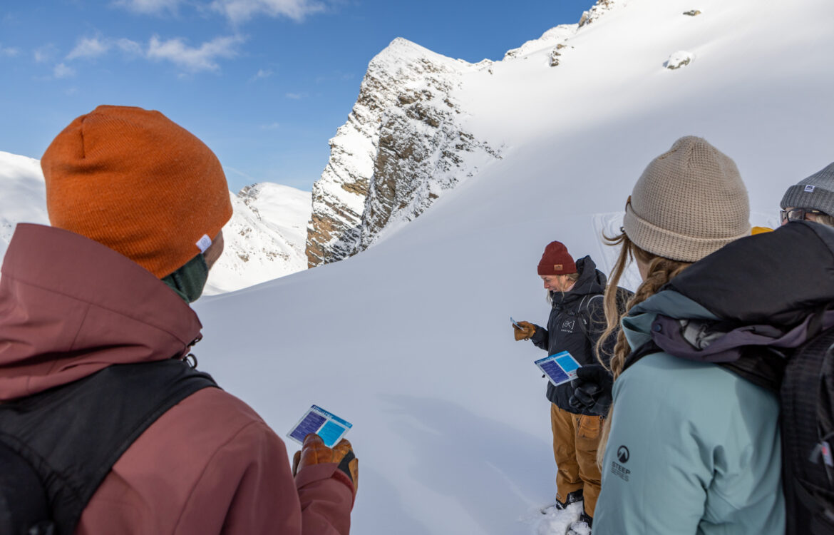
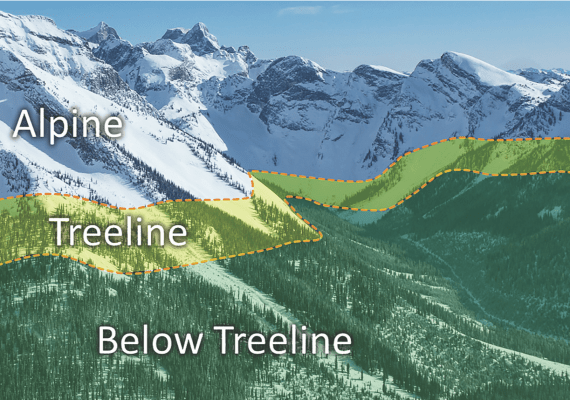
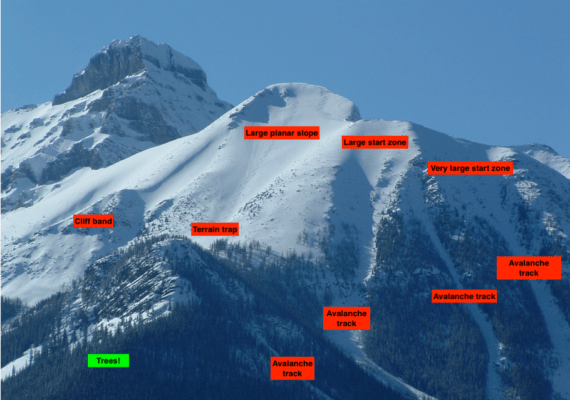
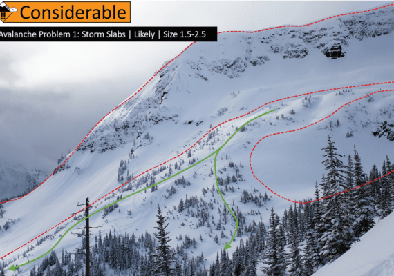
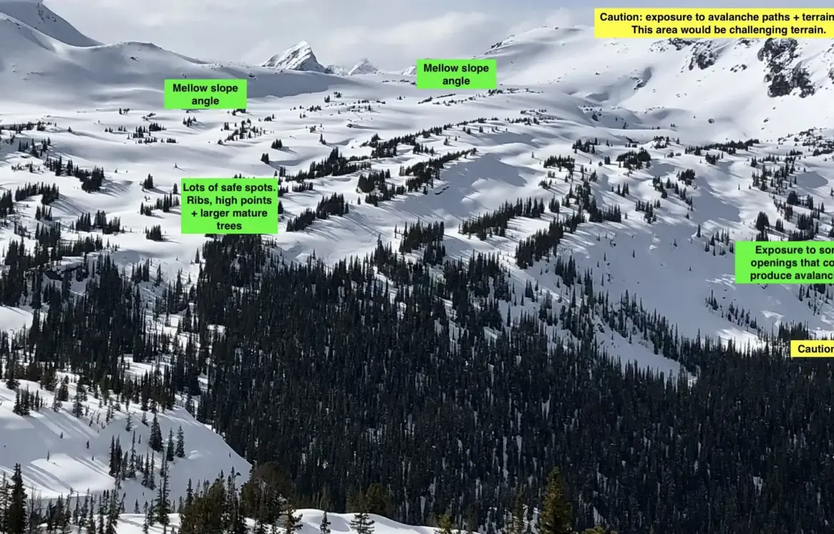
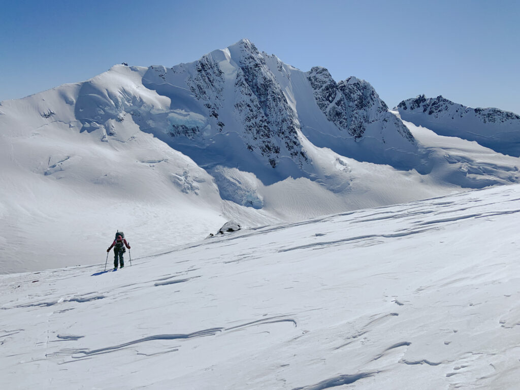
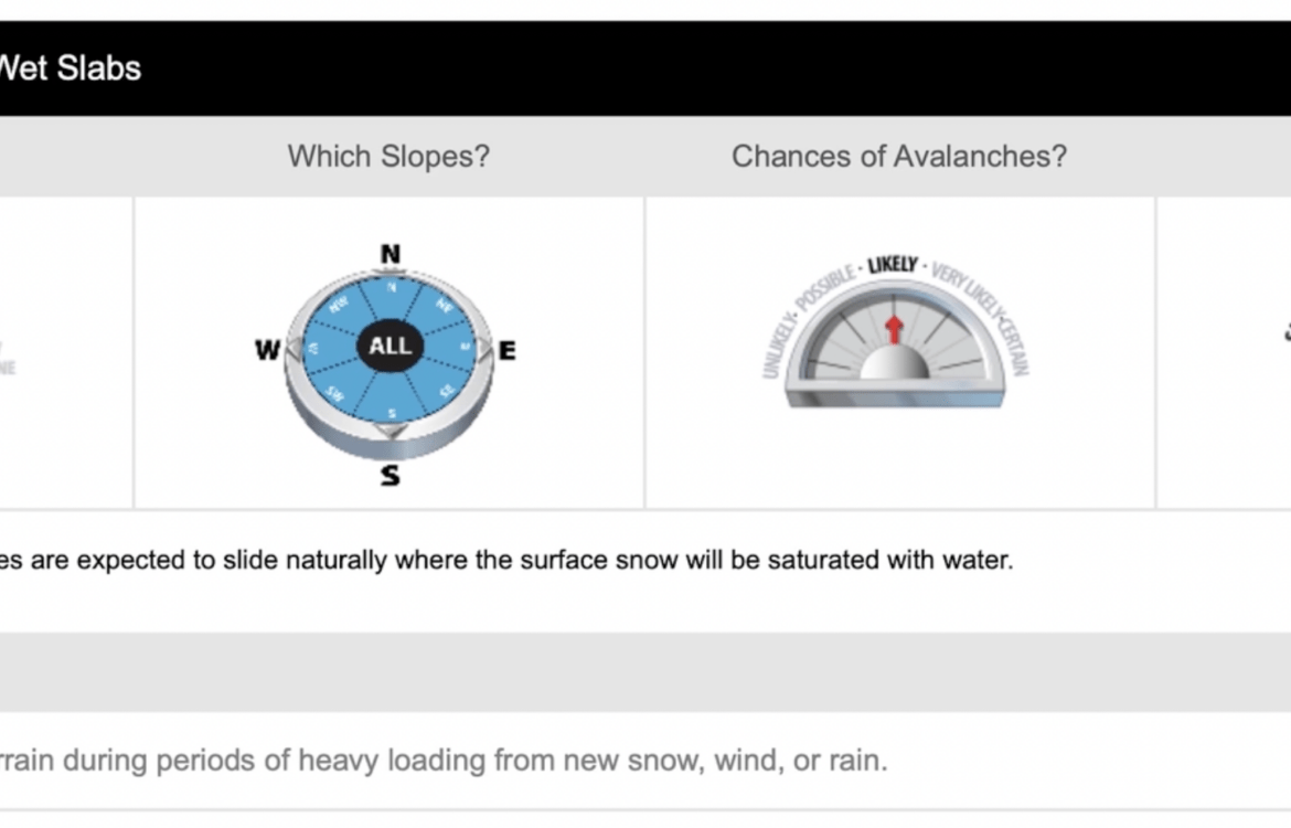
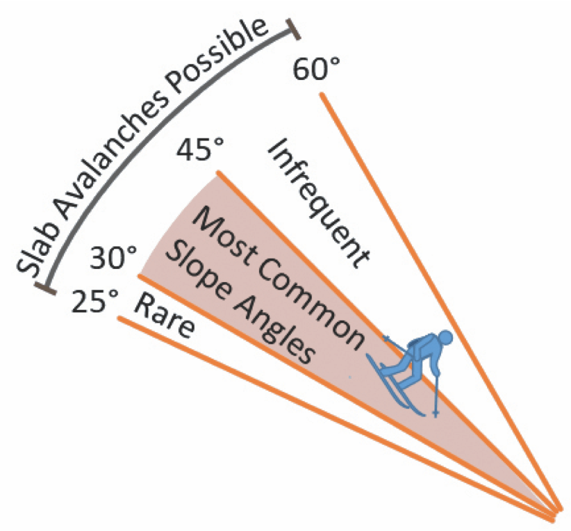
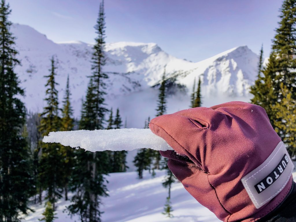
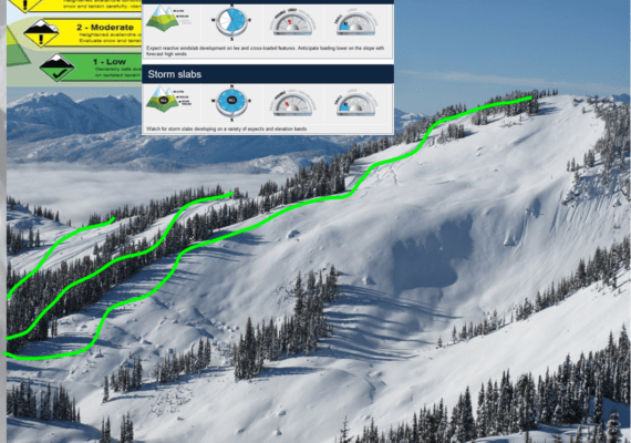
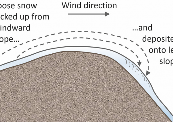
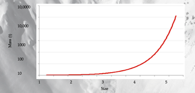
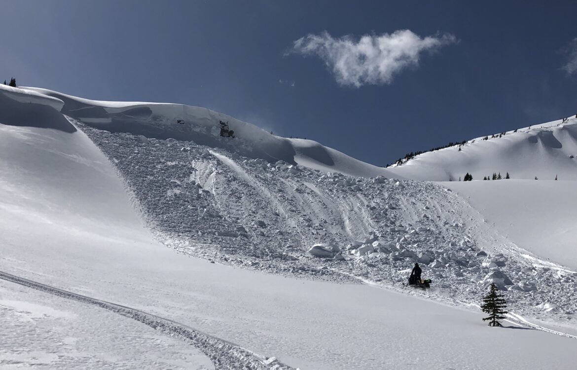
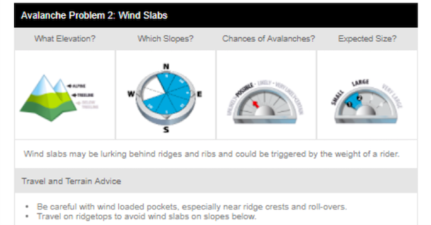
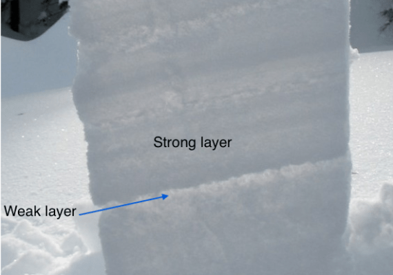
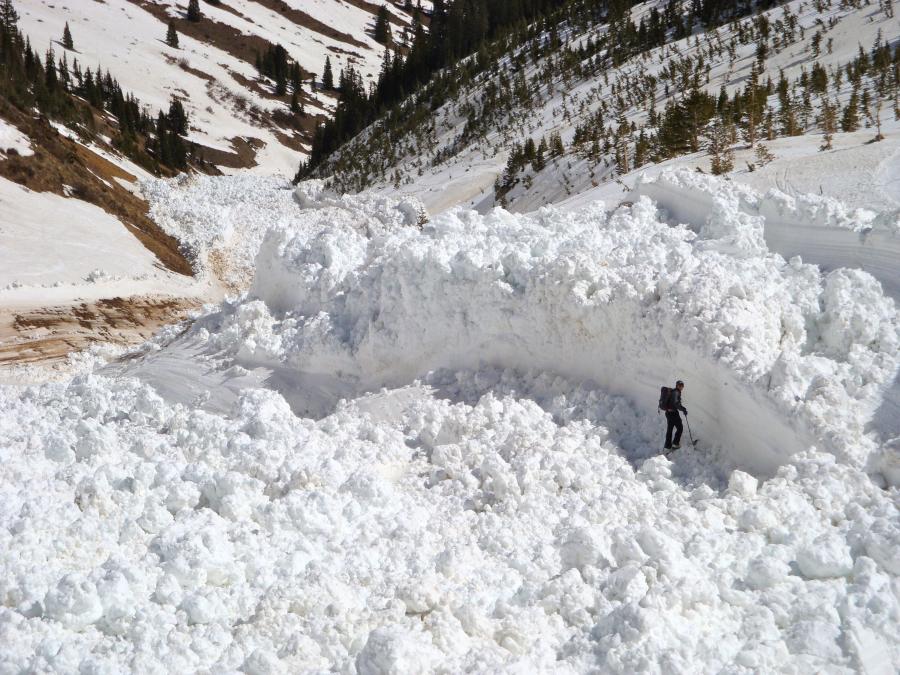
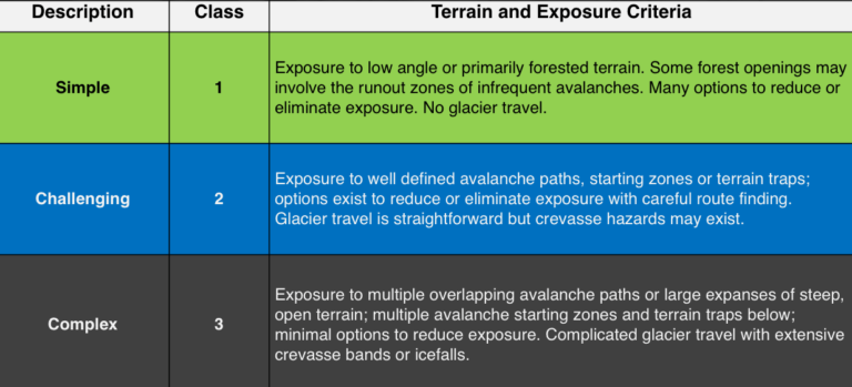
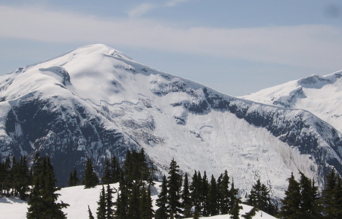
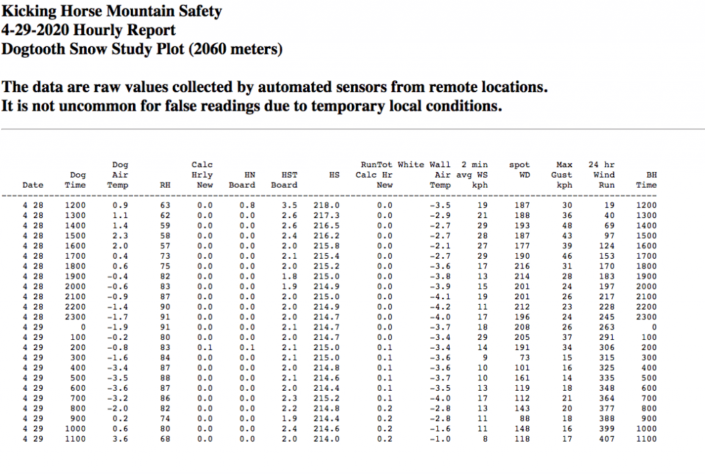
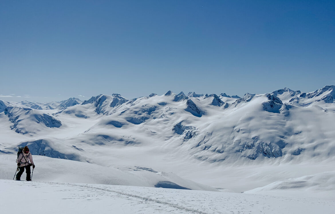
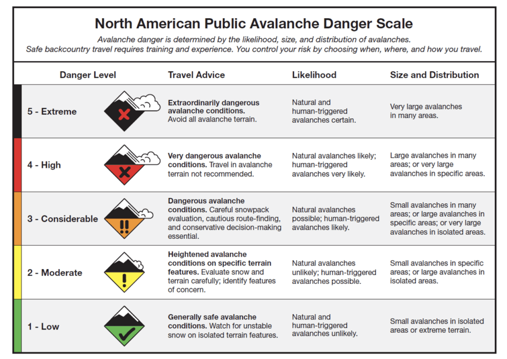
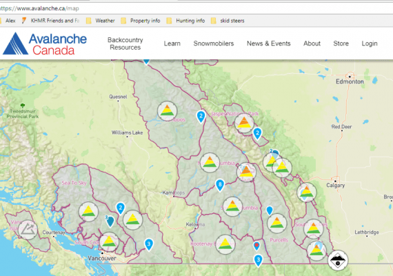
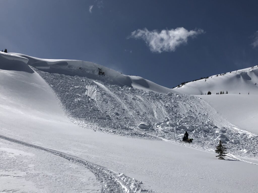
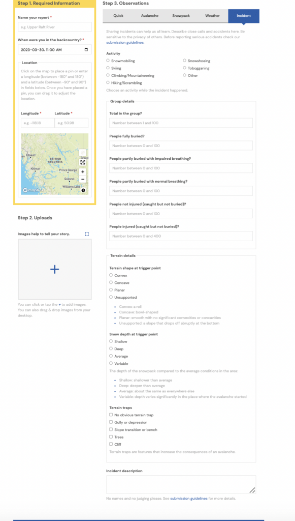
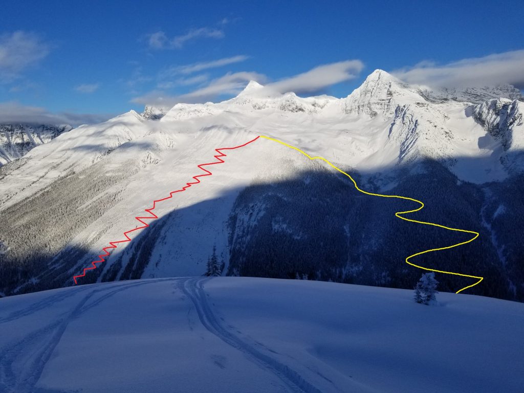
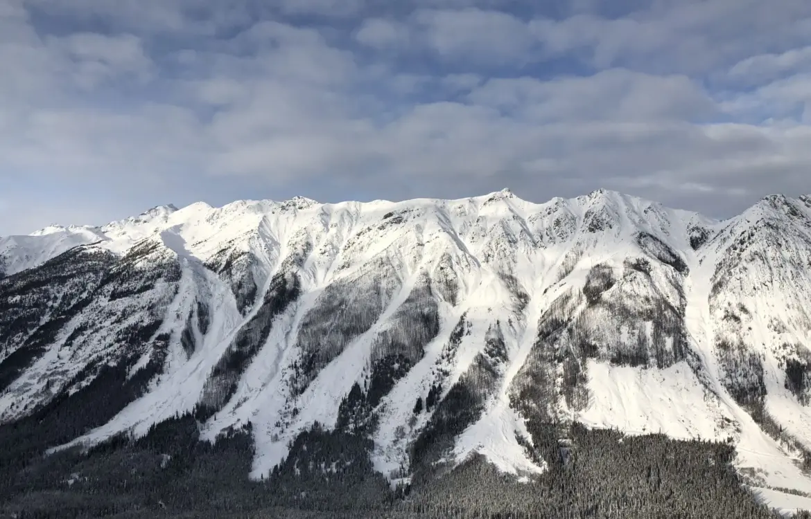
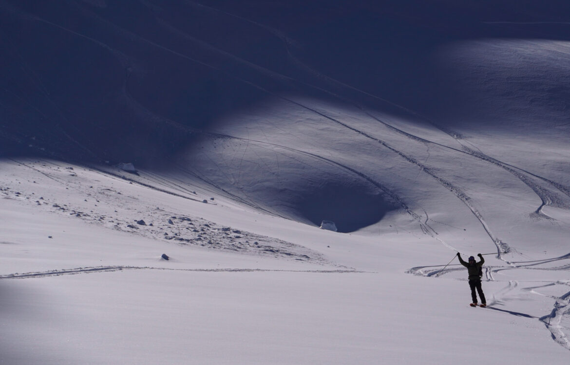
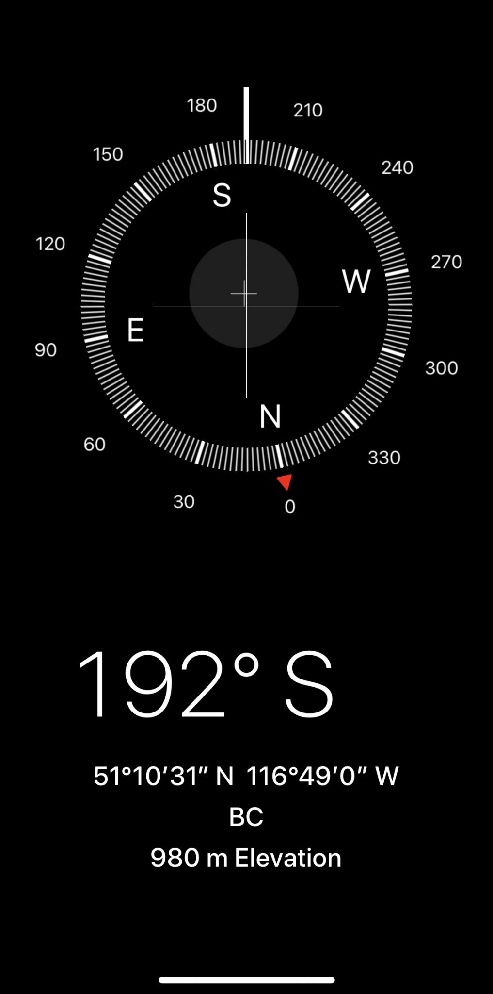
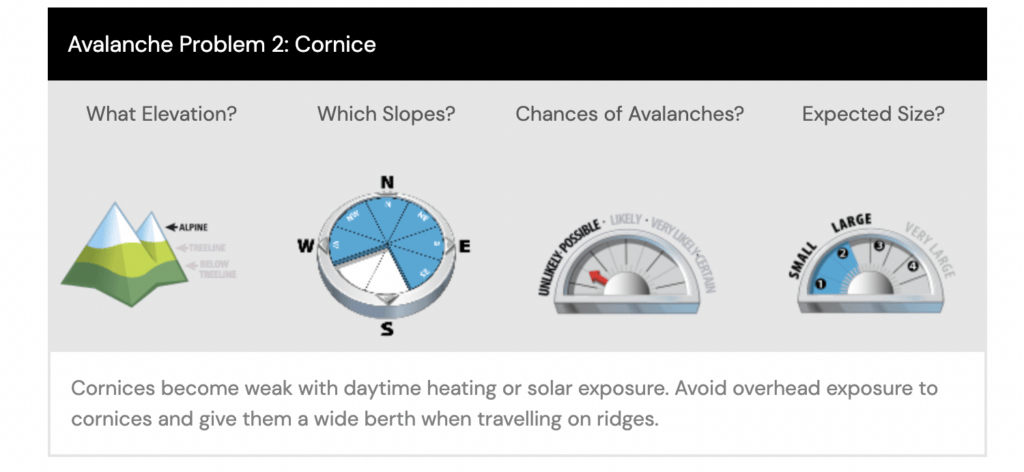
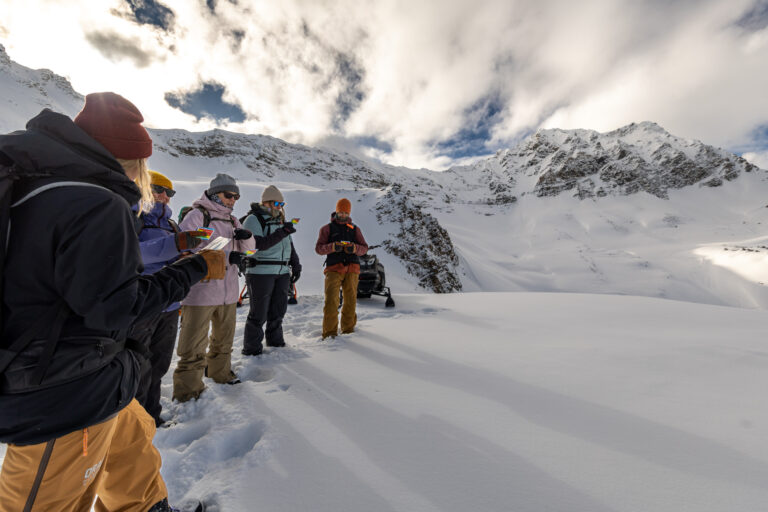
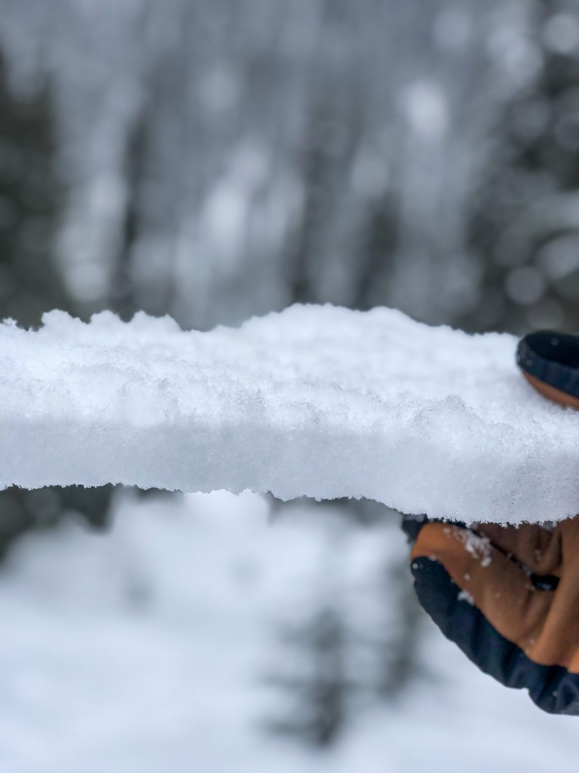
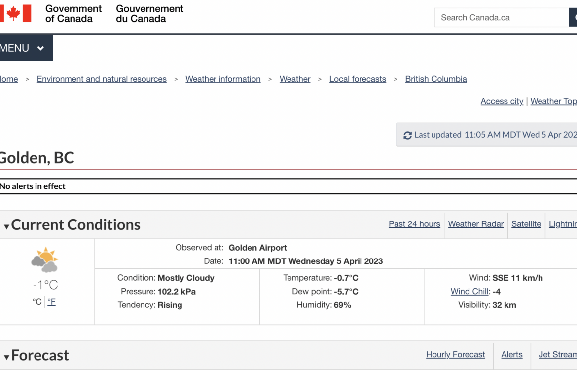
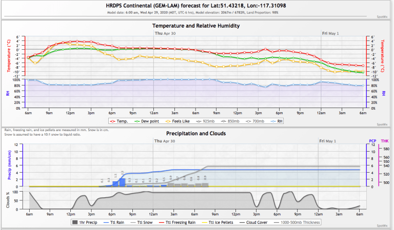
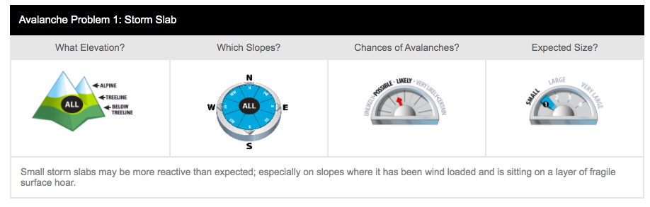
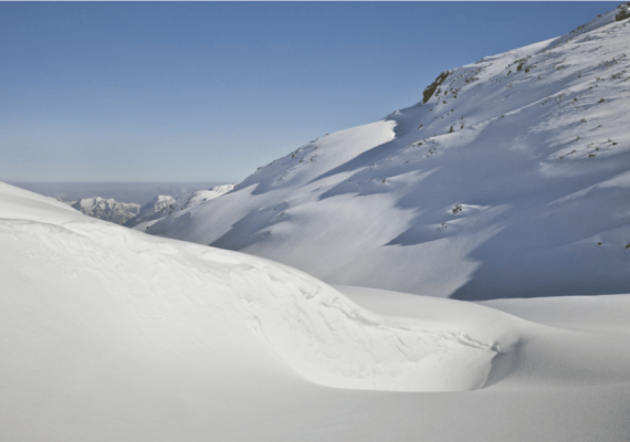
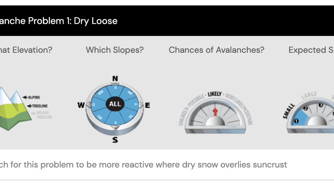
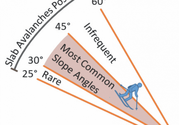
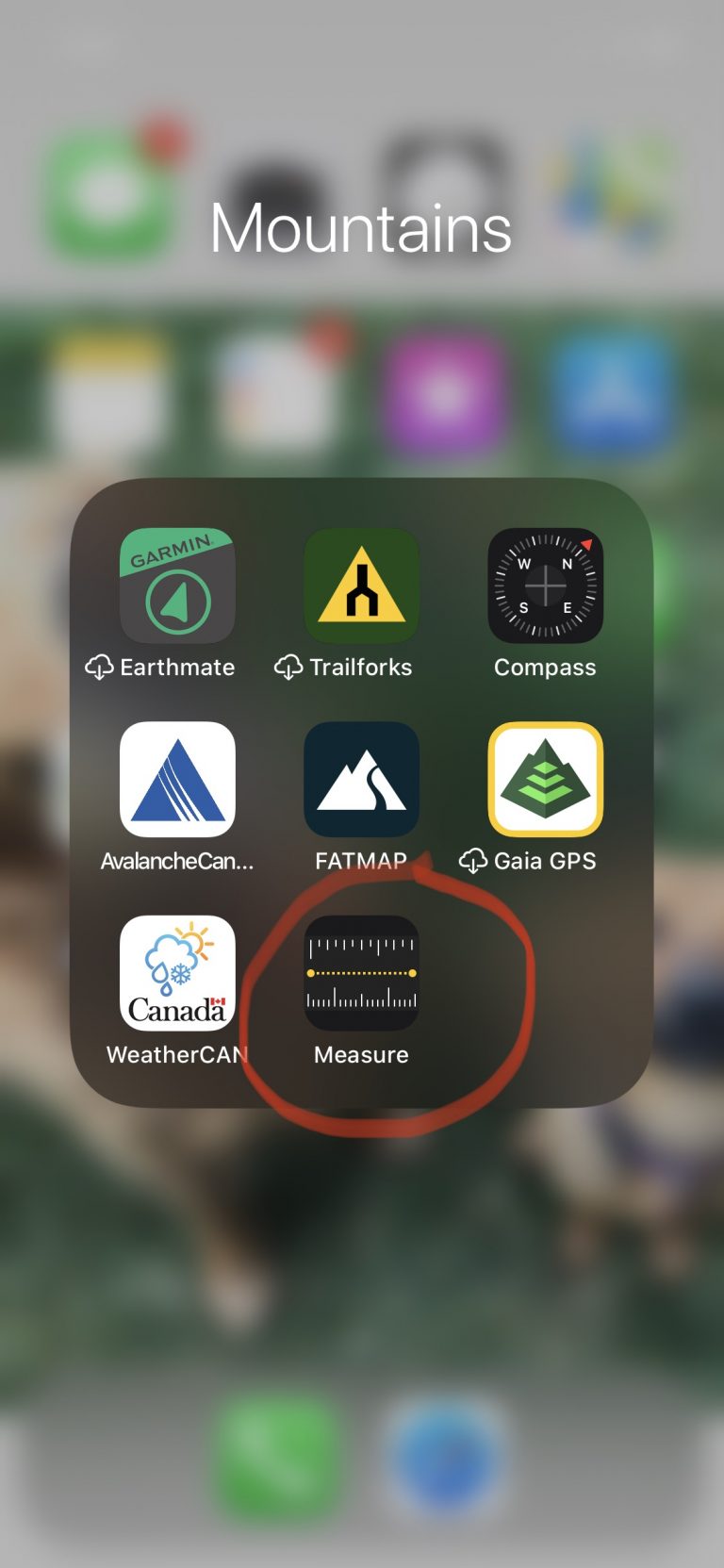
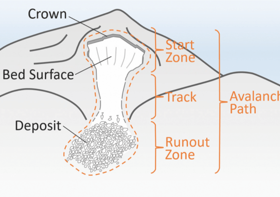
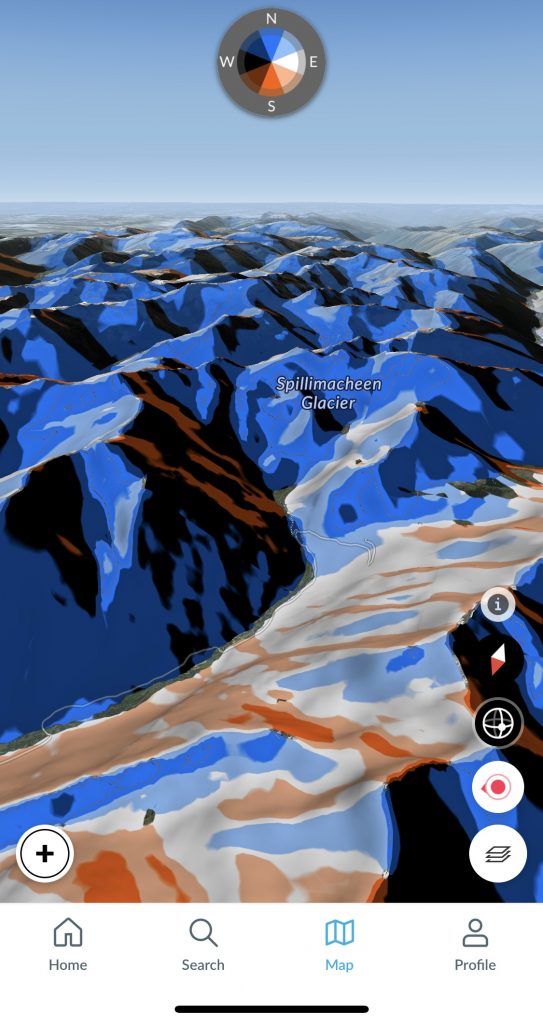
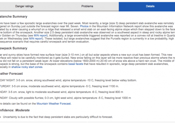
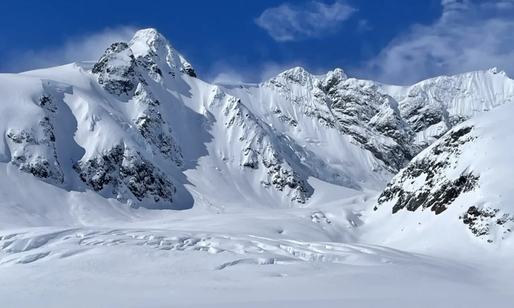
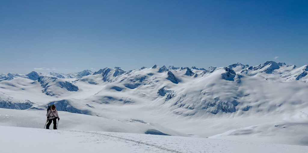
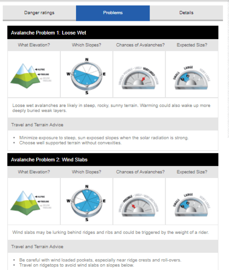
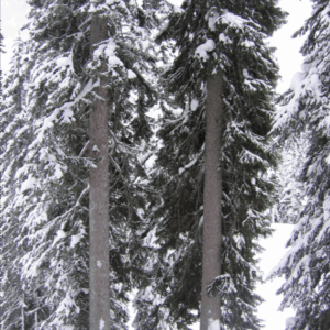
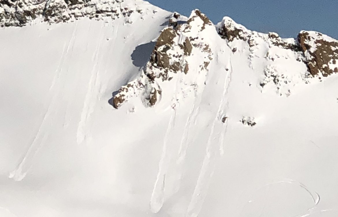
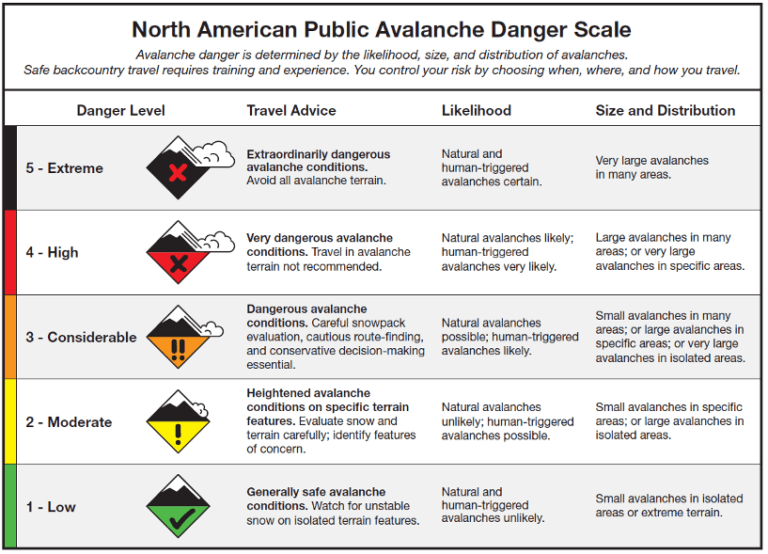
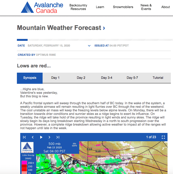
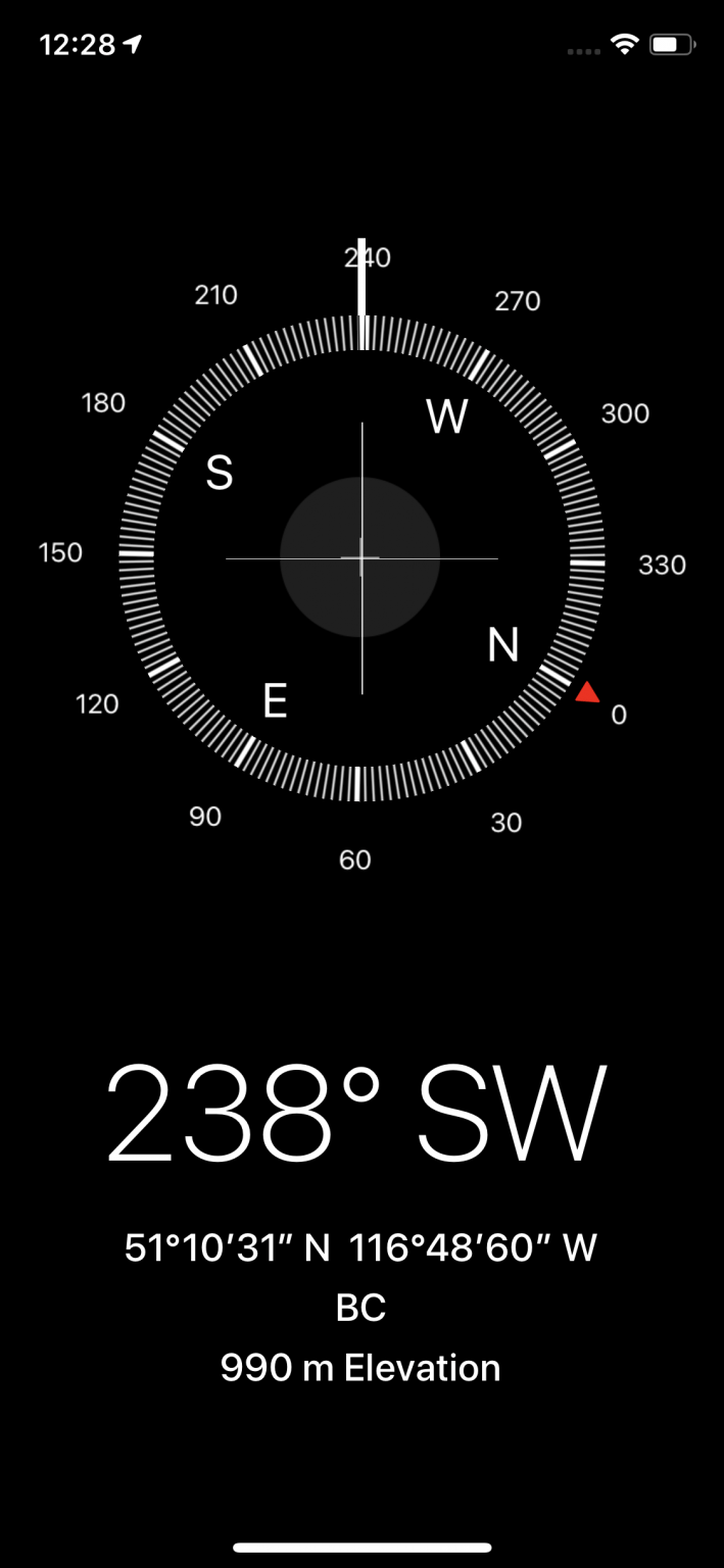
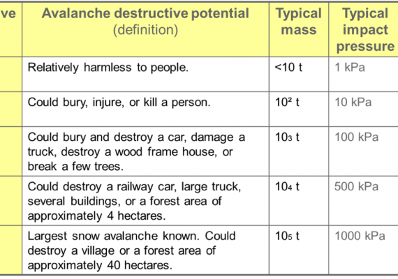
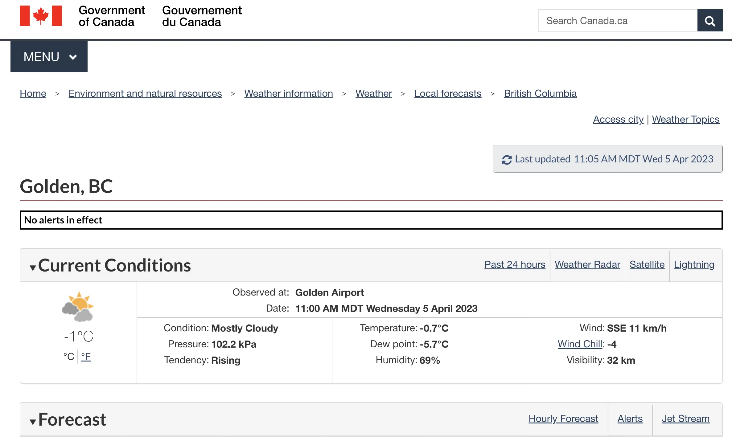
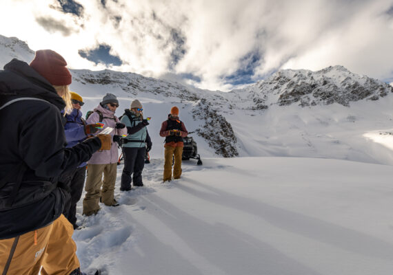
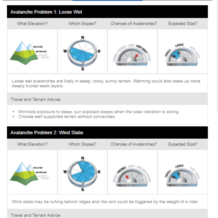
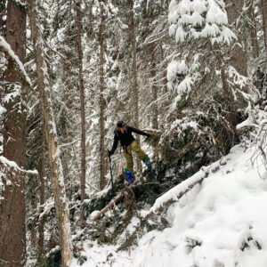
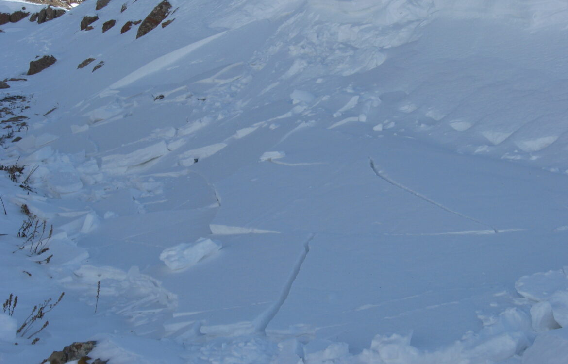
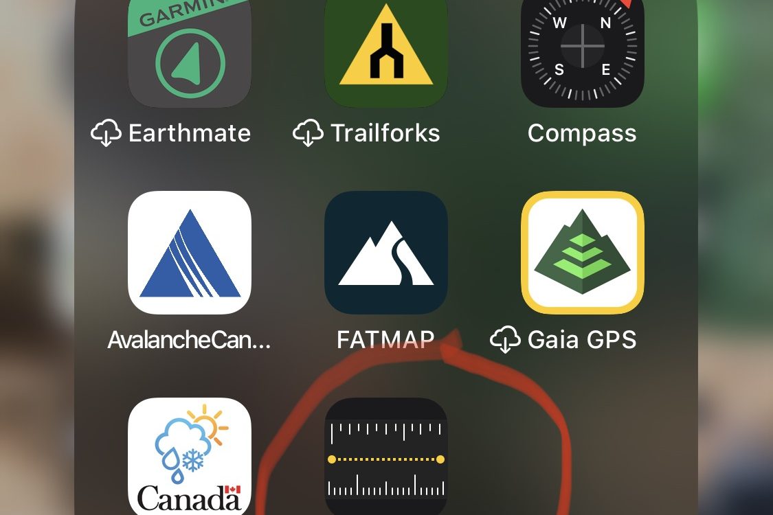
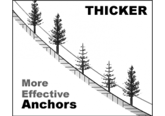
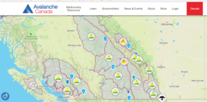
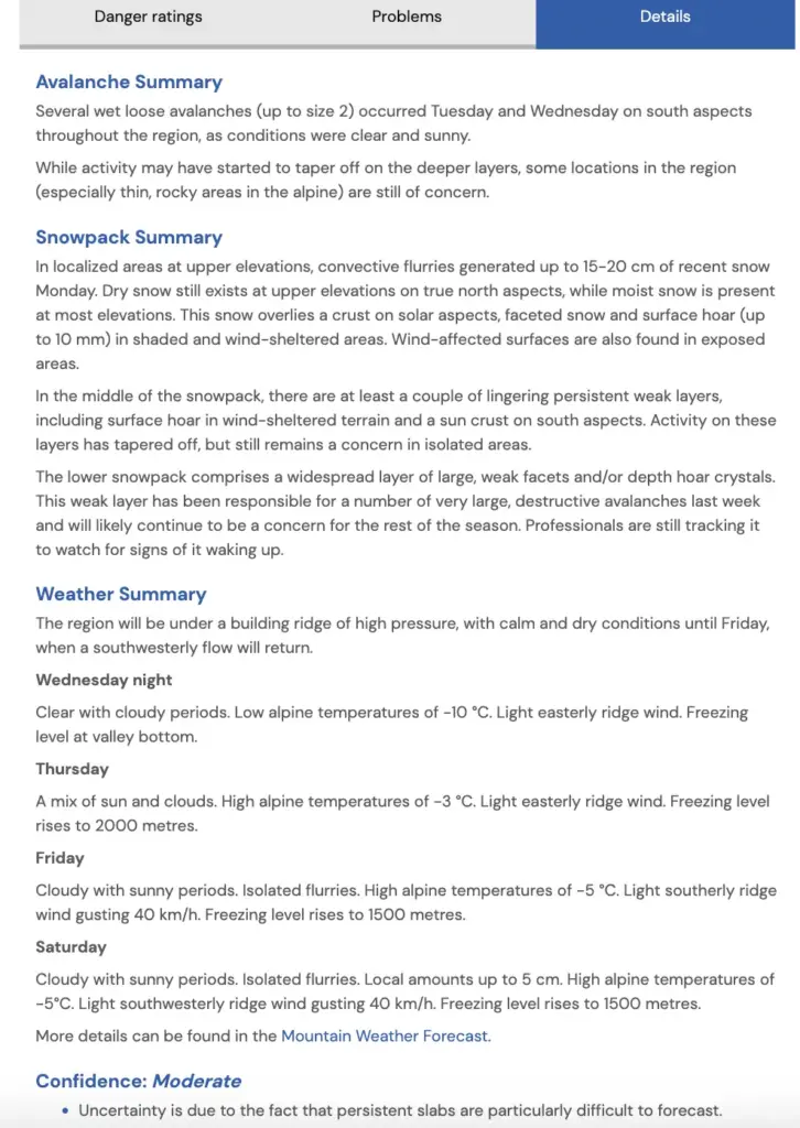
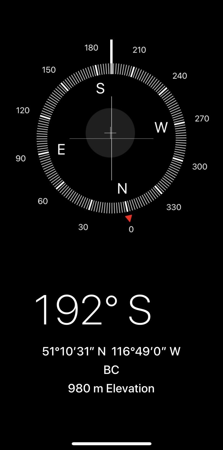
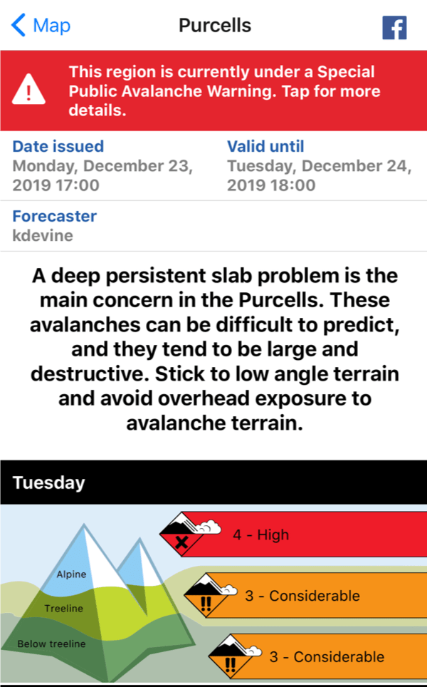
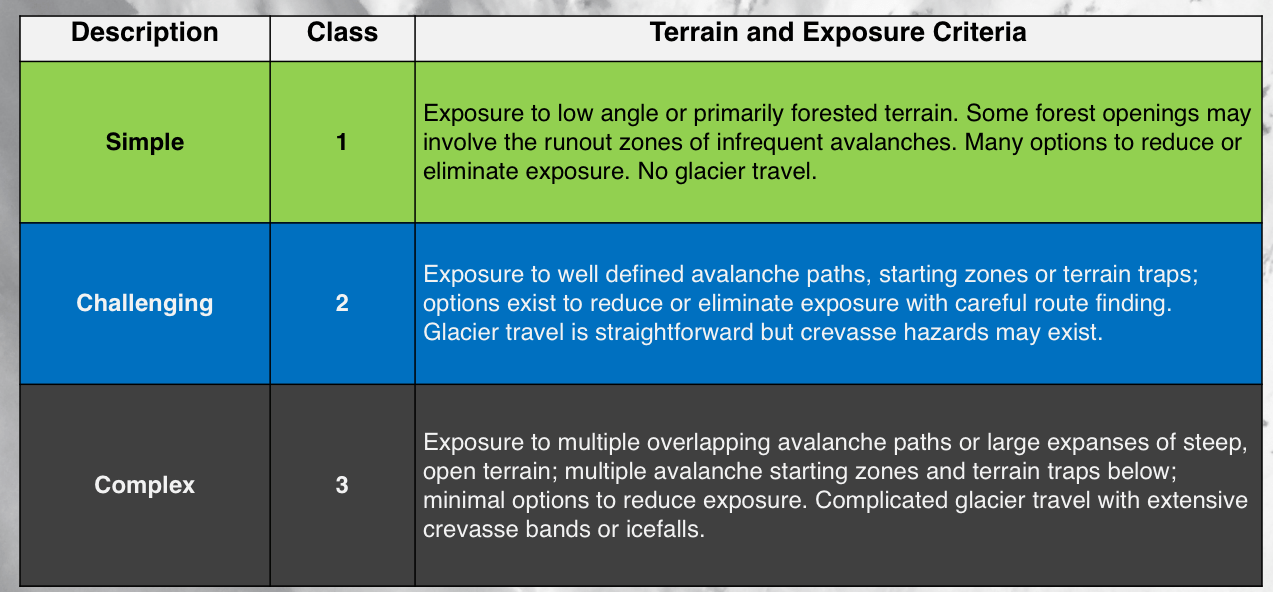
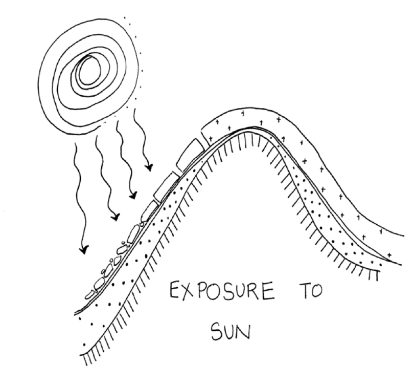
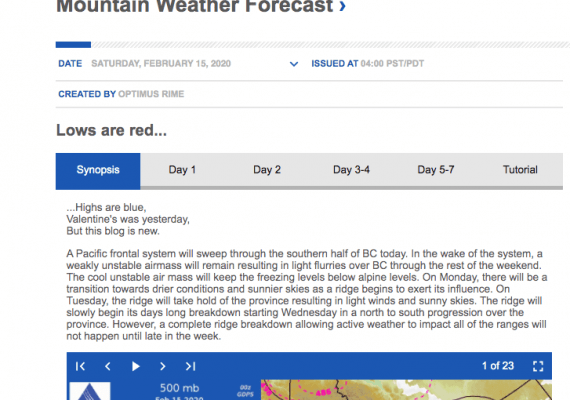
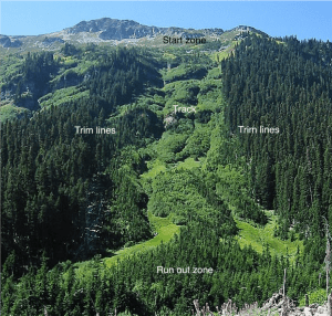
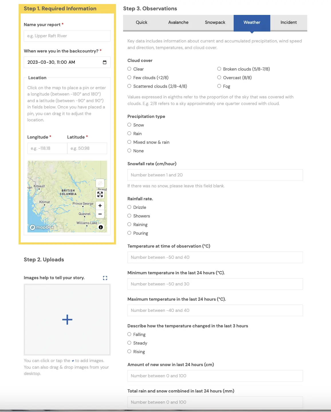
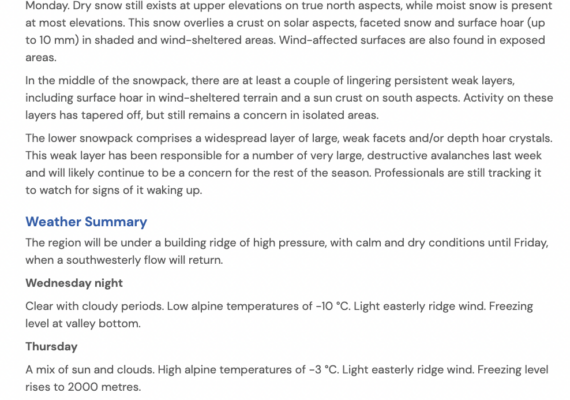
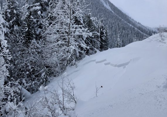
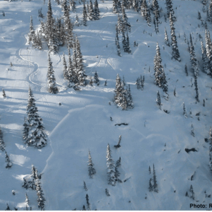
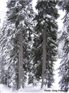
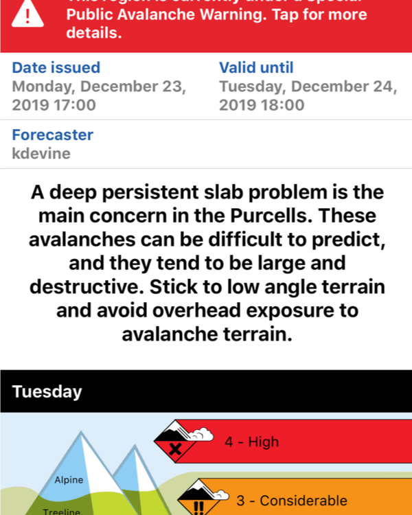
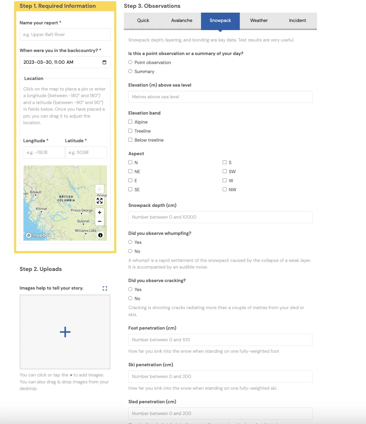
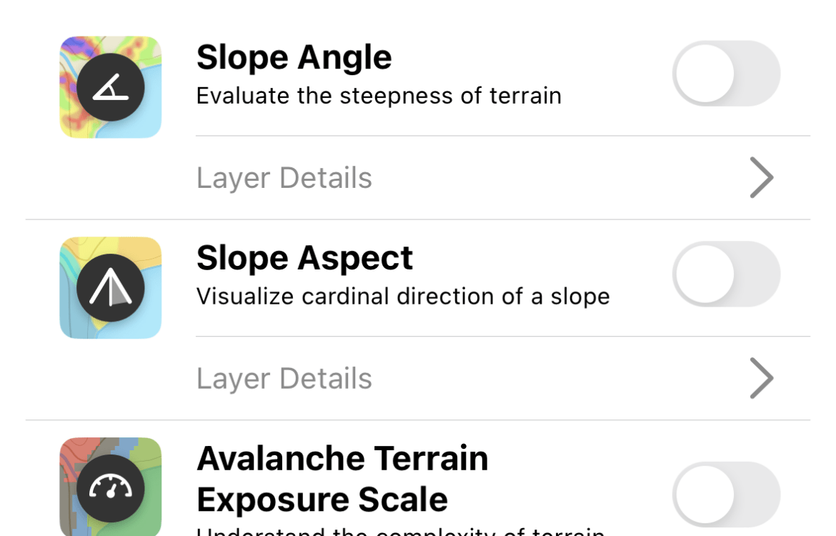
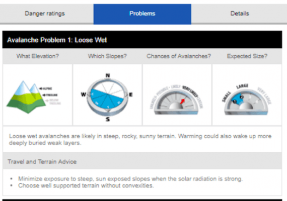
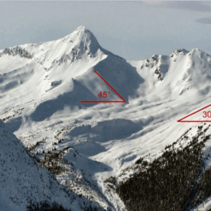
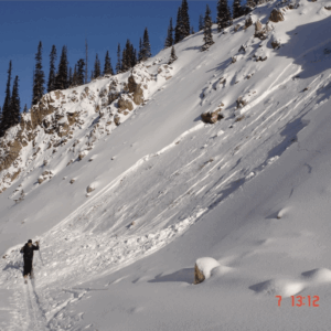
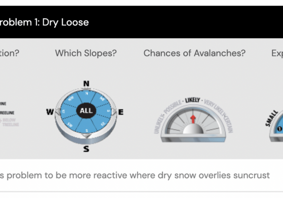
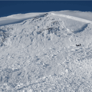
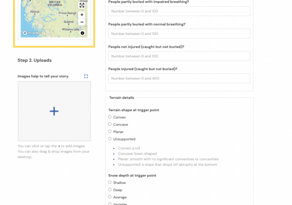
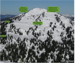
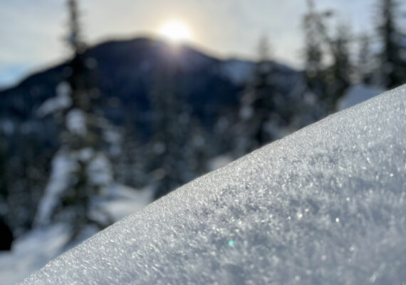
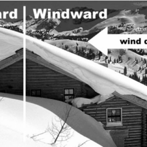
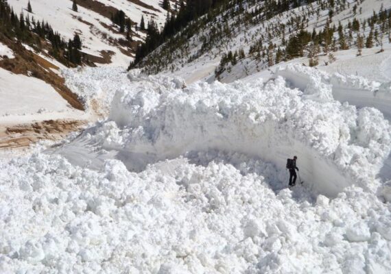
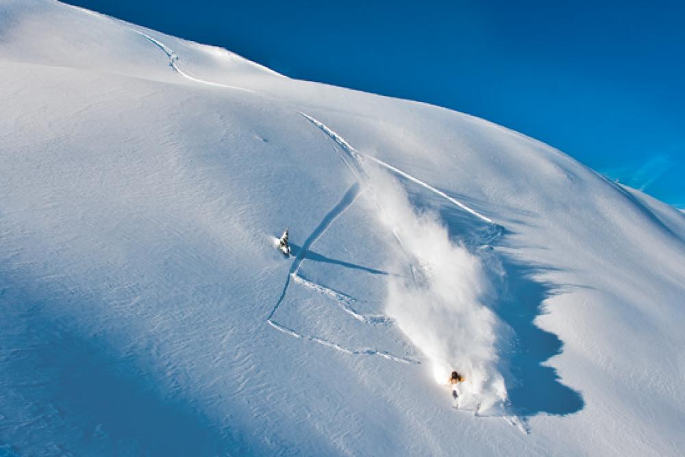
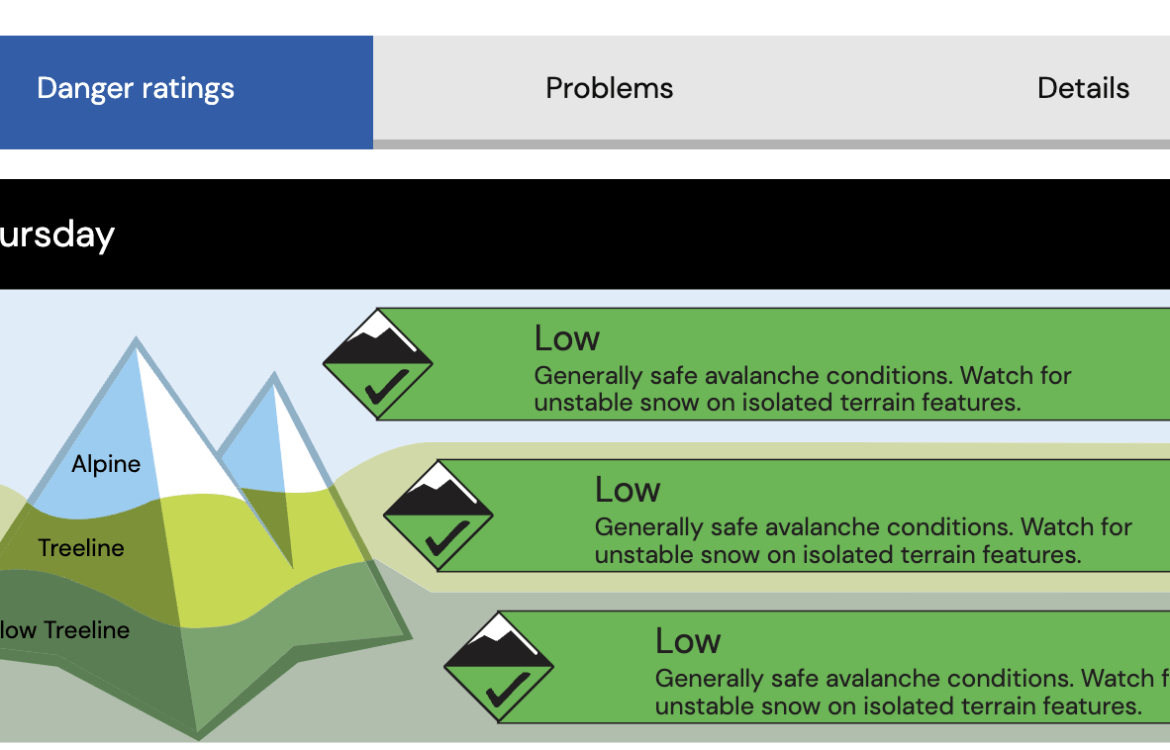
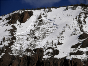
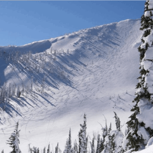
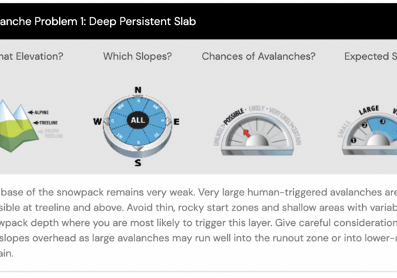
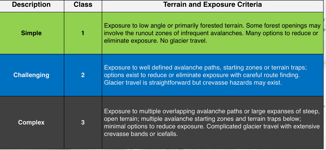
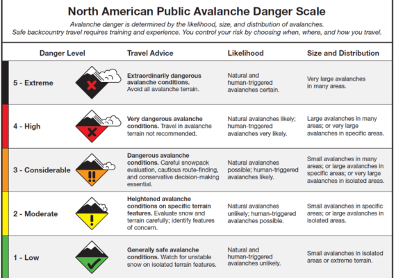
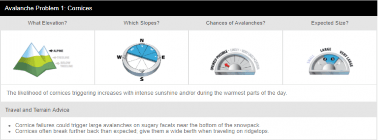
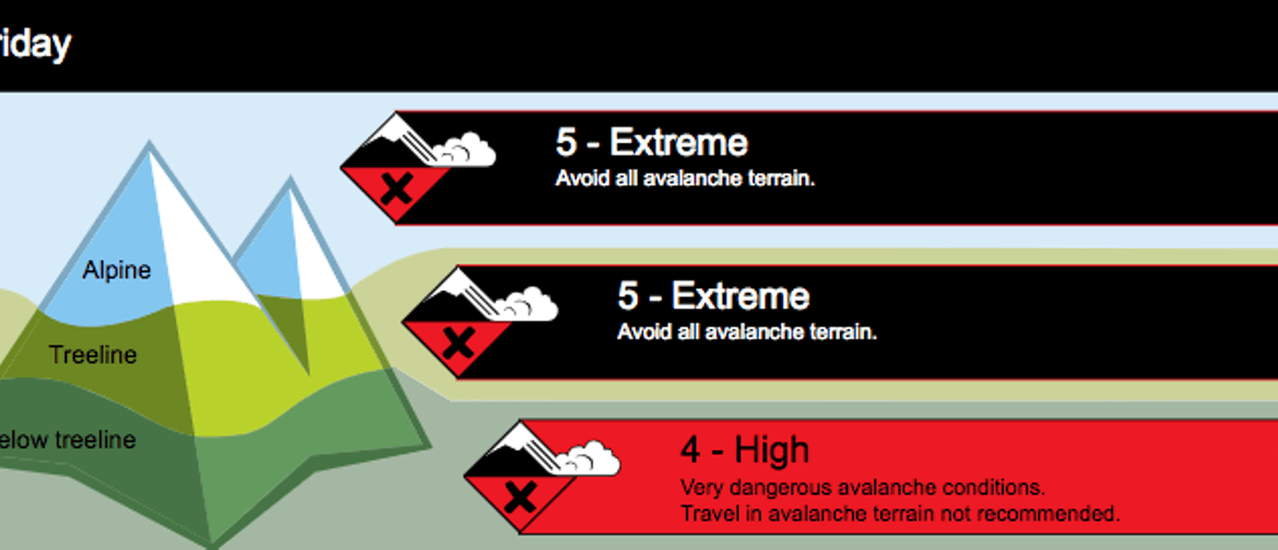
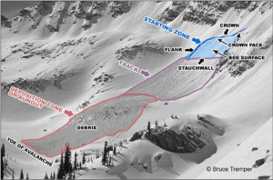
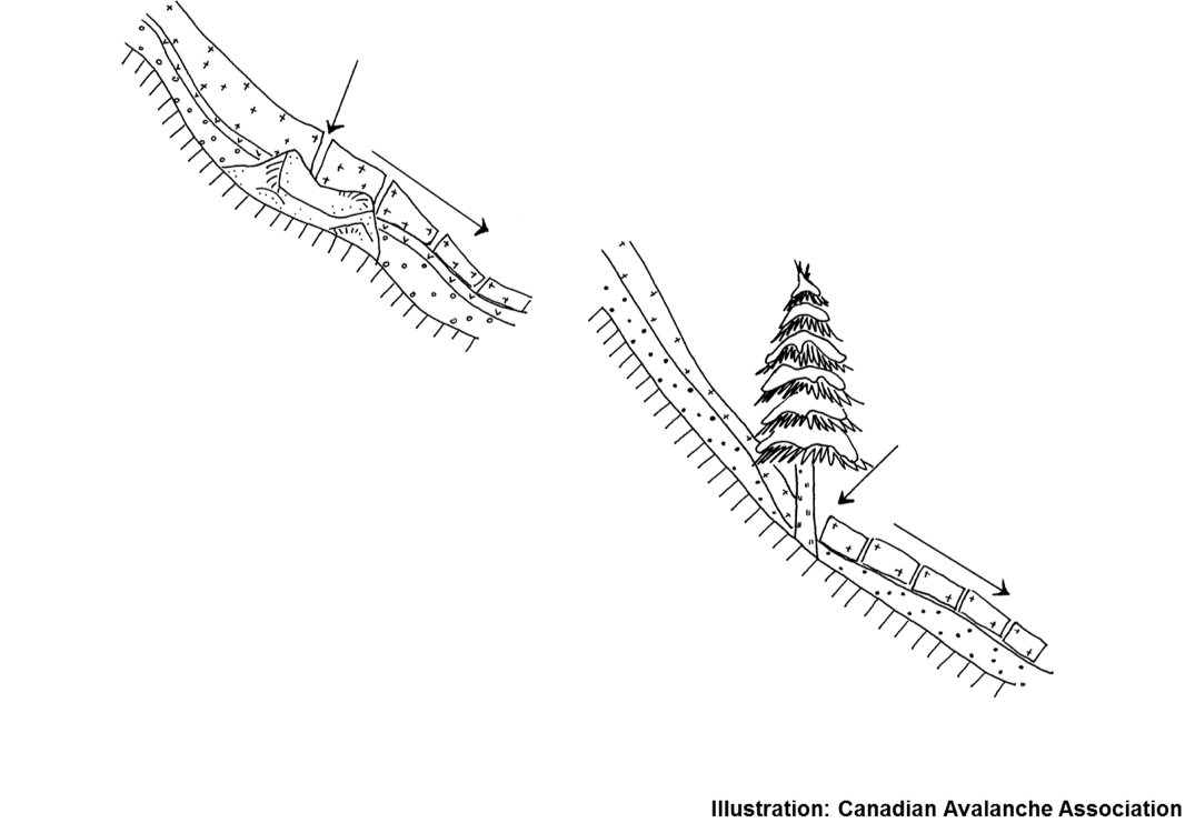
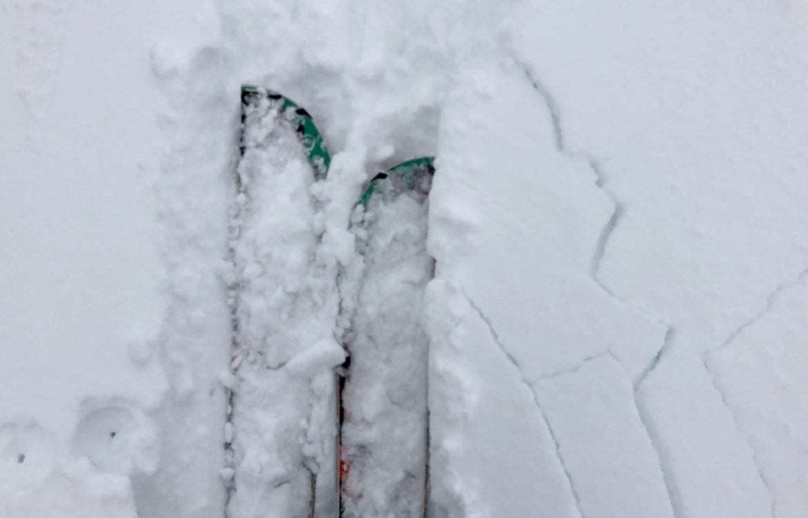
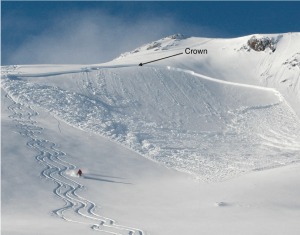
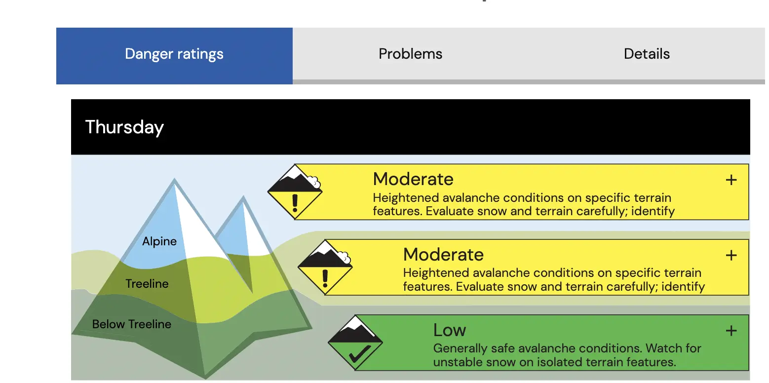
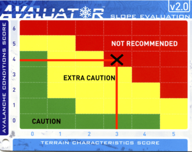
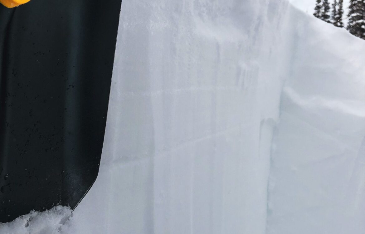
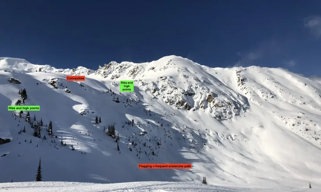
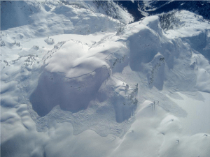
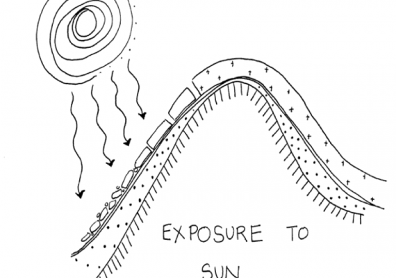
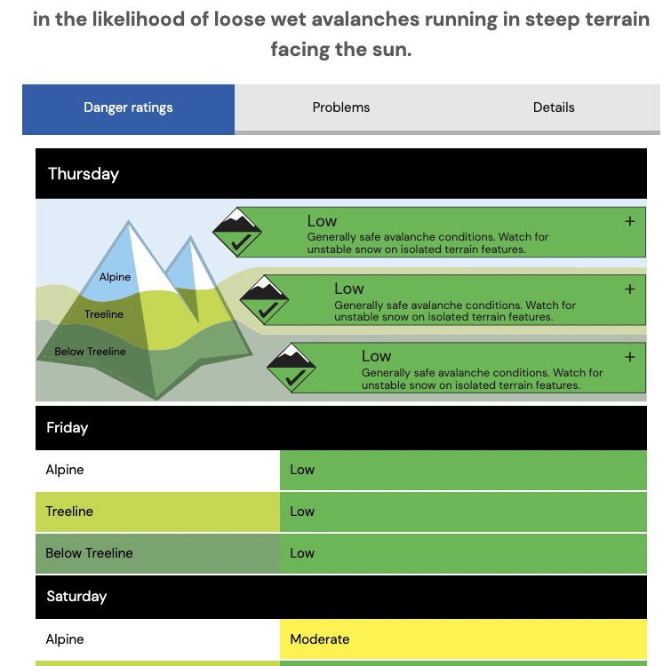
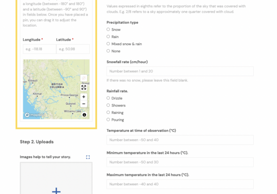
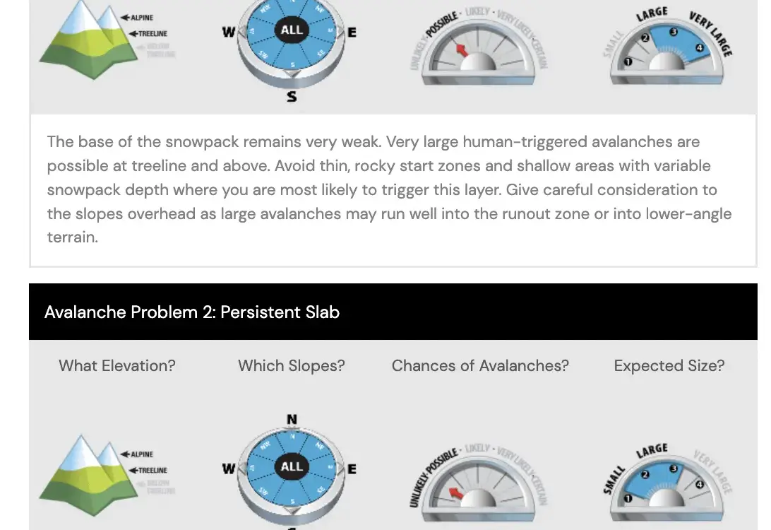
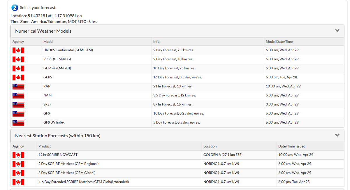
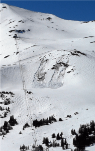
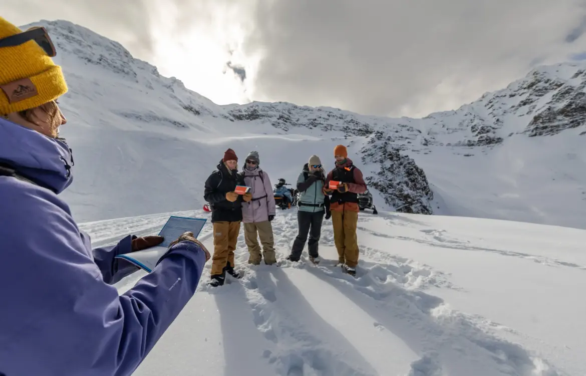
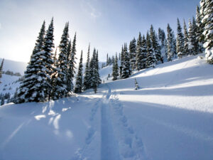
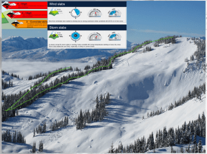
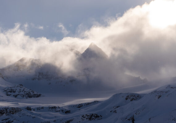
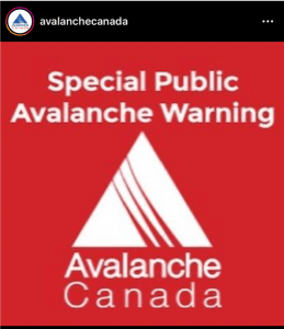
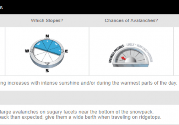
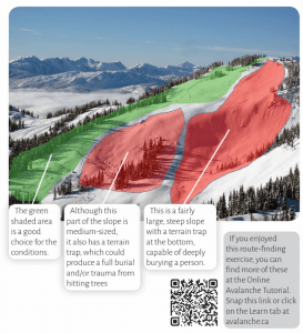
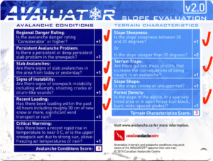
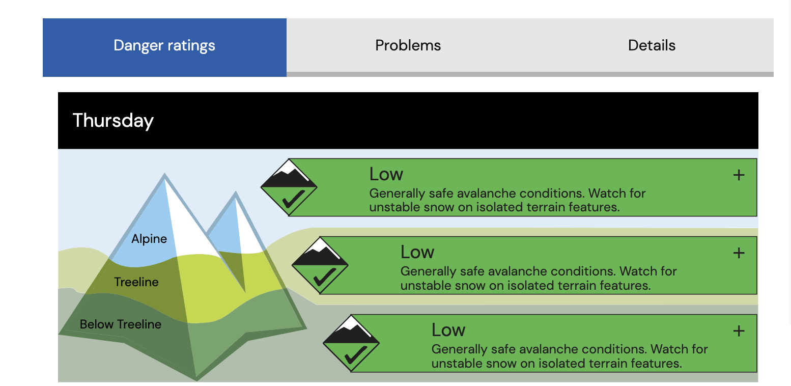
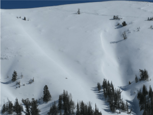
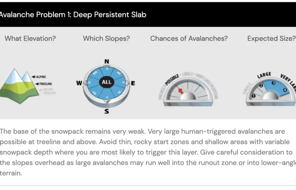
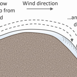
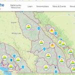
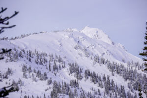
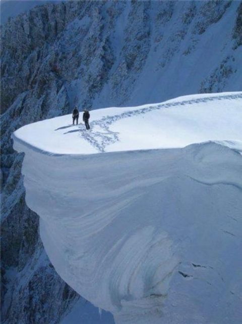
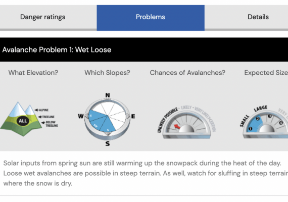
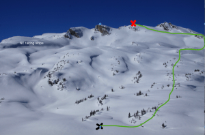
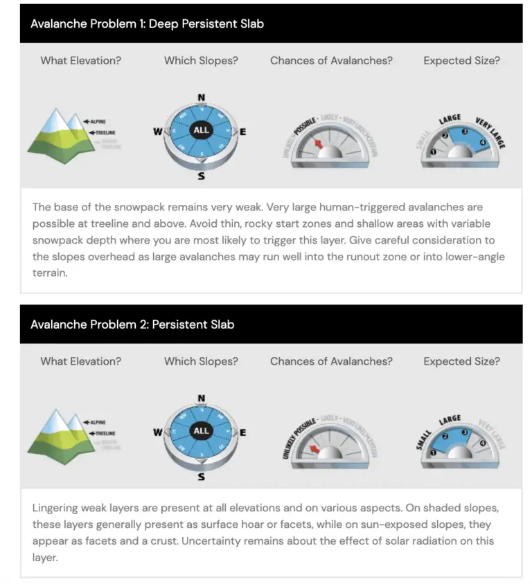
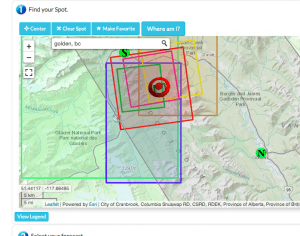
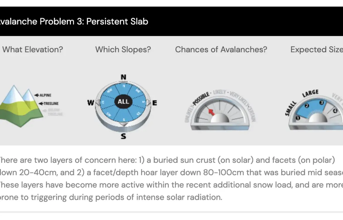
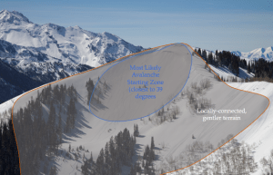
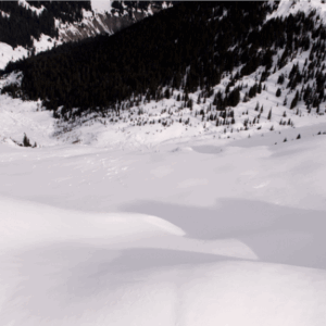
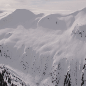
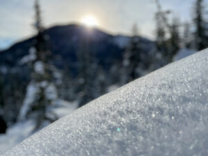
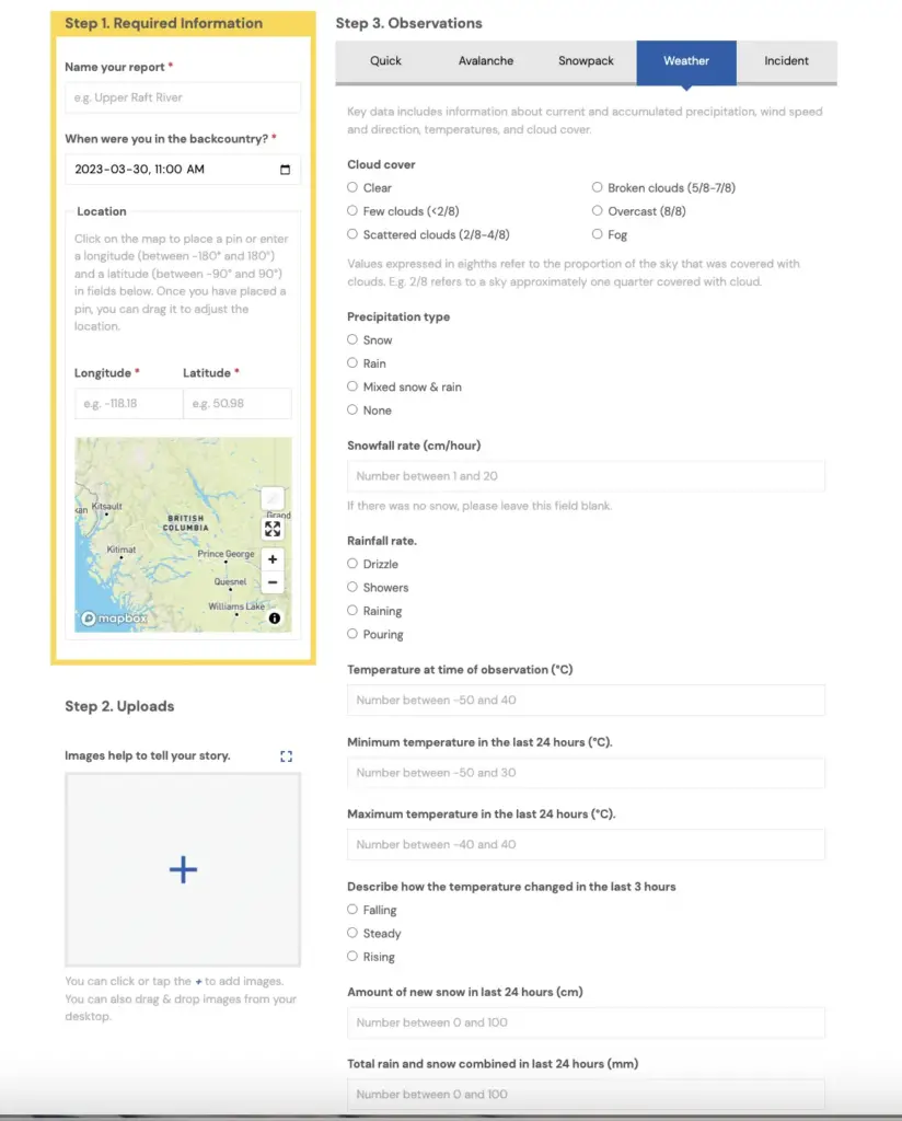
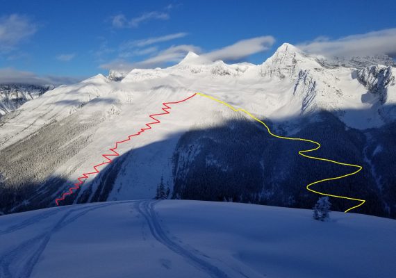
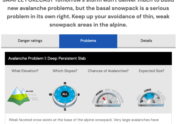
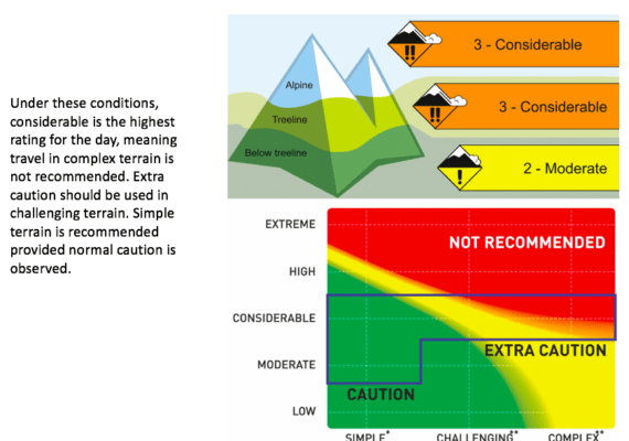
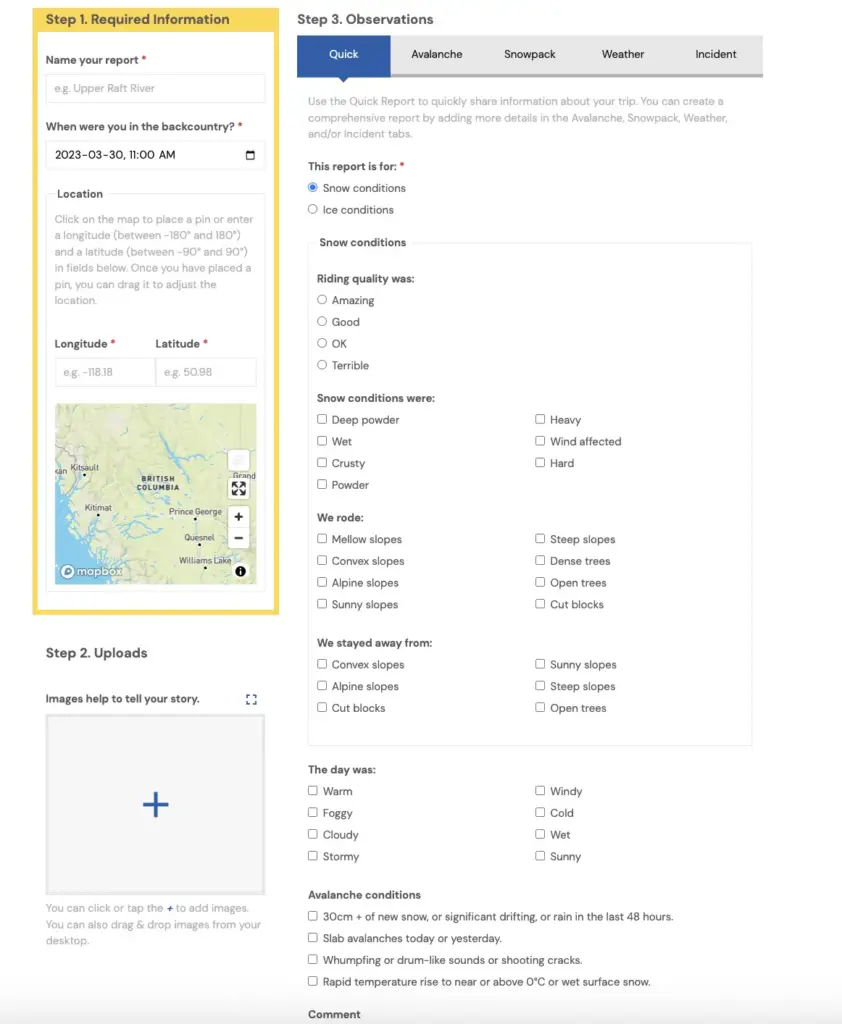
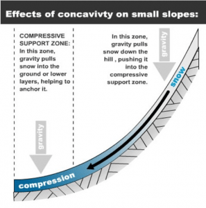
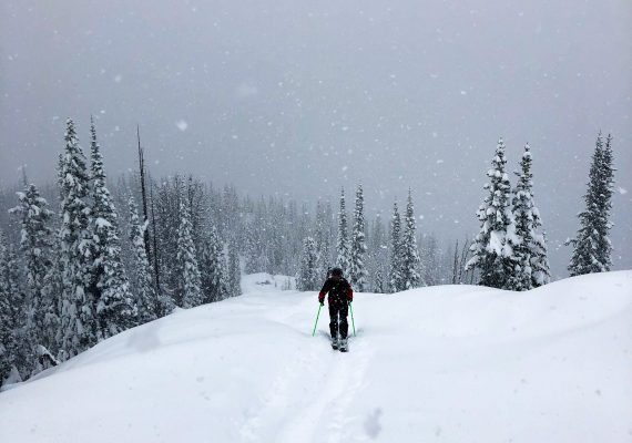
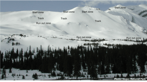
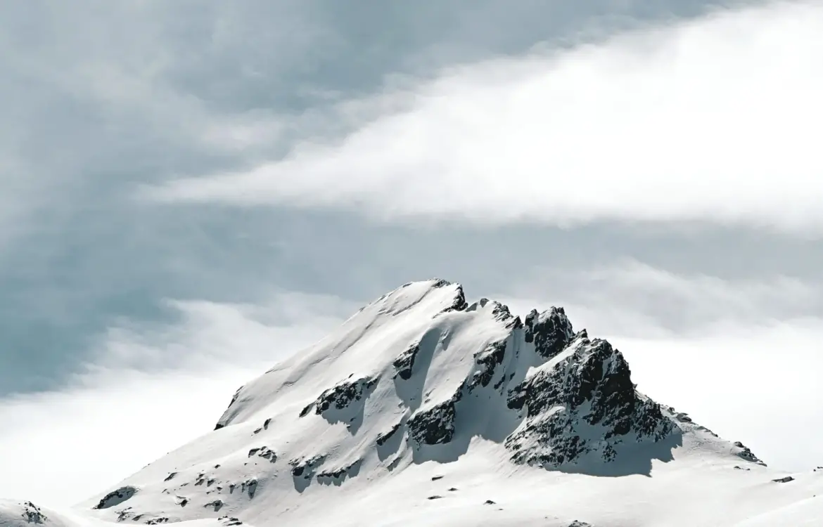
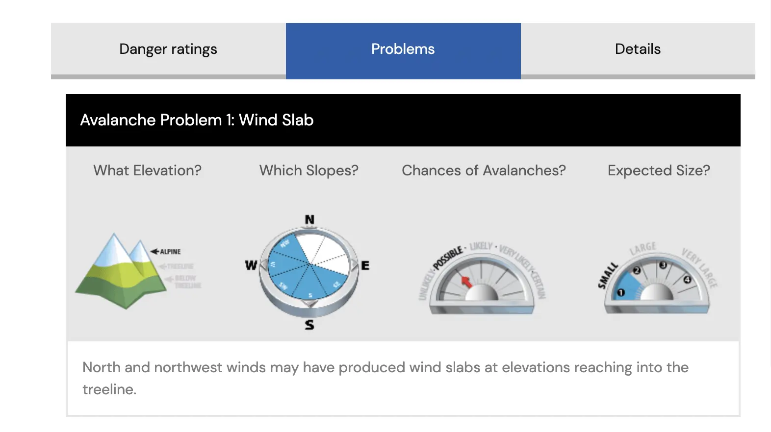
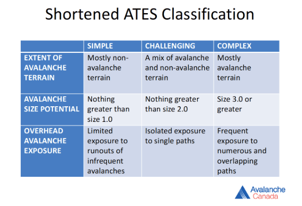
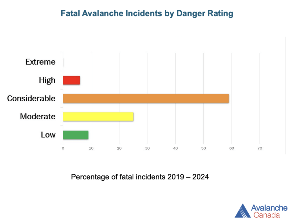
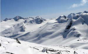
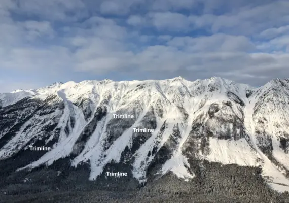
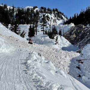
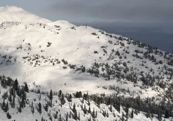
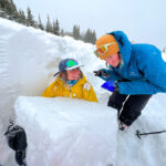
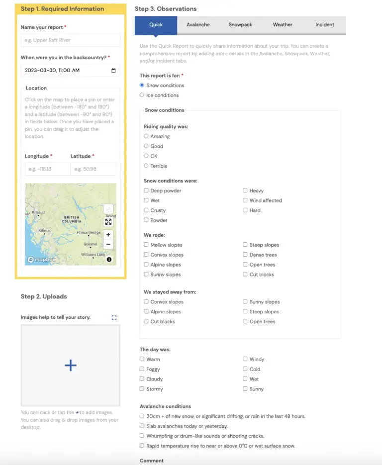
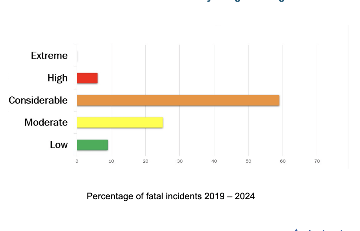
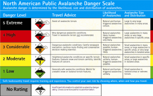
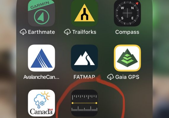
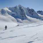
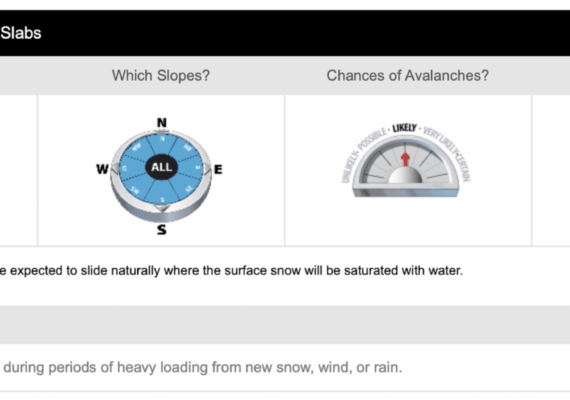
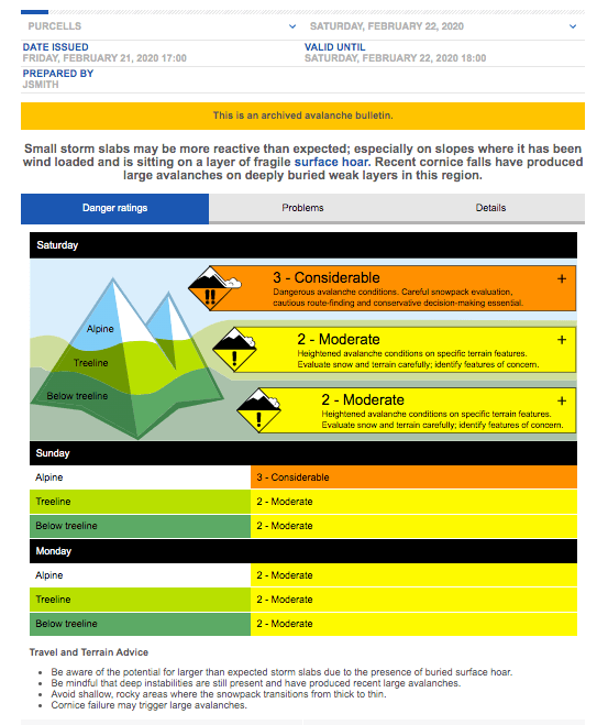
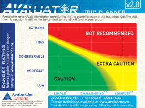
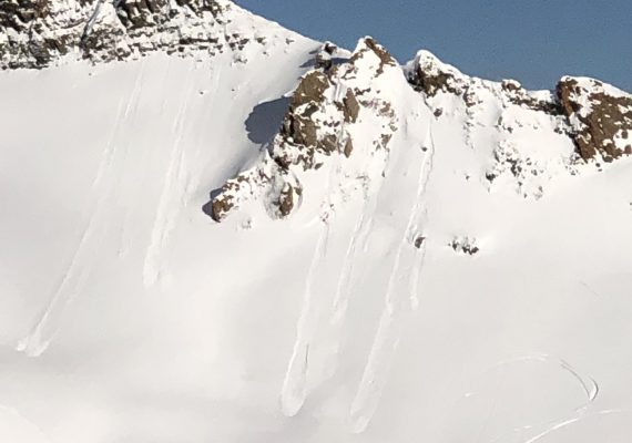
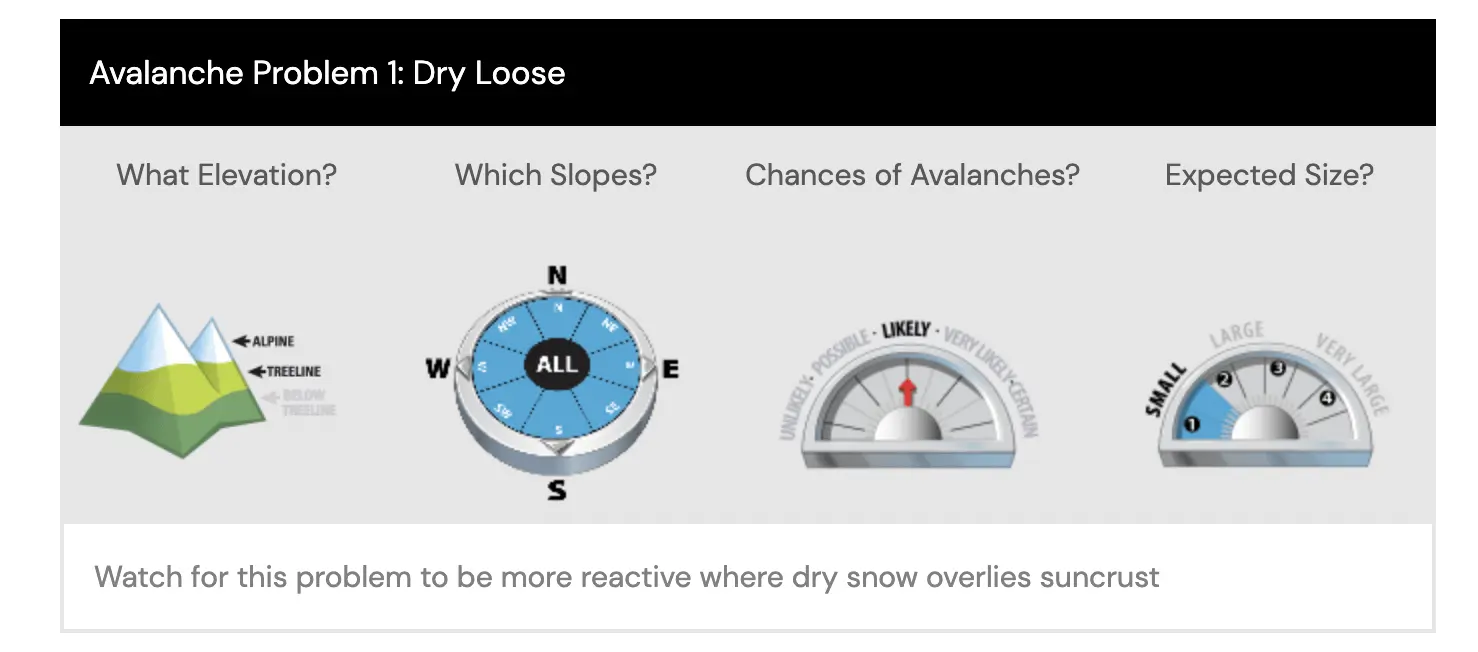
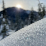
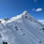
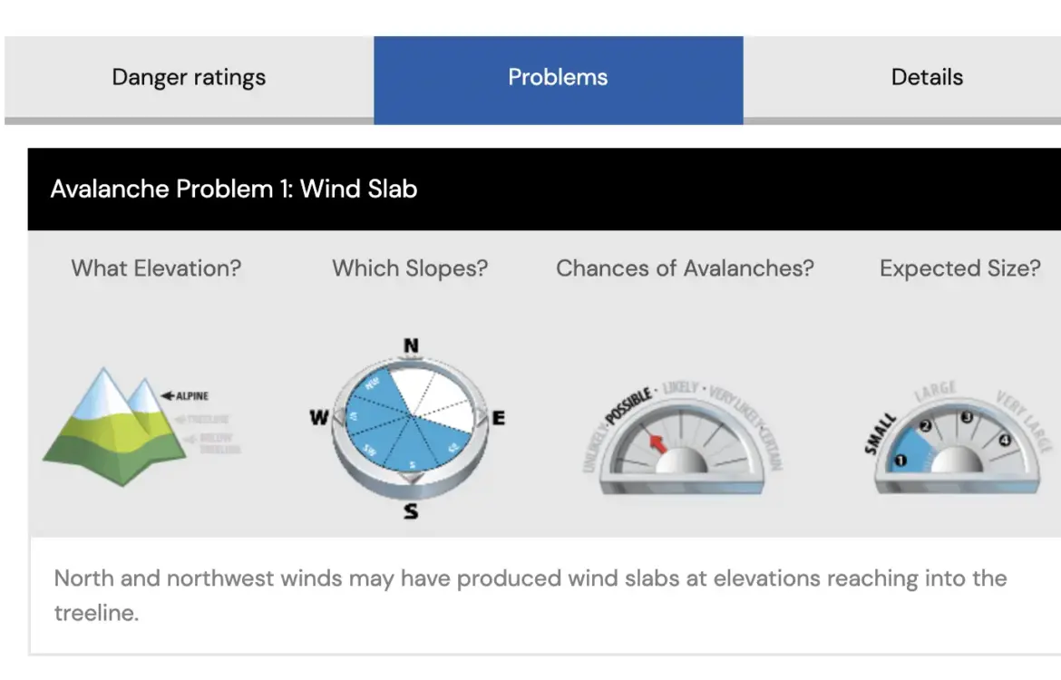
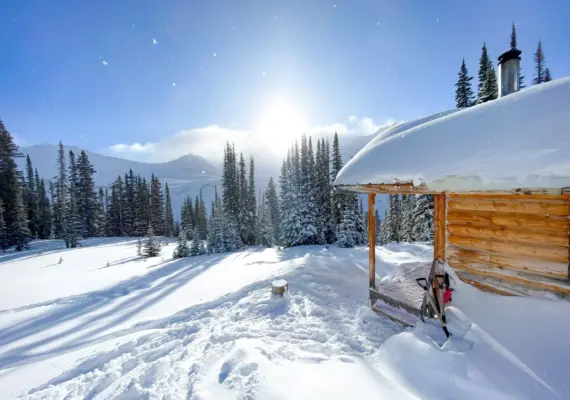
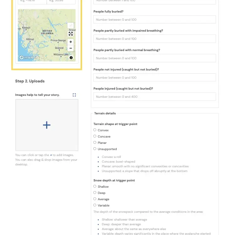
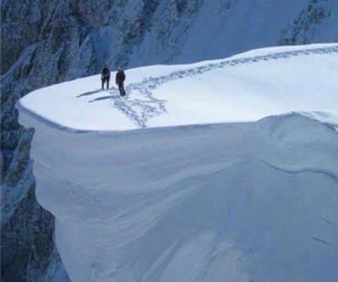
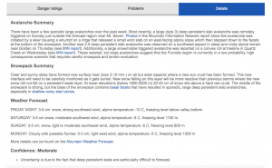
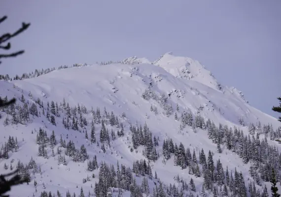
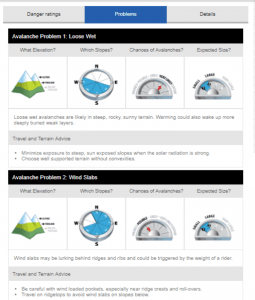
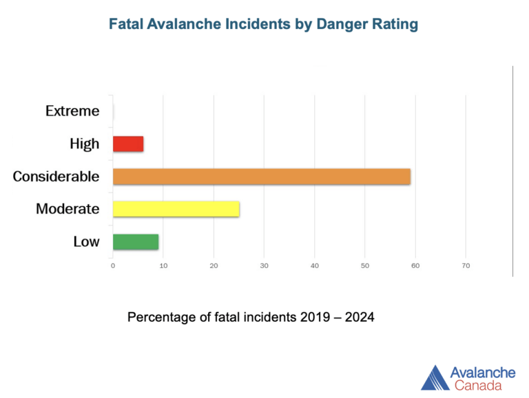
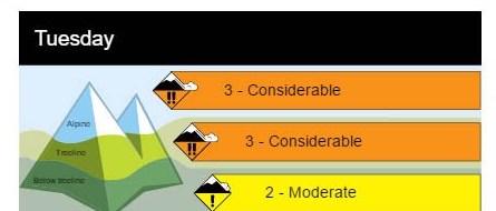
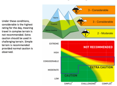
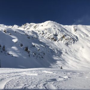
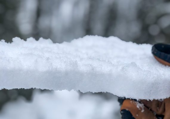
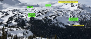
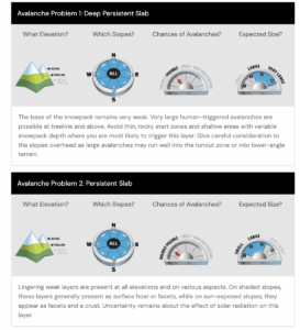
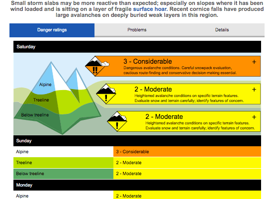
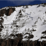
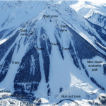
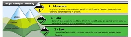
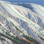
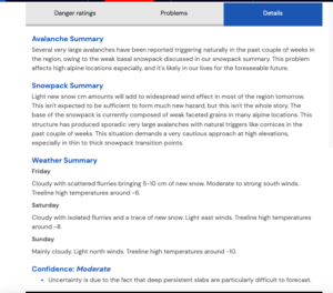
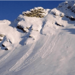
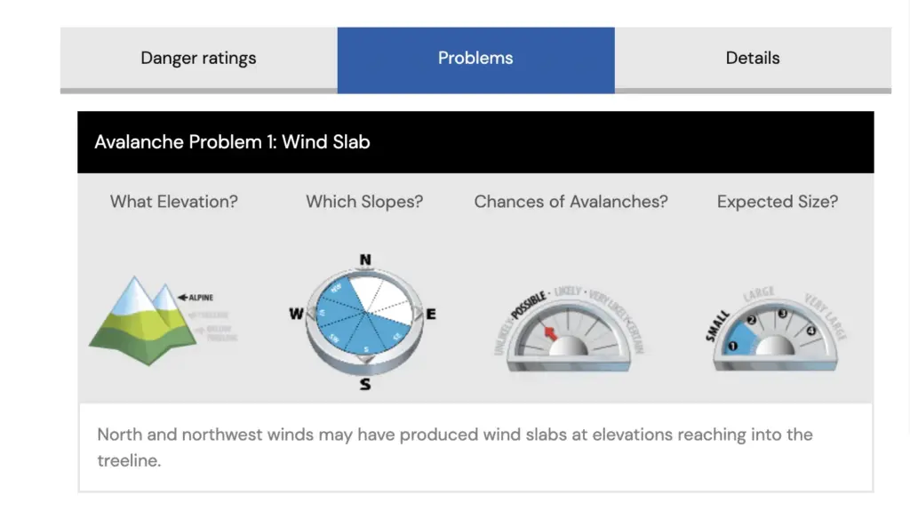
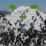
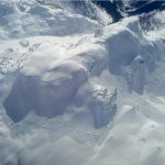
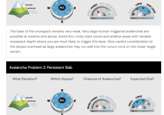
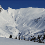
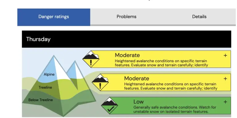
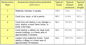
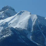
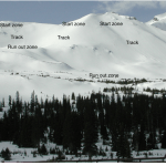
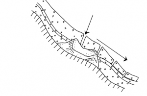
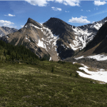
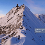
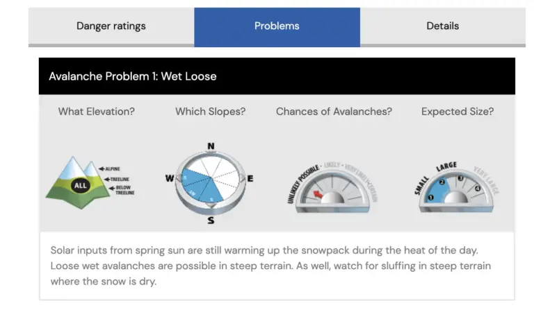
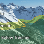
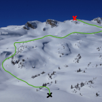
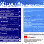
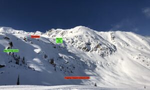
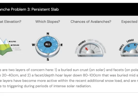
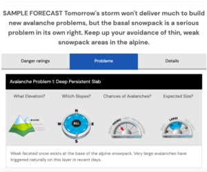
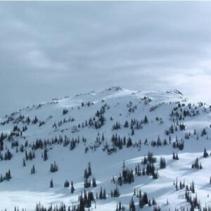
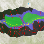
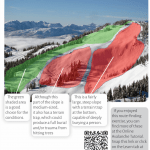
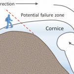
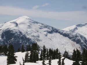
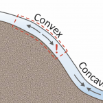
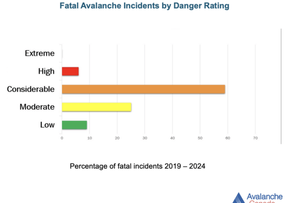
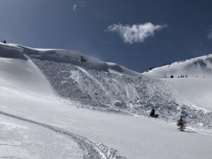
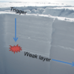
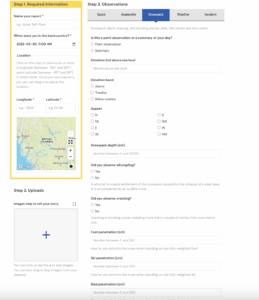
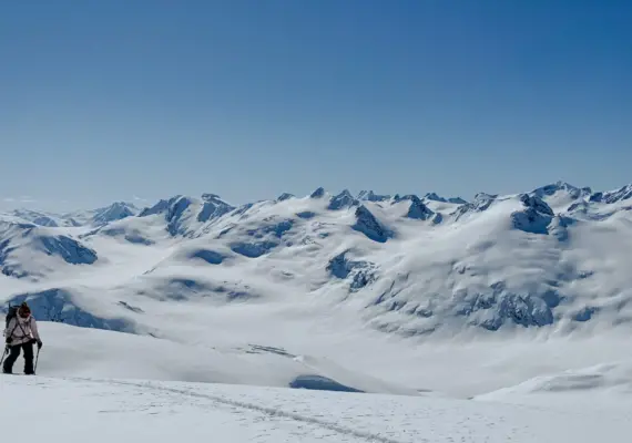
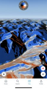
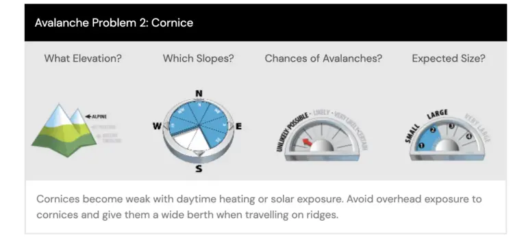
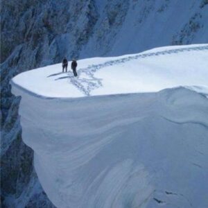
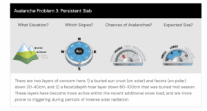
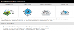
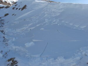
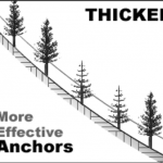
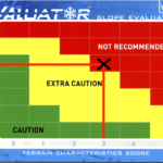
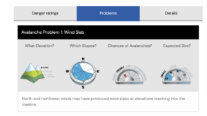
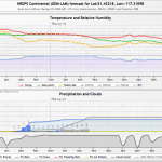
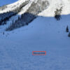
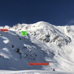
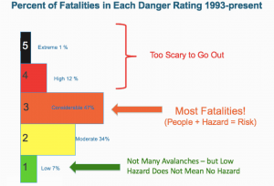
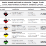
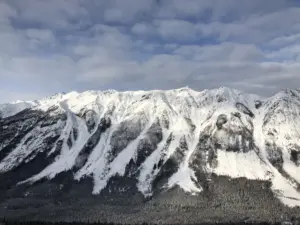
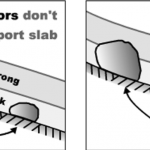
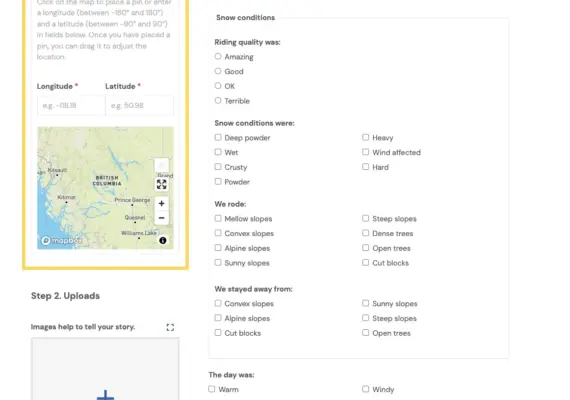
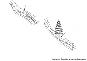
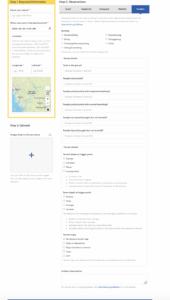
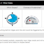
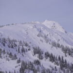
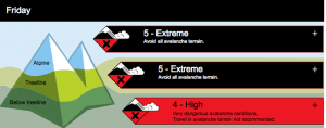
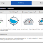
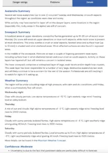
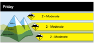
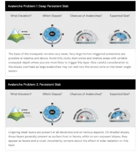
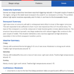
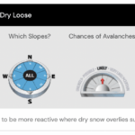
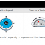
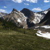
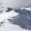
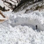
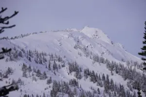
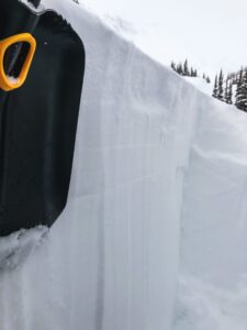
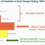
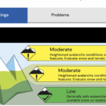
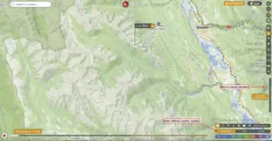
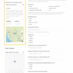
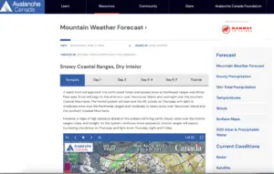
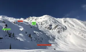
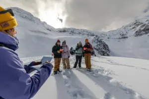
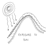
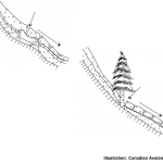
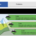
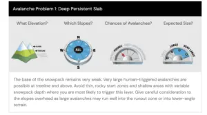
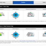
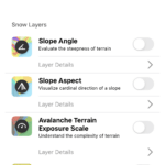
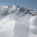
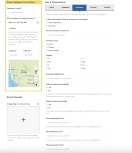
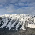
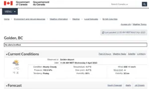
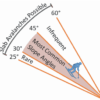
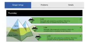
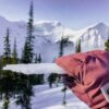
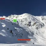
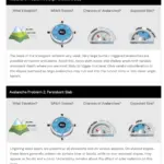
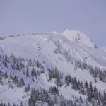
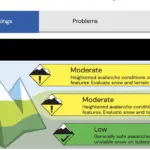
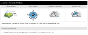
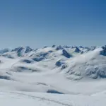